 Hiking
Elephant Head
Hiking
Elephant Head
Antelope Island
Overview
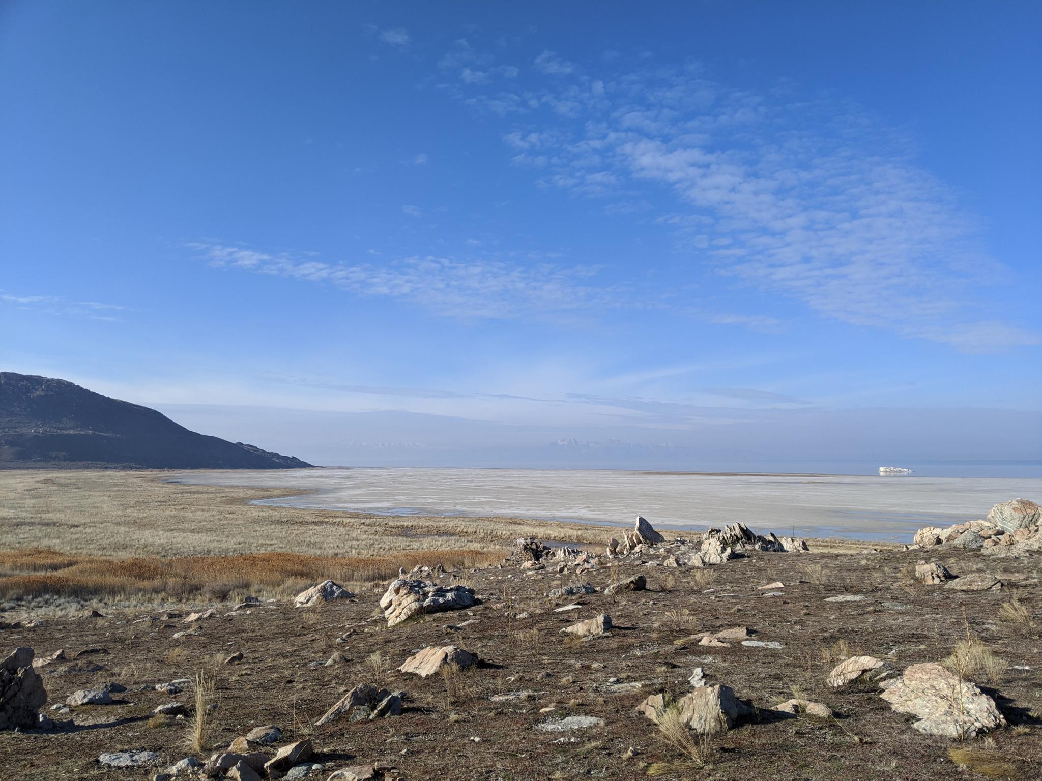
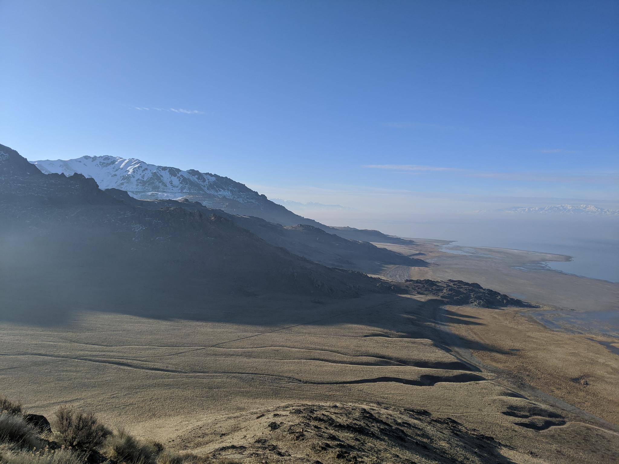
Elephant Head is one of the iconic hikes at Antelope Island. It is popular for good reason. The hike meanders along the short of the Great Salt Lake, taking in the view of White Rock Bay, before climbing to the lofty viewpoint of Elephant Head overlooking the Great Salt Lake over 600’ below.
This is a good distance for a moderate day hike and is equally popular with mountain bikers. You are almost assured to see wildlife along the way. Bison, in particular, seem to like to hang out near the trailhead or up on the ridge near Elephant Head.
The DNR offers the following tips if you encounter bison:
- If you see a bison and it stops what it is doing and starts paying attention to you, you are too close and should slowly back away.
- If you see a bison in the distance, do not walk across the rangeland to get closer to it. Take your photos from a safe distance.
- If you are hiking and a bison is close to or on the trail, you should either back away and return the way you came, or leave the trail and give the animal a very wide berth when passing it. It is OK to go off the trail if your safety is at risk.
In my experience, most buffalo encounters require just a little patient for the animals to move out of the way. Common sense and plenty of space prevail.
Getting There
The trailhead is reached by first getting to Antelope Island. The island is off I-15, west of Layton. Take exit 332 off I-15, and head west on Antelope Drive. About 7 miles from the freeway is the entrance to the park.
From the entrance to the park, cross the causeway and go left at the first junction after the causeway. Shortly after, take the next right, toward the signed Buffalo Point/White Rock Bay Campground.
To reach White Rocks Bay, a signed road goes off on the left before Buffalo Point. Follow this, a right, then a left at well signed junctions. The road passes through the White Rock Bay Campground to a parking area at the trailhead.
Route Description
From the trailhead, follow the path to the break in the fence and information kiosk. From the kiosk, the route follows the dirt road south, staying near the lake shore. This section is amazing at sunrise and sunset!
Follow the road to near the base of the ridge. Junction Trail comes in on the left near a cedar tree. Stay right as the dirt road climbs to the top of the ridge and a trail junction. Bison often frequent this junction. Left goes to the Split Rock Loop, go right instead.
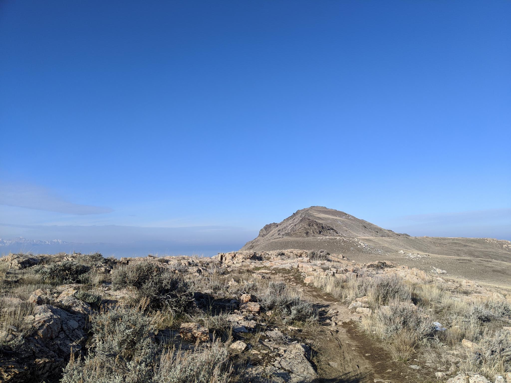
The trail follows the ridge through a couple of rocky sections, then traverses around the north end of Elephant Head to an overlook above the Great Salt Lake. The overlook has great views south into the Split Rock Loop area and the south end of the island. Stansbury Island is the mountain range to the west.
Return the same way.
Maps

12T 395775E 4542258N
41°01'30"N 112°14'23"W
12T 395779E 4542139N
41°01'26"N 112°14'23"W
12T 397212E 4538347N
40°59'23"N 112°13'19"W
12T 397024E 4537901N
40°59'09"N 112°13'27"W
12T 395360E 4538094N
40°59'14"N 112°14'38"W