
 Pahranagat National Wildlife Refuge
Alamo
Overview
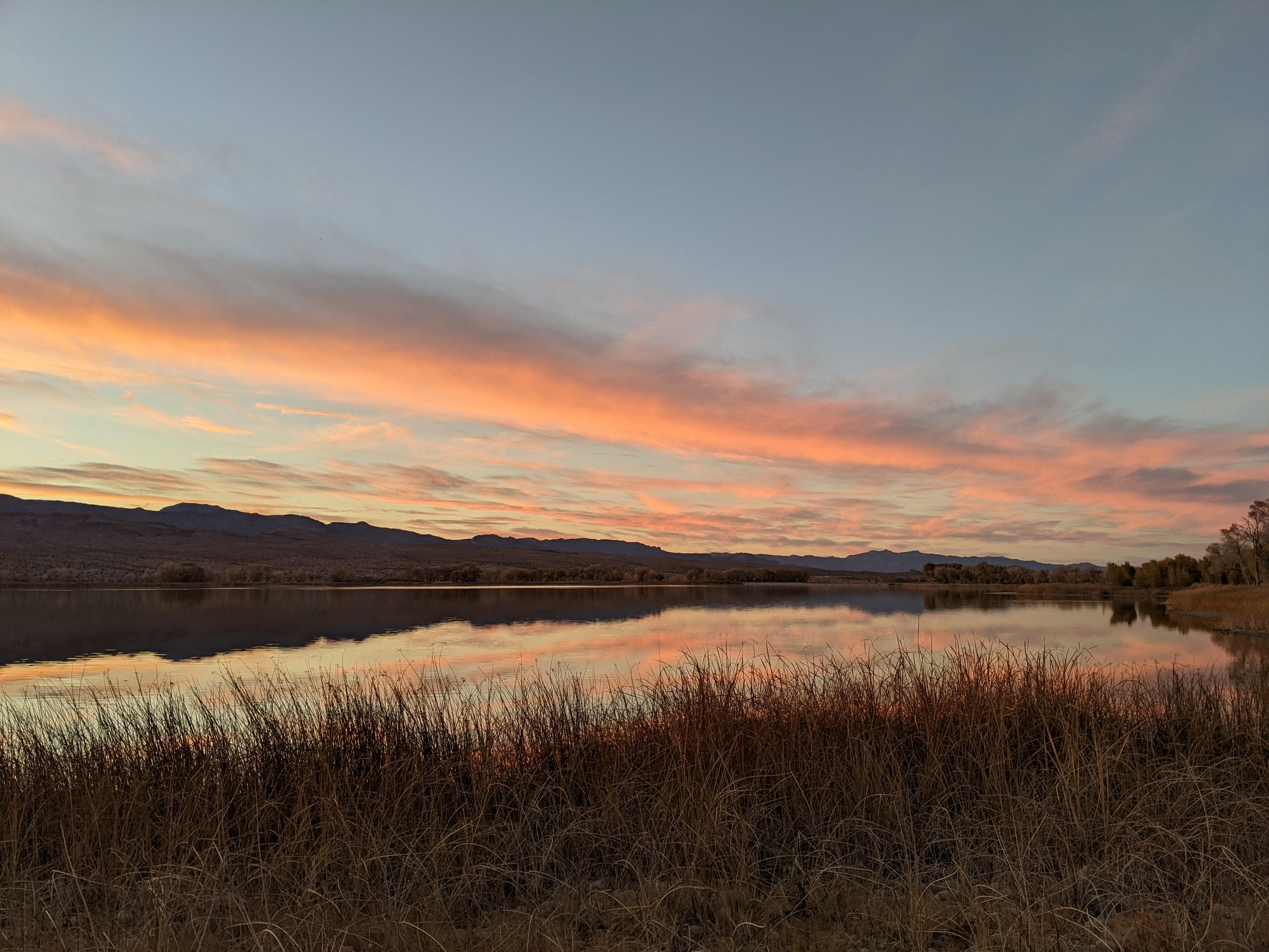
Two things really impressed me about Pahranagat National Wildlife Refuge, near Alamo, Nevada. The first is that the refuge offers free camping, with small developed sites that each offer great shoreline access to Upper Pahranagat Lake. I was surprised to find free developed camping less than an hour and a half from Las Vegas, and happy to be able to find a site on Thanksgiving day (though the campground filled up by the end of the day).
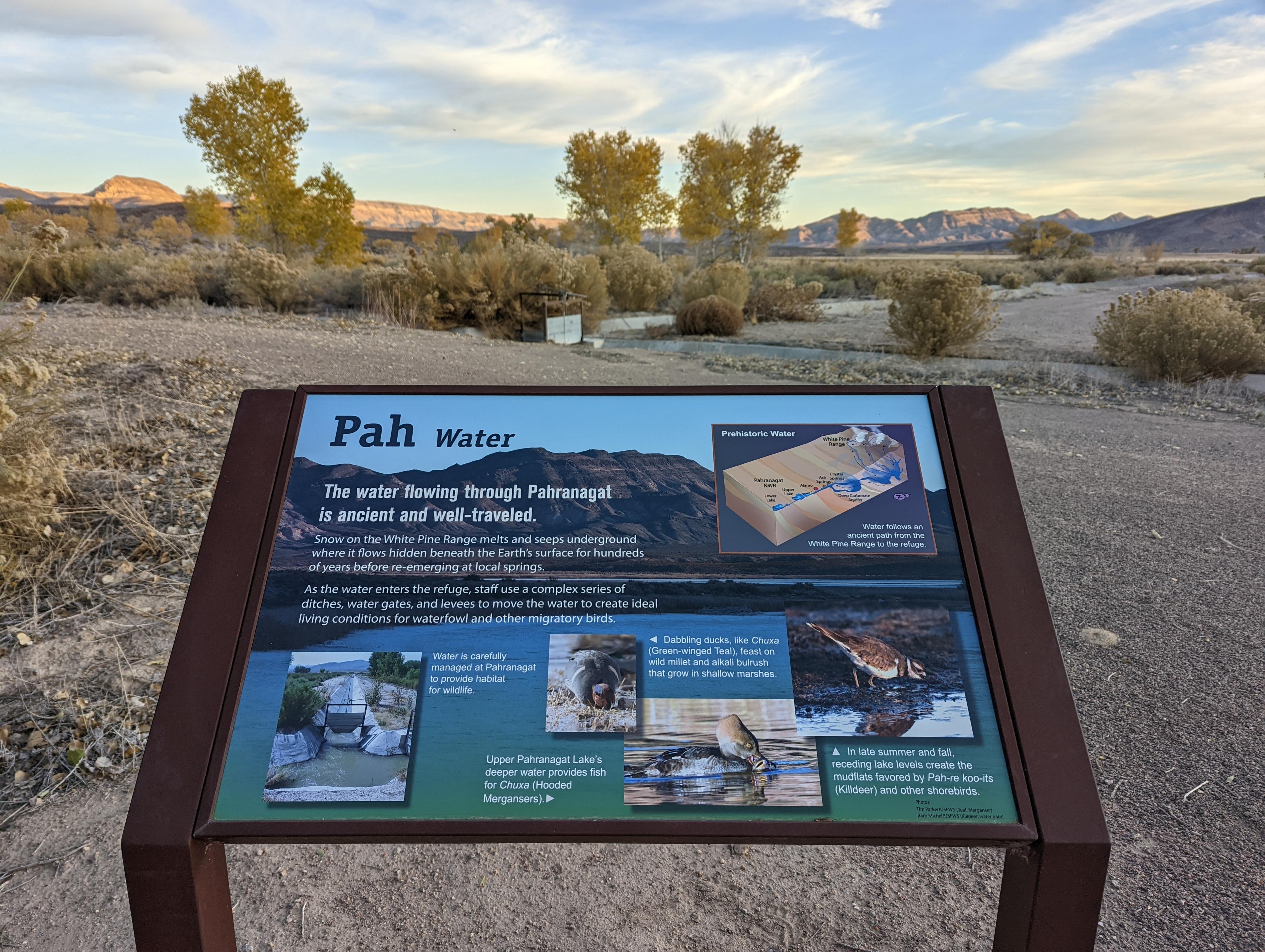
The second thing I thought was really cool was how the refuge pays tribute to and incorporates information from the Nuwuvi (Southern Paiute and Chemehuevi tribes). The main refuge sign by the visitor center (a few miles down the road from the camping) indicates that the refuge is on Nuwuvi ancestral land, and members of the Nuwuvi put together the text for informational signs about the importance of the wetlands and their own connection to the land.
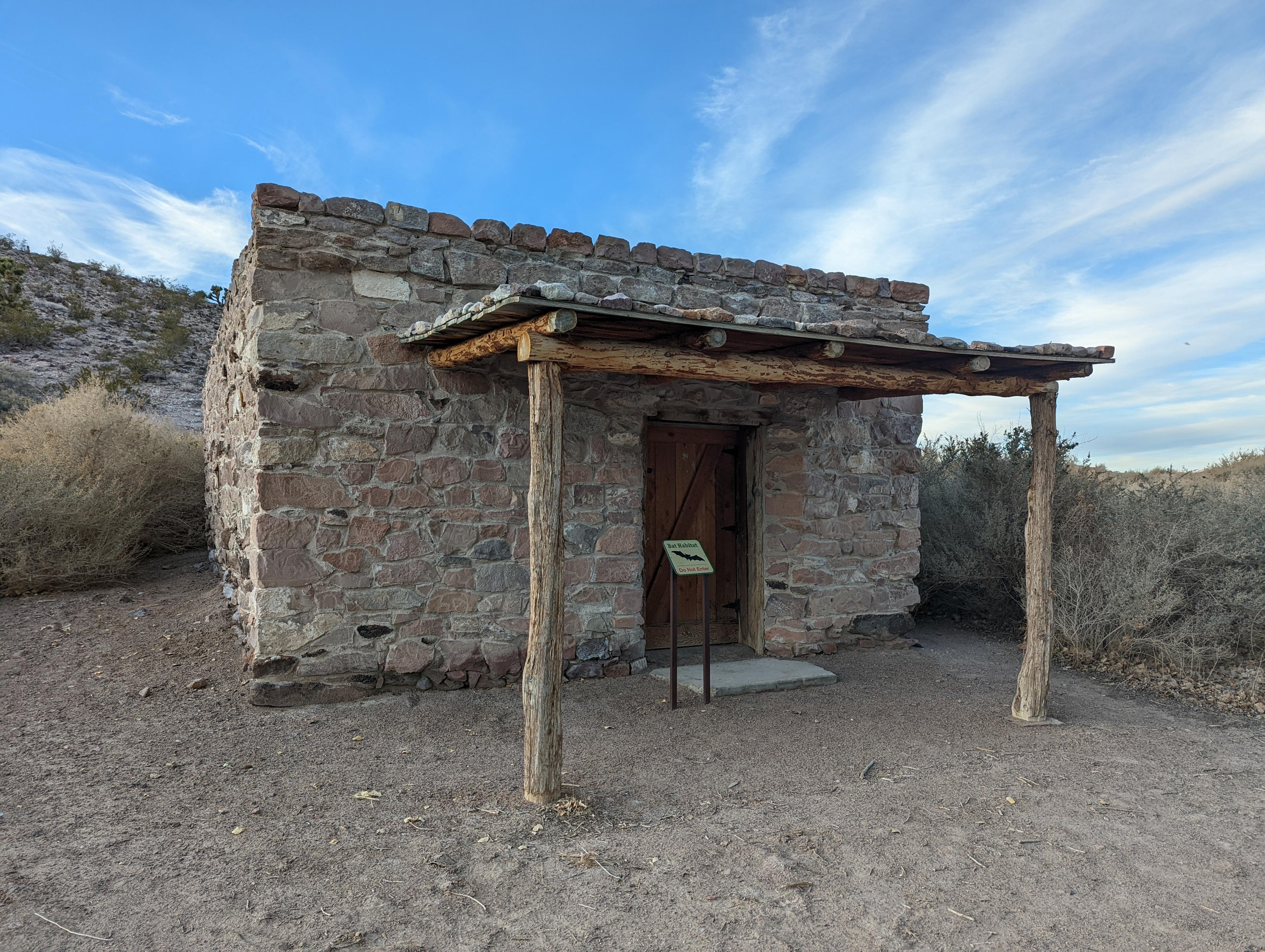
There are several miles of trails around the Refuge that are open to hiking and some are open to biking. I explored two of the short trails that start at the visitor center, but would definitely recommend exploring more of the Refuge if time allows. The trails I checked out are composed of packed gravel and are flat and ADA accessible. The 0.4 mile Pahranagat Loop takes you on a short loop behind the visitor center past cottonwood and willow trees and a series of interpretative signs that teach about the plants, animals, and water of the Refuge. My favorite of the signs tells the Nuwuvi origin story of how animals came to occupy different habitats, but many of the signs combine some Nuwuvi words and stories with scientific information. I also hiked the Cabin Trail, which is a 0.4 mile one-way trail to two historical cabins. The Railroad Tie Cabin is set back from the trail amongst some cottonwood trees and the Petroglyph Cabin has interesting designs of unknown origin cut into the rocks at the front of the cabin. I was at the Refuge right before sunset and enjoyed the beautiful light of the golden hour while on these hikes.
“Pah” means water in the Southern Paiute language and I have seen the word Pahranagat interpreted as “feet sticking in water” or “valley of shining water.” The water that feeds the lakes and wetlands at the refuge come from nearby Crystal and Ash Springs. I was told that the spring water is diverted for agriculture from February through October, but that the managers are still able to maintain water in the lakes and wetlands throughout the summer. In the fall while we were there, the upper lake was full and filled with swans that had been scared off a nearby lake by hunting.
Getting There
From the small town of Alamo NV, head south on US-93 about 7.6 miles to the refuge on the west (right) side of the road.
Alternatively, this is about 63 miles north of I-15 on US-93 if coming from the south.
Route Description
Both trails are located just beyond the visitor center. If you head to the left past the visitor center, you can enjoy the Pahranagat Loop. If you head to the right, you will be on the Cabin Trail. On the Cabin Trail, you can either return the way you came or, for a somewhat shorter return, hike along the road back to the visitor center (heading to the right on the road just past the Petroglyph Cabin). Both trails are well-labeled and easy to follow with wide red gravel paths.
Photos
Maps

11S 666643E 4126460N
37°16'11"N 115°07'14"W
11S 666481E 4126074N
37°15'59"N 115°07'21"W