 Hiking
Ashdown Gorge
Hiking
Ashdown Gorge
Cedar City
Overview
Ashdown Gorge, just below the rim of Cedar Breaks National Monument near Cedar City, is one of the most dramatic and underrated canyon hikes in the state. Fed by snowmelt and summer rains from the high plateau, Ashdown Creek cuts a winding path through cliffs, dense forests, and colorful sandstone formations that echo the famous amphitheater of Cedar Breaks above. Hiking here feels like stepping into a hidden extension of the monument itself, where the geology and scenery continue on a grand scale but with far fewer crowds.
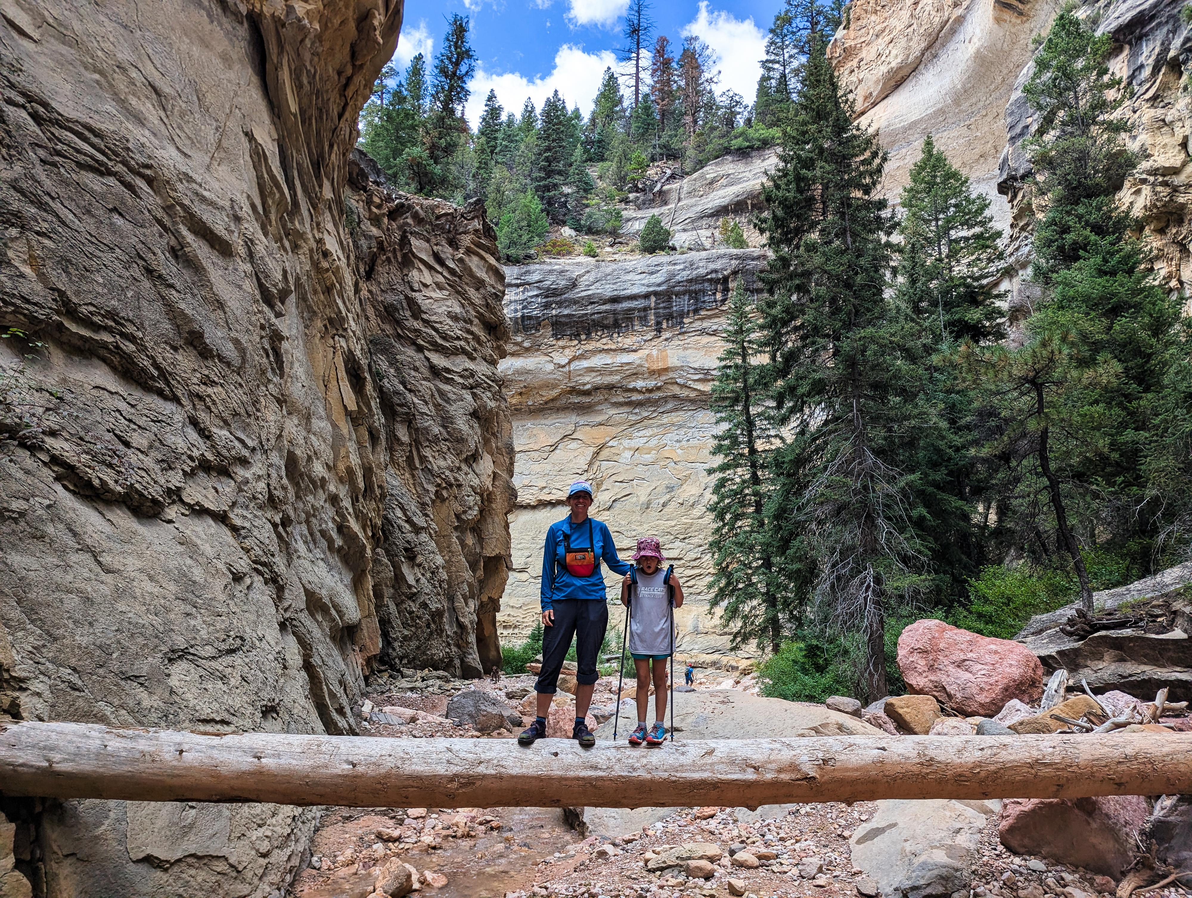
The route begins high on the Markagunt Plateau, where alpine meadows burst with wildflowers in the summer and quaking aspens blaze gold in the fall. From there, the trail drops thousands of feet in elevation, reaching Rattlesnake Creek and following it downstream before traversing over to Ashdown Gorge. Hiking in the gorge is a mix of boulder-hopping, creek crossings, and shady stretches beneath towering cliffs. It is a dramatic and photogenic place! Reminiscent, to me, of parts of Zion, though without the crowds. To be sure, you are likely to see other hikers, but far fewer than in the neighboring national parks and monuments.
This was a trip we had on our list for a long time before finally visiting. It turned out to exceed our high expectations. It is stunning. If you have time, I recommend visiting via this route, which makes a superb overnight backpacking trip. If short on time, visiting from the bottom up is also an excellent outing, though likely to feel busier. On our visit, we saw hardly any people until we reached the Ashdown Gorge/Rattlesnake Creek confluence, where we began to see many day hikers.
Getting There
Lower Ashdown Trailhead: This is the exit trailhead for this hike.
From Cedar City, head east on UT-14 toward Cedar Breaks National Monument. At milepost 7.6, about 7.6 miles from Cedar City, there is a large pullout on the north side of the road. This is the exit trailhead.
Rattlesnake Creek Trailhead: This is the starting trailhead for this hike.
From Cedar City, just as for the exit trailhead, drive east on UT-14. Continue past the exit trailhead. About 18 miles from Cedar City, turn left (north) on UT-148 toward Cedar Breaks National Monument.
Stay on UT-148 as it passes through the monument. 8.5 miles from when you turned onto UT-148, you will leave Cedar Breaks National Monument. Rattlesnake Creek Trailhead, the starting trailhead, is on the left just after leaving the monument. There is a fairly large parking area here and trailhead information signs.
Route Description
To Rattlesnake Creek (about 4.7 miles)
From the trailhead, the trail initially follows along the fence. The trail has a tiny bit of up here before beginning its descent to Rattlesnake Creek. About 0.6 miles from the trailhead, and again at about 0.8 miles a side trail goes off on the left a short distance to overlook Cedar Breaks. Both are worth the very short side trip. The trail descends to Rattlesnake Creek via some switchbacks and sweeping views along the way. Right where the trail reaches Rattlesnake Creek is a campsite. There should always be flowing water in Rattlesnake Creek.
To High Mountain Trail Junction (1.5 miles)
The trail crosses Rattlesnake Creek once, then meanders with a bit of up and down along the west bank of Rattlesnake Creek. There are a couple of good campsites in this 1.5-mile section. At the High Mountain Trail Junction, go left, reaching Rattlesnake Creek and another campsite in just a minute.
High Mountain Junction to Ashdown Gorge (1.1 miles)
From High Mountain Junction, go left, crossing Rattlesnake Creek in a minute or so. The trail now climbs to a ridge, then heads east as it descends to Ashdown Gorge. There are a few campsites near where the trail reaches the gorge.
Ashdown Gorge to Rattlesnake Creek Junction (1.1 miles)
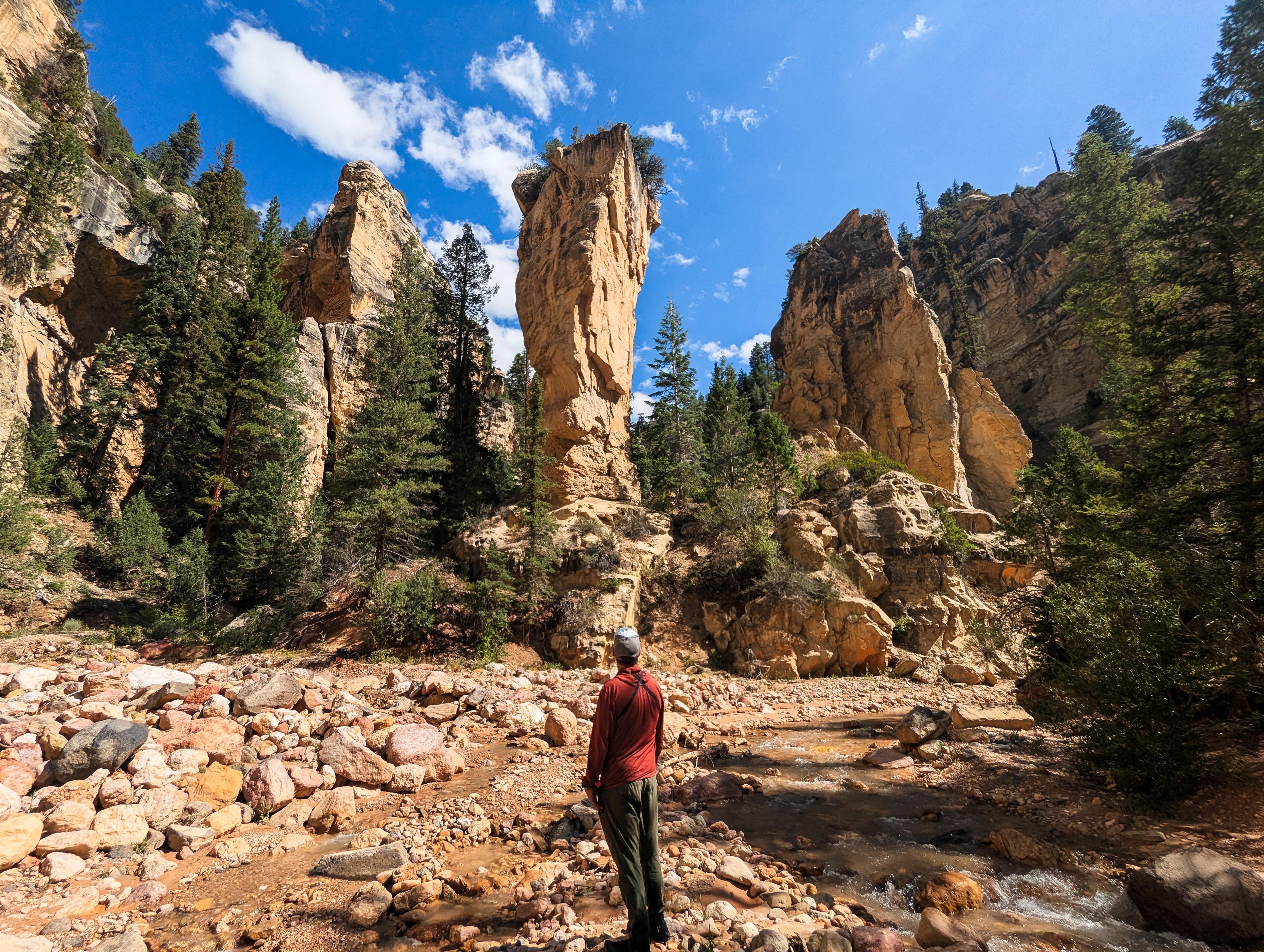
Head down Ashdown Gorge. You are very likely to get wet feet at some point, so it is easiest to just start wading. The upper section quickly deepens, and a few bends in, goes under a giant overhang. The hiking constantly crisscrosses the stream. About 1.1 miles from where you started down Ashdown Gorge, Rattlesnake Creek comes in on the right. There is a large tower here called Tom's Thumb right at the entrance. It is a magnificent spot!
Rattlesnake Falls / Lake Creek Falls Side Trip (1.7 miles round-trip)
Rattlesnake Creek, from the bottom, is a bit easier walking than Ashdown Gorge and equally beautiful to my eye. Hike up it about 0.8 mile to a junction. Left is Lake Creek, and a small waterfall is just a few minutes up that fork of the canyon. Right is Rattlesnake Creek, and the falls is 5-10 minutes up the right fork to visit. It is taller and generally has more flow than Lake Creek. Return to Ashdown Gorge the same way.
Rattlesnake Junction To Exit Trailhead (2.75 miles)
Continue down Ashdown Gorge. It is rocky and requires a fair bit of attention to find the easiest path. Keep an eye on the map; about 1.1 miles from Rattlesnake, high on the right skyline, is Flanigan Arch. It is easy to miss if you aren't looking for it.
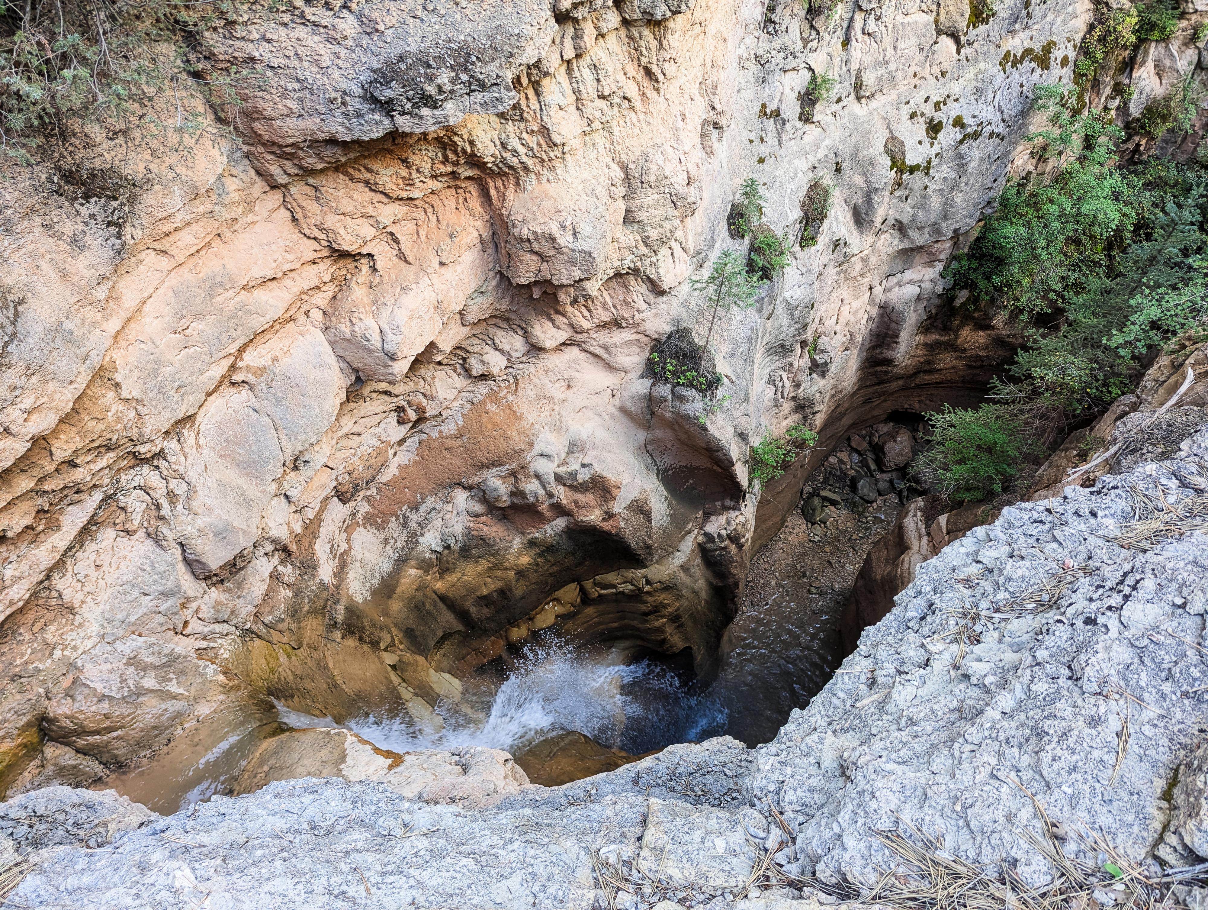
As Ashdown Gorge nears the highway, it turns northwest and you'll likely notice a couple of old vehicles in the canyon bottom. Continue down Ashdown until you reach a concrete chute and falls. The trail leaves the stream bed just before this concrete chute and climbs the left bank steeply to the large parking area along the highway.
Photos
Videos
Hiking Ashdown Gorge
Maps
 - Hiking Map")
 - Hiking Map")
12S 337889E 4169971N
37°39'45"N 112°50'17"W
12S 336921E 4169986N
37°39'45"N 112°50'56"W
12S 336686E 4169945N
37°39'44"N 112°51'06"W
12S 333306E 4168936N
37°39'09"N 112°53'23"W
12S 332906E 4168427N
37°38'52"N 112°53'39"W
12S 331922E 4167819N
37°38'32"N 112°54'18"W
12S 331738E 4167782N
37°38'30"N 112°54'26"W
12S 331753E 4167758N
37°38'30"N 112°54'25"W
12S 331963E 4167221N
37°38'12"N 112°54'16"W
12S 330891E 4167217N
37°38'12"N 112°54'60"W
12S 331474E 4167707N
37°38'28"N 112°54'36"W
12S 331623E 4167717N
37°38'28"N 112°54'30"W
12S 331501E 4167779N
37°38'30"N 112°54'35"W
12S 330044E 4166804N
37°37'58"N 112°55'34"W
12S 328481E 4167043N
37°38'04"N 112°56'38"W