Cottonwood Wash Narrows |

Paria

Hiking Cottonwood Wash Narrows - Paria Hiking Cottonwood Wash Narrows

Paria

Overview

RATING: Easy Hiking
MAPS: BUTLER VALLEY, UT;

Fri

A chance of rain showers before noon, then showers and thunderstorms likely. Mostly cloudy. High near 59, with temperatures falling to around 57 in the afternoon. West southwest wind 17 to 23 mph, with gusts as high as 35 mph. Chance of precipitation is 70%.

59 | 43

Sat

A chance of rain showers. Partly sunny, with a high near 59. Northwest wind 14 to 22 mph, with gusts as high as 32 mph. Chance of precipitation is 40%.

59 | 38

Sun

Sunny, with a high near 66.

66 | 36

Mon

Sunny, with a high near 73.

73 | 39

Tue

Sunny, with a high near 76.

76 | 43

View Full Weather Details
SEASON: Any, although summers can be hot.
GEAR: Standard Hiking Gear
WATER: None.
FLASHFLOOD: Low

Fri

A chance of rain showers before noon, then showers and thunderstorms likely. Mostly cloudy. High near 59, with temperatures falling to around 57 in the afternoon. West southwest wind 17 to 23 mph, with gusts as high as 35 mph. Chance of precipitation is 70%.

59 | 43

Sat

A chance of rain showers. Partly sunny, with a high near 59. Northwest wind 14 to 22 mph, with gusts as high as 32 mph. Chance of precipitation is 40%.

59 | 38

Sun

Sunny, with a high near 66.

66 | 36

Mon

Sunny, with a high near 73.

73 | 39

Tue

Sunny, with a high near 76.

76 | 43

View Full Weather Details
A Cairn guarding the start of the narrows.

A Cairn guarding the start of the narrows.

The good stuff, Cottonwood Wash Narrows

The good stuff, Cottonwood Wash Narrows

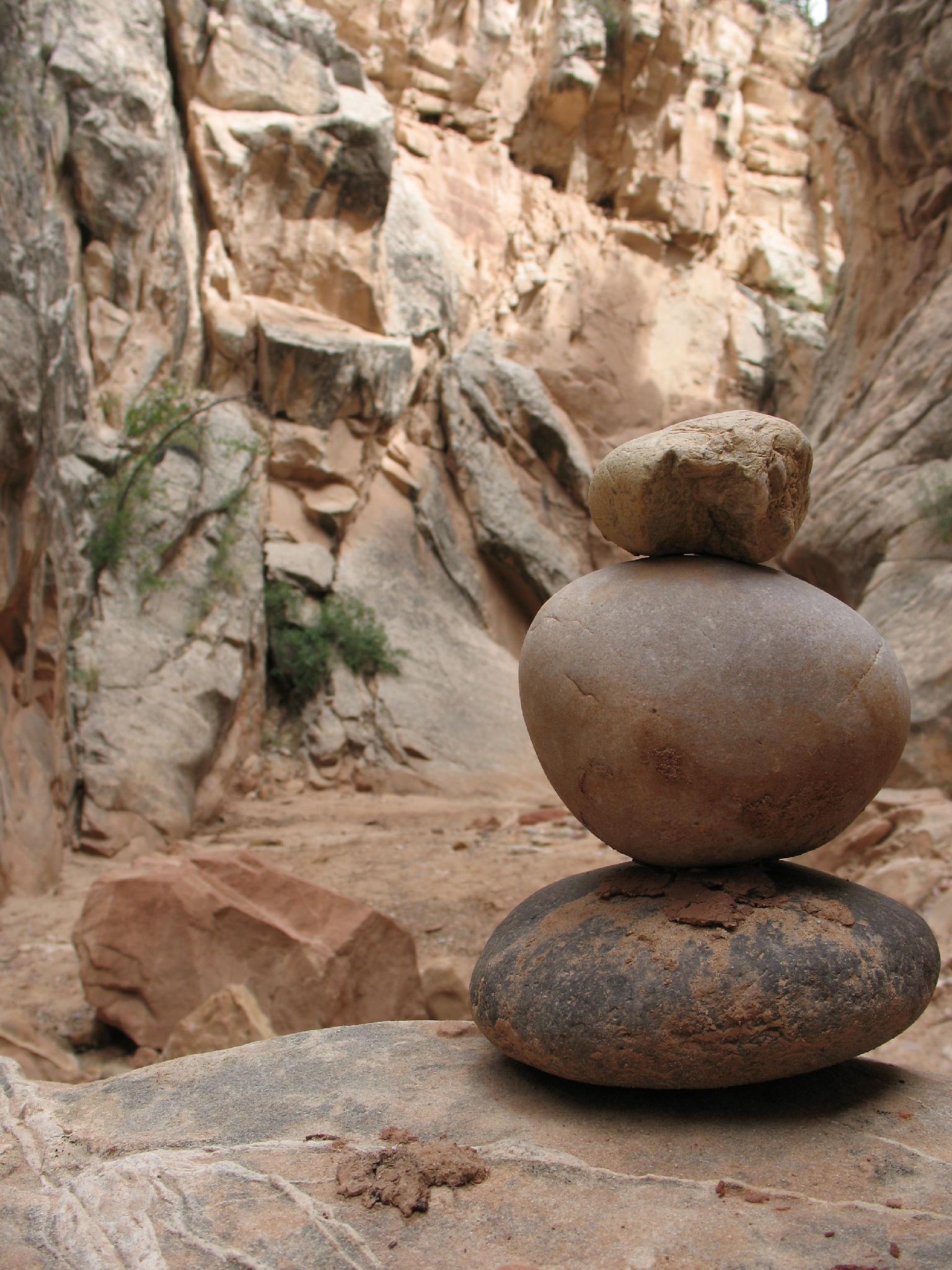
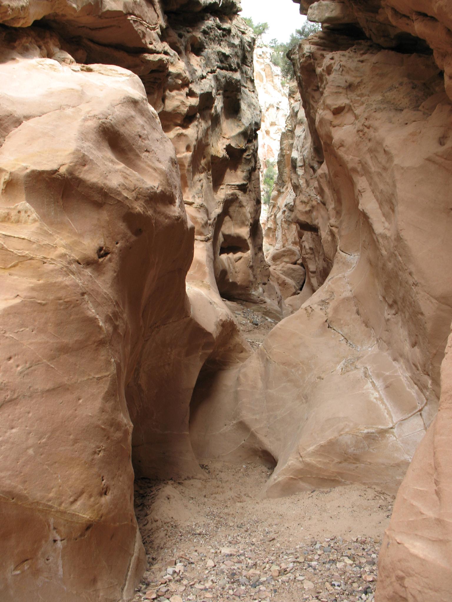
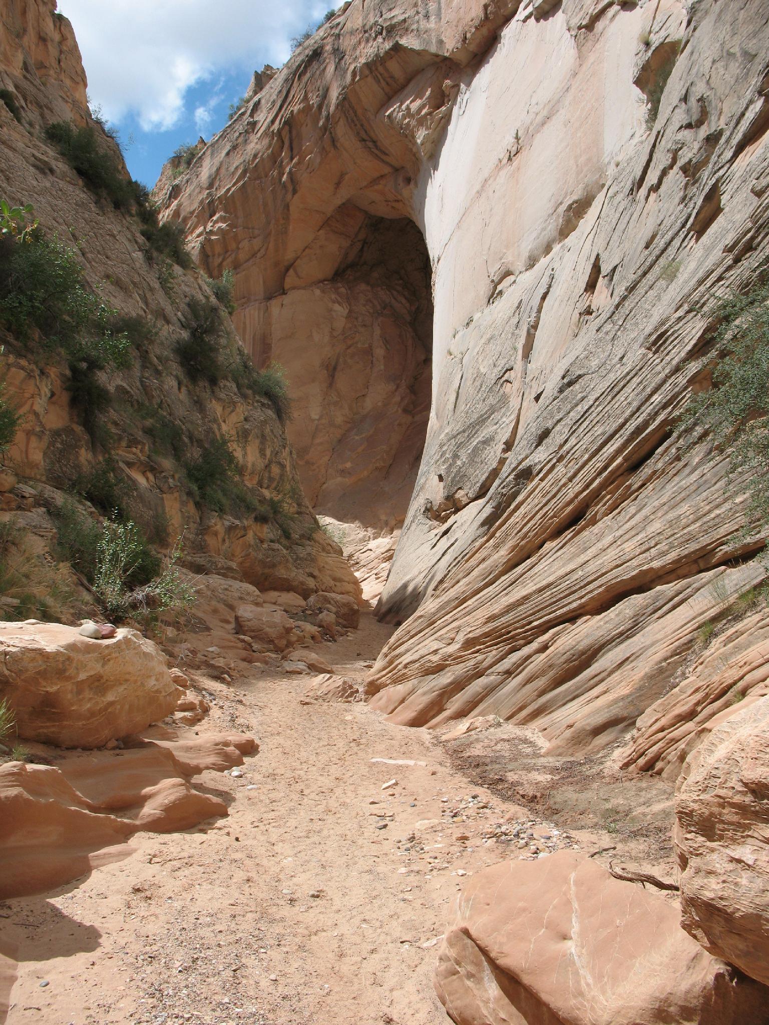
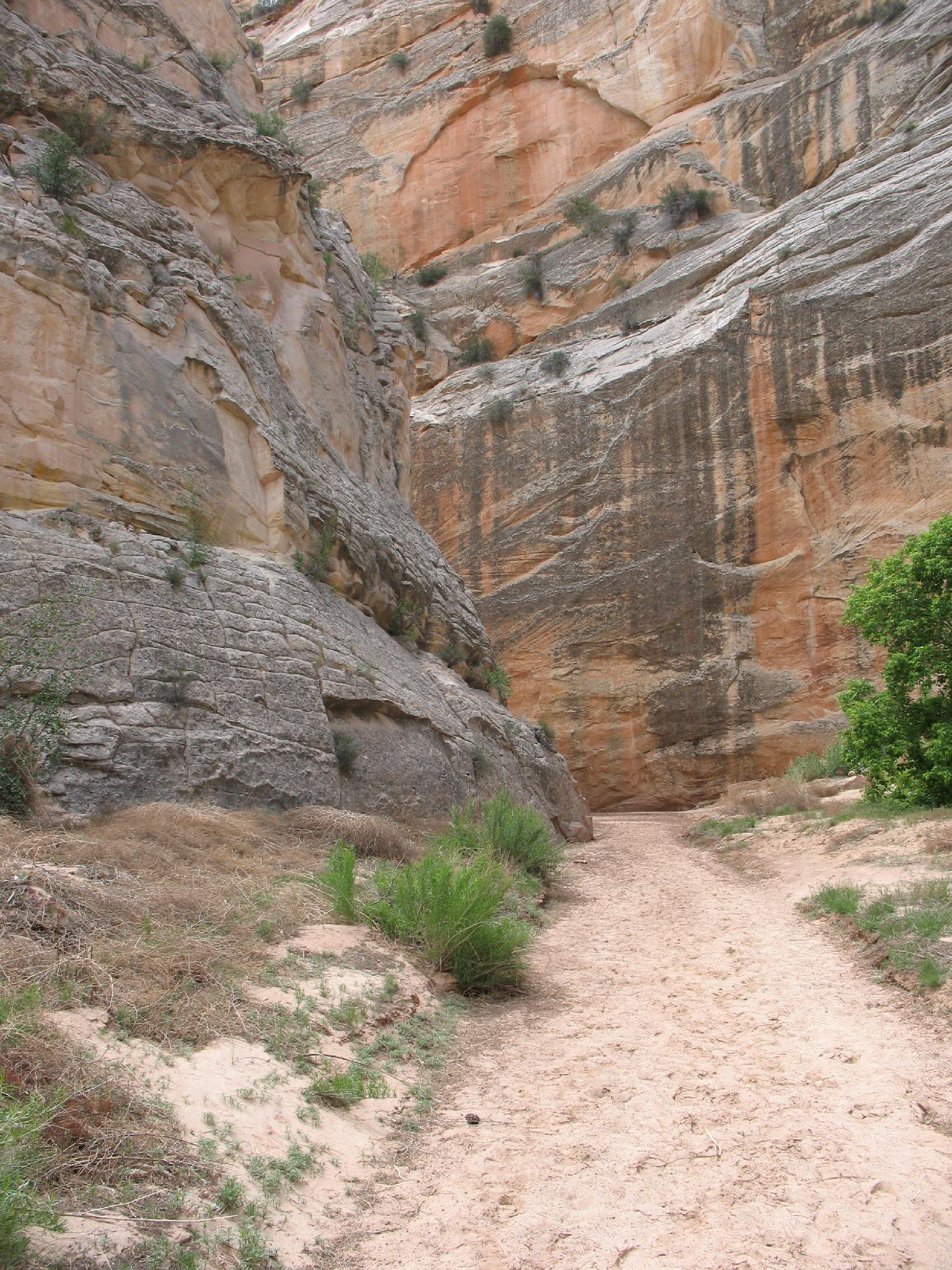
A few minute walk from the Cottonwood Wash road, and only a short distance from Grosvenor Arch, this is a family friendly adventure not to be missed. Sure, there are more dramatic slots in the area, but the Cottonwood Wash Narrows have easy access and colorful scenery. This is one I highly recommend for the whole family.

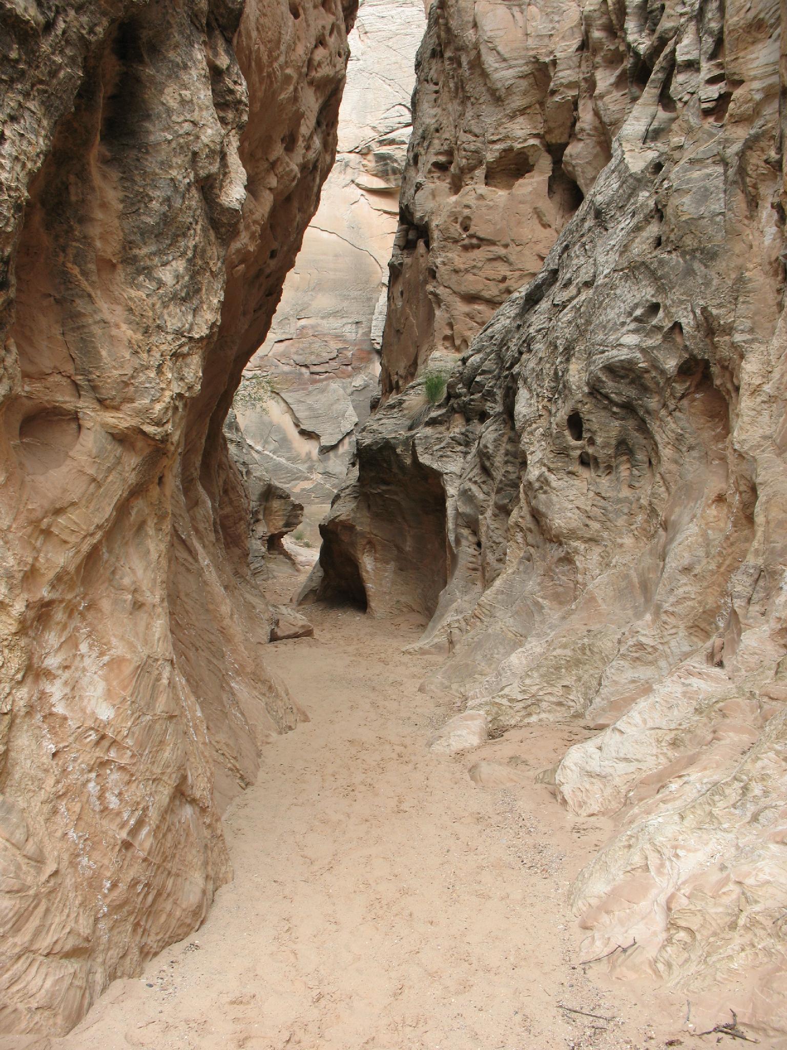
The narrows themselves are about 1.6 miles long. If you have two cars, this can be done as a through hike. If not, never fear, as it makes a pleasant out-and-back hike as well. You CAN road walk back to make it a loop but returning via the narrows is SO MUCH BETTER!

More of the narrows in Cottonwood Wash

More of the narrows in Cottonwood Wash

Open section, great colors.

Open section, great colors.

Getting There

From Cannonville Utah, go south on Main Street. This becomes Kodachrome Road and Cottonwood Canyon Road. Follow this road about 7 miles to the signed junction with Kodachrome Basin on the left.

  • Reset your odometer at the Kodachrome Basin junction. Stay straight on the Cottonwood Wash Road. Major junctions are listed below, but the goal is to stay on the Cottonwood Wash road for 9.6 miles. ( 12S 412162mE 4150982mN / N37° 30' 06" W111° 59' 38" )
  • 0.8 miles, stay left on the main road. ( 12S 413407mE 4150607mN / N37° 29' 54" W111° 58' 47" )
  • 1.1 miles - Side road on the left. Stay right on the main road. ( 12S 413960mE 4150457mN / N37° 29' 49" W111° 58' 24" )
  • 1.5 miles - Side road on the left, stay right. ( 12S 414462mE 4150303mN / N37° 29' 45" W111° 58' 04" )
  • 5.0 miles - Side road on the right, stay left. ( 12S 419353mE 4148924mN / N37° 29' 01" W111° 54' 44" )
  • 5.8 miles - Side roads on both sides, stay straight. ( 12S 420673mE 4148933mN / N37° 29' 02" W111° 53' 50" )
  • 6.7 miles - Junction, go left. ( 12S 421531mE 4148147mN / N37° 28' 37" W111° 53' 15" )
  • 9.6 miles - Grosvenor Arch Jct, go right. (Grosvenor Arch is 1.1 miles to the left and worth the side trip.) ( 12S 424892mE 4145338mN / N37° 27' 07" W111° 50' 57" )
  • 13.1 miles - Cottonwood Wash Narrows - North ( 12S 425010mE 4139808mN / N37° 24' 07" W111° 50' 50" )
  • 14.1 miles - Cottonwood Wash Narrows - South ( 12S 424822mE 4138372mN / N37° 23' 21" W111° 50' 57" )
Nice walls and lines in the narrows.

Nice walls and lines in the narrows.

Cottonwood Wash Narrows

Cottonwood Wash Narrows

Route

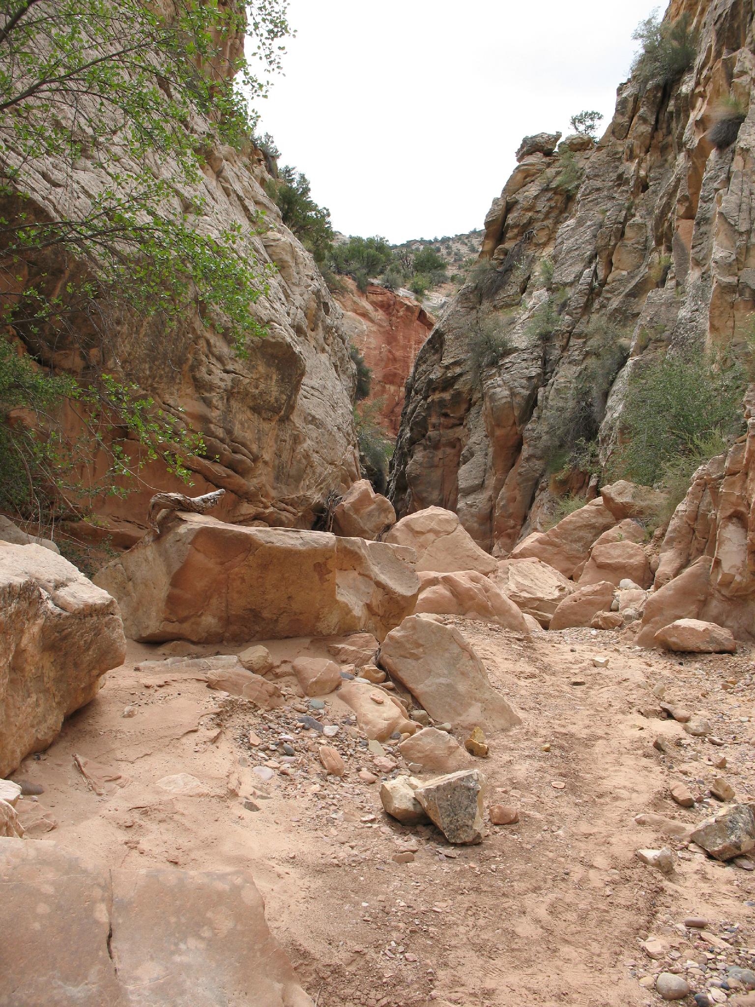
The route is easy. Either from the north or south trailheads, pick up the well worn social trail on the west side of the road. Both trailheads have small parking areas.

The social trails both enter Cottonwood Wash. The north heads left, DOWN Cottonwood Wash through the meandering narrows with towering walls and colors on both sides. The south trailhead, not surprisingly, heads north UP Cottonwood Wash.

Though only 3 miles round trip without a shuttle, expect 2-3 hours as there is much to see and enjoy in the narrows.


Videos

Cottonwood Wash Narrows richardpattison

Maps

Route - One Way / 1.67 miles / Elevation Range 5,501 - 5,743 ft.
Printable Maps:
Trailhead North

12S 425010mE 4139808mN

N37° 24' 07" W111° 50' 50"

Trailhead South

12S 424822mE 4138371mN

N37° 23' 21" W111° 50' 57"

Comments

Want to make a comment? Login and let yourself be heard.