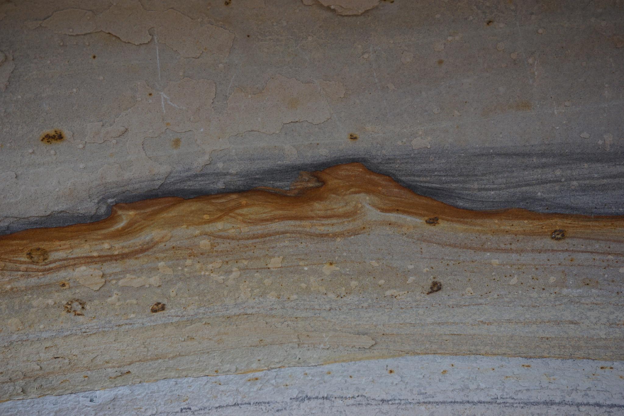
Mica Mine |

Grand Junction

Hiking Mica Mine - Grand Junction Hiking Mica Mine

Grand Junction

Overview

RATING: Easy Hike
MAPS: GLADE PARK, CO; ISLAND MESA, CO

Fri

A chance of rain showers before 9am, then showers and thunderstorms. Mostly cloudy, with a high near 57. Southwest wind 10 to 15 mph. Chance of precipitation is 80%.

57 | 47

Sat

Showers and thunderstorms. Cloudy, with a high near 52. Chance of precipitation is 80%.

52 | 43

Sun

A chance of rain showers before noon, then a chance of showers and thunderstorms. Partly sunny, with a high near 56.

56 | 42

Mon

Sunny, with a high near 66.

66 | 42

Tue

Sunny, with a high near 71.

71 | 47

View Full Weather Details
SEASON: Any
GEAR: Standard Hiking Gear
WATER: None

Fri

A chance of rain showers before 9am, then showers and thunderstorms. Mostly cloudy, with a high near 57. Southwest wind 10 to 15 mph. Chance of precipitation is 80%.

57 | 47

Sat

Showers and thunderstorms. Cloudy, with a high near 52. Chance of precipitation is 80%.

52 | 43

Sun

A chance of rain showers before noon, then a chance of showers and thunderstorms. Partly sunny, with a high near 56.

56 | 42

Mon

Sunny, with a high near 66.

66 | 42

Tue

Sunny, with a high near 71.

71 | 47

View Full Weather Details
Patterns in the rock along the way

Patterns in the rock along the way

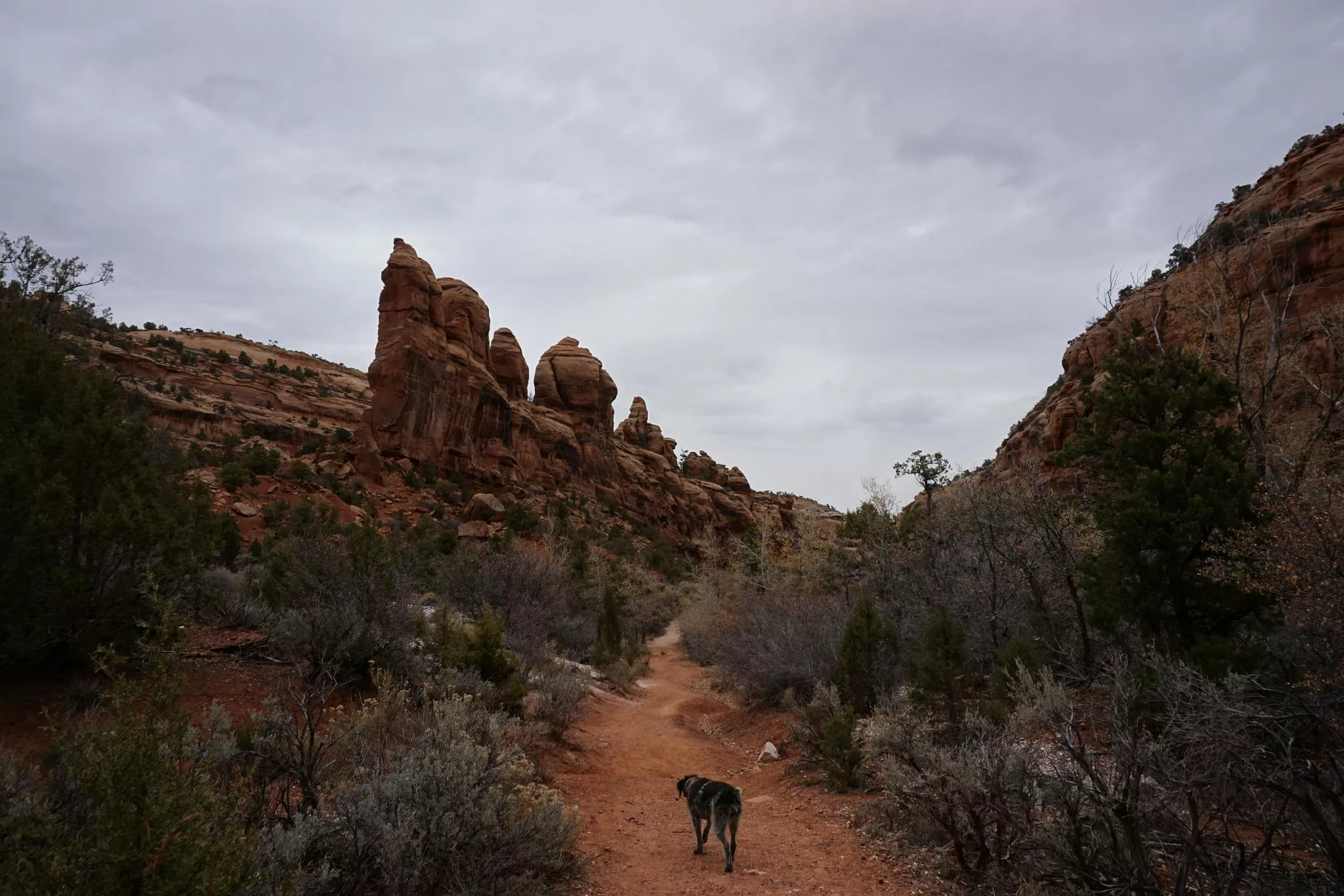
It is easy to see why the Mica Mine is one of the more popular hikes for locals, The relatively short 3-ish mile round trip hike visits a lovely riparian canyon, as well as an impressive old Mica Mine. The trail is on an old road, which makes for generally easy hiking. Dogs are allowed, making it popular with dog owners as well.

Historical Note: The mine was known as the Williamson Mine and operated until the 1950s. Mica, the product of the mine, is a thin, clear, layered mineral that was heavily used in paints, electrical insulation, and greases. The ground surrounding the mine is still covered in the mineral and you can also see mica in the walls of the mine
A jagged skyline

A jagged skyline

Getting There

From I-70, take the I-70 business loop through Grand Junction. When the business loop meets Grand Ave, go right, toward Colorado National Monument. Grand Avenue crosses the Colorado River and becomes Broadway.

Once over the Colorado River, turn left onto Monument Road. Follow Monument Road about 2 blocks to D Road on the left. After 0.3 miles, turn right onto Rosevale Rd. After 0.9 miles on Rosevale Rd, turn right onto Little Park Road.

Follow Little Park Road 5.3 miles to the Bangs Canyon trailhead on the left side of the road. The large trailhead with a pit toilet is a minute off Little Park Road and well signed.

Abby enjoying the hike out.

Abby enjoying the hike out.

Route

From the trailhead, follow the trail to Rough Canyon / Mica Mine. The trail follows an old road that passes through a sandstone road cut a few minutes from the trailhead. Once through the road cut, at the canyon bottom, the trail splits. Go right (left visits Rough Canyon).

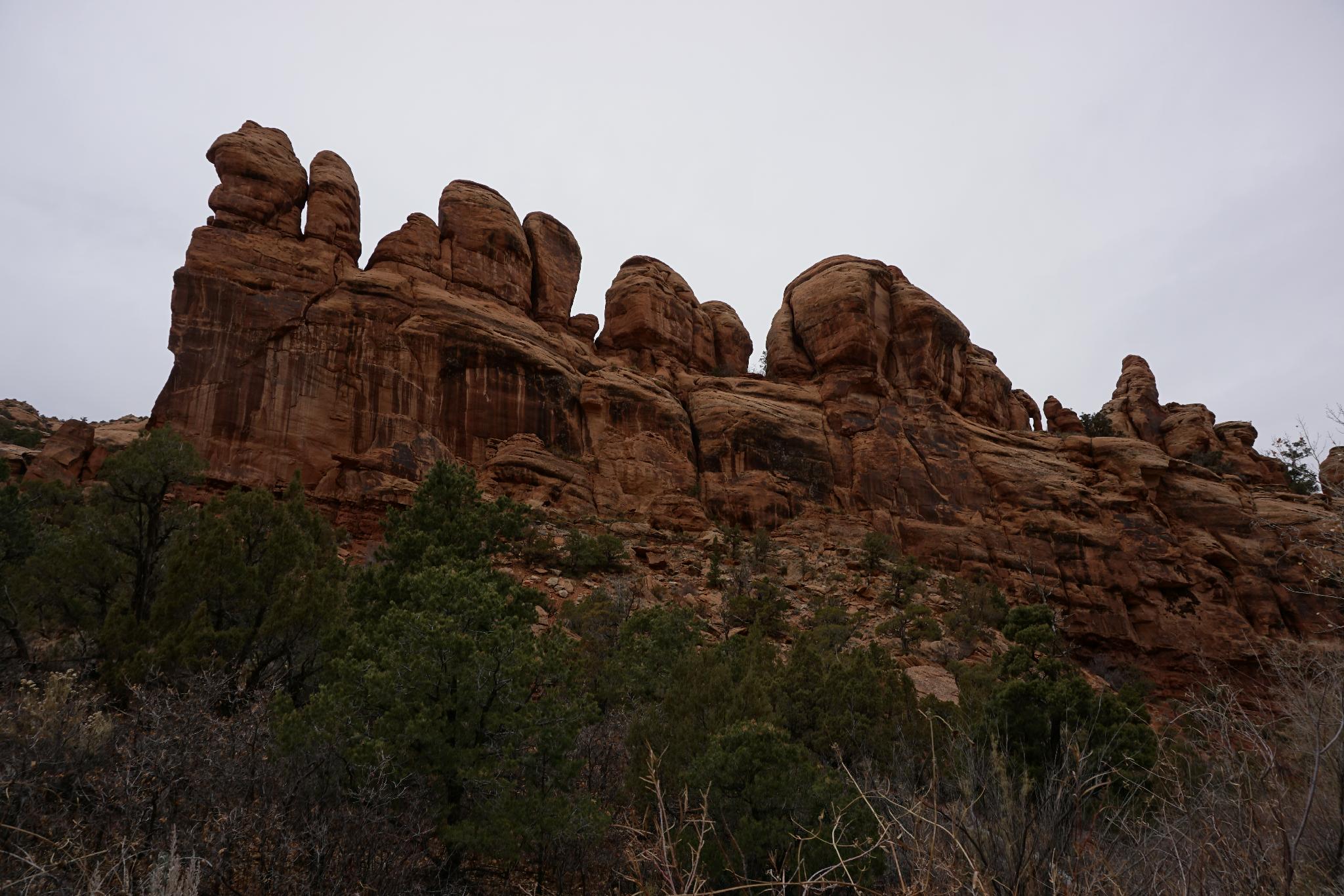
The trail meanders mostly in or near the canyon bottom and has riparian scenery. A few bends up the skyline becomes jagged with sandstone towers and spires. Magnificent!

A small area of mica is visible on the left at about 1.25 miles, with a small dead-end mine tunnel visible shortly after. Continue past a couple of more minutes to the main mine, a huge undercut on a bend. The scale is impressive.

Return the same way after visiting the mine.


Maps

Route / 2.94 miles / Elevation Range 6,042 - 6,241 ft.
Printable Maps:
Trailhead

12S 706360mE 4318228mN

N38° 59' 20" W108° 37' 03"

Jct - Right

12S 706173mE 4317990mN

N38° 59' 12" W108° 37' 11"

Mica Mine

12S 705124mE 4317066mN

N38° 58' 43" W108° 37' 55"

Comments

Want to make a comment? Login and let yourself be heard.