 Hiking
Lambs Canyon Pass and Millvue Peak
Hiking
Lambs Canyon Pass and Millvue Peak
Millcreek Canyon
Overview
Like most Millcreek Canyon hikes, this is a steep one! That being said, the effort is worth it in my opinion. The hike is broken up into two different parts. Section one climbs to the pass and returns the same way. This is about 1.75 miles and 1,700 ft elevation gain one way. A solid workout!
Those wanting more can continue to Millvue Peak, which clocks in at about 2.5 miles and nearly 2700' of elevation gain ONE WAY. An overachiever workout! Millvue is the local name for the peak at elevation 8,926' to the east of Lambs Pass. It is not named on the USGS quads.
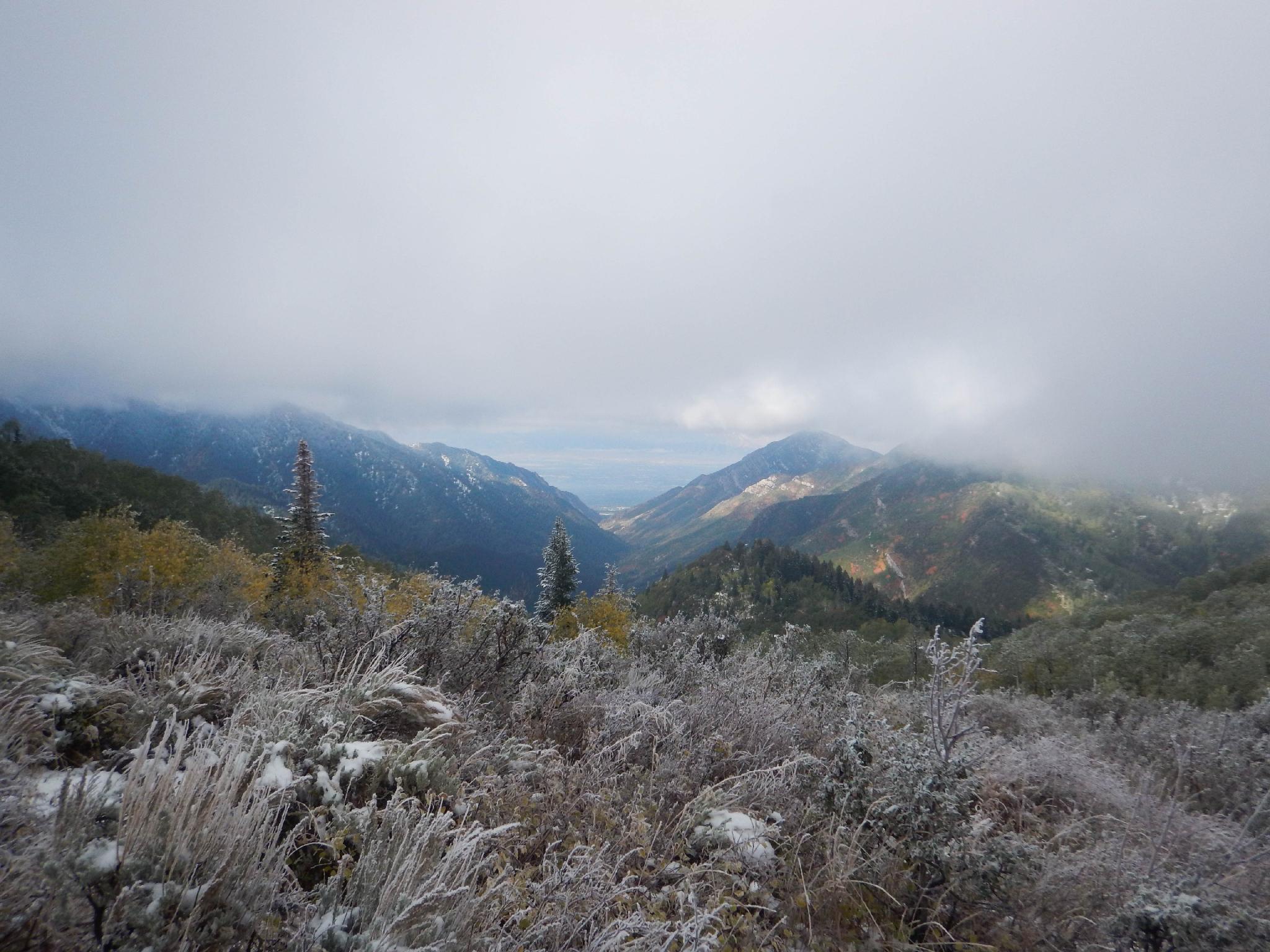
Both sections of the hike have big views of Millcreek Canyon. In fall, in particular, the leaves and dusting of snow on higher peaks are spectacular.
Getting There
Millcreek Canyon is on the east side of the Salt Lake Valley, just south of I-80 and Parleys Canyon. To get there, take I-215 South from I-80 and take exit 4 off of I-215 and go left (east) on 3900 South.
Turn left on Wasatch Blvd just after crossing under the highway, then the next right on Millcreek Canyon Road.
0.7 miles from the junction of Wasatch Blvd and Millcreek Canyon Road is the entrance to Millcreek Canyon and the pay booth.
Mileage below is from the pay booth.
- 0.7 miles - Pipeline Trailhead on the left (north).
- 2.4 miles - Church Fork Trailhead on the left (north).
- 2.5 miles - Desolation on the right (south).
- 3.4 miles - Porter Fork on the right (south).
- 3.5 miles - Burch Hollow Trailhead (north).
- 3.7 miles - Terraces Picnic Area / Trailhead (south).
- 3.8 miles - Winter Gate Closure
- 5.4 miles - Elbow Fork Trailhead (Mount Aire and Lambs Canyon Pass/Millevue Peak)
Route Description
From the Elbow Fork Trailhead, follow the trail on the north side of the canyon. It passes a restroom, then meanders up along the stream. In just a few short minutes, a junction is reached. Left goes to Mt Aire, go right, toward Lambs Canyon.
The trail follows, then crosses the stream as it climbs steeply along the stream. It finally leaves the stream and begins a wide traverse and switchback up to the Lambs Canyon Pass.
Millvue Peak
From the pass, just before the wooden sign, a social trail takes off on the right, heading up the slope. This is the social trail to Millvue Peak. Follow it as meanders up along the ridge. In places, it can be a bit overgrown, but only for a few short sections.
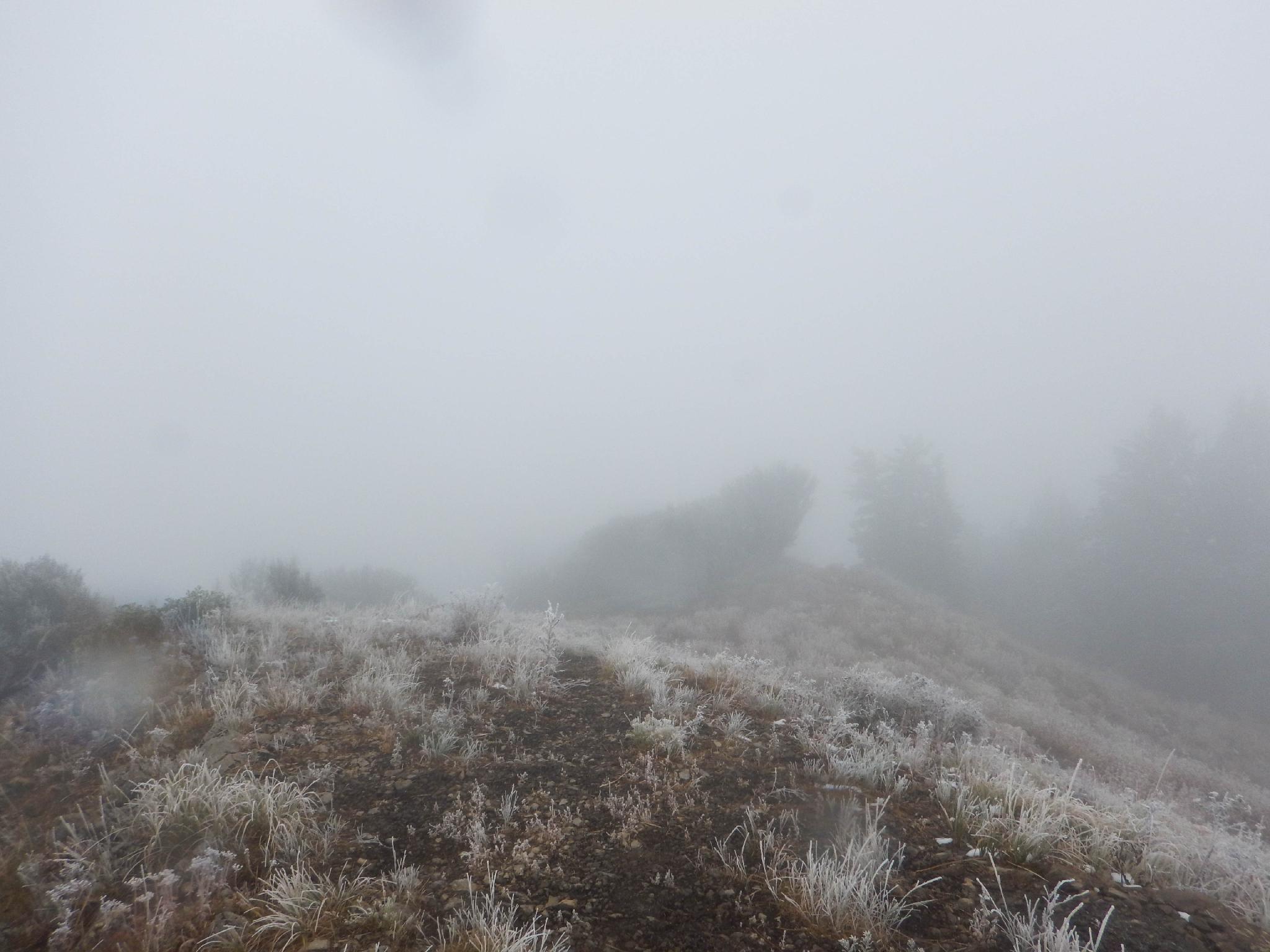
The social trail climbs steeply to a utility building before a final short meander to the top and hopefully stunning views. If you happen to visit on a cloudy day as I did, you may consider it Mill-NOT-vue Peak.
Return the same way.
Maps

12T 441716E 4506448N
40°42'25"N 111°41'24"W
12T 441748E 4506744N
40°42'34"N 111°41'23"W
12T 442914E 4506356N
40°42'22"N 111°40'33"W
12T 443771E 4505973N
40°42'10"N 111°39'56"W