Five Kiva Pueblo |

Blanding

Hiking Five Kiva Pueblo - Blanding Hiking Five Kiva Pueblo

Blanding

Overview

RATING: Easy hike
MAPS: BLACK MESA BUTTE, UT

Tue

Sunny, with a high near 72. West wind 5 to 15 mph, with gusts as high as 25 mph.

72 | 44

Wed

Sunny, with a high near 72.

72 | 45

Thu

Sunny, with a high near 60.

60 | 35

Fri

Sunny, with a high near 68.

68 | 37

Sat

Sunny, with a high near 74.

74 | 43

View Full Weather Details
SEASON: Any, although summers can be very hot. Difficult if there is snow on the ground.
GEAR: Standard Hiking Gear
WATER: None, bring all you need.

Tue

Sunny, with a high near 72. West wind 5 to 15 mph, with gusts as high as 25 mph.

72 | 44

Wed

Sunny, with a high near 72.

72 | 45

Thu

Sunny, with a high near 60.

60 | 35

Fri

Sunny, with a high near 68.

68 | 37

Sat

Sunny, with a high near 74.

74 | 43

View Full Weather Details
The ruin just upstream from Five Kiva Pueblo

The ruin just upstream from Five Kiva Pueblo

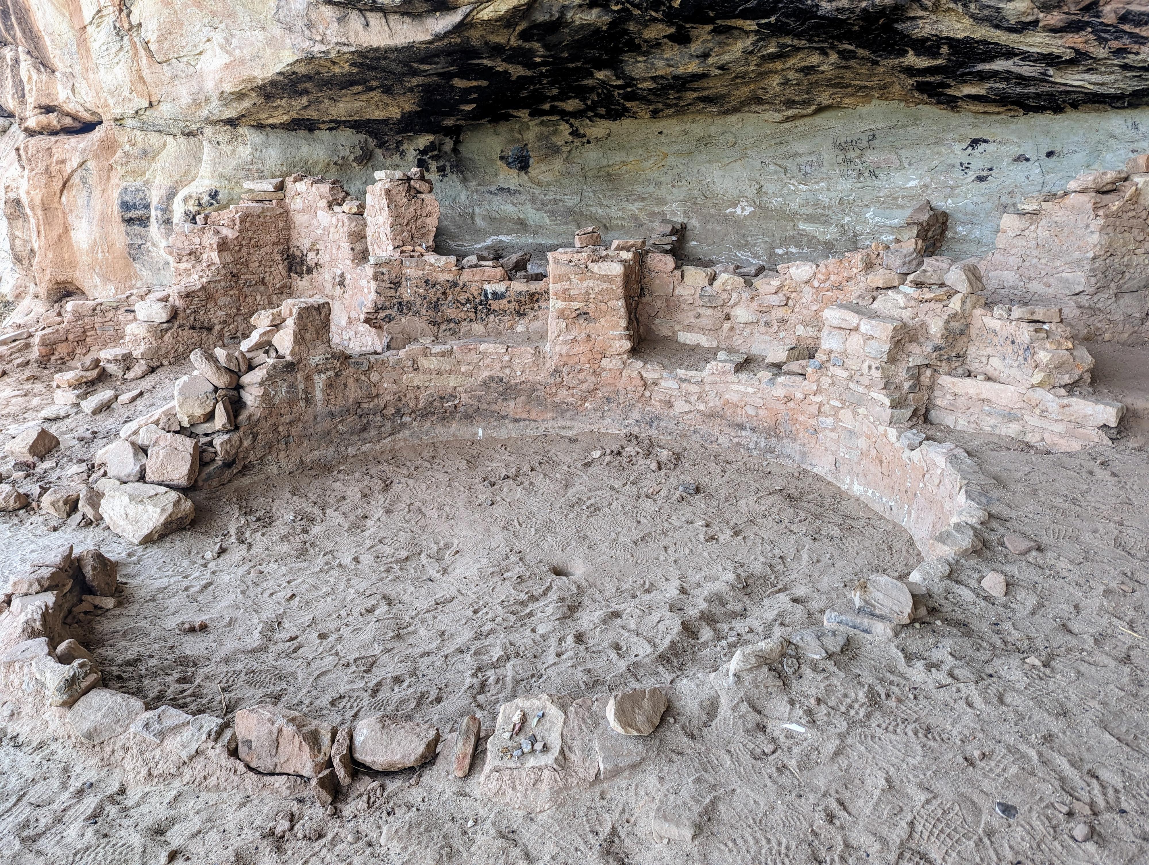
The area around Blanding is rich in archaeological sites. This site, just south of town, is the Five Kiva Pueblo site. Easy access, with a short hike, makes this is a fascinating place to visit if in the area. It is one I had overlooked for many years as I passed through. When we finally stopped to visit in 2024, we found it an amazing and fascinating site.

Note: A kiva is a circular underground room thought to have been used for spiritual ceremonies. They were significant to the ancient peoples that built them and lived in the area. This site seems to have five kivas, perhaps making it a place of very high importance. The location, an alcove above a small flowing creek, seems like an idyllic place to live.
One of the kivas at Five Kiva Pueblo

One of the kivas at Five Kiva Pueblo

Getting There

From downtown Blanding, head south on US-191 toward Bluff for about 1.5 miles to Ruin Road on the right. This is about 0.2 miles past mile marker 50. Follow Ruin Road to it's end in 1.7 miles at the trailhead.

Happy hiker just getting started in the day.

Happy hiker just getting started in the day.

Route

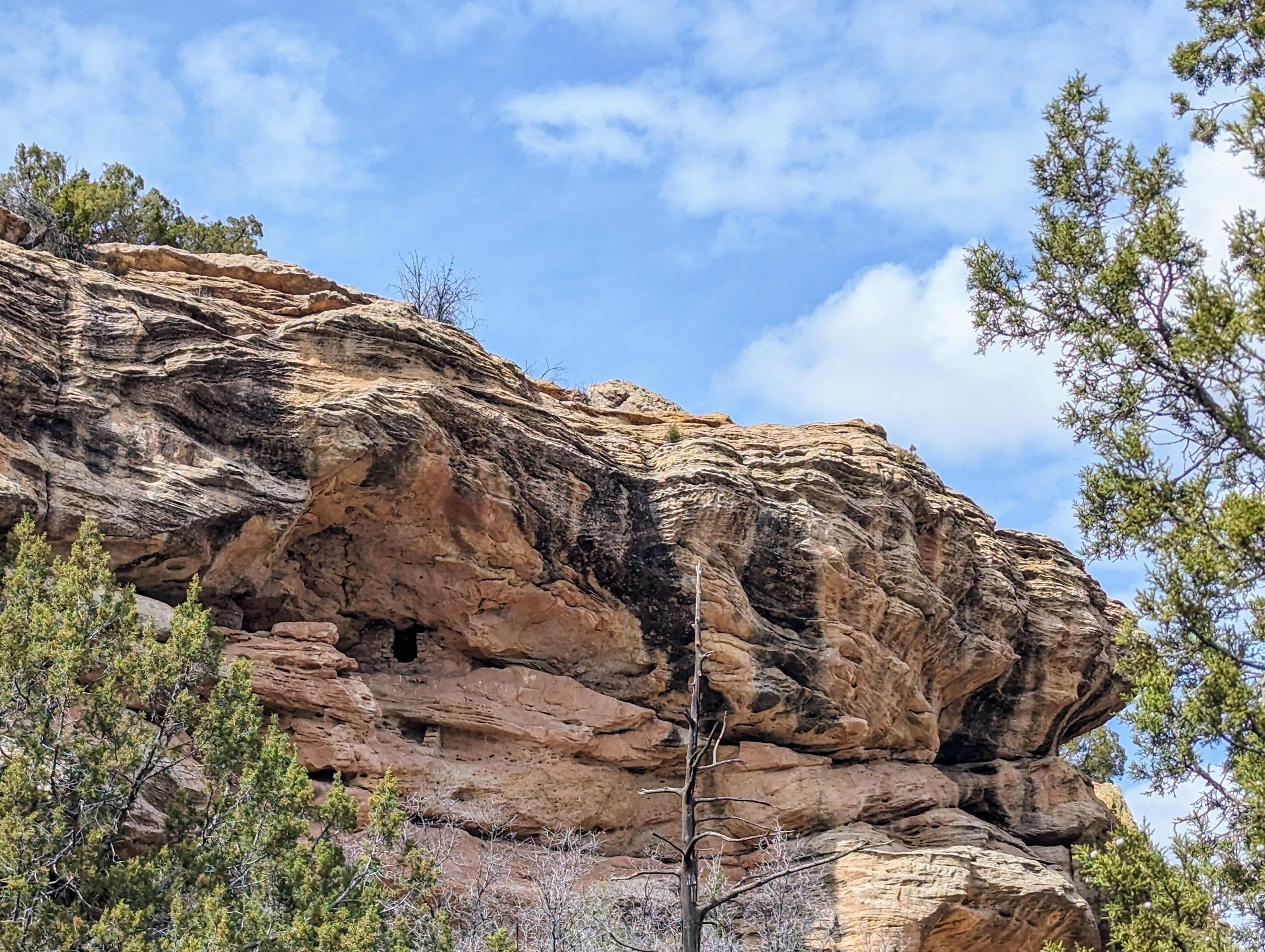
From the trailhead, look across the canyon. You can see the Five Kiva Pueblo across the canyon, as well as a well-preserved ruin wall to the right (north) of the main site.

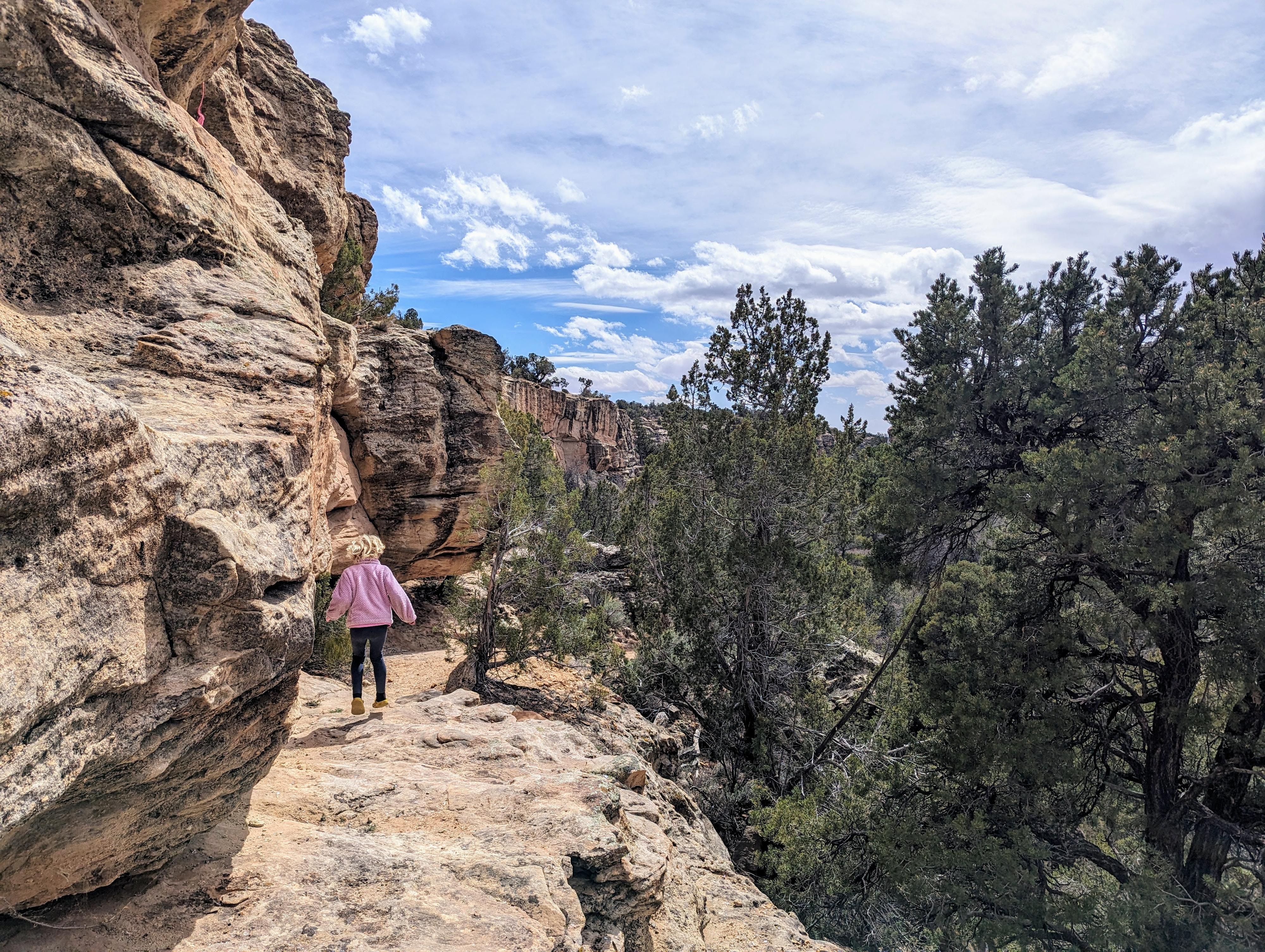
Follow a social trail south that descends off the canyon rim from the trailhead down to the stream below. It hops across the stream, then heads up to the alcove and Five Kiva Pueblo Ruin proper.

If you look across the canyon, and upstream, you can see another ruin. To reach it, follow a rough social trail down and upstream from Five Kiva Pueblo. You'll pass a granary right below Five Kiva as well as a few other minor ruins.

Return the same way.


Maps

Route / 0.37 miles / Elevation Range 5,692 - 5,783 ft.
Printable Maps:
Five Kiva Trailhead

12S 632423mE 4161466mN

N37° 35' 27" W109° 30' 00"

Five Kiva Ruin

12S 632317mE 4161470mN

N37° 35' 27" W109° 30' 05"

Granary

12S 632325mE 4161488mN

N37° 35' 27" W109° 30' 04"

Ruins

12S 632414mE 4161548mN

N37° 35' 29" W109° 30' 01"

Comments

Want to make a comment? Login and let yourself be heard.