Tezcatlipoca Tower |

Moab North

Climbing Tezcatlipoca Tower - Moab North Climbing Tezcatlipoca Tower

Moab North

Overview

RATING: 5.7
MAPS: Klondike Bluffs, UT

Sat

Mostly sunny, with a high near 76. West northwest wind 5 to 15 mph.

76 | 49

Sun

Sunny, with a high near 78.

78 | 48

Mon

Mostly sunny, with a high near 80.

80 | 52

Tue

Sunny, with a high near 80.

80 | 50

Wed

Sunny, with a high near 79.

79 | 52

View Full Weather Details
SEASON: Any, although summers can be hot.
GEAR: TCU's, BD C4 #4 (or equivalent), 1 quick draw, 50 m ( 165 ft. ) rope

Sat

Mostly sunny, with a high near 76. West northwest wind 5 to 15 mph.

76 | 49

Sun

Sunny, with a high near 78.

78 | 48

Mon

Mostly sunny, with a high near 80.

80 | 52

Tue

Sunny, with a high near 80.

80 | 50

Wed

Sunny, with a high near 79.

79 | 52

View Full Weather Details
Lucy hanging out at Tezcatlipoca Tower.

Lucy hanging out at Tezcatlipoca Tower.

The route goes up the crack, step left, then up to the summit.

The route goes up the crack, step left, then up to the summit.

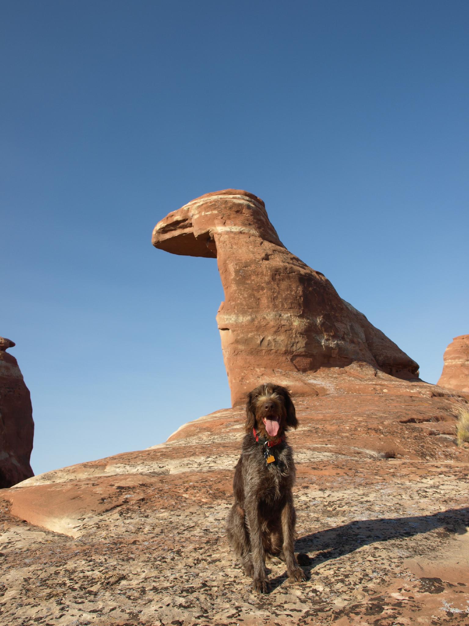
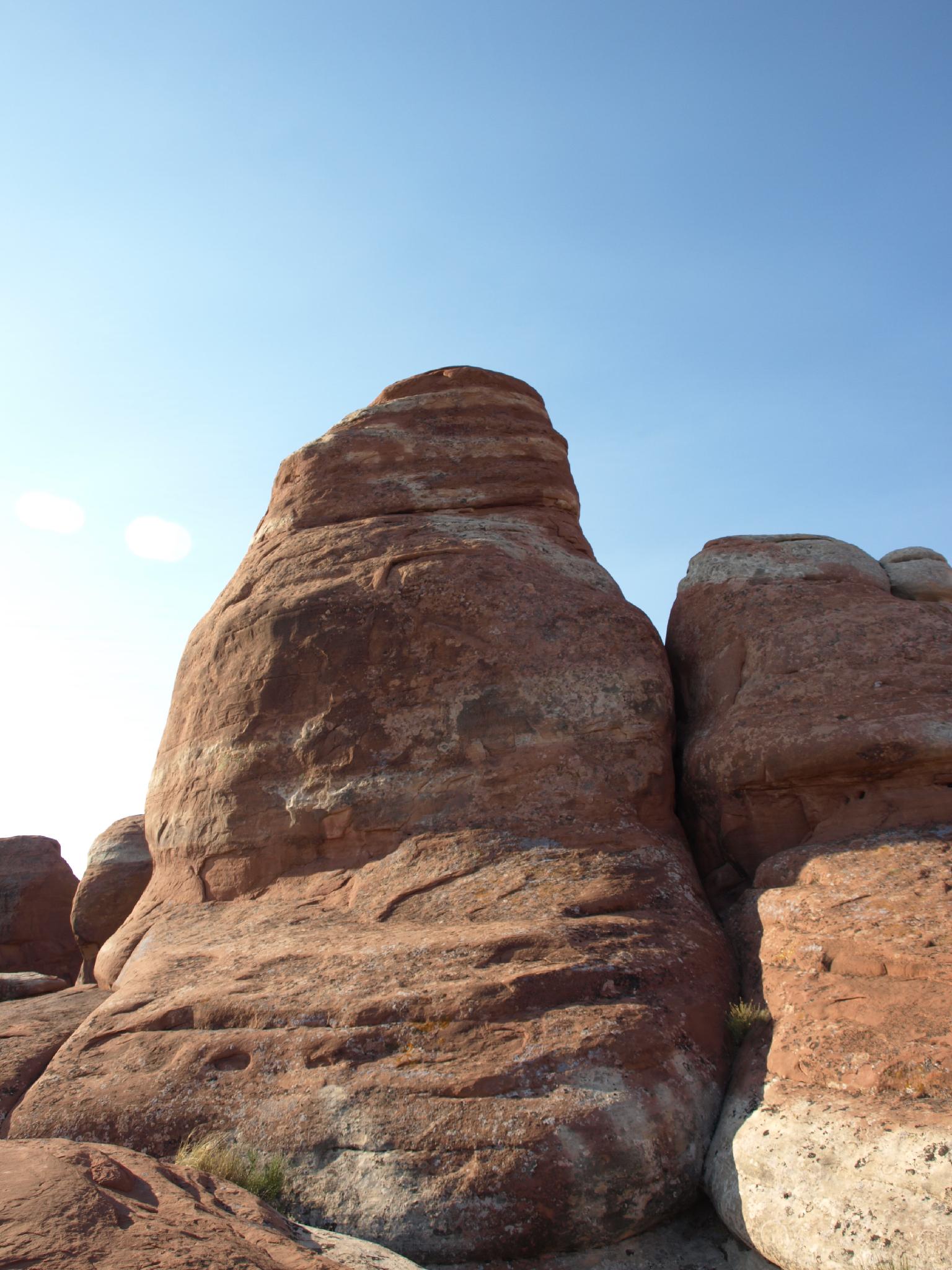
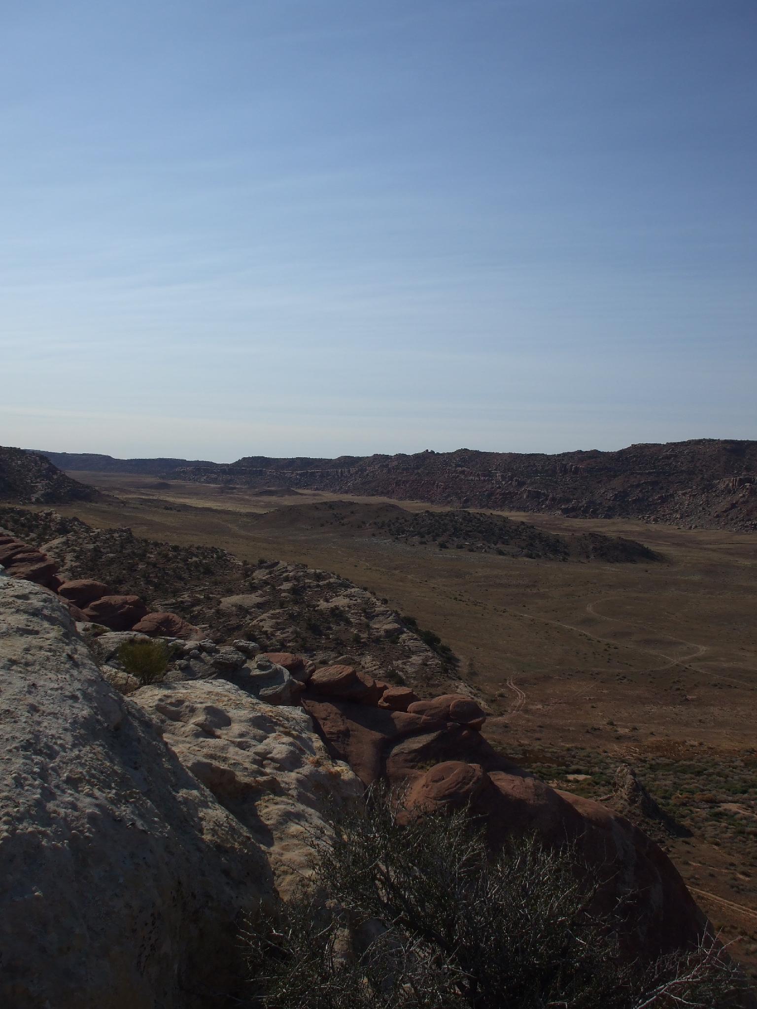
Tezctlipoca, although a very short tower at about 15 m ( 50 ft. ) tall, is very unique in it's shape. The climb is short, but the approach hike is delightful with expansive views of the La Sal mountains, San Rafael Swell, Abajo mountains, and even the Henry mountains in the far distance on a clear day. Don't expect to see anyone in this area. Although close to the highways, it is infrequently visited.

Big views on the approach to Tezcatlipoca Tower

Big views on the approach to Tezcatlipoca Tower

A little easy bouldering on the way to the tower.

A little easy bouldering on the way to the tower.

Getting There

Travel south from I-70 on highway 191 about 4.4 to milepost 152.6, or travel north out of Moab on highway 191 about 25 miles to the same milepost.

  • Go east on a good dirt road, reseting your odometer as you cross the railroad tracks. ( 12S 603034mE 4303792mN / N38° 52' 37" W109° 48' 44" )
  • After 1.1 miles you will cross a small bridge. Just after the bridge at 1.2 miles, go right. ( 12S 604016mE 4305521mN / N38° 53' 33" W109° 48' 02" )
  • At 2.6 miles you will cross a cattle guard. ( 12S 605967mE 4304420mN / N38° 52' 56" W109° 46' 42" )
  • Continue until 3.7 miles where you reach a junction, where you go right. ( 12S 607499mE 4304312mN / N38° 52' 52" W109° 45' 38" )
  • At 4.0 miles you will cross another cattle guard. Stay left after the cattle guard. ( 12S 607632mE 4303758mN / N38° 52' 34" W109° 45' 33" )
  • Continue to 4.9 where a small side road goes off on the left. Park a short distance off the main road down this side road. ( 12S 608393mE 4302508mN / N38° 51' 53" W109° 45' 02" )

Route

From the trailhead hike above the white cliffs on the ascending ramp. You want to be above all the white cliffs, and below the boulder strewn dirt slope. Follow the ramp as it ascends for about 30-40 minutes to the top of the cliffs. There are amazing views in this section. Once on top, head for the red and white entrada sandstone garden that is evident straight ahead. Tezcatlipoca is in this entrada area, and will be evident as you pass it. (1.5 miles from the trailhead to the tower)

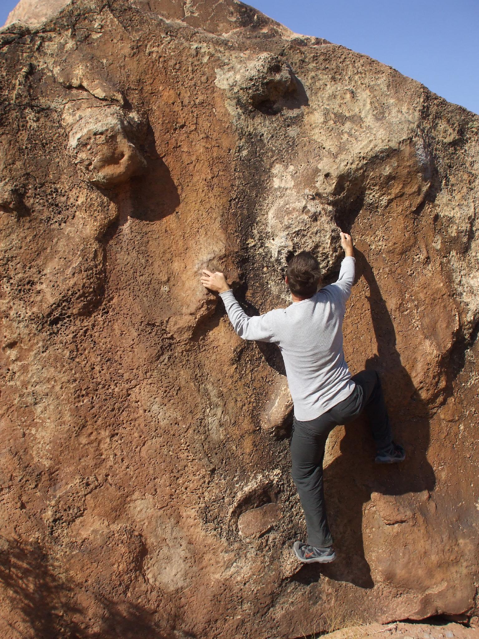
Find one of several routes down to the base of the tower. The climb ascends the chimney on the backside for a few moves before traversing over and up to the top. The piton below the summit is visible from the base. Enjoy the views from the top, this is a unique place. Return the way you came.

Tezcatlipoca was a central deity in Aztec religion, one of the four sons of Ometeotl, he is associated with a wide range of concepts including the night sky, the night winds, hurricanes, the north, the earth, obsidian, enmity, discord, rulership, divination, temptation, jaguars, sorcery, beauty, war and strife.
– http://en.wikipedia.org/wiki/Tezcatlipoca


The tower was so named because the first ascent was done solo by Mike Baker by the light of the full moon. Originally rated 5.5, it will likely feel a bit harder to most. (5.7)


Photos

Maps

Printable Maps:
Trailhead

12S 608435mE 4302496mN

N38° 51' 53" W109° 45' 01"

Base

12S 610156mE 4301442mN

N38° 51' 18" W109° 43' 50"

Comments

Want to make a comment? Login and let yourself be heard.