
 Fremont Indian State Park
Sevier Valley
Overview
Fremont Indian State Park is one of the often-overlooked gems in Utah. It is an amazing state park that anyone with an interest in Native American culture, history, or art should put high on their list to visit. I have visited Nine Mile Canyon many times over the years. When I finally visited Fremont Indian State Park, I was dazzled by the amount and quality of rock art lining the canyon walls. To me, it was as fascinating to visit as Nine Mile Canyon, though with easier access. Even on a holiday weekend, we felt we had the park mostly to ourselves, with few other visitors.
Getting There
The park is located off I-70 in Clear Creek Canyon at exit 17. This is about 20 miles west of the town of Richfield.
Route Description
Rock art and historic sites are fragile, non-renewable cultural resources that, once damaged, can never be replaced. To ensure they are protected, please:
- Avoid Touching the Petroglyphs: Look and observe, BUT DO NOT TOUCH!
- Stay on the Trails: Stay on the most used trails when visiting sites, and don't create new trails or trample vegetation.
- Photography and Sketching is Allowed: Do not introduce any foreign substance to enhance the carved and pecked images for photographic or drawing purposes. Altering, defacing, or damaging the petroglyphs is against the law -- even if the damage is unintentional.
- Pets: Keep pets on a leash and clean up after them.
- Artifacts: If you happen to come across sherds (broken pottery) or lithics (flakes of stone tools), leave them where you see them. Once they are moved or removed, a piece of the past is forever lost.
If you only have time for a short visit... (1-3 hours)
The park has an excellent museum and trail system that starts at the visitor center/museum. If time for your visit is short, I recommend going straight to the visitor center and hiking the trails there. They give the best bang for your buck time wise.
If you have a full day...
Below are brief descriptions of the hikes and roadside panels that we found particularly enjoyable in the order I would recommend them. All of these plus the visitor center trails can be visited in 1 day, though if rock art is of great interest to you, it is easy to spend a couple of days visiting the panels and soaking in their details.
Arch of Art Viewpoint
This stunning wall has excellent rock art visible from the road with binoculars, or a short walk up to see them up close. I thought the panels here were particularly interesting.
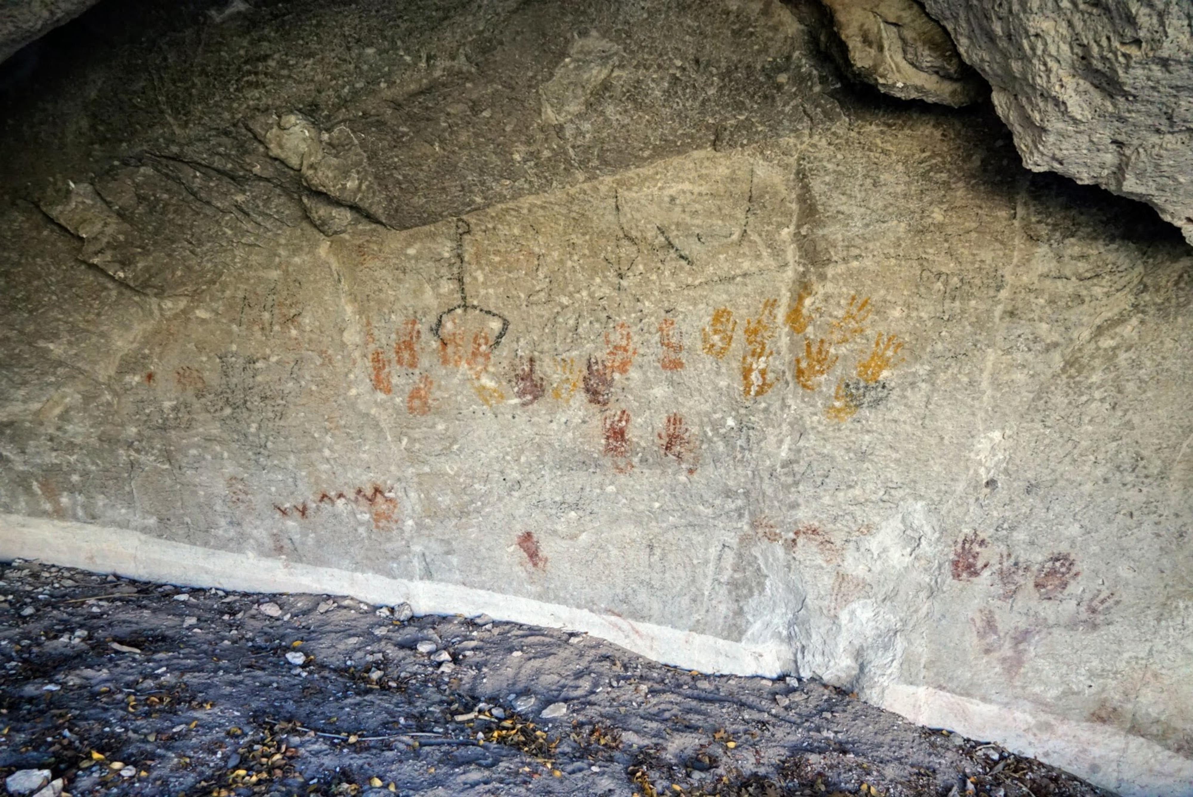
Cave of a Hundred Hands
This short hike (0.7 miles round trip) crosses under the highway and visits a cave on the south side of the canyon that has handprints in it. It is dramatic and a favorite of many park visitors.
Sheep Shelter Trail (and Indian Blanket Viewpoint)
These two sites start at the same trailhead and share the first part of the trail. The Indian Blanket Viewpoint is a short hike to a view across the canyon of a large pictograph that looks like a blanket. Bring binoculars and a telephoto lens to better see the panel. From the Indian Blanket informational sign, this fascinating story:
Many years ago, according to legends, a group of Paiute Indians passed through Clear Creek Canyon on the way to their winter camping area. While they were in the canyon, a recently born baby of a young woman died and was buried near here. During the winter, the mother was troubled by the thought of her baby being alone in the cold. The following spring she returned to the burial site. Nearby, she painted a blanked on a rock face so the baby could use the blanket to keep warn during cold winters at this lonely place.
A short distance uphill from the Indian Blanked Viewpoint is the Sheep Shelter is a fascinating place to visit. Excavation found use of this small overhang dating back as far as 3700 B.C.
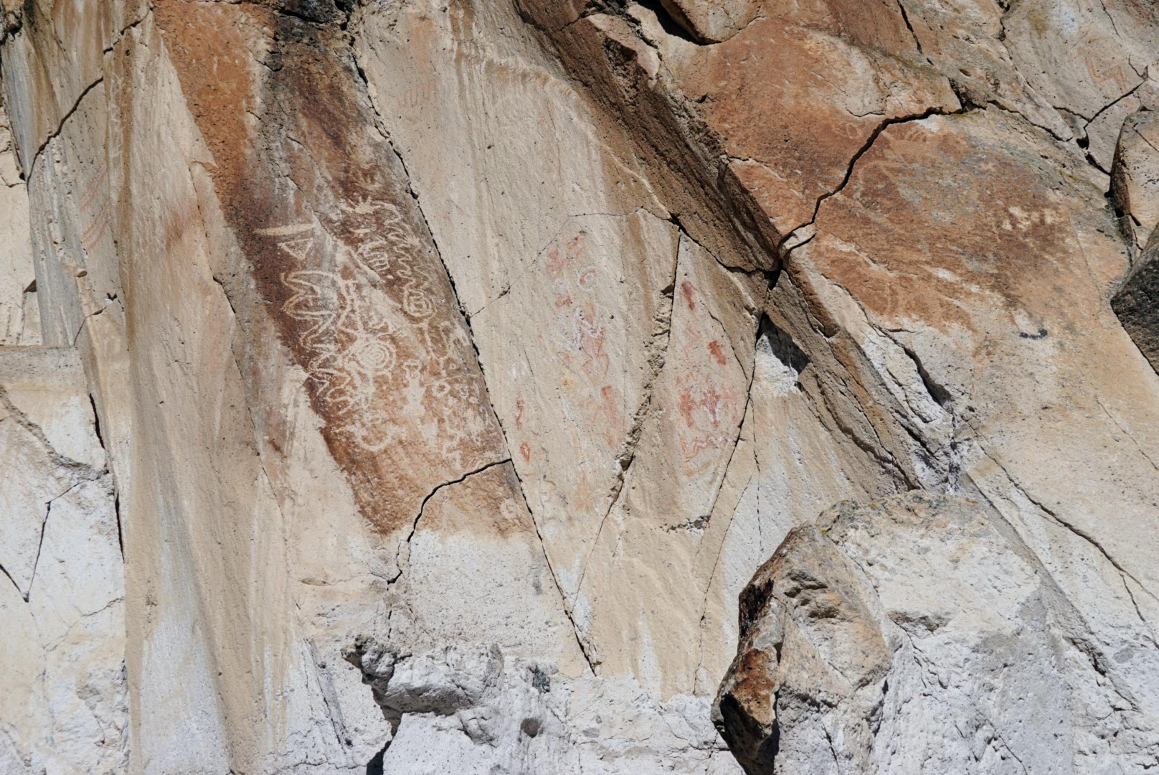
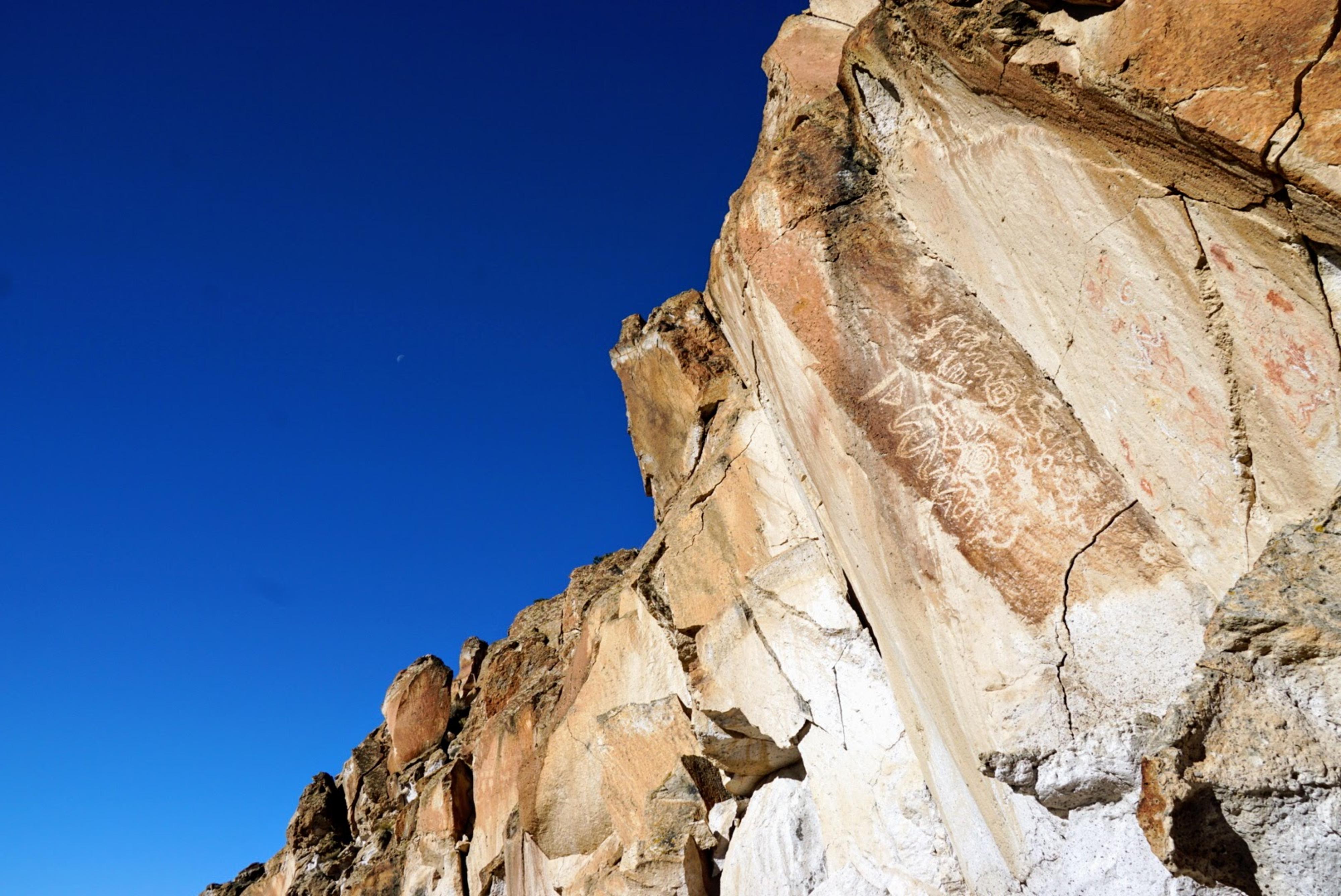
Skinner Canyon Rock Art Sites
Visiting these sites requires driving on a bit of dirt road. The first site is reachable by most vehicles, the second will require high clearance. It is a short walk from the pavement to visit both sites, and walking makes a good alternative if you do not want to drive down the dirt road. The upper site was one of our favorites of the trip.
Centennial Picnic Area and Cabin
This is a lovely area for a picnic and makes a great lunch spot during the day.
Canyon of Life Rock Art Trail
This was our first stop of the day, and turned out to be more of an adventure than we were expecting. From the trailhead, follow the trail a couple of minutes to where it forks. Right goes over to an excellent panel. Left heads north, then quickly west to a steep loose gully. There is a large panel at the top of the gully on the right on the flat surface. You can JUST make it out from below, binoculars help. A trail climbs up the gully to get a better view of it, but it is steep, loose, and definitely not for beginners. Not recommended for most, it is difficult to go up and even more difficult to go down. We had an old park brochure that described the route, or we would not have attempted it.
Newpaper Rock Viewpoint
You are not allowed to climb up to Newspaper Rock, so this viewpoint is the best way to see it. Binoculars and a telephoto lens required.
Photos
Maps


12S 382417E 4270616N
38°34'34"N 112°20'59"W
12S 382817E 4270641N
38°34'35"N 112°20'43"W
12S 382880E 4270704N
38°34'38"N 112°20'40"W
12S 382751E 4270769N
38°34'40"N 112°20'46"W
12S 384108E 4270854N
38°34'43"N 112°19'50"W
12S 384012E 4270937N
38°34'46"N 112°19'54"W
12S 384423E 4270952N
38°34'46"N 112°19'37"W
12S 384936E 4271111N
38°34'52"N 112°19'16"W
12S 385942E 4270949N
38°34'47"N 112°18'34"W
12S 383955E 4271017N
38°34'48"N 112°19'56"W
12S 384094E 4271189N
38°34'54"N 112°19'51"W
12S 384031E 4271203N
38°34'54"N 112°19'53"W
12S 384076E 4271179N
38°34'54"N 112°19'51"W
12S 384070E 4271051N
38°34'49"N 112°19'51"W
12S 384374E 4270789N
38°34'41"N 112°19'39"W
12S 384150E 4270955N
38°34'46"N 112°19'48"W
12S 386996E 4270941N
38°34'47"N 112°17'50"W
12S 387052E 4271248N
38°34'57"N 112°17'48"W
12S 387193E 4271408N
38°35'02"N 112°17'43"W