
 Hickison Petroglyph Area
Austin
Overview
Crossing Nevada on US Route 50 is both a desolate and engaging experience at the same time. For those just hurrying through, the route seems empty and inviting. There are, however, quite a few fascinating roadside attractions a few minutes off the highway that make for great roadside stops.
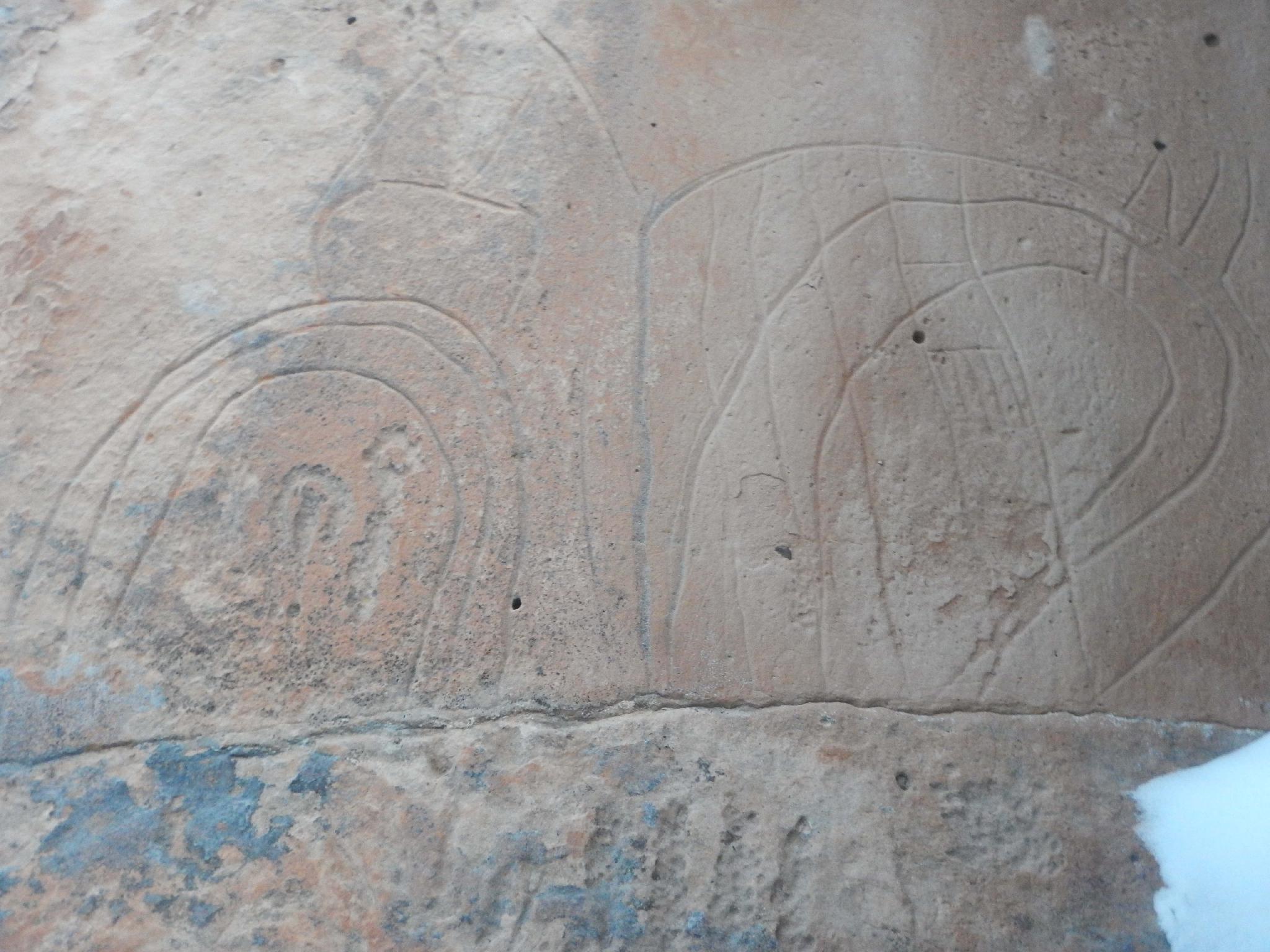
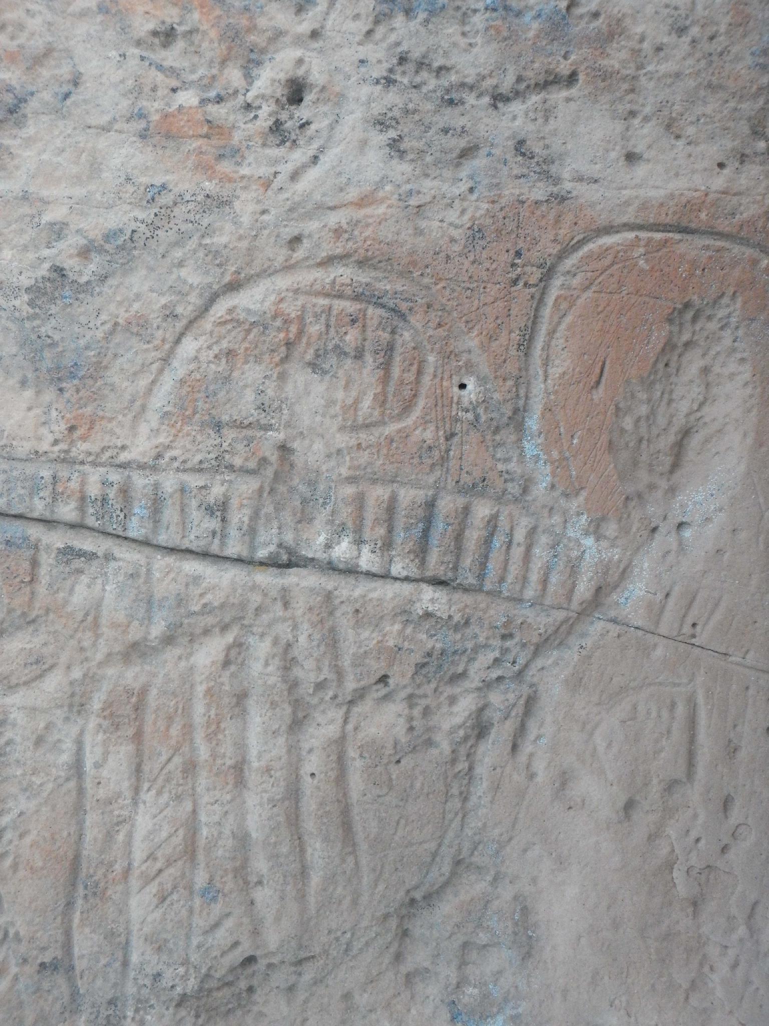
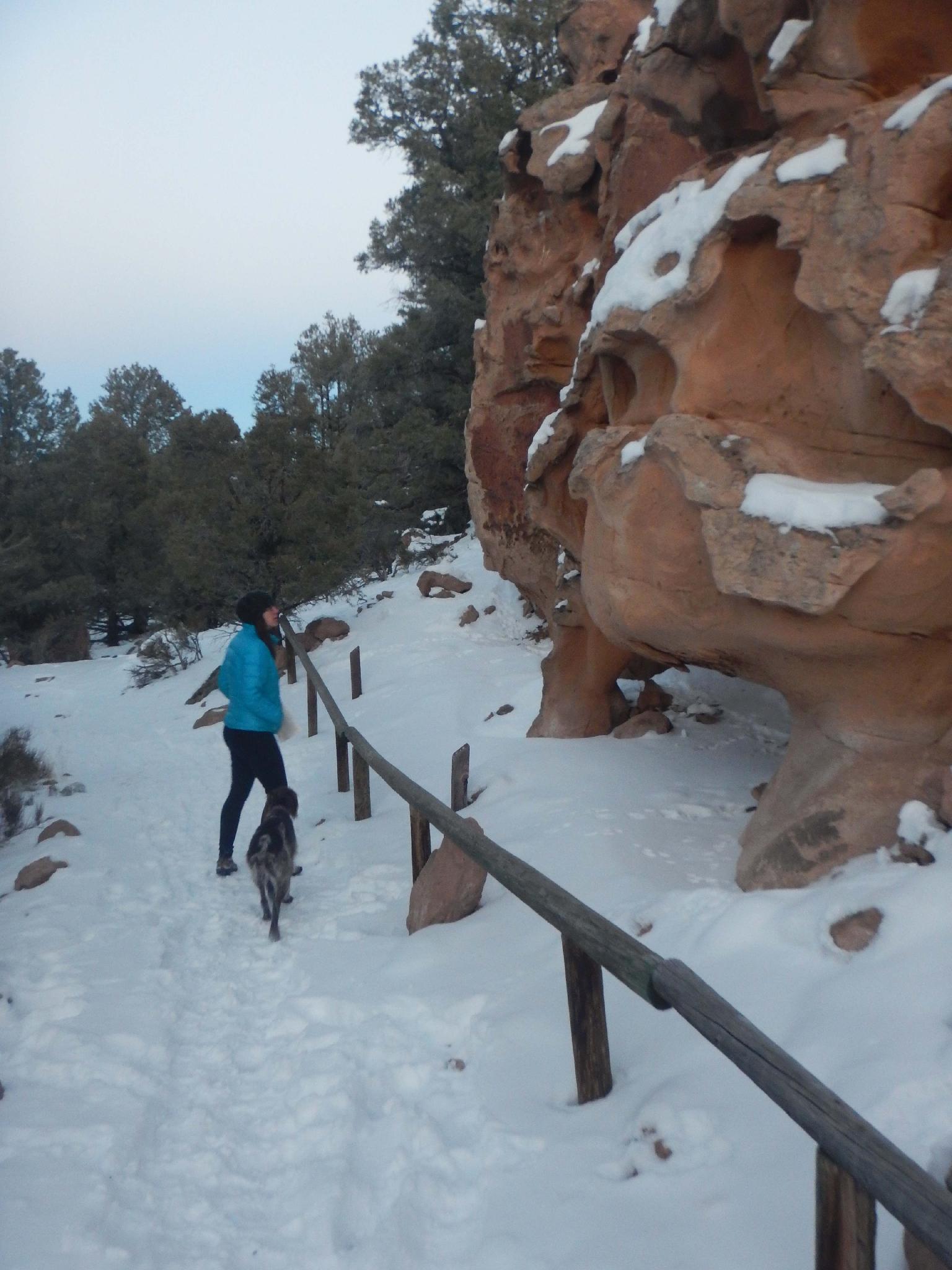
Hickison Petroglyph Recreation Area is one of those stops and is steeped in history. The panel is mere minutes off US-50 and offers an excellent way to stretch your legs while passing through. There is a great camping area here as well, making it a good place to stop and break up a drive if passing through.
From the BLM:
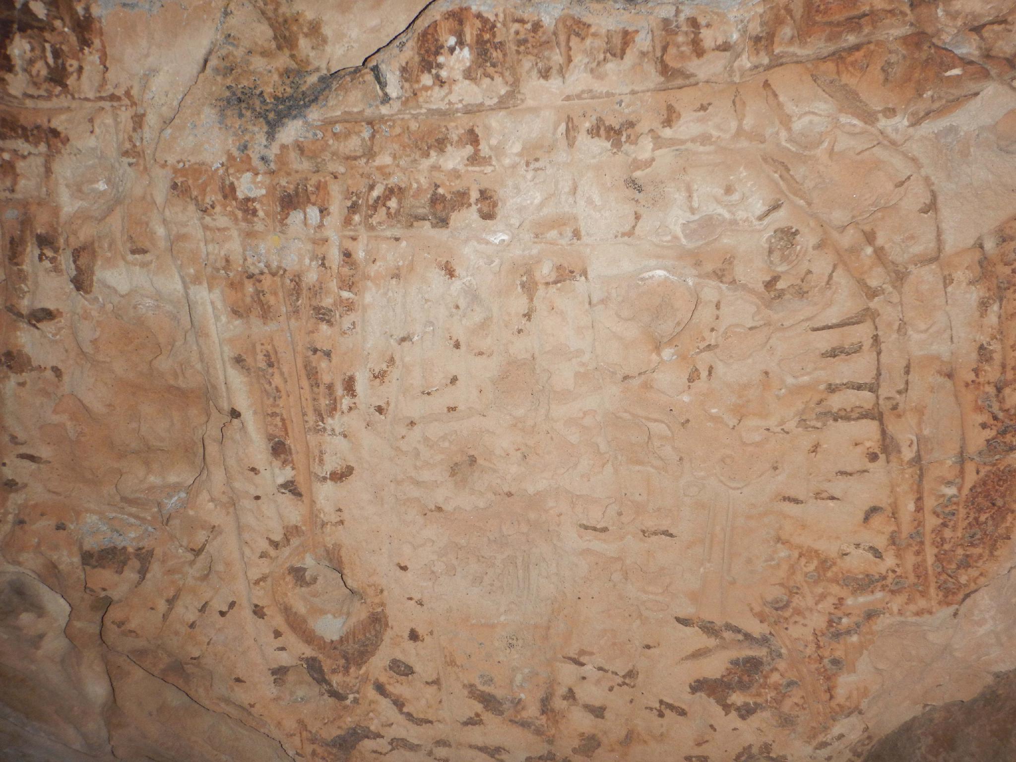
The Hickison Summit area of the Great Basin is rich in prehistoric and historic resources. Not only are there petroglyphs such as found here at the Hickison Petroglyph site, but there are numerous prehistoric hunting and living sites dating back as far as 10,000 BC. Historic sites include the trails of frontier explorers, John C. Fremont and James H. Simpson, the Pony Express Route, the Overland Stage Route, mining camps, and ranches.
Prehistoric sites dating back 11,000 to 12,000 years have been recorded in Big Smoky Valley, the next valley west on U.S. Hwy 50, and Monitor Valley, where you are now. At that time, many of the valleys in the Great Basin supported large lakes. Big Smoky Valley had two such lakes, Lake Toiyabe, about 25 miles south of here, and Lake Tonopah, southwest of Tonopah, Nevada. From the distribution of these early archaeological sites, it appears that people were living around these lakes and exploiting the abundant plants and animals dependent on the lakes. Archaeologists refer to this early period of human occupation of the Great Basin as the Western Pluvial Lakes Tradition.
As the climate changed, becoming drier through time, the ways in which people lived changes. The lakes dried up and people began to rely more on upland resources, such as mountain sheep, antelope and deer, and plants including Indian rice grass and pinyon pine. By the historic period (1850), the Western Shoshone, the people EuroAmericans found already occupying the central Great Basin, were hunters and gatherers living on a wide variety of plants and animals.
The first EuroAmericans to see this portion of the Great Basin were John C. Fremont and his surveying party. In 1845, Fremont and his men passed just south of here, roughly along the route of U.S. Hwy. 50. Fourteen years later, on May 26, 1859, Captain James Simpson and his party crossed Hickison Summit into Big Smoky Valley on their way west. Simpson had been given the responsibility for finding the shortest route across Nevada. He was successful and his path would be followed by the Pony Express in 1860 and Butterfield's Overland Mail and Stage in 1861.
Silver was discovered about 22 miles west of here near Austin in 1862. Although never large producers themselves, the Austin mines proved that precious metals occurred in this part of the West and prospectors quickly made additional discoveries. With the development of mines, the demand for food and draft animals spurred the development of ranches and farms. Soon most Nevada valleys contained farms, ranches, and mining camps.
Getting There
From Austin, NV, the Hickison Petroglyph Recreate Area area is about 25 miles east on US-50 and well signed. If coming from the east, it is about 45 miles west of Eureka. The panel trail starts at the campground. Pit toilet available.
Route Description
Rock art and historic sites are fragile, non-renewable cultural resources that, once damaged, can never be replaced. To ensure they are protected, please:
- Avoid Touching the Petroglyphs: Look and observe, BUT DO NOT TOUCH!
- Stay on the Trails: Stay on the most used trails when visiting sites, and don't create new trails or trample vegetation.
- Photography and Sketching is Allowed: Do not introduce any foreign substance to enhance the carved and pecked images for photographic or drawing purposes. Altering, defacing, or damaging the petroglyphs is against the law -- even if the damage is unintentional.
- Pets: Keep pets on a leash and clean up after them.
- Artifacts: If you happen to come across sherds (broken pottery) or lithics (flakes of stone tools), leave them where you see them. Once they are moved or removed, a piece of the past is forever lost.
From the parking area/campground, a short trail makes a loop visiting the several panels. There are interpretive signs along the way. The hike is short enough to be family friendly to most.
Those wanting an even shorter walk should go left (counterclockwise) on the trail to reach the best panels in just a couple of minutes from the trailhead.
Maps

11S 521352E 4366593N
39°26'55"N 116°45'07"W
11S 521320E 4366650N
39°26'57"N 116°45'08"W
11S 521317E 4366518N
39°26'53"N 116°45'08"W