Soda Basin | San Juan River

Hiking Soda Basin - San Juan River Hiking Soda Basin

San Juan River

Overview

RATING: Easy Hike
MAPS: MEXICAN HAT, UT

Wed

Areas of smoke before 8am, then isolated showers and thunderstorms between noon and 3pm. Mostly sunny, with a high near 103. West southwest wind 5 to 15 mph, with gusts as high as 25 mph.

103 | 73

Thu

A chance of showers and thunderstorms between noon and 3pm, then a chance of showers and thunderstorms. Partly sunny, with a high near 99. Southwest wind 5 to 10 mph. Chance of precipitation is 30%.

99 | 72

Fri

A slight chance of rain showers before noon, then a chance of showers and thunderstorms. Mostly sunny, with a high near 98.

98 | 70

Sat

A slight chance of showers and thunderstorms after noon. Mostly sunny, with a high near 98.

98 | 70

Sun

A slight chance of showers and thunderstorms after noon. Mostly sunny, with a high near 100.

100 | 70

View Full Weather Details
SEASON: Fall, Winter, Spring (Hot in the summer)
GEAR: Standard Hiking Gear
WATER: None, bring all you need.
NOTES: Reaching the trailhead typically requires high clearance.

Wed

Areas of smoke before 8am, then isolated showers and thunderstorms between noon and 3pm. Mostly sunny, with a high near 103. West southwest wind 5 to 15 mph, with gusts as high as 25 mph.

103 | 73

Thu

A chance of showers and thunderstorms between noon and 3pm, then a chance of showers and thunderstorms. Partly sunny, with a high near 99. Southwest wind 5 to 10 mph. Chance of precipitation is 30%.

99 | 72

Fri

A slight chance of rain showers before noon, then a chance of showers and thunderstorms. Mostly sunny, with a high near 98.

98 | 70

Sat

A slight chance of showers and thunderstorms after noon. Mostly sunny, with a high near 98.

98 | 70

Sun

A slight chance of showers and thunderstorms after noon. Mostly sunny, with a high near 100.

100 | 70

View Full Weather Details
Views down river from Soda Basin

Views down river from Soda Basin

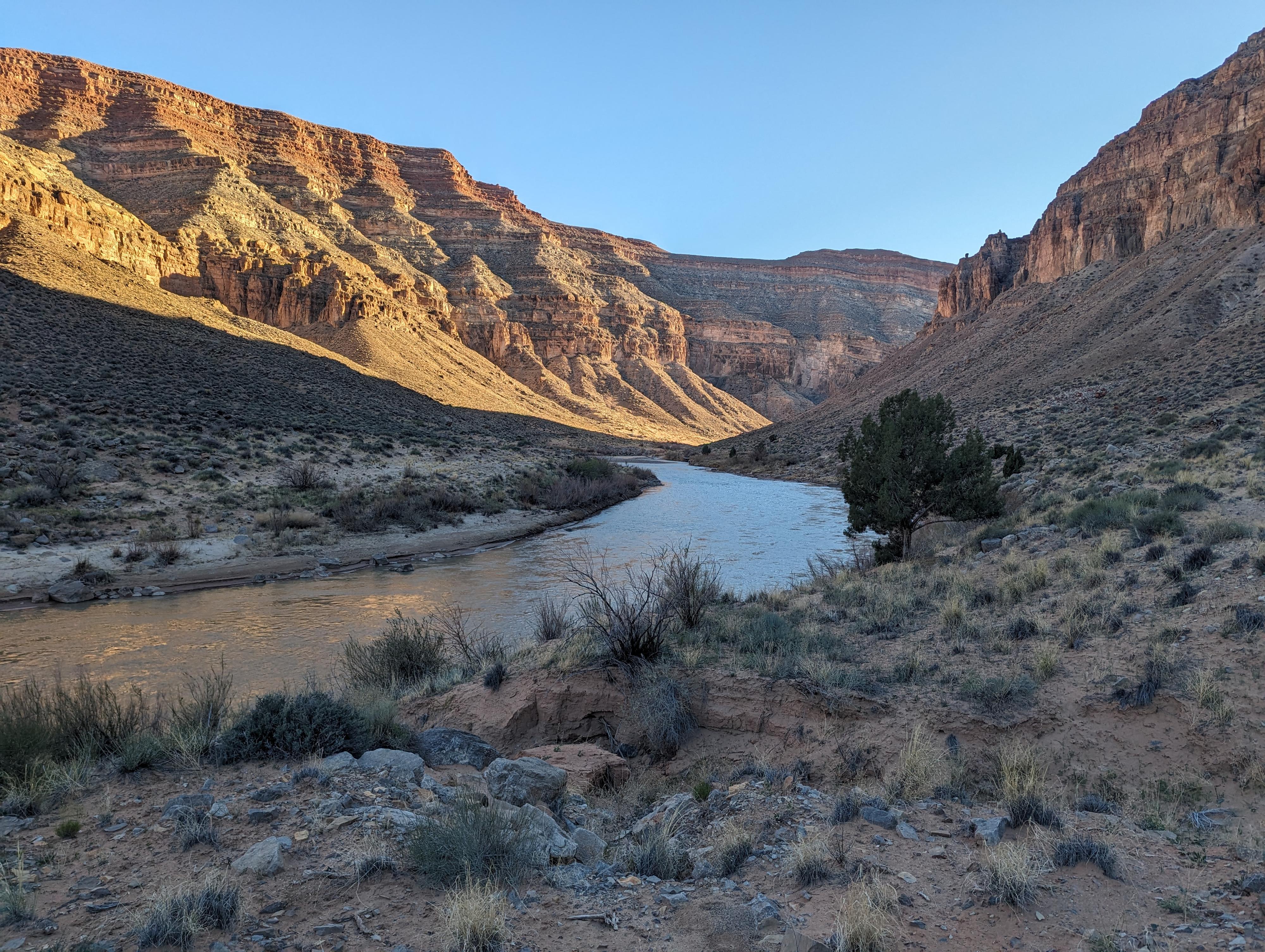
Between Comb Ridge and Mexican Hat, the San Juan River cuts deeply through the Paradox Formation, a limestone layer. This deep gorge is frequently visited by river runners, but is difficult to visit for non-river runners. The trail from Lime Creek to Soda Basin is about the only easy access hikers have to experience this deep gorge.

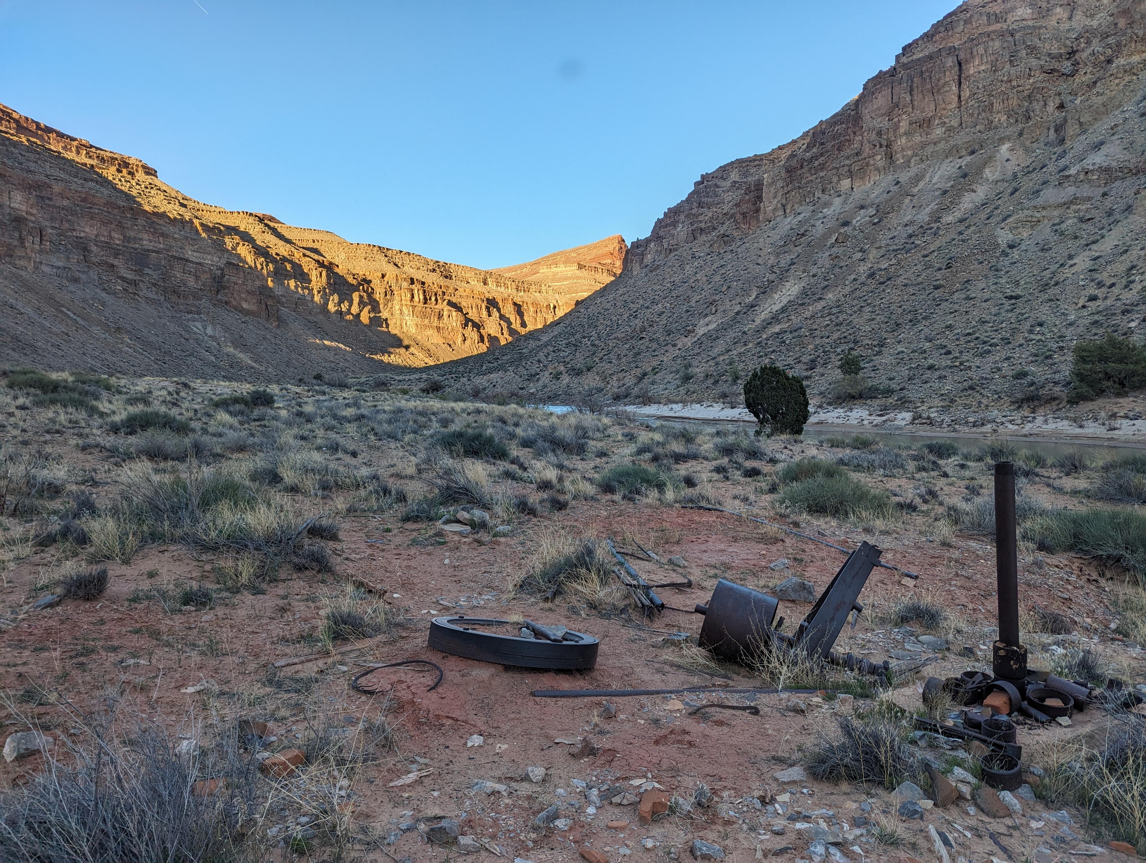
The trail, an old oil exploration road, follows along the river with excellent views of the San Juan and surrounding gorge. Because it is an old road, the hiking and navigation are easy. The turn around point, Soda Basin, has some old mining relics strewn about and is fairly interesting to check out.

Note: There is no water available on this hike, and it gets incredibly hot. Be sure to visit during cooler times of the year and bring plenty of water.
History: In 1907 Emery Goodridge began drilling for oil along the San Juan. His highly successful drilling started an oil boom to the region and gave rise to the town of Mexican Hat. The remnants of exploratory oil wells and the primitive road to Lime Creek here were built in 1928 by the Utah Southern Oil Company. Like many oil prospectors, they found no oil and abandoned their machinery.
Ledge Rapid

Ledge Rapid

Getting There

The trailhead is reached by heading west out of Bluff toward Mexican Hat on US-191 for about 20 miles to milepost 25.4 on US-163 where a dirt road leaves on the south (left) side of the road. Reset your odometer as you turn onto this road.

  • Mile 25.4 on US-163 ( 12S 601106E 4117889N / 37°12'07"N 109°51'38"W )
  • 0.65 miles - Jct - Right ( 12S 601987E 4117798N / 37°12'04"N 109°51'03"W )
  • 2.4 miles - Trailhead. There is decent primitive camping near the trailhead. ( 12S 603137E 4115959N / 37°11'04"N 109°50'17"W )
Old drill hole in the basin

Old drill hole in the basin

Route

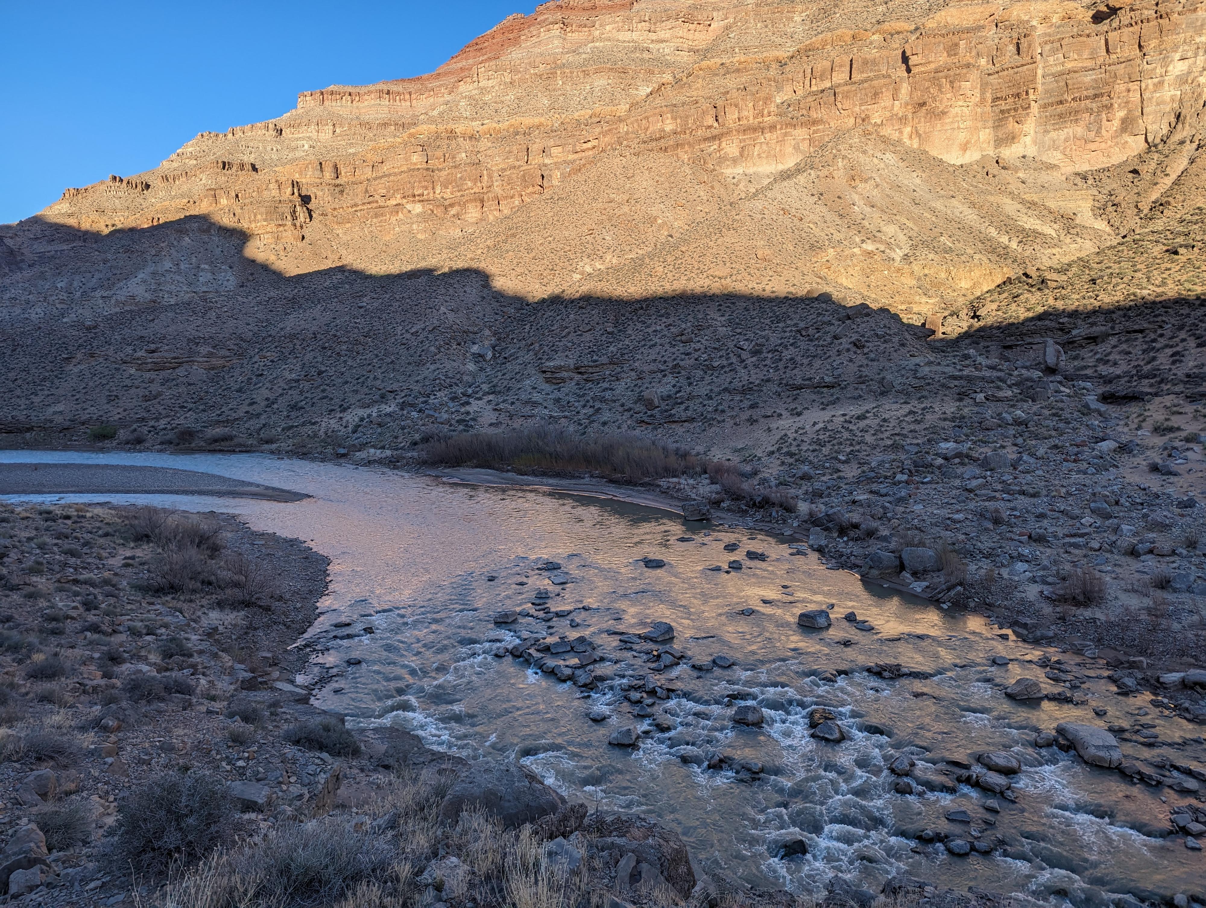
From the trailhead, the old road crosses Lime Creek. It can be a little tricky to find in a few spots, but once you find it across Lime Creek, it is easier to follow.

Follow it as it meanders along, heading up the San Juan River bank. About 3/4 of a mile from the trailhead, the old road crosses into the limestone layer and the canyon begins to deepen. A sandy campsite on the right here is known as Fossil Stop by river runners. The limestone around this area has fossils if you have a close eye.

From Fossil Stop, the old road continues as the gorge deepens. About 1.7 miles from the trailhead, the road rounds a corner and Ledge Rapid (class II) is visible just below in the river.

About 2 miles from the trailhead, the road deteriorates as you reach the old oil exploration area. From here, wandering around is your best bet. I have marked some sites on the map that I found interesting.

Return the same way.


Maps

Route / 4.82 miles / Elevation Range 4,114 - 4,196 ft.
Printable Maps:

Trailhead

12S 603137E 4115959N

37°11'04"N 109°50'17"W

Fossil Stop

12S 604117E 4115537N

37°10'50"N 109°49'37"W

Ledge Rapid

12S 605410E 4115834N

37°10'59"N 109°48'45"W

Old Well

12S 605670E 4116385N

37°11'17"N 109°48'34"W

Old Structure

12S 605603E 4116383N

37°11'17"N 109°48'37"W

Rock Chimney and Foundation

12S 605660E 4116485N

37°11'20"N 109°48'34"W

Comments

Want to make a comment? Login and let yourself be heard.