 Hiking
Petroglyph and Double Arch (Spirit Arch) Canyons
Hiking
Petroglyph and Double Arch (Spirit Arch) Canyons
Eastern Reef
Overview
As short stroll to stretch your legs as you pass by on I-70, this is a hike I have done many times over the years and always enjoy. Access is easy, the hike is short, the scenery excellent, what is not to love?!?!
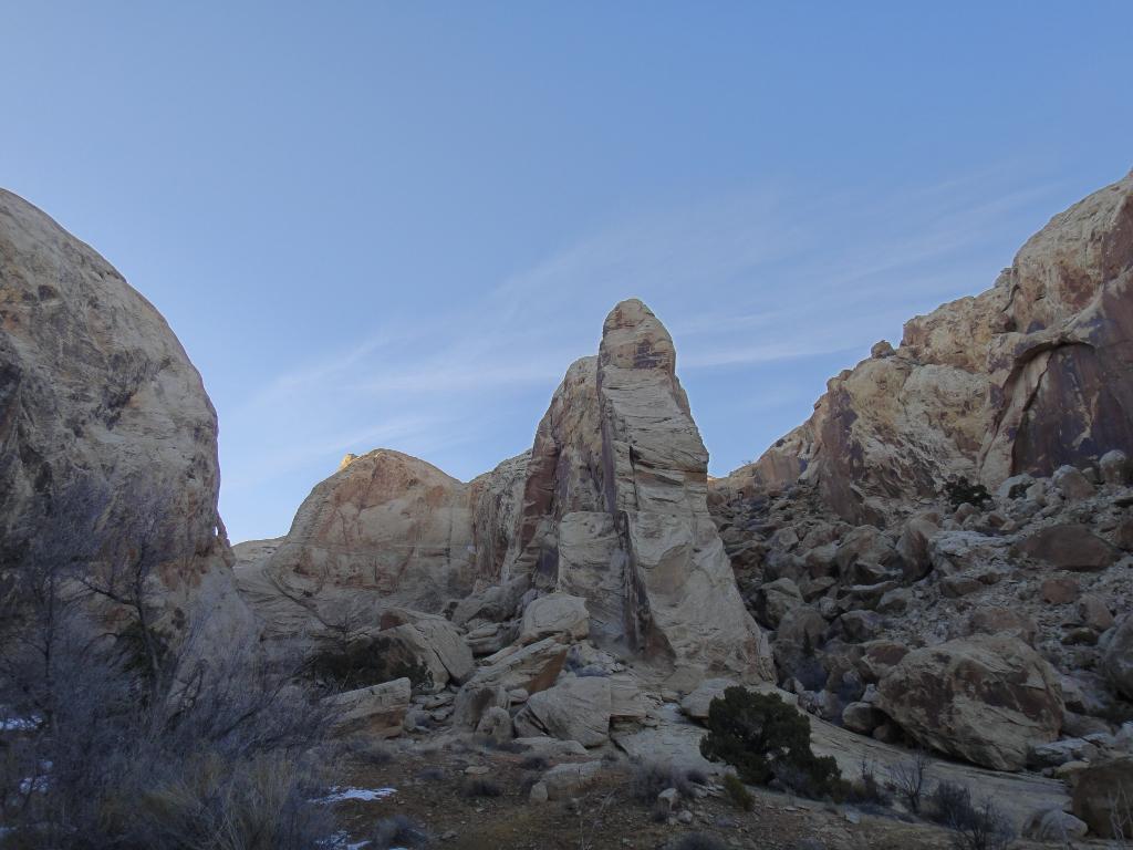
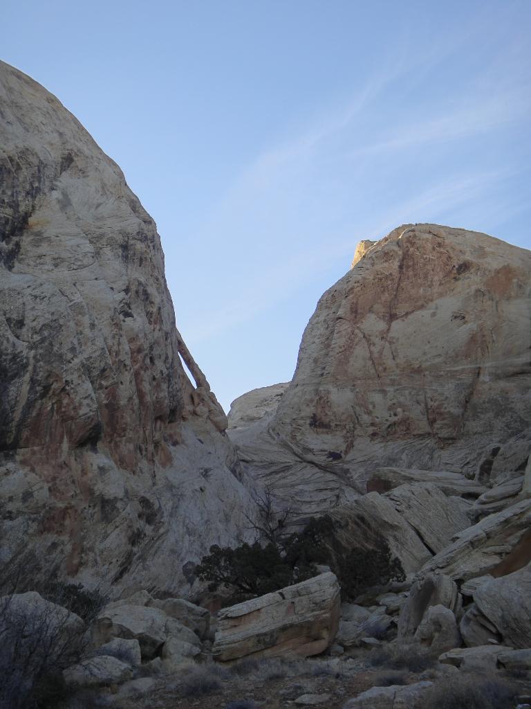
The hike visits three canyons. Box Spring Canyon, a short canyon typical of the desert. A bit lush, and ending at a dryfall, this is the least interesting of the 3, so if you are short on time, skip it. The next stop is Double Arch Canyon, an exquisite short canyon that ends at a dryfall with two large arches high on the left. There is also a small bridge directly in the watercourse. Double Arch was named by author Steve Allen in the 1990's, but seems to have been renamed to Spirit Arch in recent years.
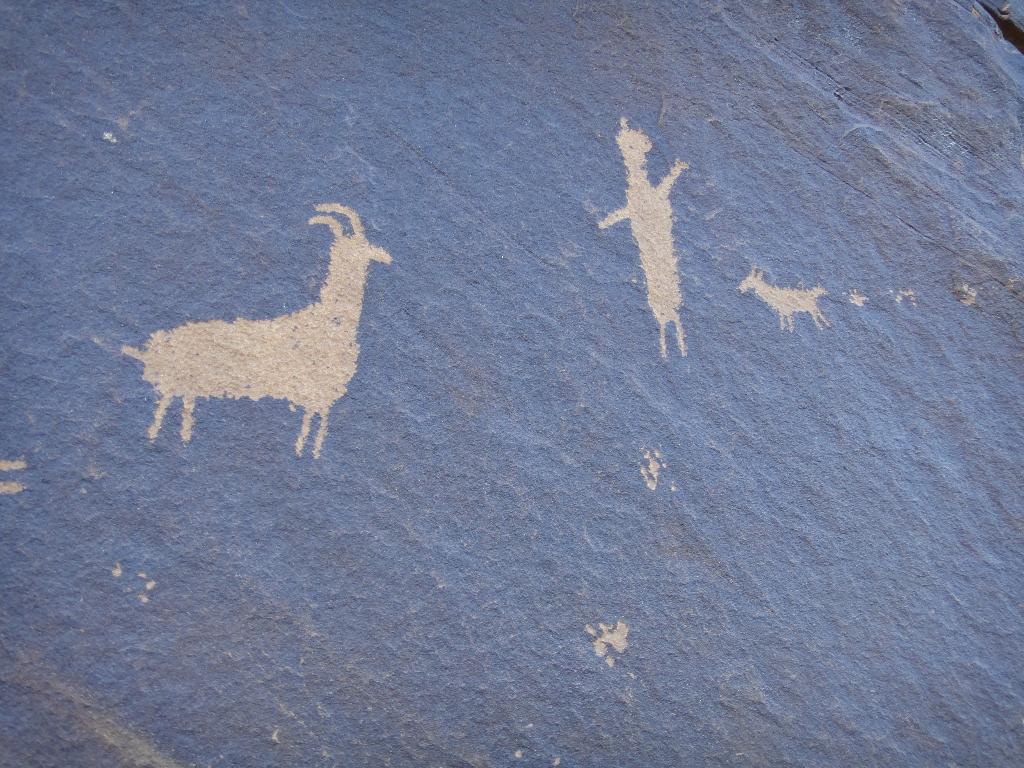
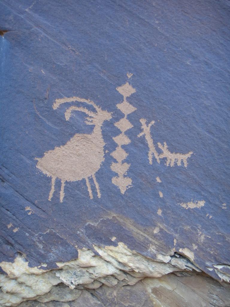
Wait, wait, there is more! The final canyon to be visited has a small panel in it. All-in-all, a very action packed 1-2-hour hike. It is easy, and short enough that it should be accessible to most.
Getting There
Go west out of Green River on I-70. At mile marker 147 (about 16 miles west of Green River) a dirt road leaves the highway on the right.
Route Description
Rock art and historic sites are fragile, non-renewable cultural resources that, once damaged, can never be replaced. To ensure they are protected, please:
- Avoid Touching the Petroglyphs: Look and observe, BUT DO NOT TOUCH!
- Stay on the Trails: Stay on the most used trails when visiting sites, and don't create new trails or trample vegetation.
- Photography and Sketching is Allowed: Do not introduce any foreign substance to enhance the carved and pecked images for photographic or drawing purposes. Altering, defacing, or damaging the petroglyphs is against the law -- even if the damage is unintentional.
- Pets: Keep pets on a leash and clean up after them.
- Artifacts: If you happen to come across sherds (broken pottery) or lithics (flakes of stone tools), leave them where you see them. Once they are moved or removed, a piece of the past is forever lost.
Box Canyon
From the trailhead, follow the stream bed upstream to a dryfall in 10-15 minutes.
Double Arch (Spirit Arch) Canyon / Petroglyph Canyon
From the trailhead, cross the stream and head west/southwest following an intermittent trail. If in doubt, stay in the wash bottom as you head south. Keep an eye out on the left. As the bank raises on the left, the social trail leaves the wash on the left and follows the rim to avoid a dryfall.
A few minutes above the dryfall the trail turns west and enters the reef. When it divides again, Double Arch Canyon is on the right and ends in less than 5 minutes. Petroglyph Canyon is the left fork. Follow it up until you can see the dryfall at its end, and look on the right for the panel. Again, less than 5 minutes from the junction.
Return the way you came.
Maps

12S 550040E 4309357N
38°55'54"N 110°25'22"W
12S 549079E 4309102N
38°55'46"N 110°26'02"W
12S 549132E 4308865N
38°55'38"N 110°25'59"W
12S 549325E 4309501N
38°55'59"N 110°25'51"W