 Canyoneering
Upper Black Box
Canyoneering
Upper Black Box
Northern San Rafael Swell
Overview
The upper black box is my favorite canyoneering adventure in the northern swell. A very short approach and exit, coupled with an incredible stretch of canyon make this one that keeps me coming back. A big thanks to jddiener for pointing out the preferred out, it makes a good canyon even better!
Check for recent heavy rains upstream as well. This is a big drainage, and a flood upstream may take a day or so to reach the Box. You wouldn't want to be caught in the Box when a flash flood comes down stream.
Getting There
The trailhead starts at the end of the Mexican Mountain road. To get to the Mexican Mountain road, which is near the San Rafael Campground, depends on where you are coming from. Once at the campground, the Mexican Mountain road is on the north side of the river, and well signed just before the cattleguard. (This is also part of the campground.)
Route Description
Short Route
From the trailhead, walk back on the road the way you came for a quarter of a mile, to a prominent side canyon on the south (left) side of the road. Rim walk this canyon a short distance on an old road until an easy descent route is found. (There are many options). Descend into the canyon, and follow it a short distance down to where it joins the Upper Black Box. (10-15 minutes from the trailhead)
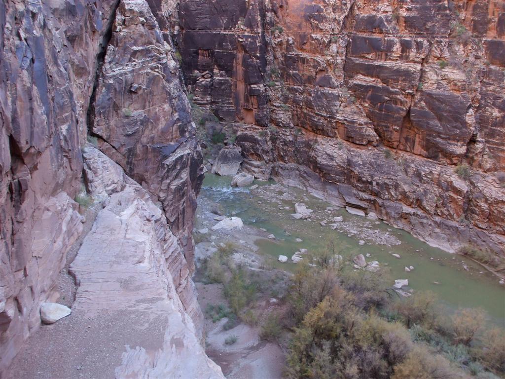
There is a trail on the right that leads down into the gully. It is loose, so use caution. Downclimb the gully to a flat ledge with 2 bolts and chains on the right. The rappel height is about 60 m ( 197 ft. ). The best approach is to fix your rope here, leave it, then pick it up when you have finished the canyon, saving the weight of carrying it through.
Take off your harness, put on your wetsuit (if you brought one), and head down canyon. Getting off the boulder pile at the bottom of the rappel is the crux. The pool is generally shallow, so ease in. Jumping could result in injury. The downclimb is straight forward.
Preferred Route
For the preferred route, walk back on the route about 1.5 miles to where the road curves around a side canyon and begins a slight climb up a hill. This is the preferred route canyon. Head down canyon, finding an easy, wide wash in sharp rock for about 15-20 minutes to where the canyon begins dropping and cutting into cedar mesa sandstone. Once it begins to drop, there are several short, easy down climbs until you reach a larger 15 m ( 50 ft. ) drop where several mammoth boulders have blocked the canyon. beginners may want to rappel this. More advanced canyoneers can do an exposed chimney on the right a short distance to a small chockstone, then downclimb under the large boulders and finally down to the canyon floor in a cave like room. This is shortly followed by another easier downclimb on the left.
Five minutes past this obstacle, the San Rafael River comes into view. This is an exquisite place, and is very reminiscent of rappelling into the Zion narrows. Down climb, or rappel the low angle slot on the left until reaching the large perch overlooking the river. There are several anchors here. Choose one, and rappel up to 30 m ( 99 ft. ) meters down to the river depending on where the anchor is extended to. Be sure to test the pull, it can be difficult.
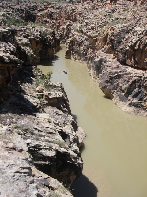
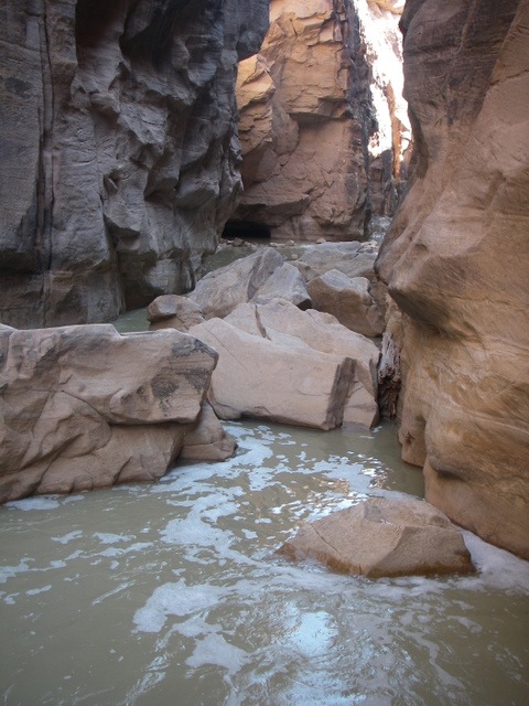
Coil your rope, drybag your gear, and continue down the wide river as it begins narrowing into the Black Box. A boulder section is encountered, but pretty easy to find a way around. About an hour or so after the rappel, you will reach the rockfall at the bottom of the short route. Use caution getting over the rockfall, the water is not very deep, so jumping is not advised. This rock fall is easy to identify, as the entire river passes through a slot on the right, with a dry pile of boulders is on the left.
Both Routes
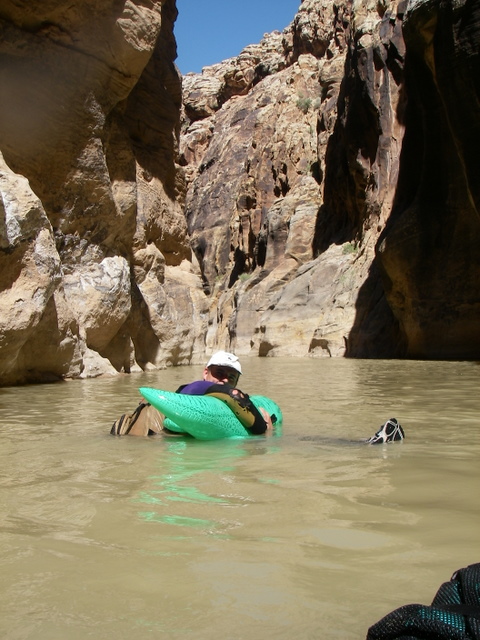
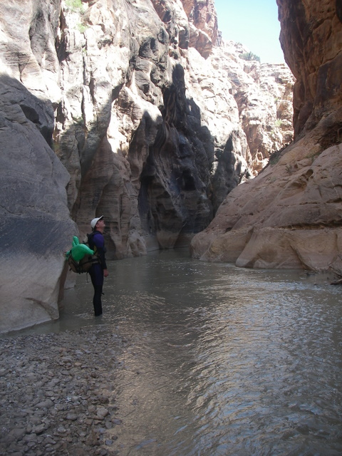
The rest of the canyon alternates between wading and swimming in most conditions. It takes about 2-3 hours to get to the end of the canyon. Enjoy. Near the end the canyon has a long, shallow, narrow section to swim. Magnificent! Once past this section, the canyon opens immediately. Go left, through the willows, up the first little canyon. Follow this canyon until you reach the old mining road. Turn left on the mining road and follow it back to your car. (a 20-25 minute walk).
If you left your rope at the rappel, don't forget to pick it up on the way out.
Photos
Maps

12S 544126E 4318492N
39°00'52"N 110°29'25"W
12S 542590E 4318892N
39°01'05"N 110°30'29"W
12S 543926E 4318099N
39°00'39"N 110°29'34"W
12S 544176E 4317864N
39°00'31"N 110°29'23"W
12S 545095E 4318637N
39°00'56"N 110°28'45"W