Prostitute Butte |

South of Moab

Roadside Attraction Prostitute Butte - South of Moab Roadside Attraction Prostitute Butte

South of Moab

Overview

RATING: Roadside Attraction
LENGTH: 1+ hours
MAPS: TROUGH SPRINGS CANYON, UT;

Fri

Mostly sunny, with a high near 73. South southwest wind 5 to 15 mph.

73 | 50

Sat

Mostly sunny, with a high near 72. North wind 5 to 15 mph.

72 | 50

Sun

Sunny, with a high near 75.

75 | 49

Mon

Mostly sunny, with a high near 78.

78 | 53

Tue

Sunny, with a high near 77.

77 | 52

View Full Weather Details
SEASON: Any, hot in summer.
WATER: None.

Fri

Mostly sunny, with a high near 73. South southwest wind 5 to 15 mph.

73 | 50

Sat

Mostly sunny, with a high near 72. North wind 5 to 15 mph.

72 | 50

Sun

Sunny, with a high near 75.

75 | 49

Mon

Mostly sunny, with a high near 78.

78 | 53

Tue

Sunny, with a high near 77.

77 | 52

View Full Weather Details
Balcony Arch at Prostitute Butte

Balcony Arch at Prostitute Butte

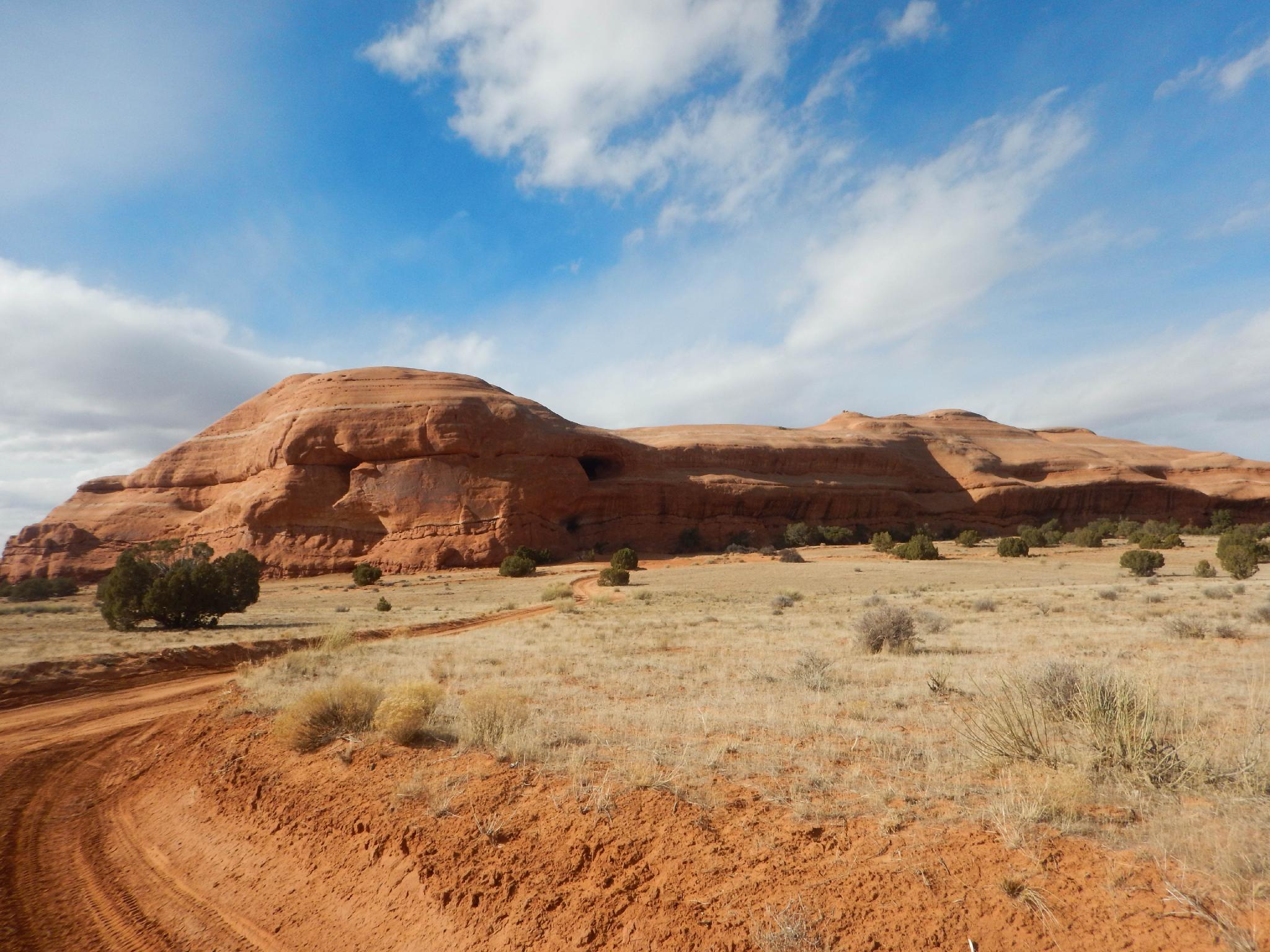
Was this area once the red light district of Moab? With a name like Prostitute Butte, you have to wonder about the area's history! The name, as rumor has it, came from the original white settlers to the area. The local Anasazi people used the area for religious ceremonies to their "mother deity". The white settlers may have found the ceremonies offensive and hence the name. The butte is also now known as Lone Rock, though most of the locals call it by the original name, Prostitute Butte.

This is the perfect area to get a bit of space from the often busier Moab area proper. Primitive camping is excellent, as are the views. Throw in a couple of arches to visit, and this makes for a great outing! Mountain biking and off roading are also very popular in the area.

Beware: Reaching the area requires high clearance. The road is rough, with a few rock sections that will stop low clearance vehicles. The BLM has many designed campsites along the way, though the area can fill up on very busy weekends. Please obey the camping restrictions and only camp outside of the restricted areas.
Prostitute Butte / Lone Rock

Prostitute Butte / Lone Rock

Getting There

Travel south out of Moab on US-191 toward Blanding/Monticello. About 13 miles south of Moab, at milepost 112.7 is a side road on the right. This is where the highway reaches the crest of a hill. Turn right onto this dirt road.

  • Reset Odometer. ( 12S 636806mE 4253719mN / N38° 25' 17" W109° 25' 58" )
  • 0.4 miles - Junction, stay left. There are many side roads from here on out. Stay on the main road at all junctions. ( 12S 636734mE 4254158mN / N38° 25' 31" W109° 26' 01" )
  • 5.0 junction - Go right another quarter of a mile. Balcony Arch is straight ahead where the road meets Prostitute Butte. ( 12S 630713mE 4254834mN / N38° 25' 56" W109° 30' 09" )
Picture Frame Arch at  Prostitute Butte

Picture Frame Arch at Prostitute Butte

Balcony Arch at Prostitute Butte

Balcony Arch at Prostitute Butte

Route

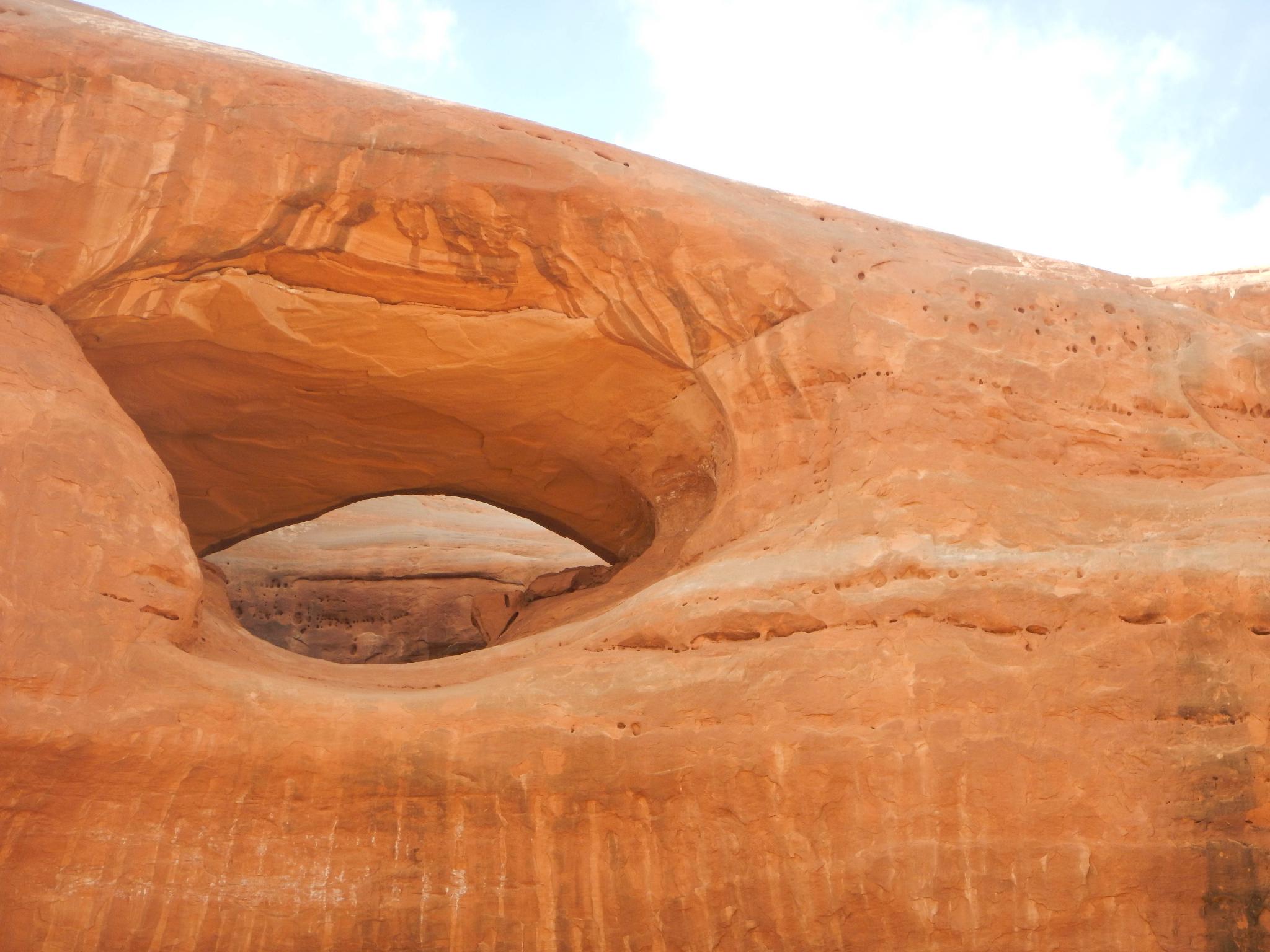
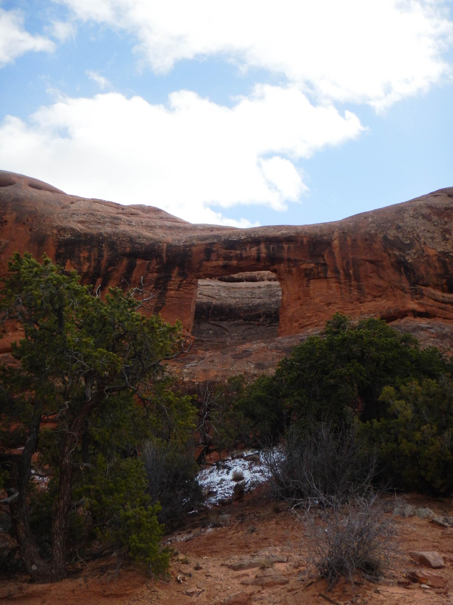
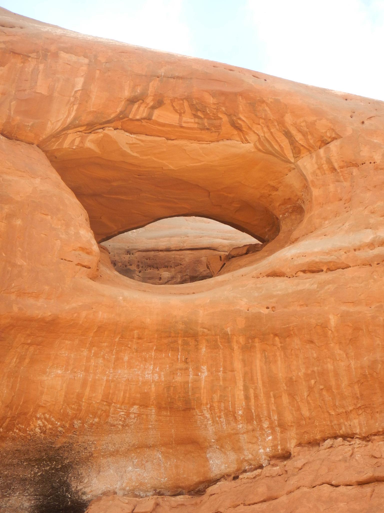
Once at Prostitute Butte, the first arch you reach is the impressive Balcony Arch. Continue north on the ever roughening road (or walk this section) through the notch between the two buttes. Once on the north side of the buttes, follow the jeep road west along the base of the Butte to visit Picture Frame Arch.


Photos

Maps

Printable Maps:
Balcony Arch

12S 630548mE 4255161mN

N38° 26' 07" W109° 30' 15"

Picture Frame Arch

12S 630704mE 4255522mN

N38° 26' 18" W109° 30' 09"

Comments

Want to make a comment? Login and let yourself be heard.