Funnel Arch | Kane Creek

Hiking Funnel Arch - Kane Creek Hiking Funnel Arch

Kane Creek

Overview

RATING: Easy hike
MAPS: MOAB, UT

Sat

Sunny, with a high near 100. West southwest wind around 5 mph.

100 | 69

Sun

Sunny, with a high near 101. West southwest wind around 5 mph.

101 | 71

Mon

Sunny, with a high near 102.

102 | 72

Tue

Sunny, with a high near 103.

103 | 72

Wed

Sunny, with a high near 101.

101 | 73

View Full Weather Details
SEASON: Any, though summers can be hot.
GEAR: Standard Hiking Gear
WATER: None

Sat

Sunny, with a high near 100. West southwest wind around 5 mph.

100 | 69

Sun

Sunny, with a high near 101. West southwest wind around 5 mph.

101 | 71

Mon

Sunny, with a high near 102.

102 | 72

Tue

Sunny, with a high near 103.

103 | 72

Wed

Sunny, with a high near 101.

101 | 73

View Full Weather Details
Funnel Arch

Funnel Arch

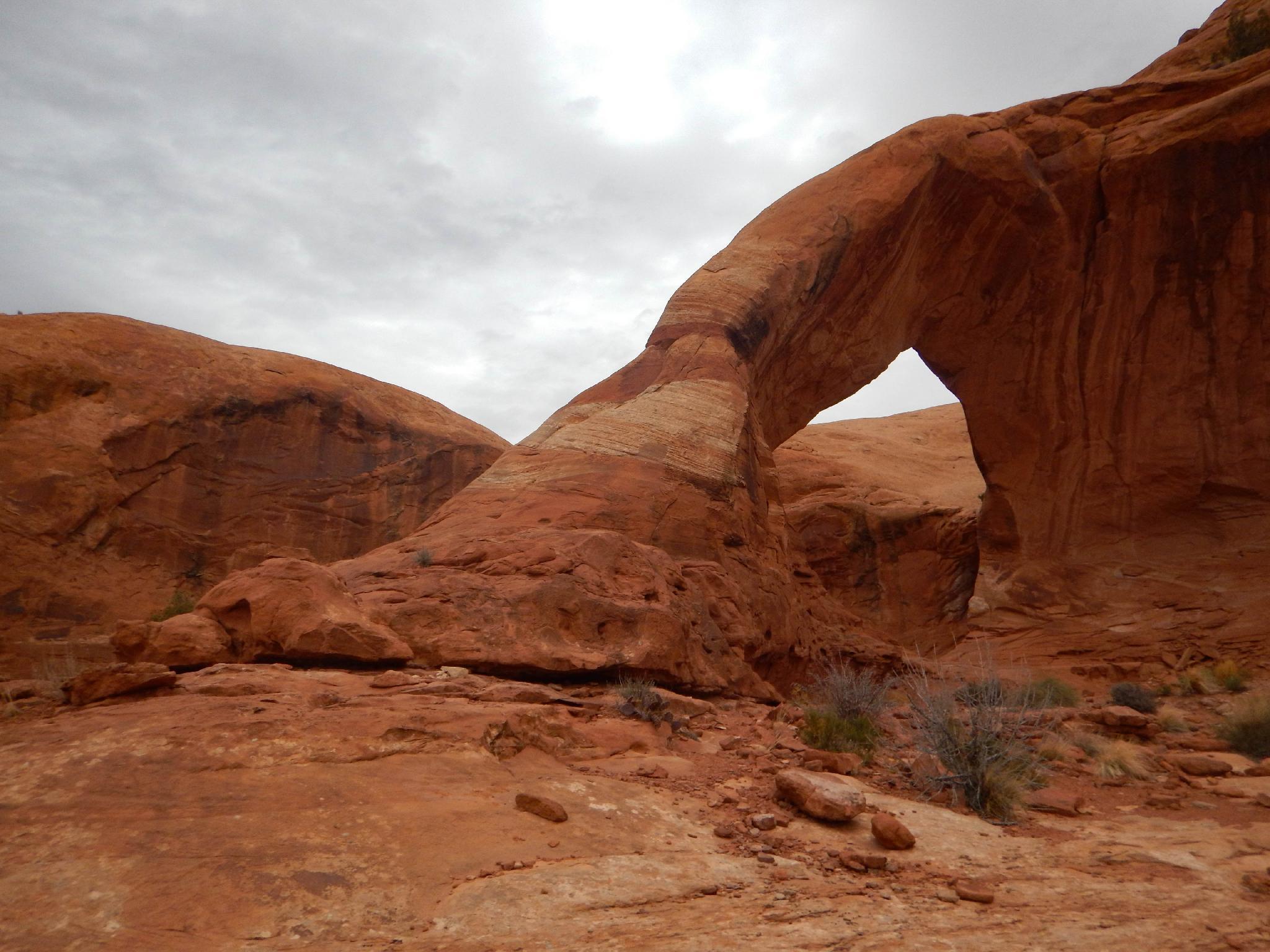
Visting Funnel Arch is a short outing, but with some adventure and big views along the way. Children with competent leadership will likely enjoy the challenges of the hike. There is a bit of scrambling and route finding required, but the problematic bits can be spotted fairly easily and safely. The rewarding views are not to be missed. The arch is also less commonly known as Cable Arch.

Note: There is much to see in Kane Creek. Be sure to look at the Kane Creek Rock Art write-up for all the details.
Kane Creek from the hike

Kane Creek from the hike

Getting There

From downtown Moab, head to south to Kane Creek Blvd. Turn right on Kane Creek Blvd. (This is currently where the McDonald's and Burger King are.)
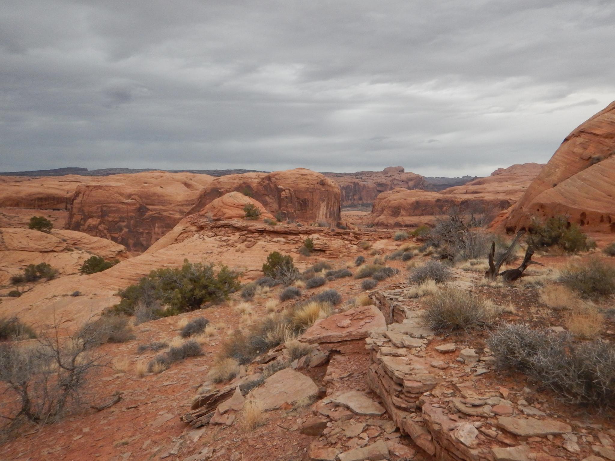
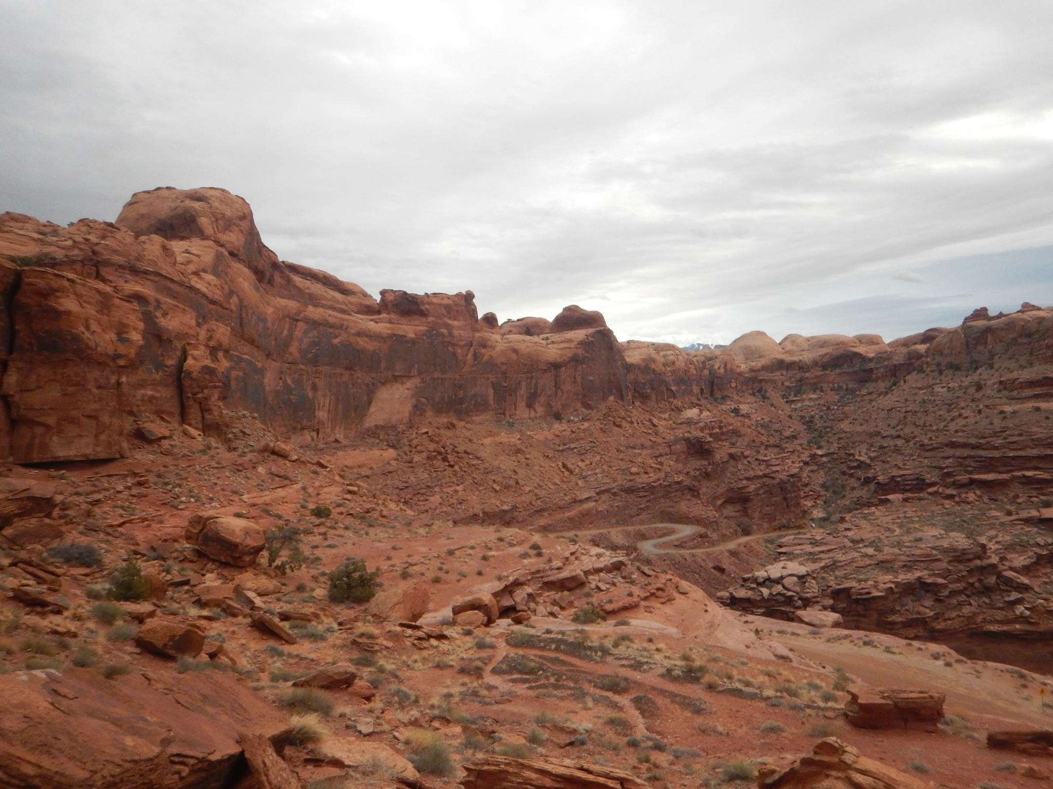
  • Reset odometer as you turn onto Kane Creek Blvd. ( 12S 626362E 4269376N / 38°33'50"N 109°32'59"W )
  • 2.6 miles - Moab Rim Trailhead and Pit Toilet on the left. ( 12S 623455E 4268771N / 38°33'32"N 109°34'59"W )
  • 2.7 miles - King Bottom Campground ( 12S 623368E 4268646N / 38°33'28"N 109°35'03"W )
  • 3.05 miles - Moonflower Campground / Trailhead on the left and rock art panel. ( 12S 623137E 4268307N / 38°33'17"N 109°35'12"W )
  • 3.5 - Dirt road goes off on the left and up a hill. This is the Elephant Panel Trailhead. ( 12S 622637E 4267587N / 38°32'54"N 109°35'34"W )
  • 4.0 miles - Small Sheep Rock art panel next to the road on the left. ( 12S 622334E 4267010N / 38°32'35"N 109°35'46"W )
  • 4.3 miles - Small petroglyph panel next to the road on the left. ( 12S 622112E 4266521N / 38°32'19"N 109°35'56"W )
  • 4.6 miles - Pritchett Canyon Trailhead ( 12S 622059E 4266123N / 38°32'07"N 109°35'58"W )
  • 4.7 miles - Road turns to dirt with a big parking area on the right. ( 12S 622011E 4266036N / 38°32'04"N 109°36'00"W )
  • 5.1 miles - Small parking area and trail going up to a panel on the left. ( 12S 622546E 4265578N / 38°31'49"N 109°35'39"W )
  • 5.3 miles - Large parking area on the right. This is the False Kiva Trailhead, and also the Amasa Back Trail Parking area. ( 12S 622314E 4265360N / 38°31'42"N 109°35'48"W )
  • 5.8 miles - Amasa Back Trail ( 12S 621895E 4264888N / 38°31'27"N 109°36'06"W )
  • 6.1 miles - Birthing Rock on the right. Small parking area. This is also the trailhead for Map Panel. ( 12S 621821E 4264647N / 38°31'19"N 109°36'09"W )
  • 6.18 miles - Boulder with petroglyph on the right. ( 12S 621845E 4264524N / 38°31'15"N 109°36'08"W )
  • 6.2 miles - Parking are on the left just after cresting a hill and starting down the other side. This is the Funnel Arch Trailhead. ( 12S 621995E 4264439N / 38°31'12"N 109°36'02"W )
Views along the trail.

Views along the trail.

Route

From the parking area, head up hill using the path of least resistance to the cliff band to the north. There is a small drainage here that requires a bit of scrambling to surmount. (Class 4/Easy 5th class and can be spotted from below.)

Once up the initial short climbing section, go left and find a social trail through a notch between domes. From here follow a cairned trail north then east to a small clearing and Funnel Arch.

Funnel Arch is not visible until you are at it. Be sure to remember the way, route finding on the way back can be tricky if you weren't paying attention on the way there!


Maps

Route / 0.79 miles / Elevation Range 4,258 - 4,555 ft.
Printable Maps:

6.2 miles - Parking are on the left just after cresting a hill and starting down the other side. This is the Funnel Arch Trailhead.

12S 621994E 4264439N

38°31'12"N 109°36'02"W

Birthing Rock

12S 621811E 4264636N

38°31'18"N 109°36'10"W

Petroglyph Boulder

12S 621845E 4264523N

38°31'15"N 109°36'08"W

Map Panel

12S 621899E 4264703N

38°31'21"N 109°36'06"W

Funnel Arch

12S 622175E 4264674N

38°31'19"N 109°35'55"W

Comments

Want to make a comment? Login and let yourself be heard.