 Hiking
Collins Gulch
Hiking
Collins Gulch
Little Cottonwood Canyon
Overview
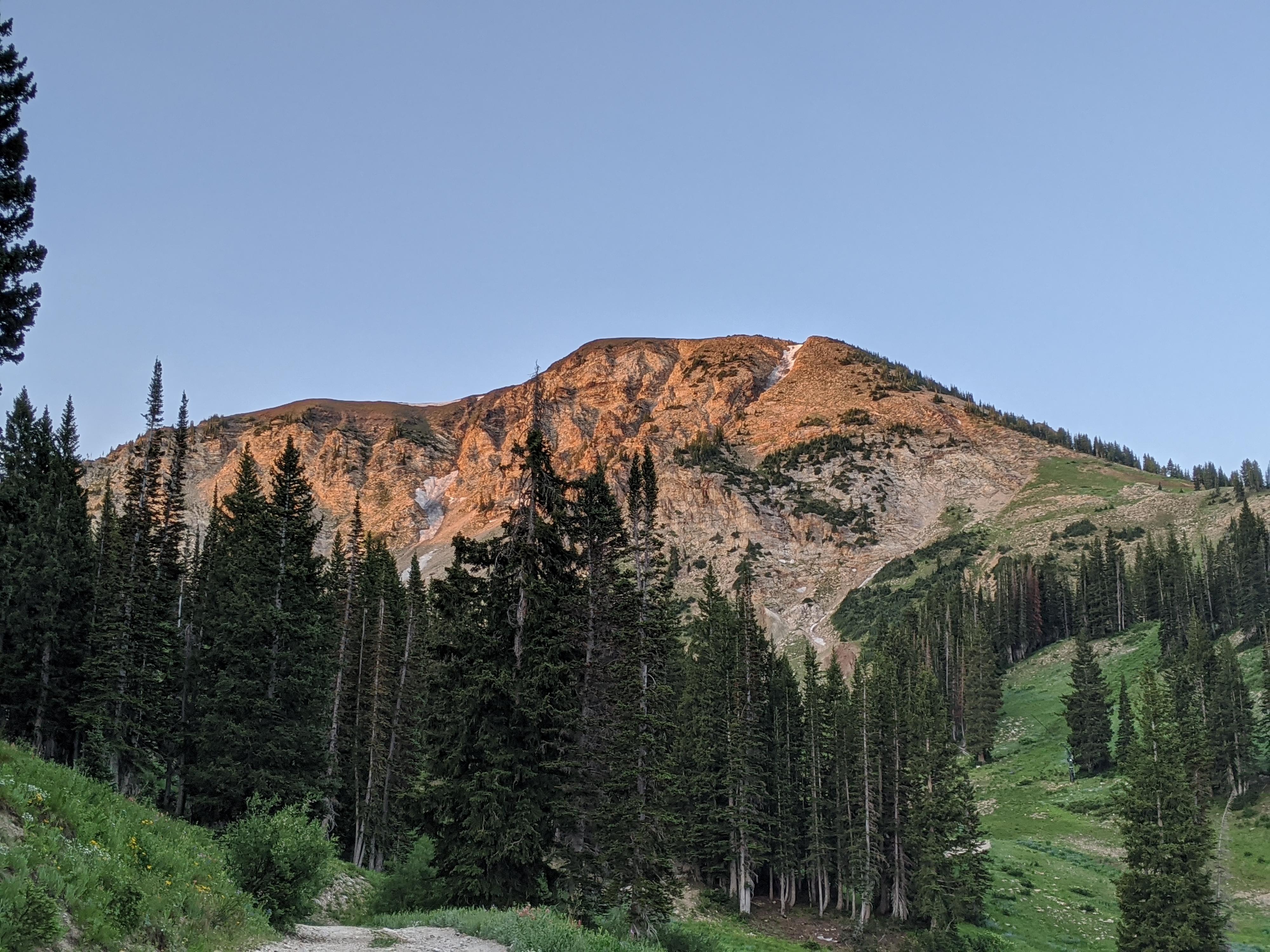
Collins Gulch is a good alternative to Albion Basin if the parking is full or crowds are getting you down! The hike is a steep one as it weaves up the developed ski resort to Germania Pass. The ski resort lifts, buildings, and accessories contrast with the lush green slopes dotted with wildflowers and trees. Though heavily developed, it is a lovely hike once you look past the developments. The upper section, with its hanging valley, is particularly nice.
The ski road makes for easy travel. Being and out-and-back, you can make this outing as long or short as time/motivation allow. Reaching Germania Pass is about 2000’ of elevation gain and feels like a good effort to reach! If going all the way to Germania Pass, consider continuing to Sugarloaf pass for excellent views into Mineral Basin and of Mount Timpanogos in the distance, then descending the Greeley road and looping back to the trailhead on the Albion Meadows Trail. This makes for a longer outing, but great scenery throughout and a chance to make a nice loop.
Getting There
Little Cottonwood Canyon is on the east side of the Salt Lake City Valley. Get there by following I-215 to the east, taking exit 6 off the interstate and heading east toward the mountains.
Follow 6200 South which becomes Wasatch Blvd for 1.8 miles to the stop light and signs for Big Cottonwood Canyon. Continue south (straight) through the light an additional 2.3 miles to a junction and light. Stay left here, reaching the mouth of Little Cottonwood Canyon in an additional 1.6 miles.
From the mouth of Little Cottonwood, travel up the canyon. At 7.9 miles, the Alta main entrance/Wildcat Base/Gold Miners Daughter are on the right. This is the trailhead area, park on the south east corner of the parking lot.
Route Description
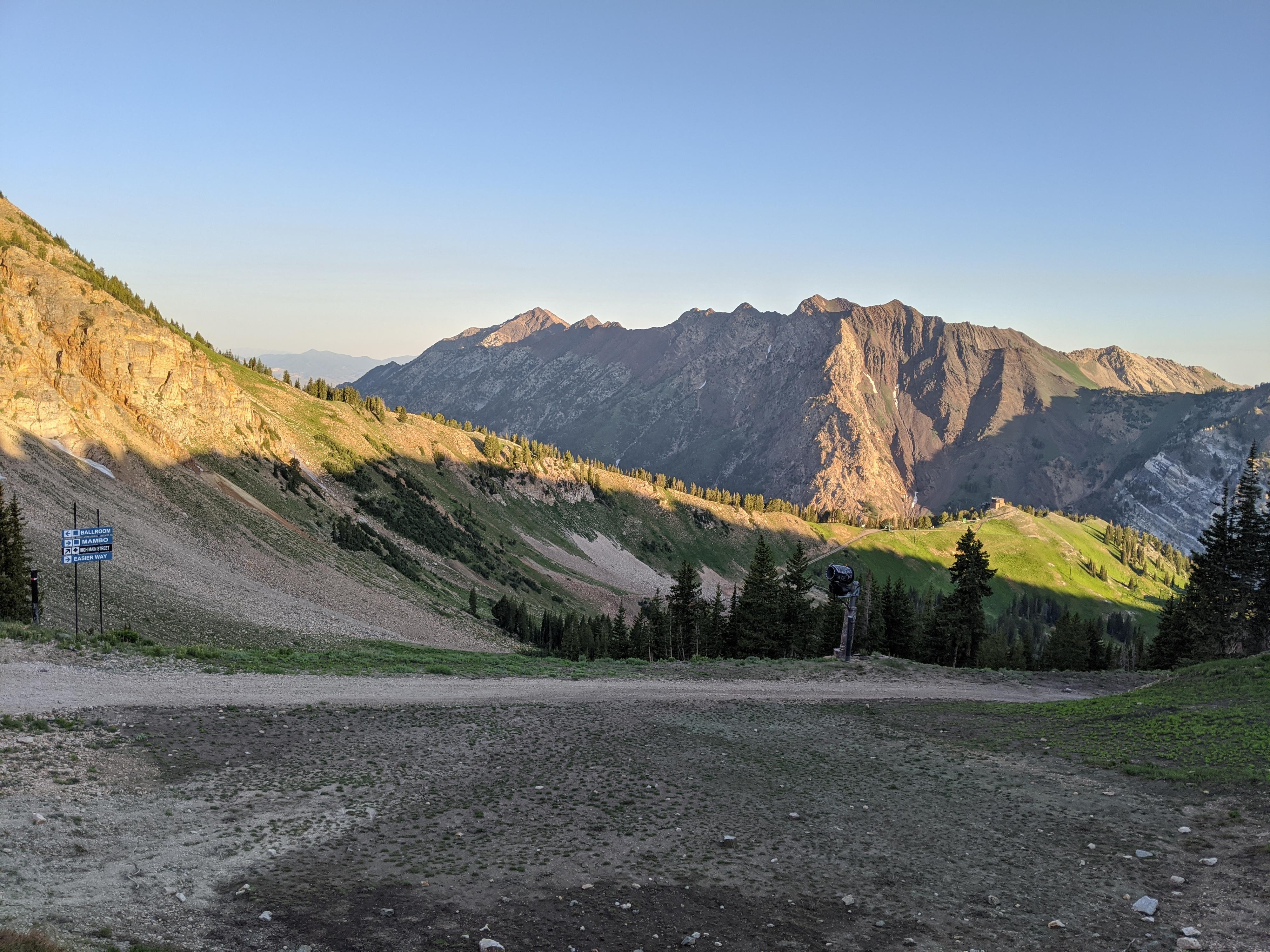
Navigation is easy. From the WIldcat Base entrance at Alta, the trail begins on the east side of the parking lot. Follow the trail up to the dirt road. Note, a signed single-track trail leaves on the left here. That is the Albion Meadows trail, go right instead on the obvious dirt road. The dirt road heads west briefly, then turns, passes under the Wildcat and Collins ski lifts, and begins climbing up steeply.
After the first bend, the angle eases a bit and the views of Mount Superior and Cardiff pass to the north across Little Cottonwood come into view. Keep climbing, staying left/straight at the top of the first lift. At a second junction halfway up the mountain, stay left again (right goes to the top of Wildcat Ski Lift).
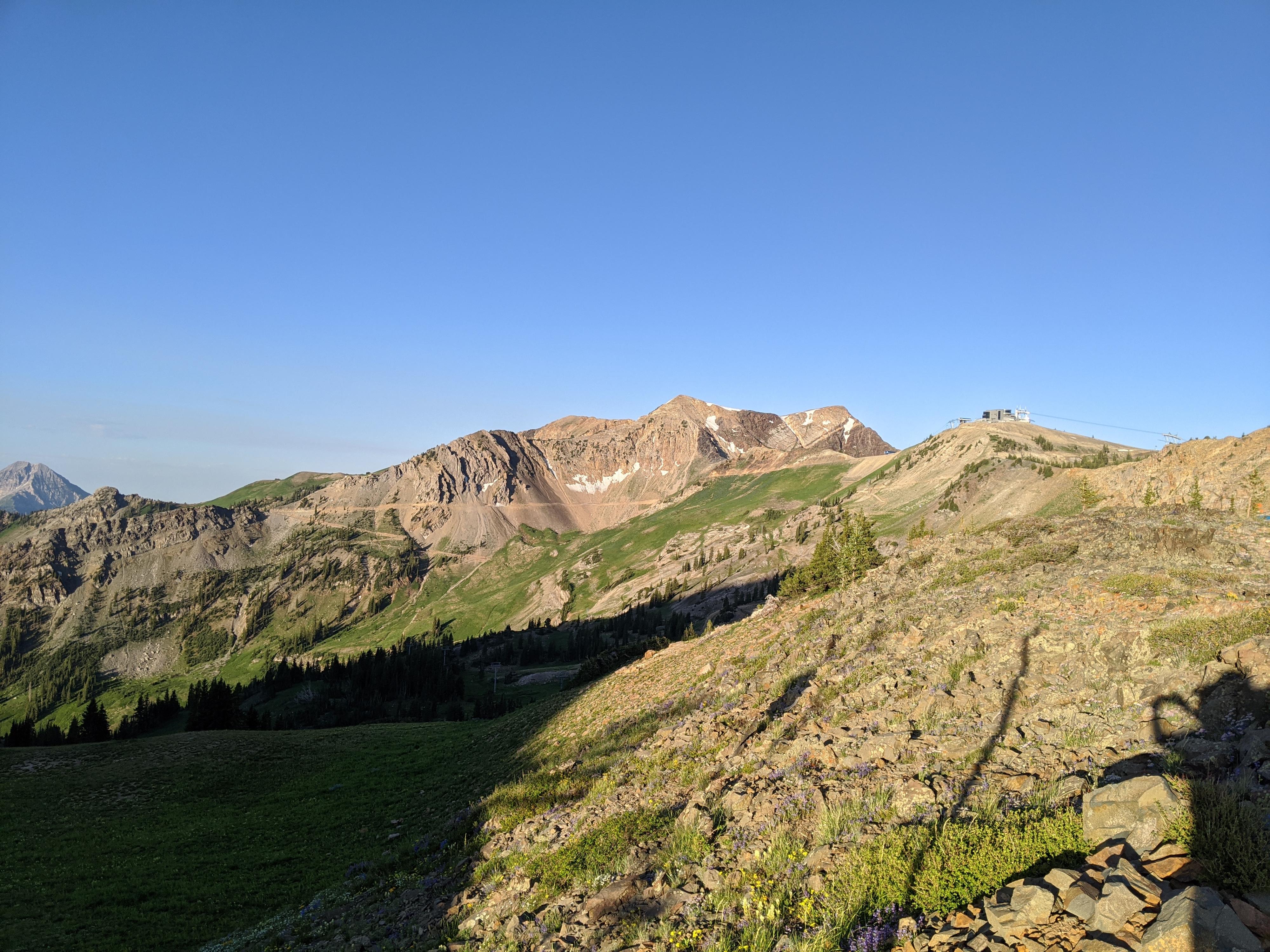
Mount Baldy is the prominent peak that becomes increasingly visible. As you near the base of it, the road cuts east and climbs steeply up to Germania Pass and the top of the ski lift. There are good views into Albion Basin and of Sugarloaf Peak to the south from the pass.
If time allows, continue from Germania Pass up to the ridge above on the road. This is Sugarloaf Pass with views down into Mineral Basin and of Mount Timpanogos in the distance. It is a perfect spot for a break before returning.
Photos
Maps

12T 445940E 4493266N
40°35'18"N 111°38'20"W
12T 446027E 4492394N
40°34'50"N 111°38'16"W
12T 446054E 4491917N
40°34'35"N 111°38'15"W
12T 446536E 4491398N
40°34'18"N 111°37'54"W
12T 446639E 4490881N
40°34'01"N 111°37'49"W