 Hiking
Boulder Mail Trail
Hiking
Boulder Mail Trail
Escalante
Overview
One of the Escalante classics, I would go so far as to elevate this hike to one of the Colorado Plateau classics. This is a hike every desert lover should do at least once. The trail follows the old mail trail and telegraph line between Boulder and Escalante. En route, the trail passes through Sand Creek, Death Hollow, and Mamie Creek, all top notch canyons with views second to none. The descent into Death Hollow, in particular, is amazing. This route is great both for the views and as an opportunity to stand in awe of the tenacity and hard work needed to forge a trail across the difficult terrain. The telegraph line is still visible in many places, strung between trees.
At 15 miles, this hike can be done as a long day hike by the fit, but the scenery and side trips make it much better suited to an overnighter or even a 2-night backpack.
Getting There
Exit Trailhead (Escalante River Trailhead)
On the east side of the town of Escalante, turn north at the cemetery. Instead of going into the cemetery, go right on the road as it follows the perimeter of the cemetery, then heads east. Take the first left in about 0.4 miles and follow the slightly rougher road 0.6 miles to the trailhead and a parking area on the left.
Start Trailhead (Boulder Airstrip)
From the town of Escalante, head east on UT-12 for about 24 miles to the Hell Backbone road (FR 1431) on the left. Go left onto the Hells Backbone road, then the first major left in 0.1 miles. Follow this generally good dirt road 0.4 miles to just after it crosses the airstream. This is the signed Boulder Mail Trail trailhead.
Route Description
To Sand Creek (2.5 miles / 1-1.5 hours)
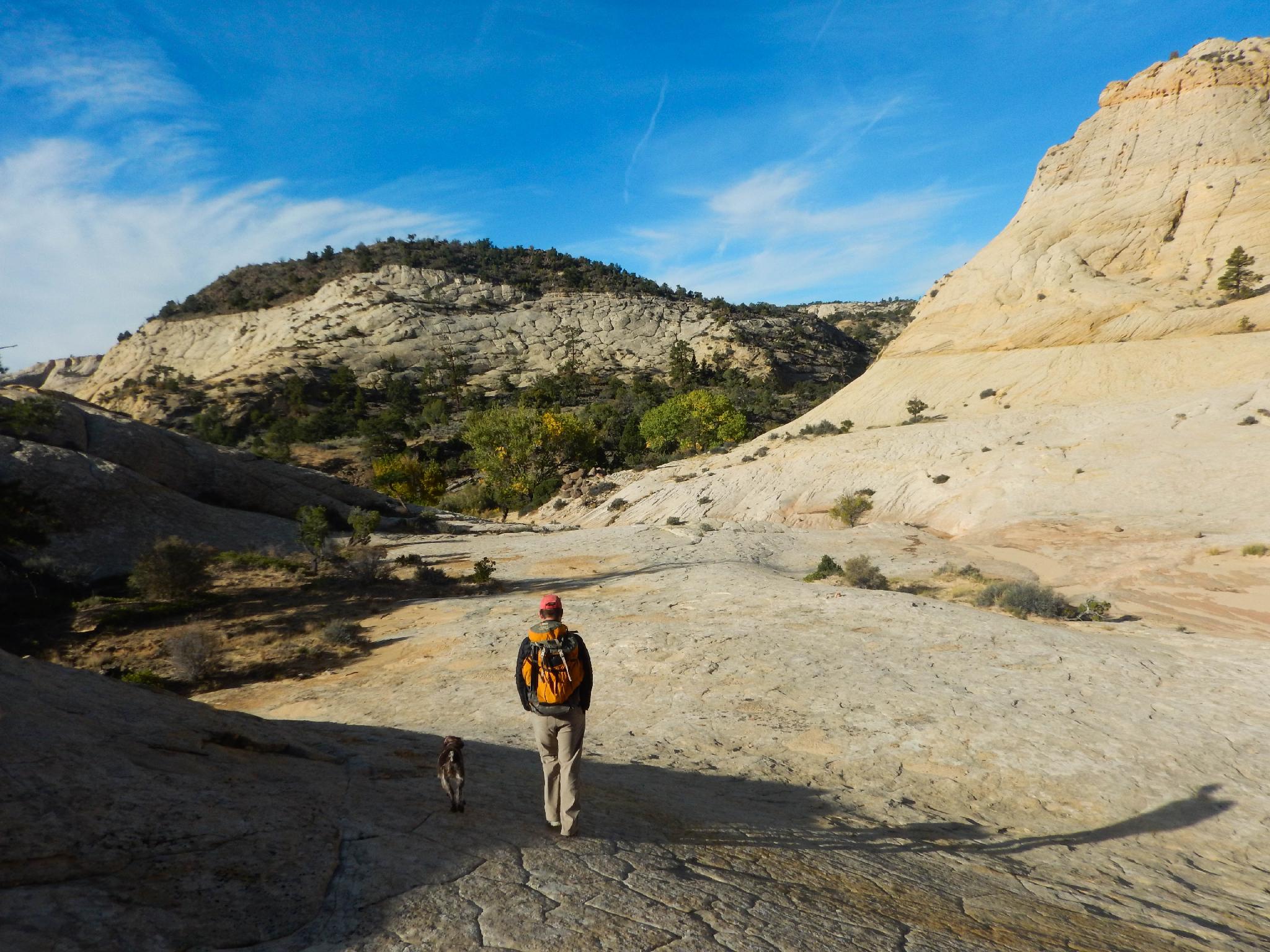
From the trailhead, the trail is easy to follow as it winds its way across cedar flats. The views are not particularly great in this section. After about an hour, the trail begins dropping into Sand Creek. This beautiful drainage offers quite a few campsites, though it’s pretty close to the trailhead.
Once at the bottom of Sand Creek, go downstream just a minute or two and pick up the trail on the other side of the creek. The trail winds along a ledge above stream level for a few minutes before beginning its climb out of Sand Creek.
To Death Hollow (4 miles from Sand Creek to the BMT EXIT from Death Hollow / 2-3 hours)
The cairned trail climbs slickrock to the rim of Sand Canyon, then crosses more cedar plains. Again, not very scenic yet. After about 1.5 hours, the trail reaches the rim of Death Hollow. Follow the map closely here, a side trail continues to the left (old Bowington Road), but you want to go right. As of 2016, this was pretty evident, and the most used trail was the correct one.
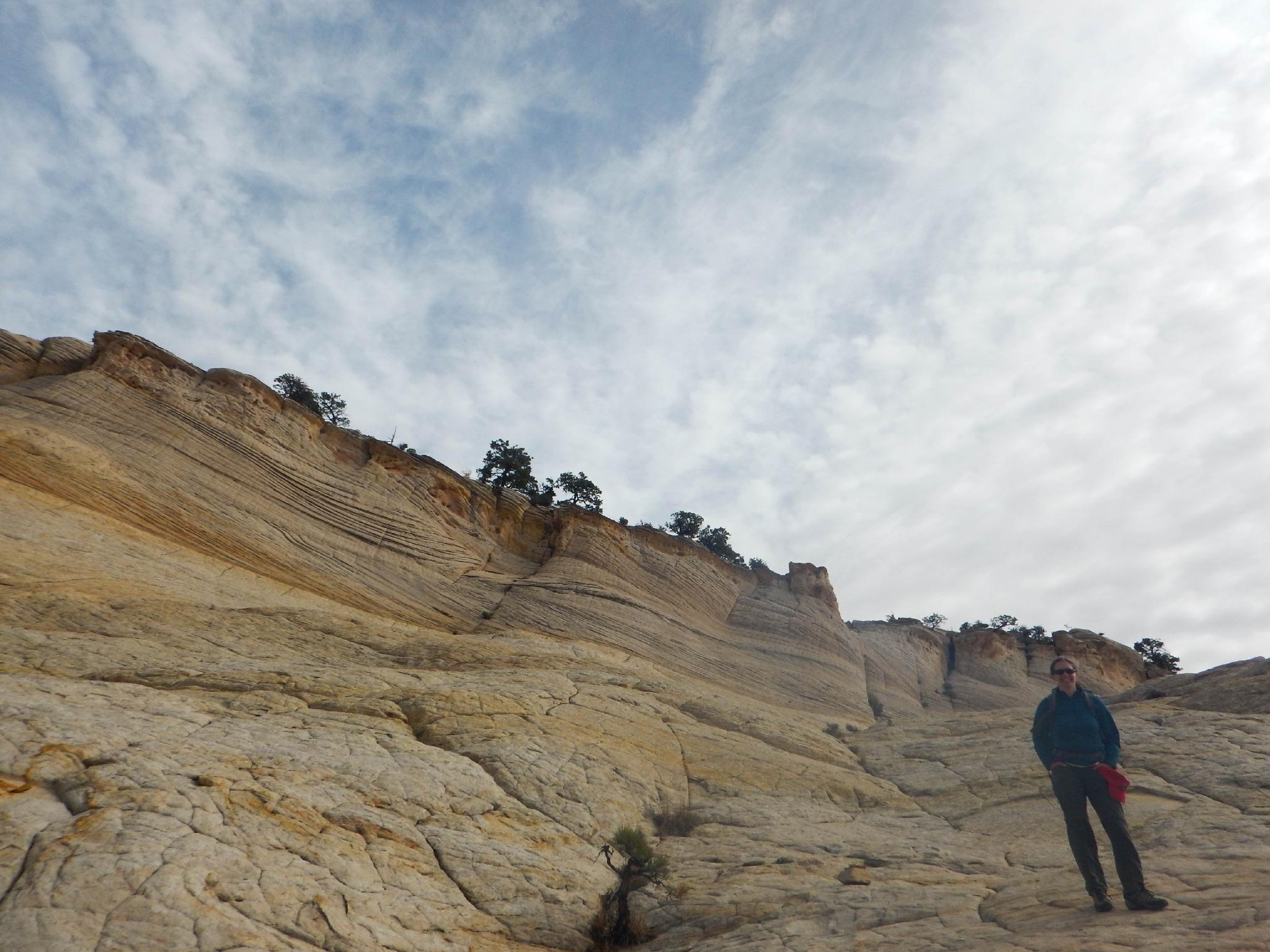
The trail cuts back to the right as it begins descending into Death Hollow. Follow cairns closely. The upper section is natural, but about 1/2 down the trail becomes constructed as it precipitously angles down. It is humbling to imagine the work and vision needed to create this trail! It angles down, zig-zags a couple of times, then descends to the floor of Death Hollow.
Head down Death Hollow. A social trail offers easy passage at first, but when the poison ivy gets thick, it is often easiest to walk in the streambed. About 20-30 minutes down the canyon, at the first reasonable looking place, the Boulder Mail Trail leaves on the right up to a cairned route. There is good camping and lots to explore in Death Hollow. Many may wish to camp here, though I personally liked Mamie Creek a bit better.
To Mamie Creek (2.3 miles from Death Hollow / 1 hour)
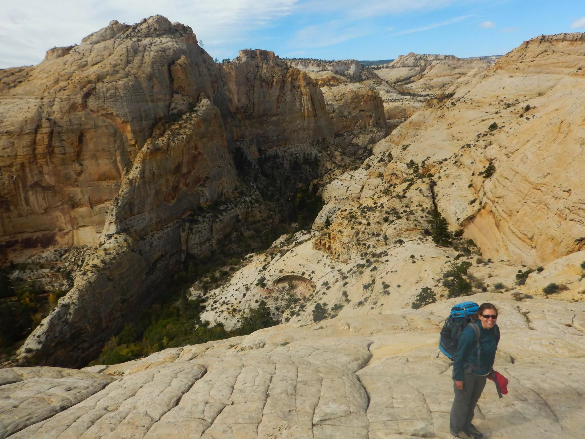
The trail climbs steeply out of Death Hollow but is well cairned and easy to follow. Once up on the rim, it soon begins its descent into the much more open Mamie Creek. Mamie is stunning with many excellent camp sites and pools to lounge by.
To The Exit Trailhead (6.5 miles / 2.5-3.5 hours)
The hike out of Mamie Creek is gradual but continuous. Once up on the rim, the trail meanders up and down across Antone Flat. This section of the trail offers big slickrock views and is as stunning as any of the canyon crossing in my opinion. Several springs and pools are passed while crossing Antone Flat proper. The trail finally reaches the rim and Escalante town comes into view far below.
The trail zig-zags down to the base of the valley then meanders along and downstream to the confluence with the Escalante (this is to avoid private property). At the Escalante River, go upstream to where the canyon opens up then take the well-traveled trail up to the exit trailhead.
Photos
Maps
")
")
")
12S 459162E 4193061N
37°53'03"N 111°27'52"W
12S 456894E 4190674N
37°51'45"N 111°29'24"W
12S 456922E 4190572N
37°51'42"N 111°29'23"W
12S 456195E 4190467N
37°51'38"N 111°29'53"W
12S 454959E 4188596N
37°50'37"N 111°30'43"W
12S 454645E 4187860N
37°50'13"N 111°30'56"W
12S 452625E 4186619N
37°49'33"N 111°32'18"W
12S 453469E 4185974N
37°49'12"N 111°31'43"W
12S 453595E 4185898N
37°49'10"N 111°31'38"W
12S 453568E 4185868N
37°49'09"N 111°31'39"W
12S 451613E 4184560N
37°48'26"N 111°32'59"W
12S 448938E 4181592N
37°46'49"N 111°34'47"W
12S 448964E 4180624N
37°46'18"N 111°34'46"W
12S 449096E 4180218N
37°46'04"N 111°34'41"W