 Hiking
Campbell Peak
Hiking
Campbell Peak
Silver Island Mountains
Overview
Like most of the other peaks in the Silver Island mountains, Campbell Peak is a steep hike to a very seldom visited summit. The peak has many routes to the summit. The east side is much more rugged and requires more route finding. The west side, and the approach described here, is less rugged but still has some steep and loose sections and requires a bit of route finding.
Though this description is just for Campbell, once on the ridgeline, also visiting Jenkins is a good option to extend the day. Because of the looseness, steepness, and a bit of route finding, I would not recommend this to beginners.
The Bonneville Salt Flats offered ideal conditions for high-speed racing due to its smooth and level surface. Campbell traveled to Bonneville in 1935 with his updated Blue Bird, powered by a Rolls-Royce R V12 aero engine. On September 3, 1935, he made history by becoming the first person to drive an automobile over 300 miles per hour, achieving a top speed of 301.129 mph. This feat solidified Bonneville as the world’s premier site for land speed records and helped launch a new era of high-speed engineering and competition.
Getting There
Reaching the trailhead starts by going north off I-80 at exit 4. This is a few miles east of Wendover, UT, and about 115 miles west of Salt Lake City.
Once off the freeway, reset your odometer on the north side of the freeway and head north toward Bonneville Salt Flats.
Route Description
From the trailhead, depending on how far you drove, you may need to walk the dirt road to a large wash. The main road heads south here, but vehicle tracks go up the wide wash to the east. Walk up the wide wash for about a quarter of a mile to where a side branch comes in on the right.
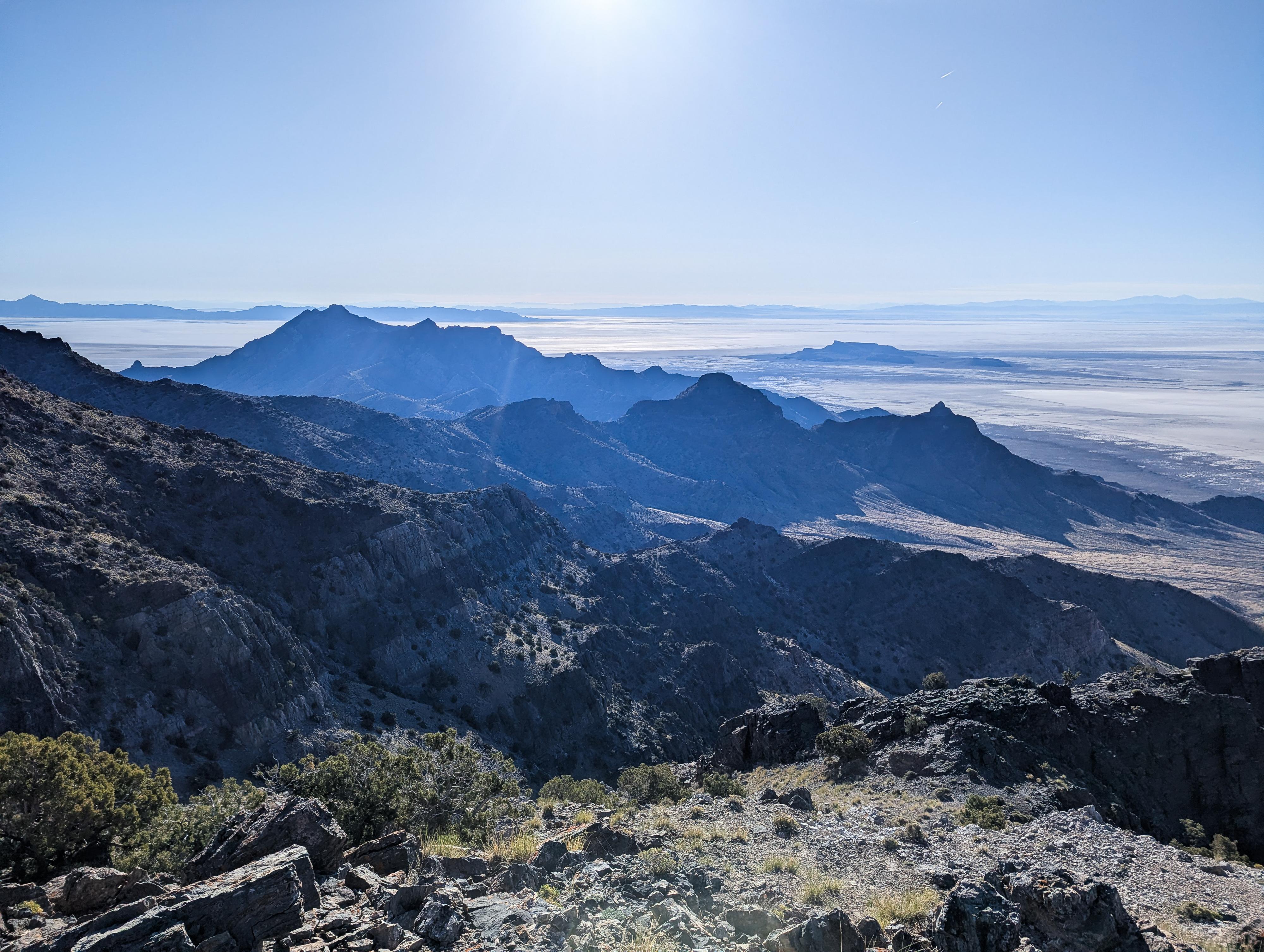
Head up the side branch and onto the ridge that is heading up. Follow the path of least resistance up the ridge to the spine of the range. There are a few rocky and loose sections along this section of ridge, but nothing more than class 2. There appeared to have been quite a bit of Big Horn sheep traffic on it when I used it. This steep ridge climbs a bit over 1,200' in about a mile to reach the main ridge of the range and the first view to the east of the salt flats and Floating Island in the distance.
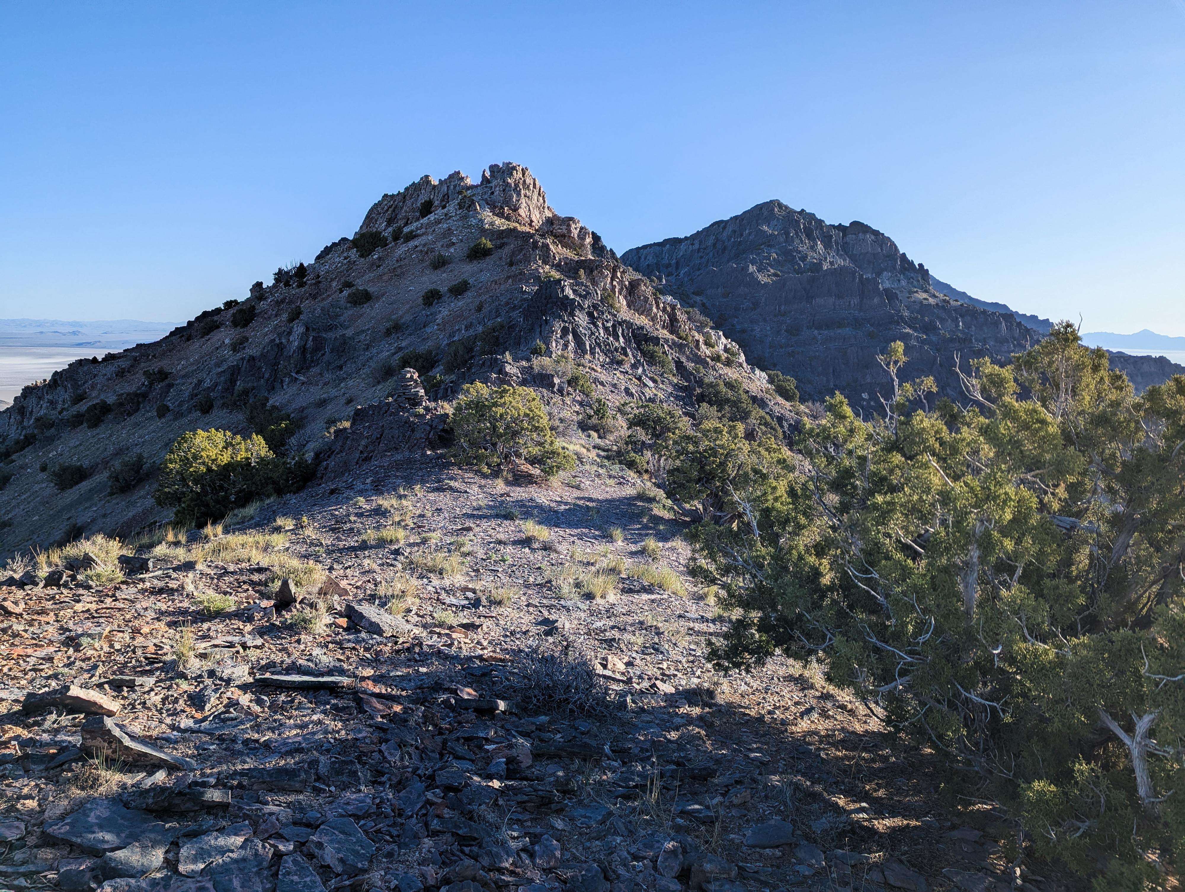
Once on the ridge, head north toward Campbell. Initially, this is easy walking, then there are a few rocky sections that require a small bit of route finding. As you near Campbell, there is one large rocky bump before a saddle. This is fairly rugged, so I recommend traversing across directly to the saddle on the east side of the range. This is steep and loose in spots. The saddle is where the descent route goes down on the west side.
From the saddle, the gray rock cliffs surrounding Campbell might look a bit intimidating, but it is relatively straightforward class 2 hiking with some route finding.
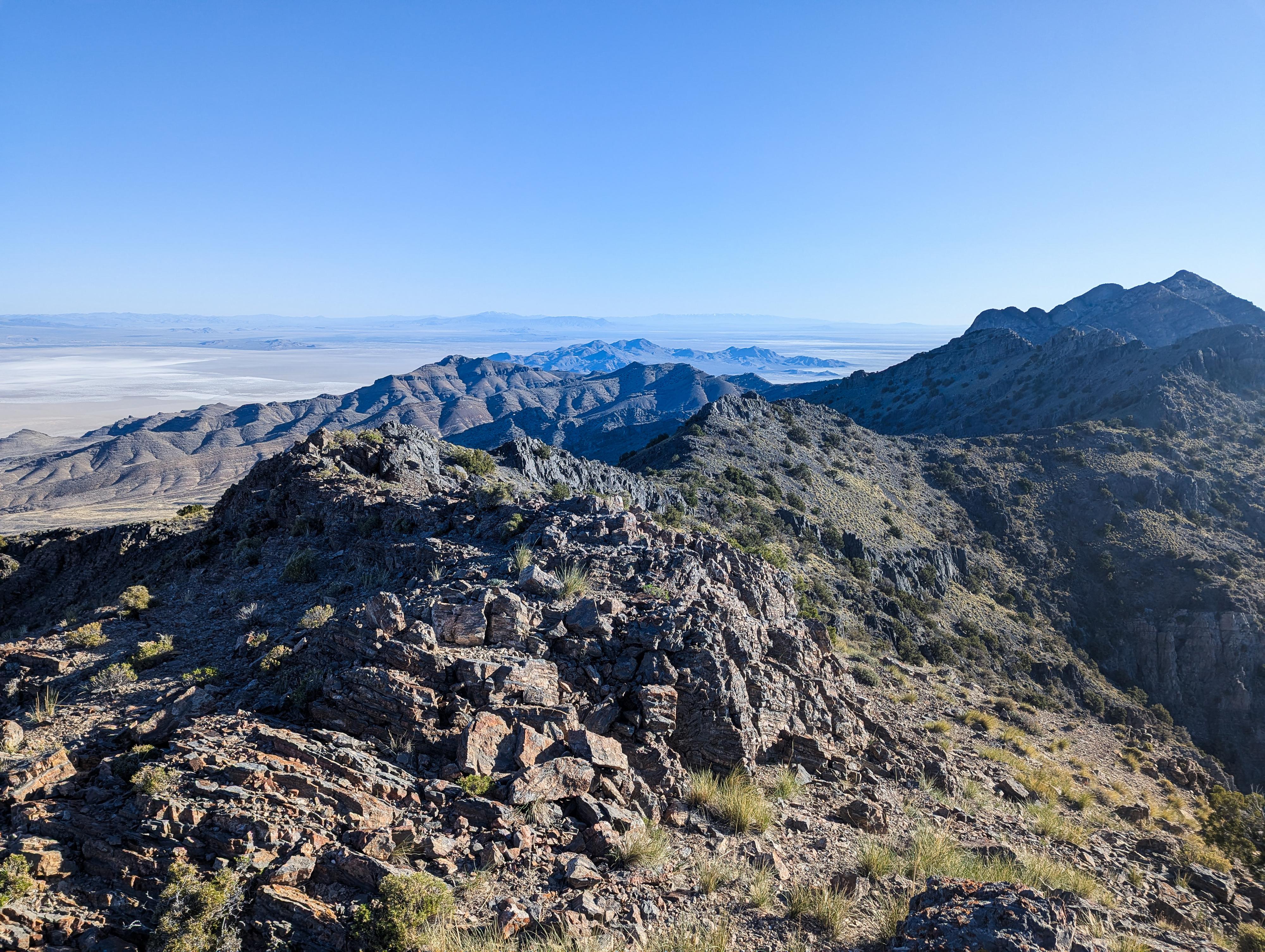
The summit has great, lofty views. To the north is Graham Peak, the highpoint of the island, and Crater Island in the distance beyond. To the west is Pilot Peak, and to the east are the salt flats and Floating Island.
Descent:
Descend back to the saddle. Instead of following the ridgeline back, descend the gully that drops down west from the saddle. It is steep and a little loose at first, but relatively straightforward, and I think easier than the ridgeline.
After about 3/4 of a mile of descent, the ridge on the left (south) side of the drainage gets lower and lower. Once reasonable low, head south, up and over the ridge to the wash on the other side that is heading southwest back to the trailhead.
Once you work down to the wash floor and start following it down, you will see an old mine on the right side. It is closed off, but seems to have a pretty impressive and steeply angled shaft heading down.
Follow the main wash back to the trailhead, where you may or may not have to walk the two-track back a bit, depending on where you parked.
Photos
Maps

12T 262754E 4534315N
40°55'32"N 113°49'03"W
12T 263558E 4535493N
40°56'11"N 113°48'31"W
12T 260923E 4534687N
40°55'42"N 113°50'22"W
12T 263326E 4535233N
40°56'02"N 113°48'40"W
12T 262603E 4535618N
40°56'14"N 113°49'12"W
12T 261951E 4535325N
40°56'04"N 113°49'39"W
12T 257107E 4538629N
40°57'46"N 113°53'11"W
12T 259645E 4538227N
40°57'35"N 113°51'22"W