 Hiking
Cave Flat
Hiking
Cave Flat
Western Henry Mountains
Overview
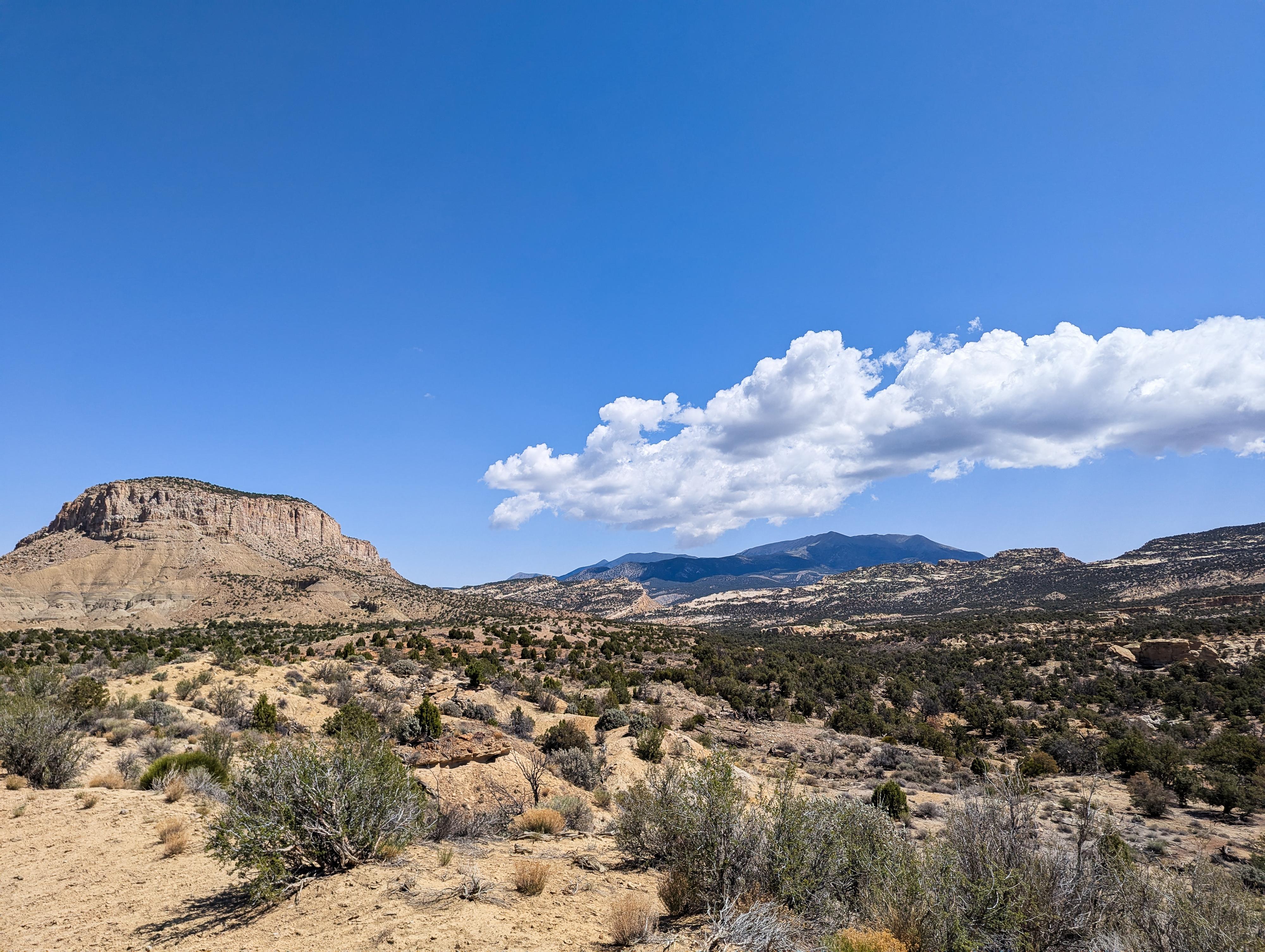
On the western side of the Henry Mountains is a remote region called Cave Flat. The area had piqued my interest for a long time. It is the winter range of the Buffalo herd, and a place I was hoping to do a long hike and find some solitude. It turned out to be a gem!
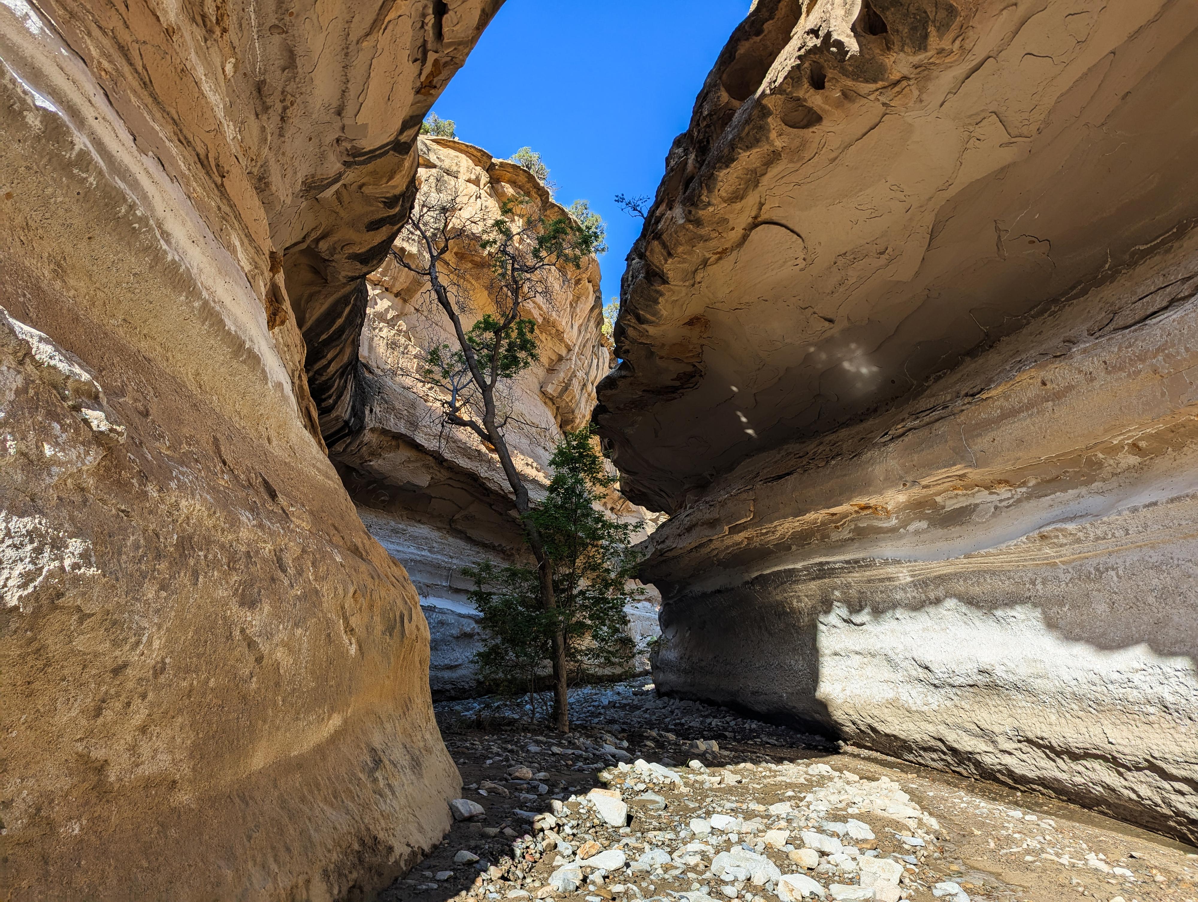
This route meanders down Bullfrog Creek that starts as a wash and slowly deepens. The creek is often dry. About 4 miles from the trailhead, the creek cuts into sandstone, deepens, and becomes much more interesting. It is about this point that water begins coming up from the ground, and the creek has a small flow. The route, after checking out some interesting side canyons of Bullfrog Creek, loops back on the old road back to the trailhead. Though not slot canyons, or particularly deep canyons, the canyons are quite beautiful.
Getting There
Travel east out of Capitol Reef National Park on highway 24. Just past the park, 0.25 miles, is the well signed Notom road. Turn right onto the Notom Road and follow it for 13.6 miles to the Sandy Ranch Junction on the left (east) side of the road.
Route Description
To Pipe Spring Canyon (5.2 miles)
From the trailhead, follow the road. It is washed out where it enters the creek bed. A short distance down canyon from the trailhead, about 1/3 of a mile, is the seasonal gate. Continue past it as the road goes through the narrowing canyon. Once through the canyon, the road leaves the creek bed on the right. Stay in the creek bed instead. It is cobblestone floored, but pretty easy walking.
This first part isn't particularly pretty. About 3.5 or 4 miles from the trailhead, depending on how you cut corners, a double arch is visible on the left (south) side of the canyon just above the creek bed. It is a beautiful arch. This is a good landmark, as the canyon soon cuts into sandstone and begins to deepen.
As the creek cuts into sandstone, there are two downclimbs that come in pretty quick succession. Climbers and canyoneers will likely find these fairly easy. Some may want a rope for people and/or lower packs. Dogs will find these two obstacles insurmountable without help, and they are high enough to be difficult to just pass dogs down. I would not recommend bringing dogs.
Once in the sandstone-walled canyon, water is likely to start surfacing and flowing in the creek. It is about 3/4 of a mile or so to where Pipe Spring Canyon comes in on the left.
Pipe Spring Canyon (1+ mile side trip)
This is a lovely side trip and can make a good place to filter water. Buffalo don't seem to travel too far up this drainage, so you can likely find a cleaner place to filter water from. As you head up, the canyon is remarkably obstacle free. The flowing stream and trees make for great scenery.
About 1/2 mile or so up, a tunnel is reached. A collapse here at some point made quite the tunnel. Getting into the tunnel is guarded by large boulders. Depending on sand levels below the boulders, teamwork MAY be able to continue upstream in the watercourse. On my visit, solo, it was not possible to climb into the tunnel.
You can use a game trail on the right (looking upstream) side of the canyon just below the tunnel to get around this obstacle and to the ridge. To re-enter the canyon above the tunnel requires a fair bit of route finding up the canyon rim until the vertical walls allow for descent back to the canyon floor. I think the tunnel is a good turnaround spot for most.
Continuing down Bullfrog Creek
Just a few minutes below Pipe Spring Canyon, there are some large trees and decent campsites if you don't mind the buffalo poop. There is also an old road/trail that leaves the canyon on both sides here. The one on the right side (north) is the one that will be followed back to the trailhead. The one on the left goes out and ends at a benchmark in about 10-15 minutes.
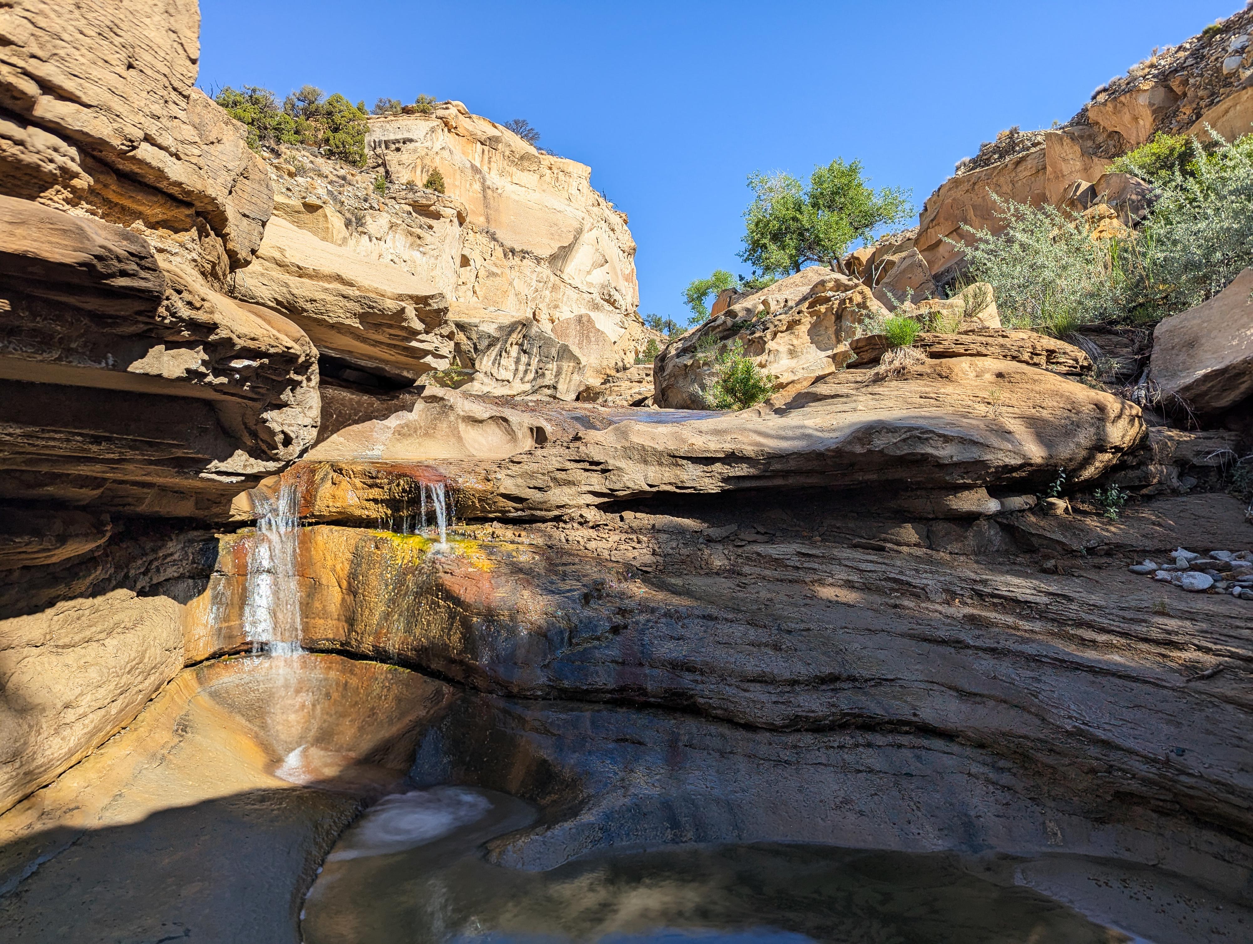
Lower Bullfrog Side Trip
From where the roads leave on both sides of the canyon, continuing down Bullfrog for a bit is a nice side trip. The section just below has many springs, small cascades, and small waterfalls. It is an idyllic place to while away some time.
Exit (4.8 miles)
Follow the old road that leaves the canyon on the right and begins climbing to the canyon rim.
As you head up this old road, keep an eye out on the left for a dramatic slot canyon. This side canyon, which reminded me of Swiss Cheese, is worth the brief visit. It is riddled with holes and curved walls. You can climb it fairly easily. Return to the road when finished. (less than 30 minutes roundtrip)
Follow the road up to the canyon rim, where a log barrier is, and the side road meets the "main" dirt road. Go right and follow the main dirt road as it meanders back to the trailhead across the flats.
Photos
Maps

12S 512168E 4204913N
37°59'30"N 110°51'41"W
12S 511878E 4204604N
37°59'20"N 110°51'53"W
12S 510907E 4200511N
37°57'08"N 110°52'33"W
12S 510882E 4200331N
37°57'02"N 110°52'34"W
12S 510681E 4199130N
37°56'23"N 110°52'42"W
12S 511398E 4199166N
37°56'24"N 110°52'13"W
12S 510237E 4199097N
37°56'22"N 110°53'01"W
12S 510443E 4198969N
37°56'18"N 110°52'52"W