 Hiking
Grotto Canyon
Hiking
Grotto Canyon
Canmore Canada
Overview
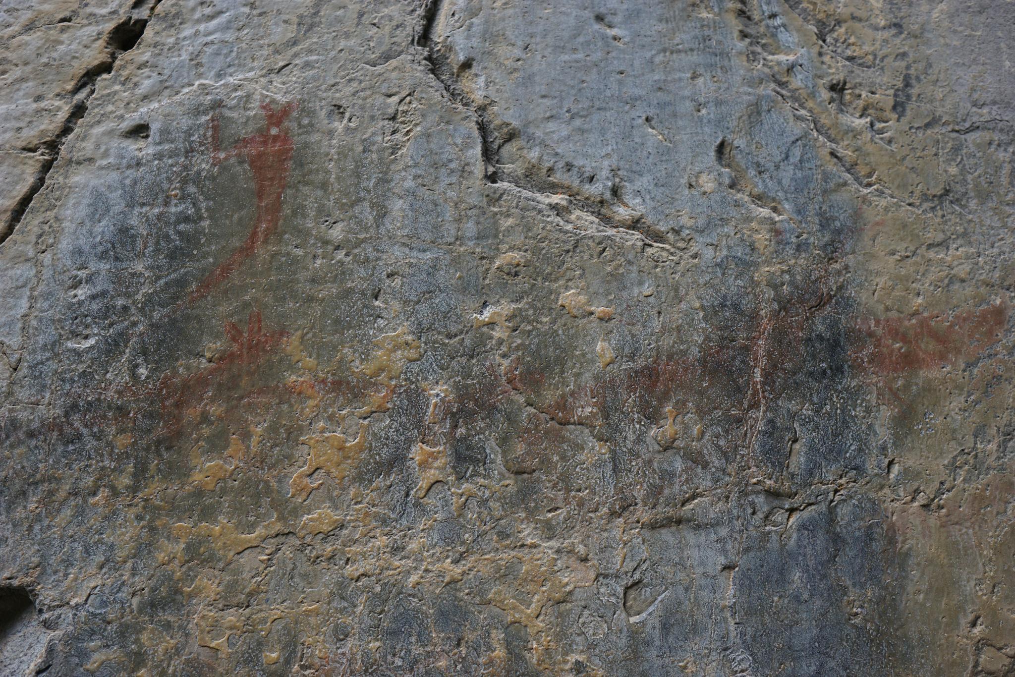
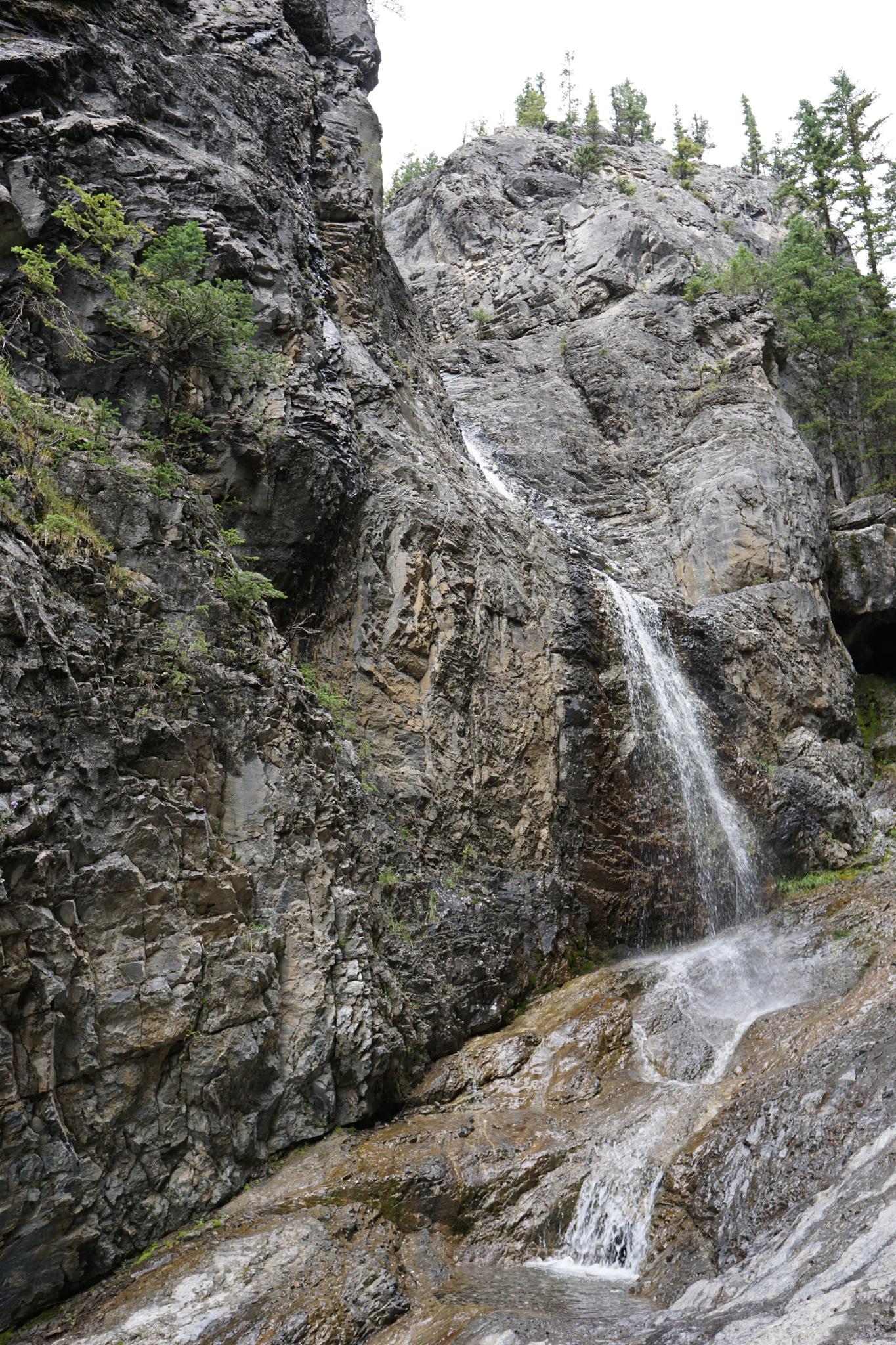
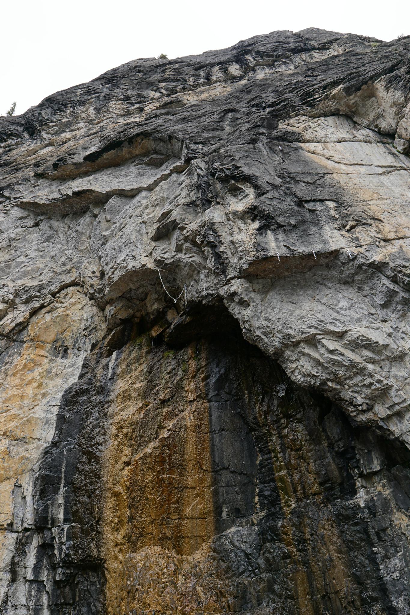
One of the more stunning hikes in the Canmore/Banff area, Grotto Canyon, is a hike not to be missed! The hike is challenging enough to be interesting, but still do-able by most groups. The trail meanders up a steep and rocky drainage (Grotto Canyon), passing a pictograph en route to a stunning waterfall. The sheer walls lining the canyon are dramatic and picturesque. You may notice the bolts along the cliffs during the hike. The area is very popular with climbers and has numerous climbs throughout the canyon.
Getting There
From the southeast side of Canmore, take Bow Valley Trail/AB-1A E for 10km. The trailhead is on the left, signed Grotto Pond.
Route Description
Rock art and historic sites are fragile, non-renewable cultural resources that, once damaged, can never be replaced. To ensure they are protected, please:
- Avoid Touching the Petroglyphs: Look and observe, BUT DO NOT TOUCH!
- Stay on the Trails: Stay on the most used trails when visiting sites, and don't create new trails or trample vegetation.
- Photography and Sketching is Allowed: Do not introduce any foreign substance to enhance the carved and pecked images for photographic or drawing purposes. Altering, defacing, or damaging the petroglyphs is against the law -- even if the damage is unintentional.
- Pets: Keep pets on a leash and clean up after them.
- Artifacts: If you happen to come across sherds (broken pottery) or lithics (flakes of stone tools), leave them where you see them. Once they are moved or removed, a piece of the past is forever lost.
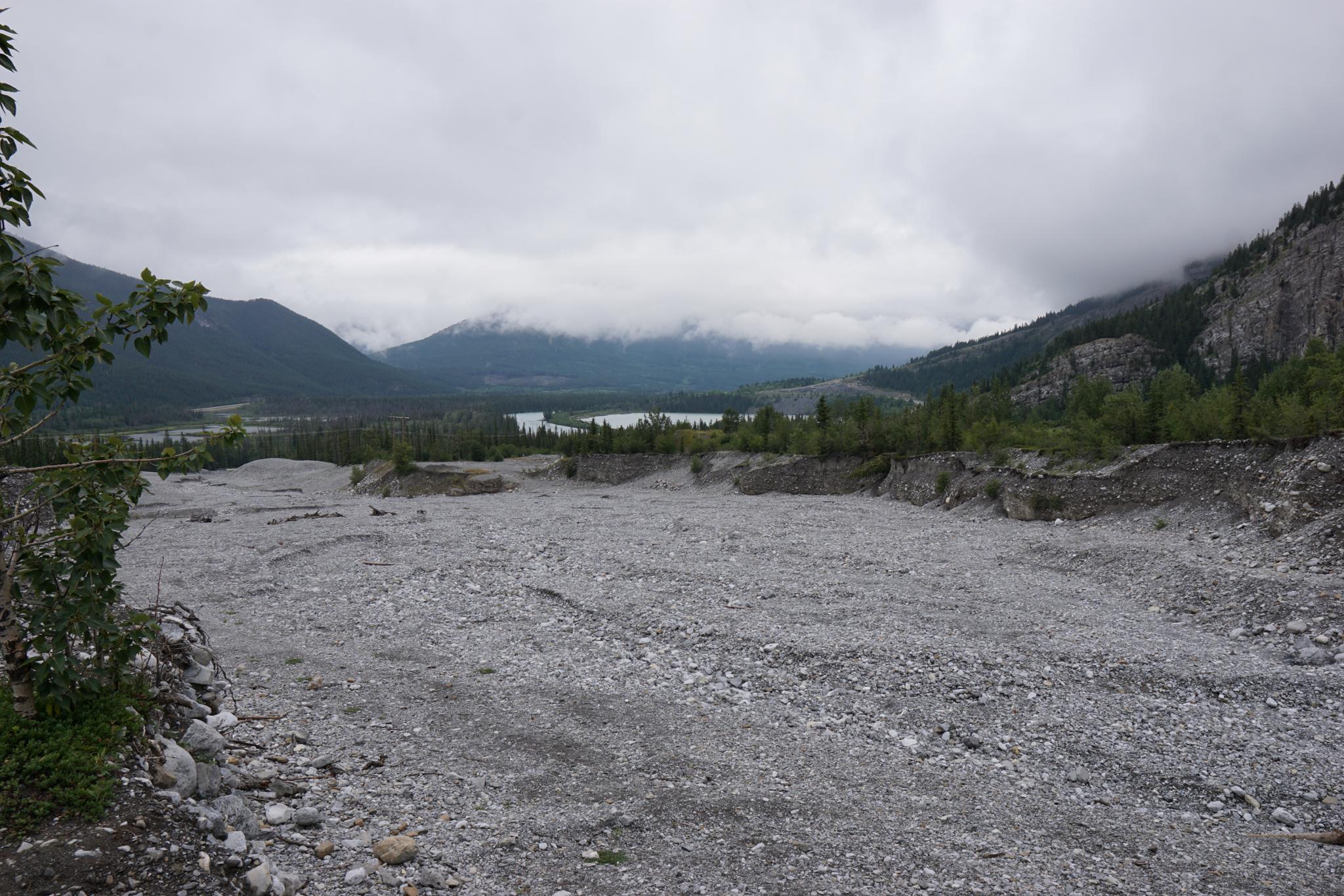
From the trailhead, the trail heads west under the power line. It crosses a road, then passes the Baymag Mineral Processing Facility. This large facility process magnesite into magnesium oxide. The oxide is used in wastewater treatment, acid neutralization, and other industrial uses. After passing the plant, the reaches Grotto Canyon.
At this point, the canyon is a broad, rocky streambed. Head up the canyon. During high water, a side trail follows the rim of the streambed, but walking in the streambed is generally easier and more scenic.
As you continue up the canyon, it narrows and deepens. The walls become more and more spectacular. When the now narrow canyon makes a fairly sharp bend to the right, then back left, look for a pictograph on the left cliff face.
Just past the pictograph, the canyon reaches a fork. The falls is visible on the right. The base of the falls can be scrambled up to with some caution.
Most return from here, though if time permits, wandering up the left fork is also interesting for about 5 or 10 minutes before it opens broadly and is less interesting.
Maps

11U 625873E 5658605N
51°03'55"N 115°12'13"W
11U 625631E 5658292N
51°03'45"N 115°12'26"W
11U 624965E 5658263N
51°03'44"N 115°12'60"W
11U 624876E 5659039N
51°04'09"N 115°13'04"W