
 Pleasant Creek
Capitol Reef
Overview
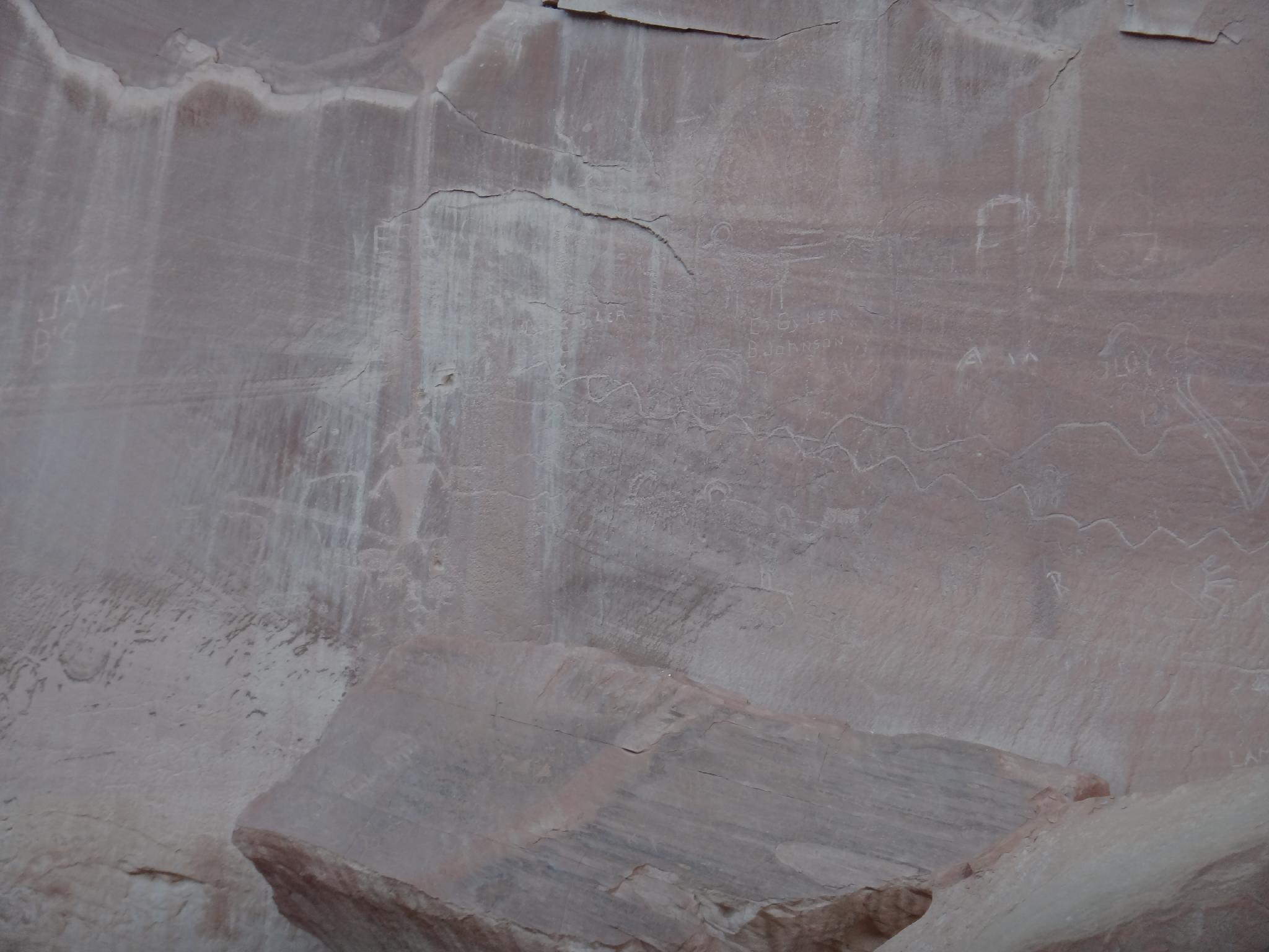
Pleasant Creek is home to likely the largest petroglyph panels in Capitol Reef. It is surprising the National Park Service doesn't promote this short hike. The hike is short enough it is nearly a roadside attraction, and should be accessible to most who are up for a short walk.
The hike can be hot and buggy in the summer, but is short enough to be tolerable even in the heat and potential bugs.
Getting There
From the Capitol Reef Visitor Center, follow the Scenic Byway. At about 1.6 miles is the pay booth. At 7.9 miles, stay right. (Left is Capitol Gorge, there is a picnic area at this junction.).
The scenic drive is now dirt, but should be accessible by most vehicles. At 10.5, after passing the research station on the left, a pullout on the right is the trailhead, next to an old corral. If you reach the pit toilet and Pleasant Creek crossing, you've gone about 0.25 miles too far.
Route Description
Rock art and historic sites are fragile, non-renewable cultural resources that, once damaged, can never be replaced. To ensure they are protected, please:
- Avoid Touching the Petroglyphs: Look and observe, BUT DO NOT TOUCH!
- Stay on the Trails: Stay on the most used trails when visiting sites, and don't create new trails or trample vegetation.
- Photography and Sketching is Allowed: Do not introduce any foreign substance to enhance the carved and pecked images for photographic or drawing purposes. Altering, defacing, or damaging the petroglyphs is against the law -- even if the damage is unintentional.
- Pets: Keep pets on a leash and clean up after them.
- Artifacts: If you happen to come across sherds (broken pottery) or lithics (flakes of stone tools), leave them where you see them. Once they are moved or removed, a piece of the past is forever lost.
From the trailhead, find a trail across the road on the north side of the parking lot. The trail is a bit faint as it descends from the road and crosses sagebrush but becomes more defined as it follows the base of the hill and heads down Pleasant Creek.
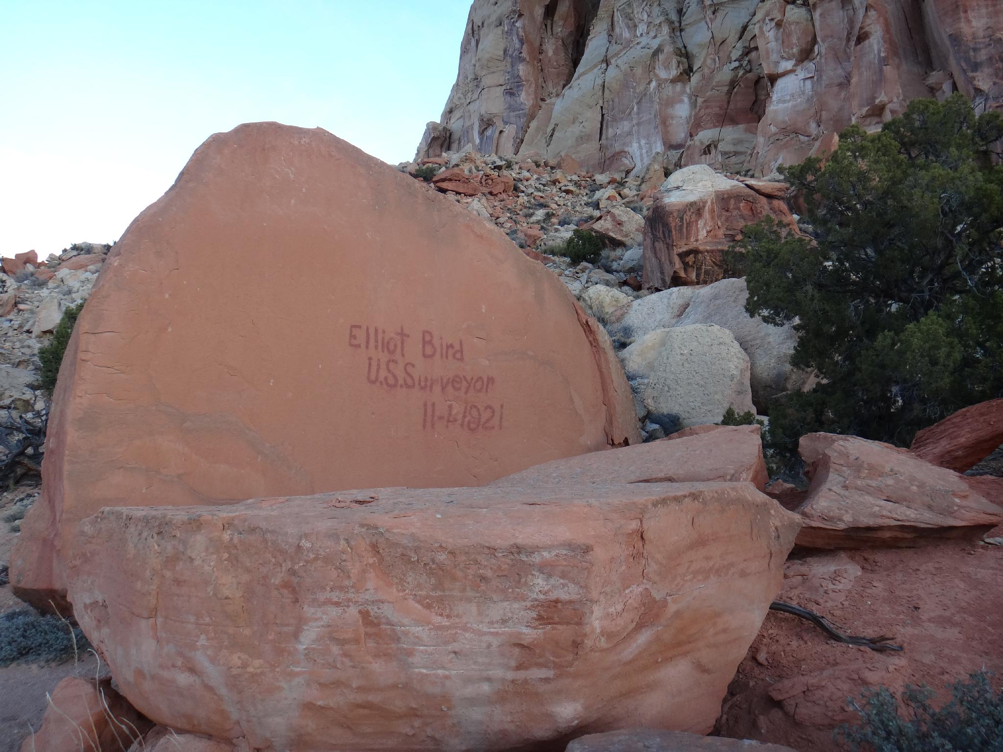
Within 5-10 minutes, near where the trail nears the cliff, an old Survey Inscription is visible just off the trail on the left. (Elliot Bird / 1921) Another 5 minutes leads to the panel proper. The panel is fenced off, with informational signs. Be sure to follow the cliff east, there is more to see along the cliff for a few hundred feet.
From the park service sign:
A one of a kind tapestry of thoughts and actions spans the rock canvas before you. Anthropomorphs (human figures), zoomorphs (animal figures), geometric and astronomic designs weave their way across the rock fabris. Pecked and painted by a succession of American Indian artists, the composition took over 7,000 years to create - from Archaic Period to historic times.
Prehistoric ancestral Pueblo people, the Fremont people and historic American Indian groups traveled along Pleasant Creek. Many of these images are recognized and respected by the Hopi, Zuni, Navajo, Ute and Paiute today. They have asked us all to help projected this rare resource as we are privileged to ponder the power of this unique place. It is both a national treasure and a valued space to neighboring Indian groups.
Archeological evidence confirms this as a special place. Unfortunately, this site's sandy foreground was plowed and plundered by heel and hoof. Protecting this area enables continued study of connections between these images and Fremont life ways.
It is unlawful and unconscionable to damage or remove any natural or cultural material anywhere in Capitol Reef. These treasures belong to everyone.
Return the way you came, or cross Pleasant Creek and wander up the south side on a social trail for a loop trip.
Maps

12S 484228E 4226182N
38°11'00"N 111°10'48"W
12S 484572E 4226439N
38°11'09"N 111°10'34"W
12S 484882E 4226515N
38°11'11"N 111°10'21"W