 Hiking
Little Holes Canyon
Hiking
Little Holes Canyon
Northern Swell
Overview
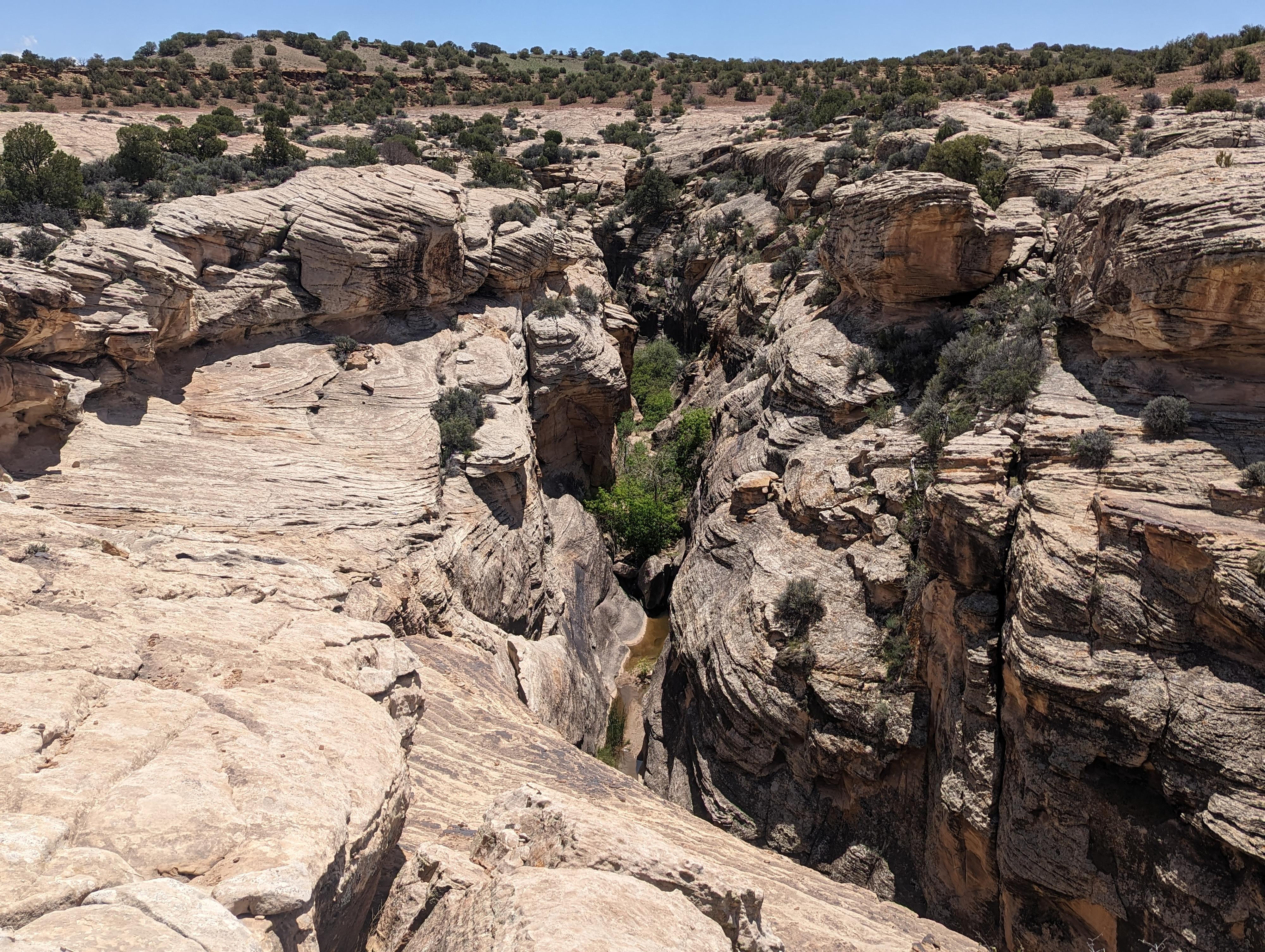
Little Holes Canyon is a side drainage of Buckhorn Wash. Steve Allen, in his book Canyoneering The Swell, has a brief write-up of Little Holes. He makes it sound somewhat idyllic, and we were excited to finally visit. The canyon, in the Navajo sanstone layer, is quite different from its neighbors, Furniture Draw or Calf Canyon. The upper section tends to be densely vegetated, somewhat narrow, and can hold water. After recent rains, the upper section had very deep pools.
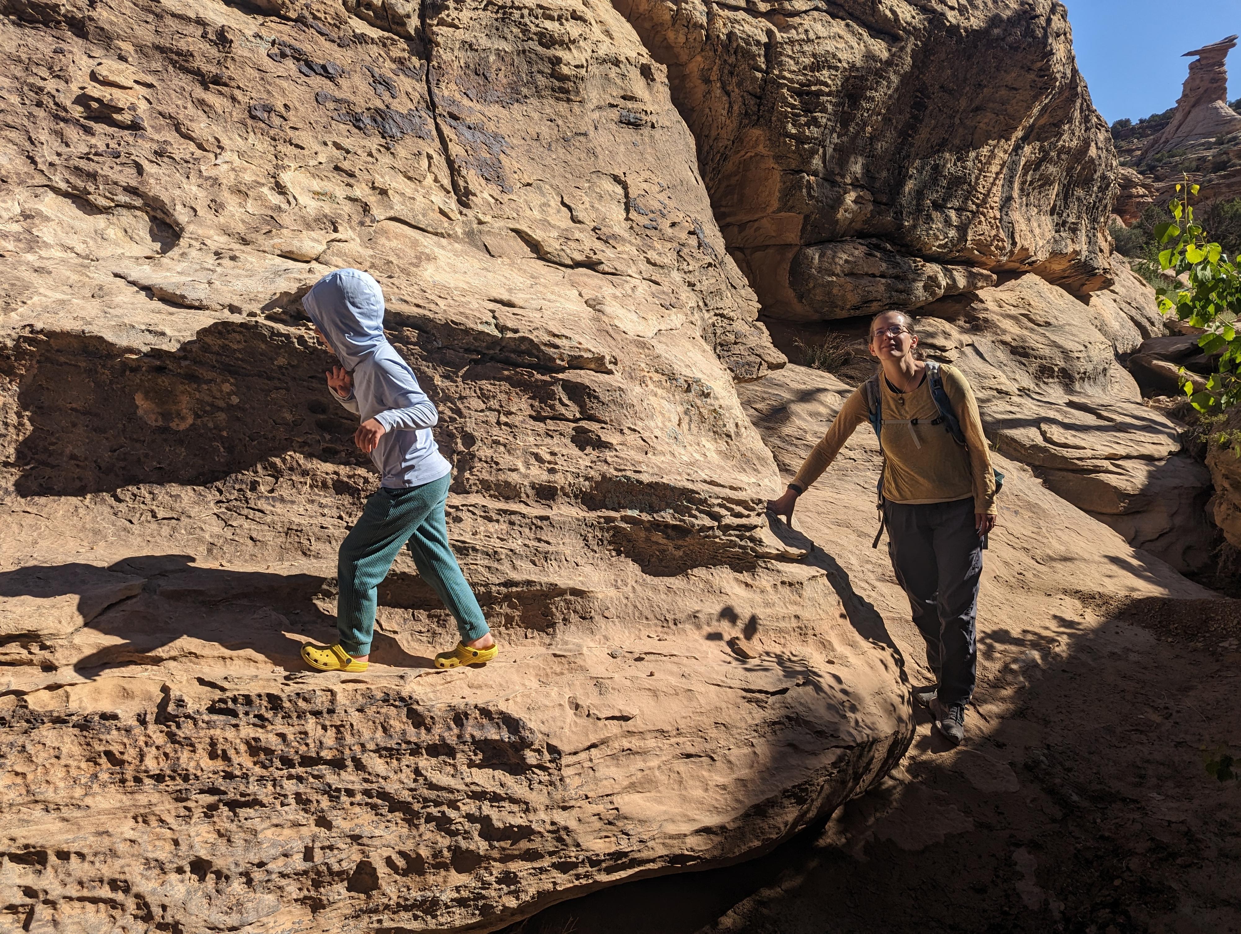
The middle and lower sections are more open, but still quite vegetated and require some persistence and route finding to traverse. The going was a bit slow at times and required a bit of route finding around various obstacles. This is a good hike for the adventurous hiker looking for some route finding challenges in and around boulders. It is likely not well suited to beginners. We took our 6-year-old on our trip, and she liked it ok, but it was clearly more challenging and not as fun as Furniture Draw or some of the other adventures in the area.
Getting There
The trailhead is near the top of Buckhorn Wash. Access starts from near Castle Dale.
Route Description
To The Conquistadors
As mentioned above, the upper section is densely vegetated and can hold a fair bit of water and a few climbing challengers (up to easy 5th class in difficulty). There are quite a few places to climb out if you change your mind, but overall, I would recommend staying on the rim and entering at the middle entry.
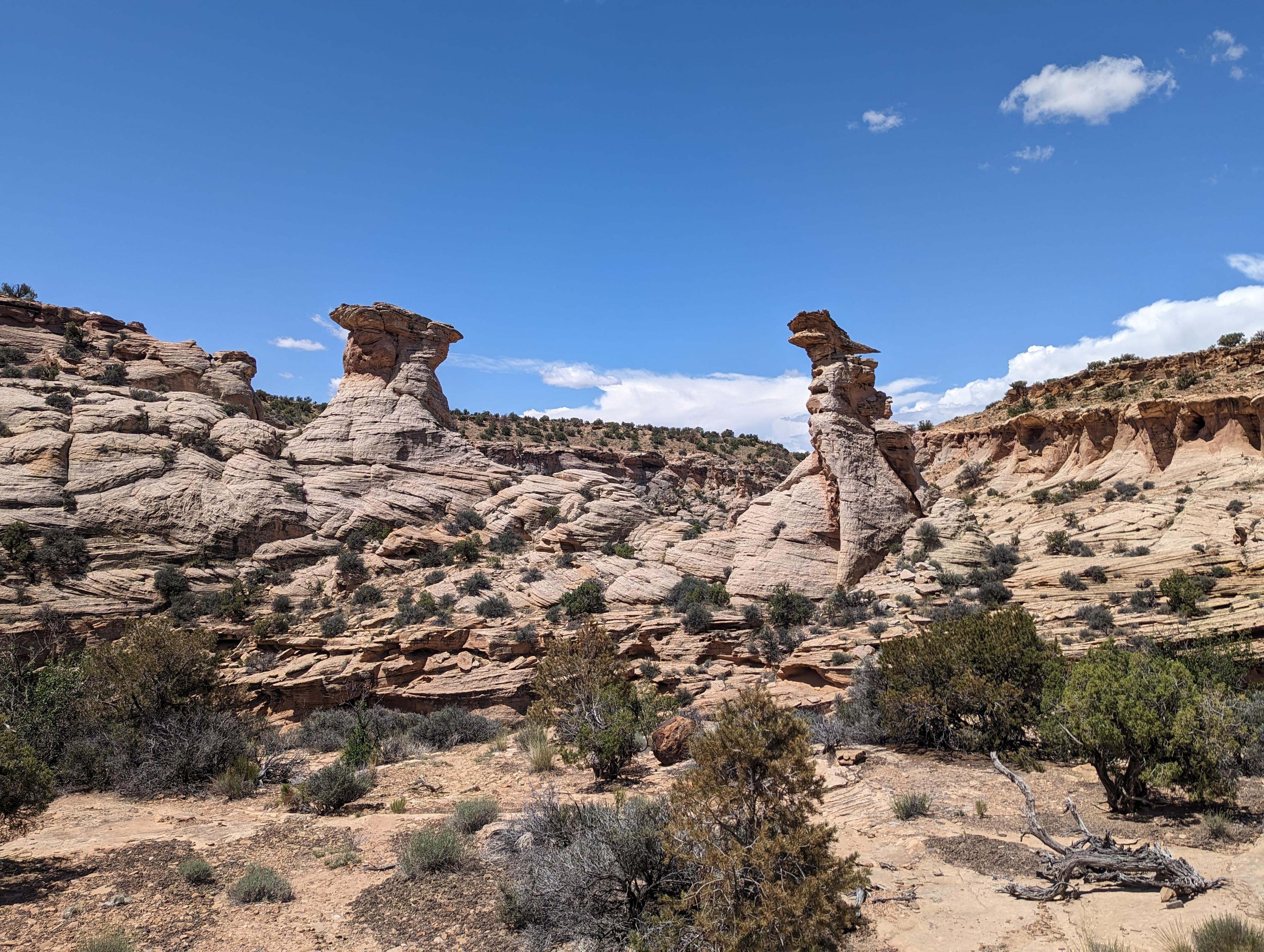
For the middle entry, drive the dirt road nearest to the rim of Little Holes on the north side for 1 mile to just before two towers are visible on the other side of the canyon. Steve Allen calls these towers The Conquistadors. As of 2023, the two-track requires high clearance but is fairly easy going. Alternatively, hiking the social trail along the rim is a bit more scenic than driving to two-track.
Enter The Canyon
There are a couple of easy entries into the canyon. The first is at the bend above The Conquistadors. You are likely to find cairns that angle down south to the canyon floor.
Alternatively, you can enter just past The Conquistadors by a second route that had cairns as well on our visit. This route takes a long angling traverse down to the canyon floor just down canyon from The Conquistadors.
Down Canyon
Once on the canyon floor near The Conquistadors, head down the canyon. In just a few minutes, the canyon drops into a short section of sculpted shallow narrows. You may find water here. After the pools are some obstacles, getting through a number of house size boulders. Alternatively, you can climb out on the right (looking down canyon) just before the sculpted narrows and follow a cairned social trail on the bench that descends back down to the canyon floor just after the house sized boulders. The bypass is quite a bit easier than working through the canyon bottom.
Below the bypass, just a few minutes, the canyon drops again where a jumble of boulders is encountered. From the top, this looks like an impassable dry fall. You can stay in the watercourse, but two short drops are encountered that may give beginners some difficulty. Alternatively, hike left from the top of this section to find an easier path to weave through the boulders.
Below this obstacle, the canyon gets easier, wider, and deeper. The further you go, the more established a social trail becomes, making passage easier down to the Buckhorn Wash road.
Return the same way.
Photos
Maps

12S 527094E 4334970N
39°09'49"N 110°41'11"W
12S 526288E 4334803N
39°09'43"N 110°41'45"W
12S 525931E 4334823N
39°09'44"N 110°41'59"W
12S 525921E 4334718N
39°09'41"N 110°41'60"W
12S 525858E 4334885N
39°09'46"N 110°42'02"W
12S 525795E 4334686N
39°09'40"N 110°42'05"W
12S 525700E 4334632N
39°09'38"N 110°42'09"W
12S 525725E 4334627N
39°09'38"N 110°42'08"W
12S 525851E 4334751N
39°09'42"N 110°42'03"W
12S 525559E 4334698N
39°09'40"N 110°42'15"W