
 Devils Playground
Bovine Mountains
Overview
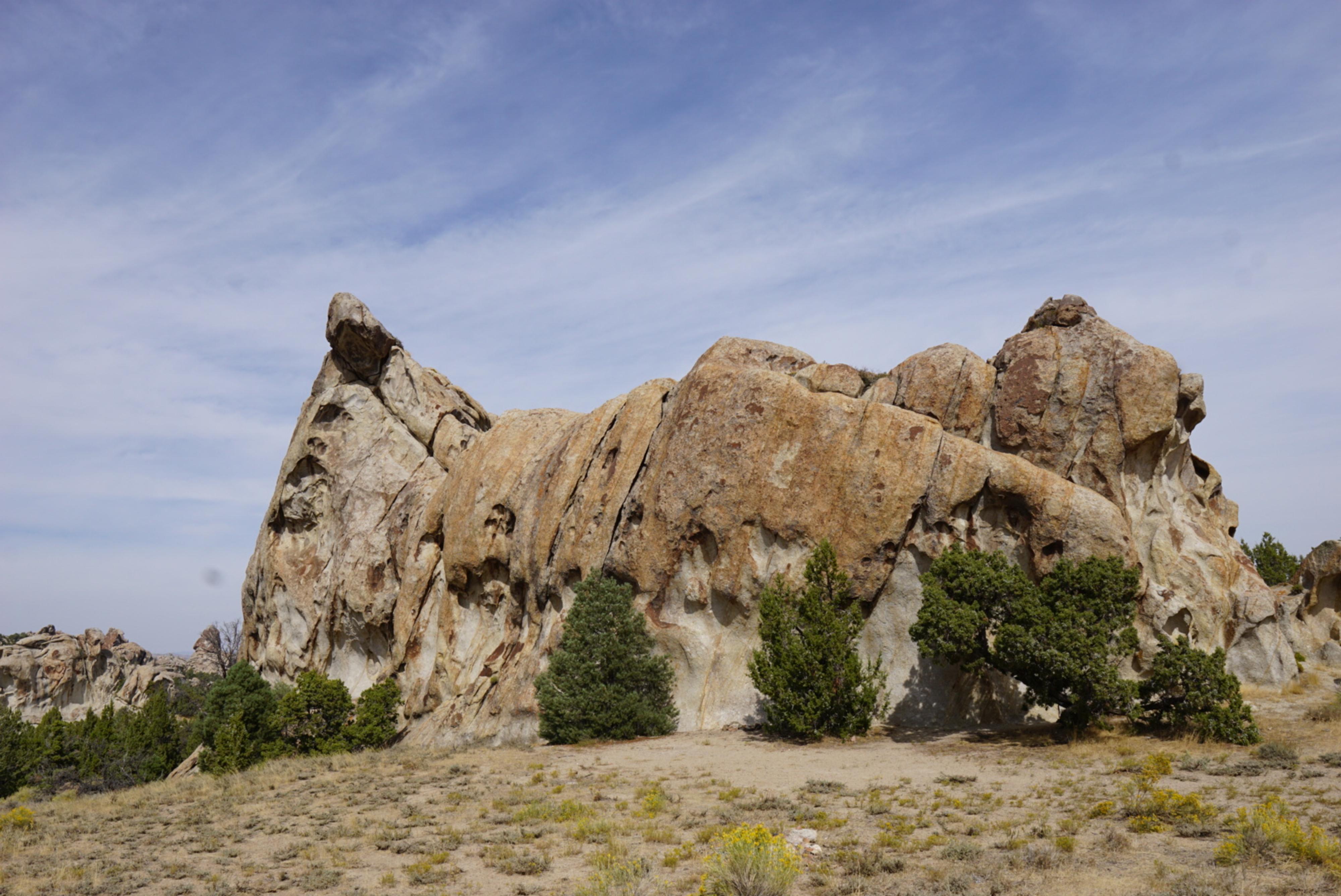
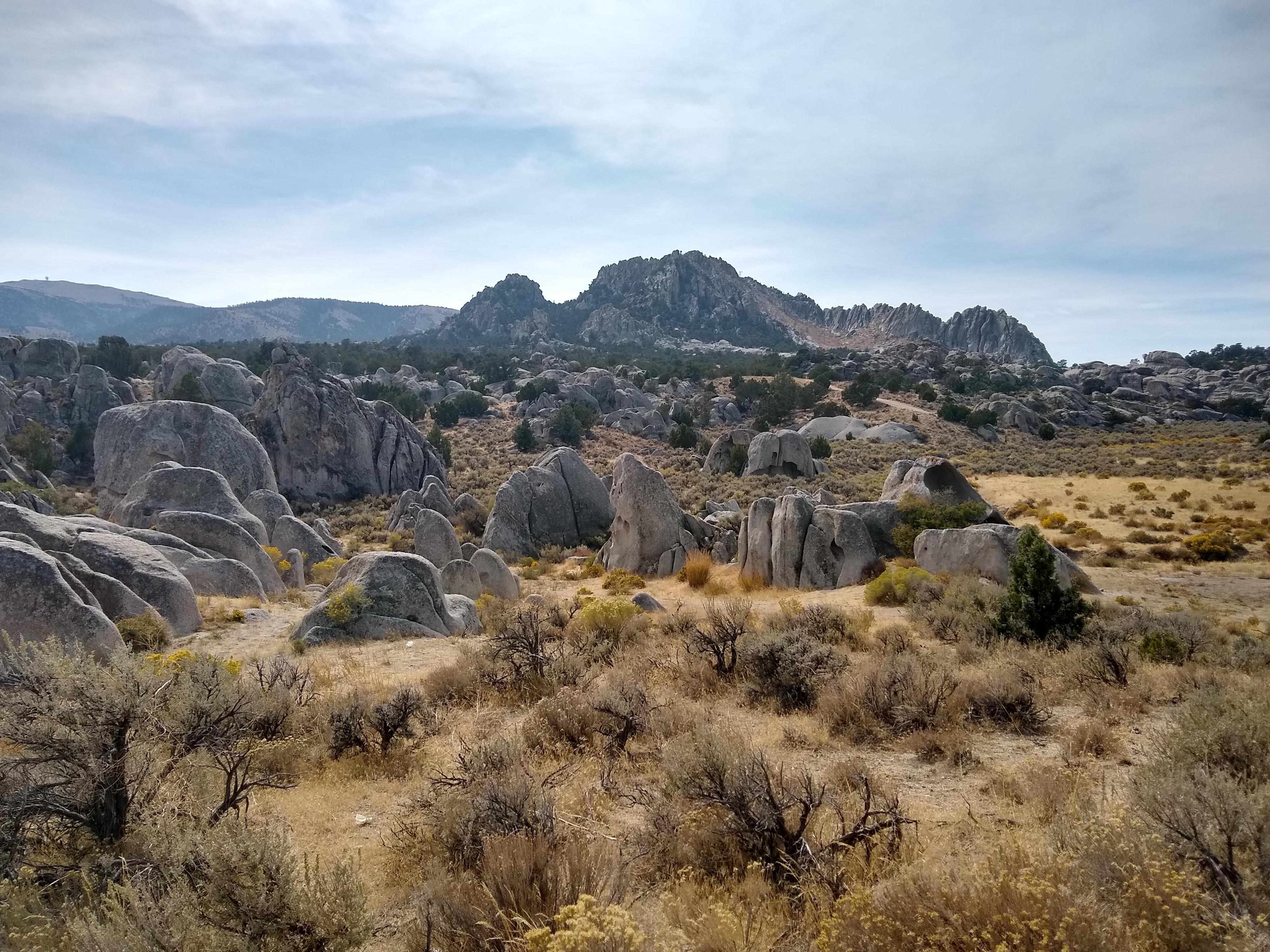
“Idle time is the devil's play” as the old saying goes. The Devil’s Playground is, then, a good place to have some idle time! The area is a unique geologic feature in north west Utah where granite is exposed and has eroded into large fins, domes, spires, and boulders. The Utah Geological Survey has an excellent page on the technical details.
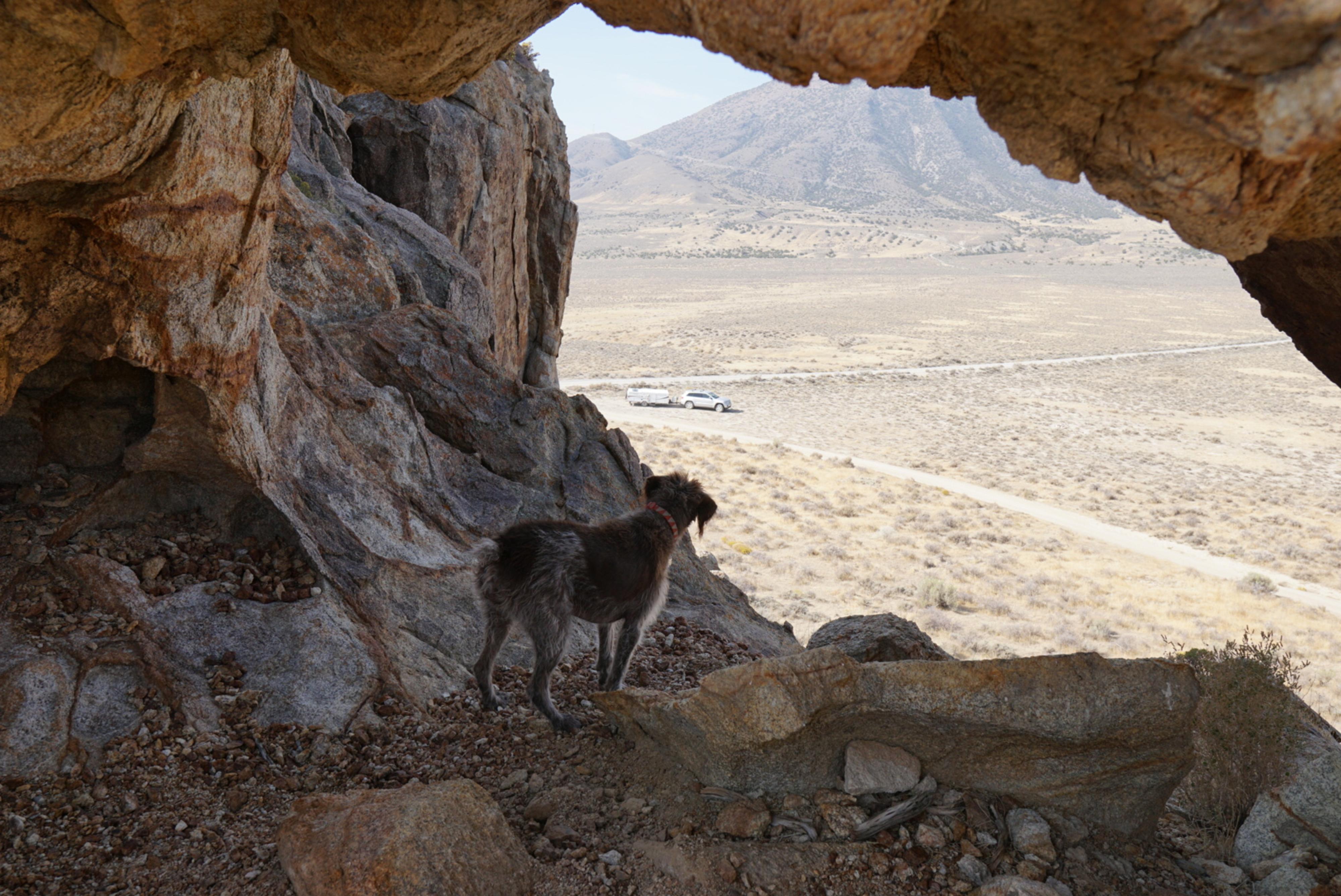
The rock is quite grainy and exfoliating. It is not good for rock climbing, but weathers into interesting shapes. The playground does not have any formal trails. Roads provide easy access to the area with lots of opportunities for wandering amongst the boulders and for primitive camping. Our 3-year-old loved scrambling on the boulders and into the many pockets and arches.
This is an excellent family destination, though a bit remote. Keep an eye on children if climbing on the rocks, it is easier to climb up then down!
Getting There
The area is reached from UT-30 in northwest Utah. The state highway connects Montello, NV to Park Valley/Rosette in the north. If coming from Montello, follow UT-30 about 40 miles to mile marker 23.9 where a dirt road leaves on the west side. From Rosette, UT (Park Valley), it is about 30 miles south on UT-30 to the same marker.
Once you turn on the dirt road, it is about a mile to a major junction just after coming around the end of the first large granite cropping. Follow the map from here. There is an amazing arch just up and right of this junction. It is easy to scramble to and gives an unobstructed view of the area to the west.
Route Description
The best way to experience the playground is to find an area that interests you, stop, and wander around! The map shows the roads I recommend.
I preferred camping on the east side, it gets more sun in cooler weather. The middle and west areas have more rock outcroppings and places to wander.
Aside from the large arch marked on the map, there are many other small solution pockets and arches. Keep an eye out.
Maps

12T 279568E 4597064N
41°29'42"N 113°38'27"W
12T 279101E 4598659N
41°30'33"N 113°38'49"W
12T 277893E 4598537N
41°30'28"N 113°39'41"W
12T 277518E 4598621N
41°30'30"N 113°39'57"W
12T 278039E 4600661N
41°31'37"N 113°39'37"W
12T 275707E 4601361N
41°31'57"N 113°41'19"W
12T 275651E 4601320N
41°31'56"N 113°41'21"W
12T 279633E 4597140N
41°29'44"N 113°38'24"W
12T 279714E 4597336N
41°29'51"N 113°38'21"W
12T 279534E 4598201N
41°30'18"N 113°38'30"W
12T 279466E 4598621N
41°30'32"N 113°38'33"W
12T 277606E 4598906N
41°30'39"N 113°39'54"W
12T 277870E 4599435N
41°30'57"N 113°39'43"W
12T 278081E 4599932N
41°31'13"N 113°39'35"W
12T 275912E 4601238N
41°31'53"N 113°41'10"W
12T 275578E 4601049N
41°31'47"N 113°41'24"W
12T 275342E 4600535N
41°31'30"N 113°41'33"W
12T 275293E 4600353N
41°31'24"N 113°41'35"W