 Hiking
City Creek Meadows
Hiking
City Creek Meadows
Salt Lake City
Overview
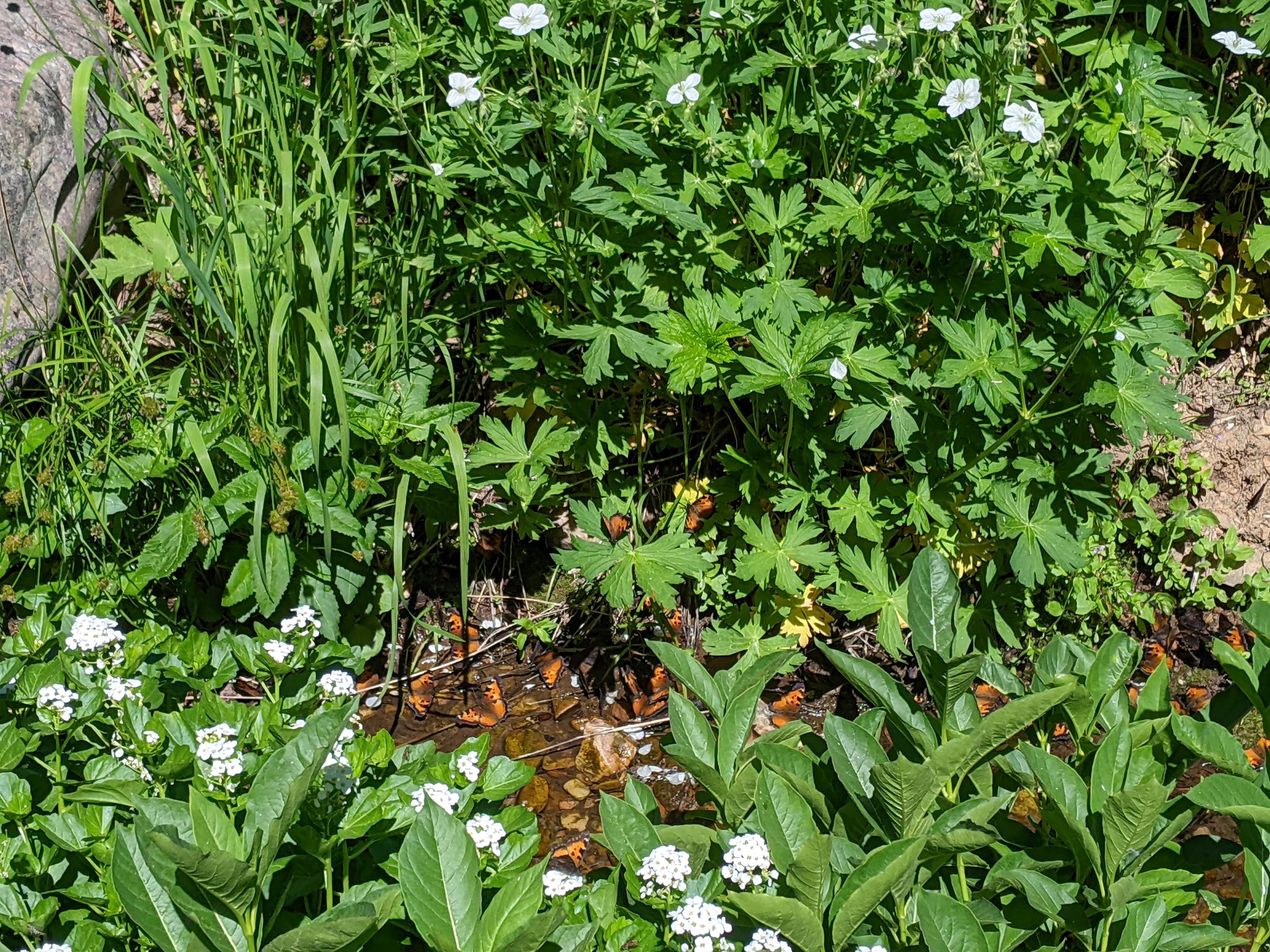
Upper City Creek Canyon is one of the most pristine canyons along the Wasatch Front. Rules against dogs, horses, and camping are in the canyon, coupled with somewhat difficult access, have made this a lightly visited area. The hike to the meadows shows this light usages. Expect a trail that is occasionally hard to find in grassy meadows, solitude, and a very natural setting. On a July day, I was dazzled by butterflies and birds, with many more spotted than I have seen elsewhere in the Wasatch.
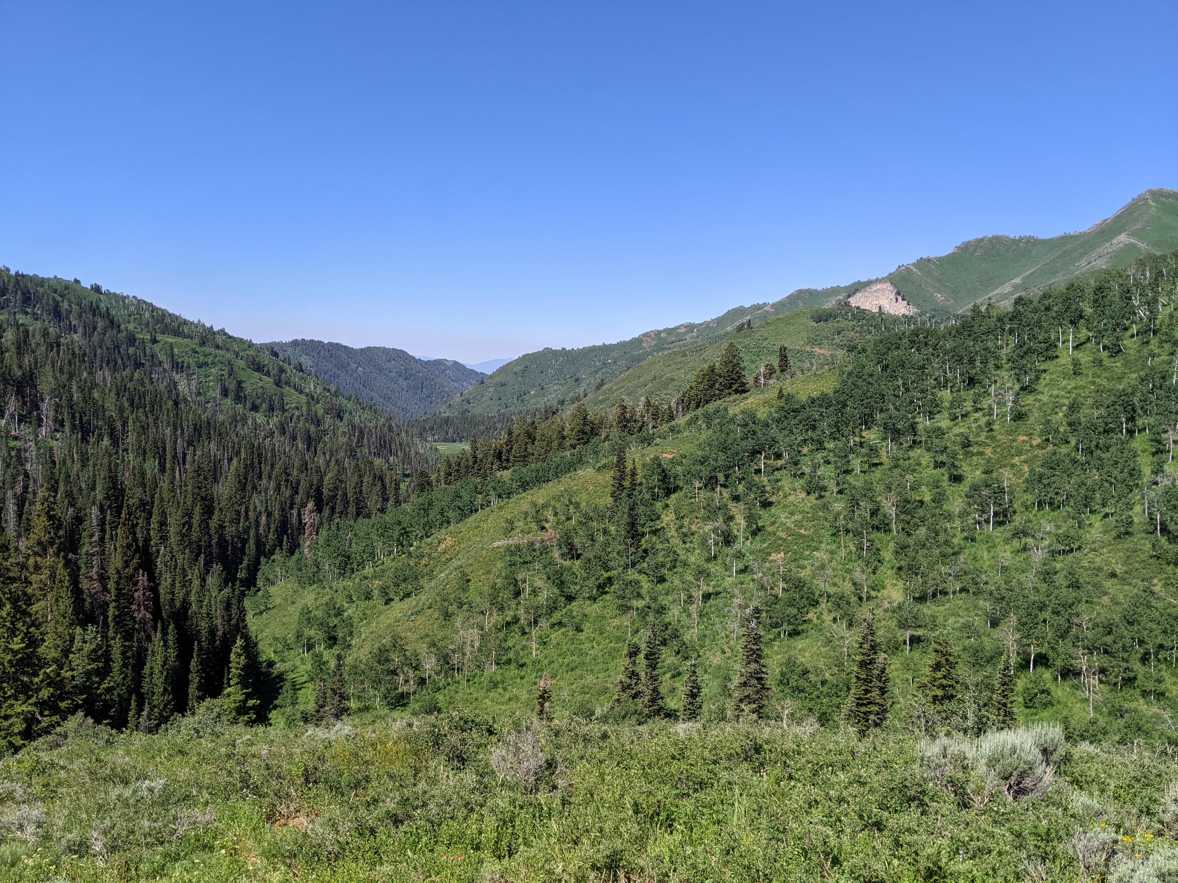
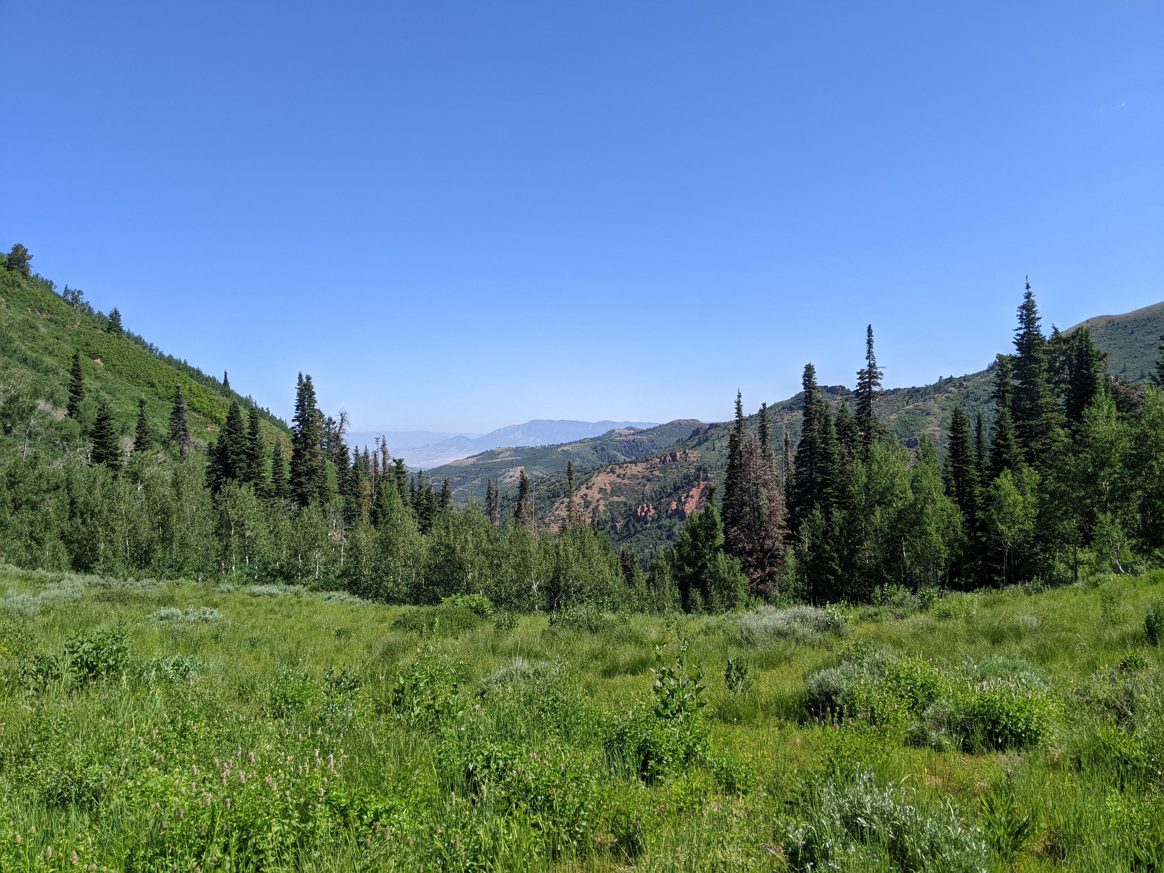
City Creek Canyon is quite narrow, deep, and forested. This is not a hike to do if you are looking for views. Most of the hike has dense forest views, though if you make it as far as the meadows, the views open up a bit. It is an excellent hike if wildflowers in the summer, fall colors in the autumn, or wildlife are your goals for the day.
Getting There
City Creek Canyon is reached via a one-way road connecting the Avenues neighborhood to the Marmalade Hill neighborhood. From downtown Salt Lake City, go east on South Temple to B Street. Go north up B Street to 11th Avenue. The left (west) on 11th Avenue. It curves and goes north into City Creek Canyon. Where the road curves back to head to the Capitol is a small side road on the right with a few parking spots. Head up this side road to the gate.
After paying the fee, continue up the canyon to its end in about 5.6 miles. The road ends at the trailhead.
Route Description
From the trailhead, follow the old jeep road as it heads east. It is easy to follow here, and not long (0.4 miles) to the Smuggler Gap trail junction (signed). Stay left on the old jeep road.
The old road crosses the stream several times, all on bridges. It is about 1.25 miles to where Cottonwood Gulch comes in on the left (north) side of the canyon. Cottonwood Gulch was the site of mining activity in the early 1900s, and the Treasure Box mine is located in the gulch. It is easy to miss.
About 0.5 miles up from Cottonwood Gulch is a large weather station in a grassy area. This is the first route finding challenge. The trail crosses the grassy meadow, but can require a bit of hunting to find it on the other side. Continue past the weather station. The trail is generally easy to find and follow, but occasionally crosses grassy areas and requires a keen eye to find.
When the large landslide that makes up the distinctive south slope of Grandview peak is visible, the meadows are near! The meadow is a great lunch and turn around spots.
Advanced Hiker To The Ridge: Continuing up to the ridge past the meadows is challenging. I followed the trail for a short distance past the meadow, then it seemed to disappear in the grass. Bits of trail, and more predominantly game trails, allow for continuing up but there is much bushwhacking involved. Excellent route finding is required. The location of the trail on the USGS map does not seem correct, or the trail has long since been abandoned.
If you work up to the ridge, the Great Western Trail is reached at Hardscrabble Pass. I walked both directions a short distance on the GWT, assuming I would find a sign and better trail heading down into City Creek from above. I did not!
Return the same way.
Photos
Maps

12T 433071E 4519582N
40°49'28"N 111°47'37"W
12T 433614E 4519746N
40°49'34"N 111°47'14"W
12T 434885E 4520169N
40°49'48"N 111°46'20"W
12T 435579E 4520187N
40°49'49"N 111°45'50"W
12T 437489E 4521140N
40°50'20"N 111°44'29"W
12T 439494E 4522715N
40°51'12"N 111°43'04"W