 Hiking
Primrose Overlook Trail
Hiking
Primrose Overlook Trail
Mount Timpanogos
Overview
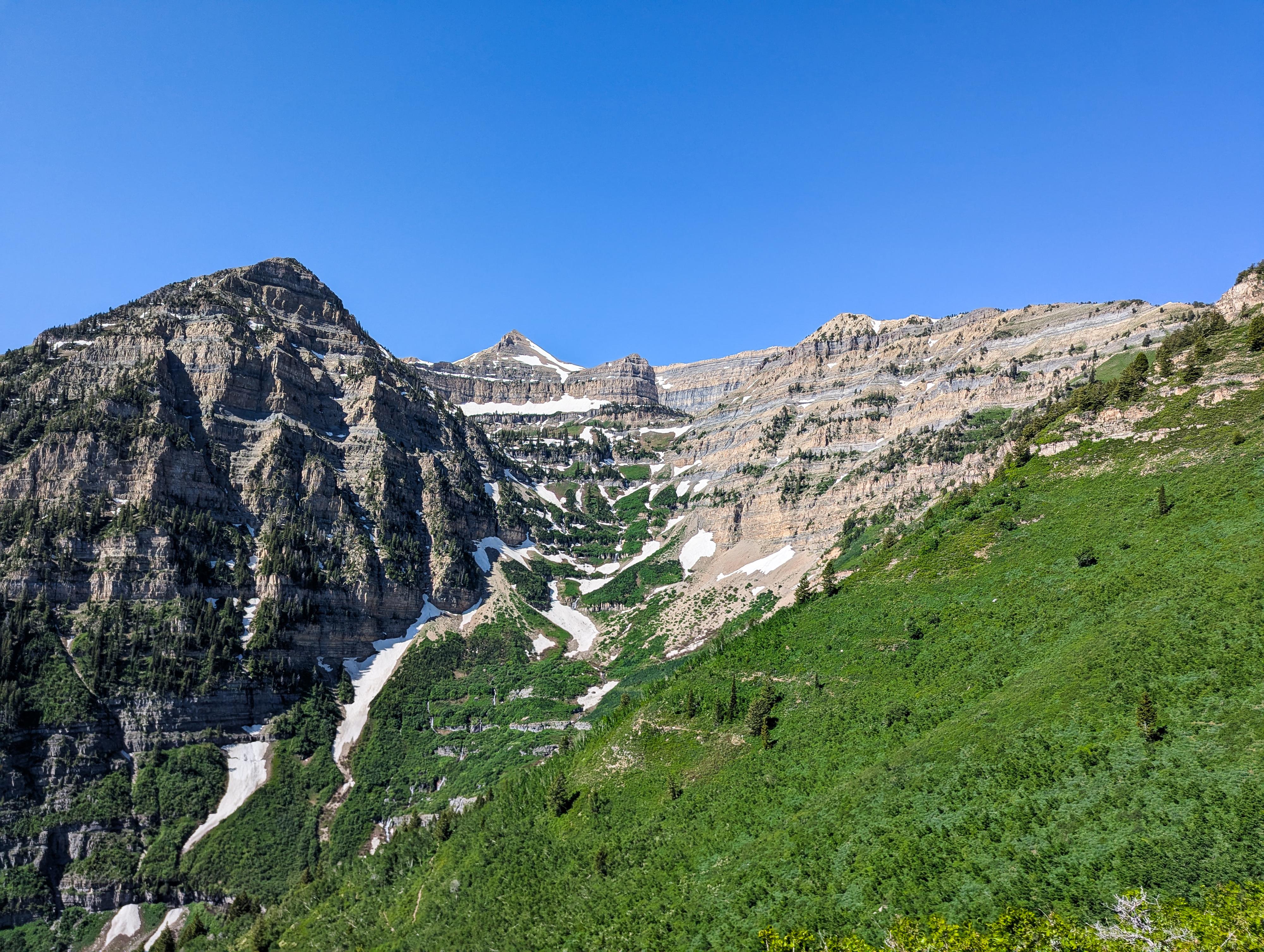
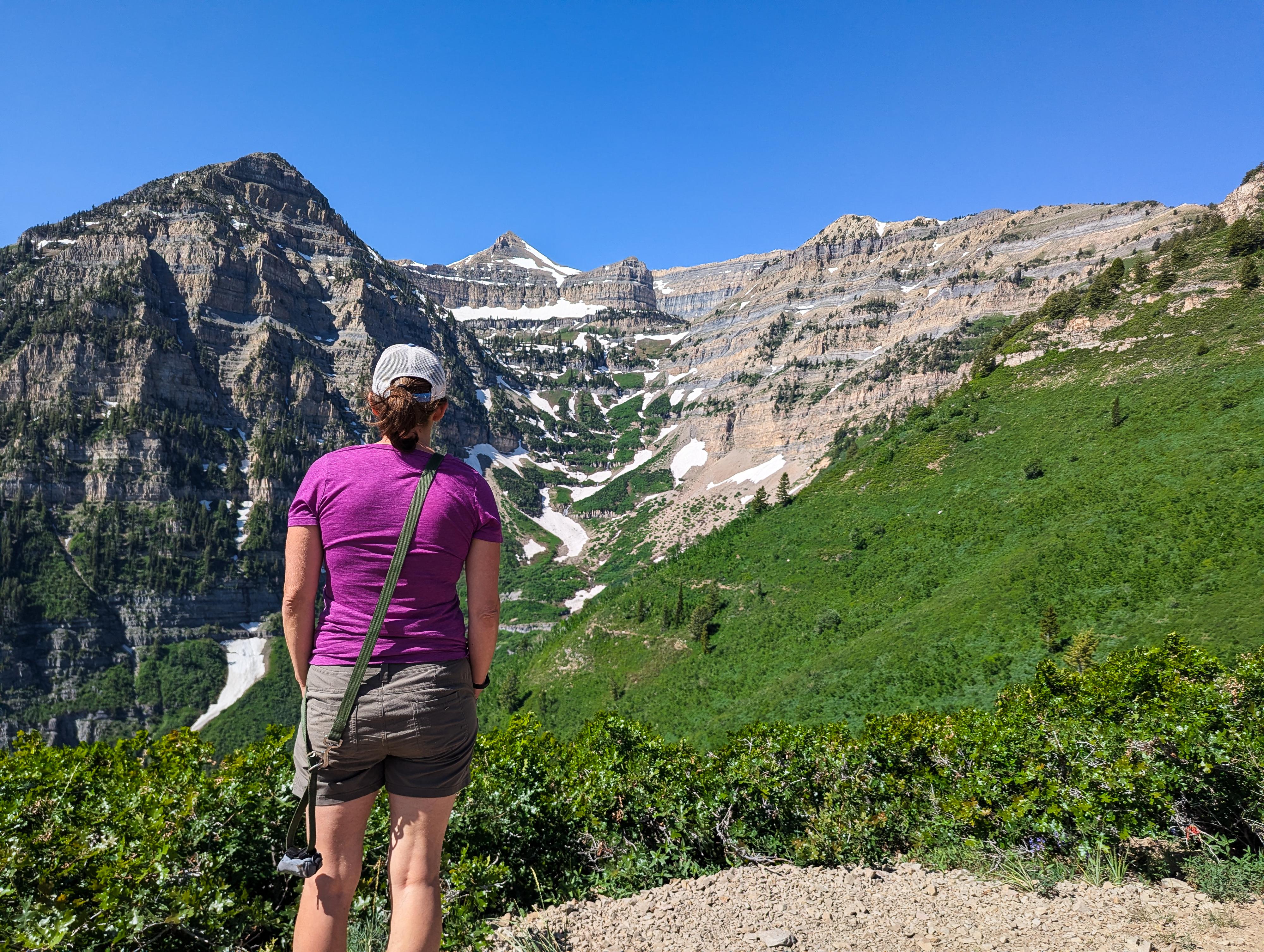
On the west side of Mount Timpanogos, in the shadow of Robert's Horn, lies the Primrose Cirque. This alpine gem has breathtaking scenery and is home to one of two common routes to the summit of Timpanogos. Though hiking up Primrose Cirque is a beautiful hike, this hike, which overlooks the cirque from high above, is even more stunning. It is rare a hike gets an audible WOW from me, but as I turned the corner to the overlook, the scenery elicited an audible WOW!
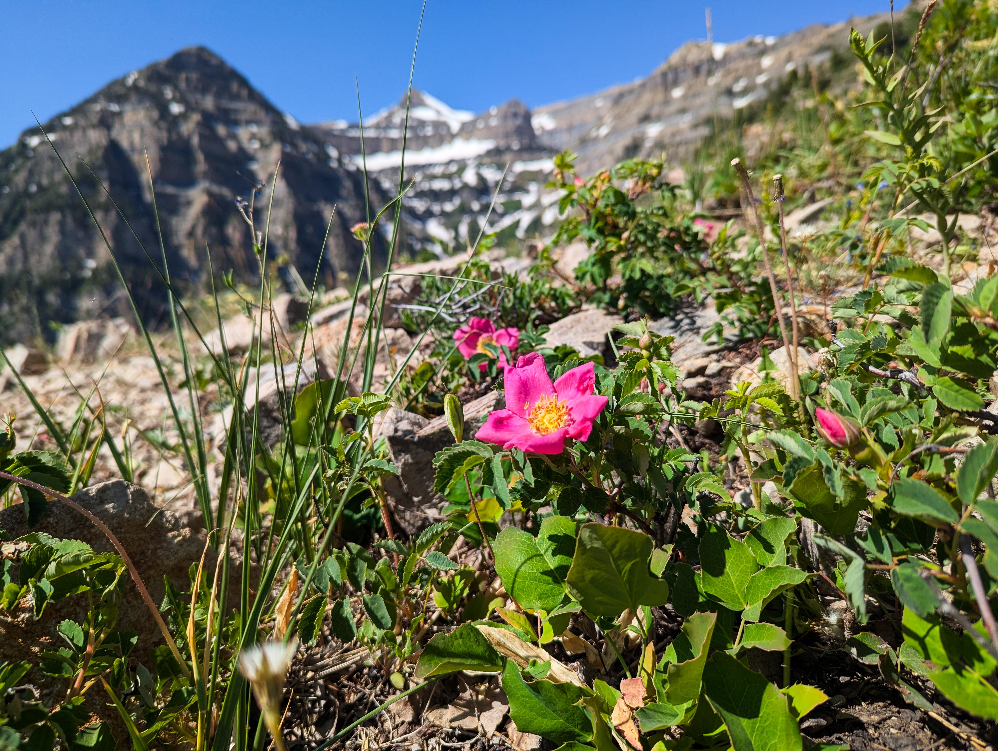
For the time and distance, I think this is one of the most scenic hikes in the Wasatch. On our spring visit, the wildflowers were out in full bloom; in the fall, the changing leaf colors would be astounding if your timing was right. The hike is about 3.6 miles with a bit under 1,000' feet of gain. On our visit, there were many groups with small children. If your family is up to the distance, it is an excellent outing. Even if you don't make it all the way to the overlook, the rest of the hike is quite lovely as well.
Getting There
From Provo, take US-189 up Provo Canyon toward Heber Utah. From the mouth of Provo Canyon, travel up the canyon about 7 miles. After about 7 miles, turn left off of US-189 on the Alpine Loop Road/Sundance Resort.
Follow the Alipe Loop Road for 8.9 miles to the Summit Trailhead on the left. This has trailhed has a small circular parking area and pit toilet.
Route Description
Follow the trail, signed Horse Flat, as it heads southwest. About 0.4 miles from the trailhead is a junction with the Snow Gauging Trail. Stay left here, on the Horse Flat trail.
About 1.25 miles from the trailhead, another major junction is reached. Stay right here as the trail heads south. The trail meanders through the trees until about 1.8 miles when it dramatically reaches the ridge and views of Primrose Cirque. It is a stunning place!
Return the same way.
Photos
Maps

12T 447909E 4475751N
40°25'51"N 111°36'51"W
12T 447621E 4473731N
40°24'45"N 111°37'02"W
12T 447557E 4475457N
40°25'41"N 111°37'06"W
12T 447618E 4474412N
40°25'07"N 111°37'03"W