
 Benson Creek
Brian Head
Overview
Benson Creek is a family friendly hike to a waterfall or a high adventure canyoneering outing. Ok, truth be told, it is a tame short canyoneering adventure as well a family friendly hike.
For hikers, this is a pleasant outing, complete with benches and picnic tables near the falls. Bring the family, bring a lunch, and enjoy the day. The short distance and easy trail make it suitable for most, though floods in recent years have made the trail a bit tougher. My 3 year old made it, but with a little assistace in spots.
For canyoneers, the approach is relatively short and soon leads to an excellent but short slot canyon section and four rappels. The shortness of the approach and easiness of the technical section make this suitable for most canyoneers.
Getting There
The trailhead is on the road to Brian Head Ski Resort from Parowan, UT. To get there, take exit 78 from I-15 and head east into the town of Parowan. Follow Main Street from the highway about 1.2 miles to Center Street and turn left on Center Street.
After 0.3 miles, Center Street curves right and becomes Canyon Road. Follow this 5.5 miles to a large parking area on the left that is signed Parowan Canyon Wildlife Management Area. This is the trailhead, and mile post 8.6 on SR-143.
Route Description
From the parking lot, follow the wide and well-used trail. It goes back down the canyon for a few minutes, nears the road, then crosses the stream on a footbridge. A small social path goes off on the left just after the bridge, stay right on the main trail.
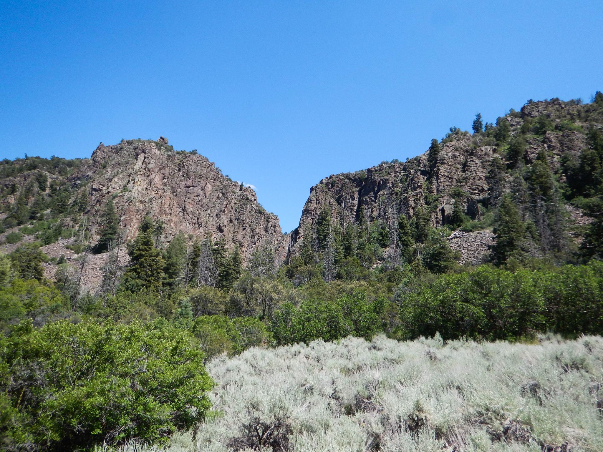
A few minutes past the first bridge is a trail junction. Again, stay left on the most used trail. A few minutes after this second junction is a third, at the edge of a sage brush clearing. This is where the hiking and canyoneering routes diverge.
Hikers (20-30 minutes total from trailhead):
Stay left. A few picnics tables and benches appear before the trail enters the stream bottom. Follow the trail a few minutes up to the 10 m ( 33 ft. ) falls. This section washed out a couple of years ago and the trail is re-emerging. Follow the most used path. Return the same way.
Canyoneers (1-1.5 hours total approach time / 2 miles total approach):
Go right. Stay on the most used social trail. There are many animal trails that can make this a bit confusing. With a close eye, the main trail should be easy to follow. The trail climbs, then bends east as it climbs more steeply. It soon flattens out, contours around, and drops steeply into the bottom of Benson Creek.
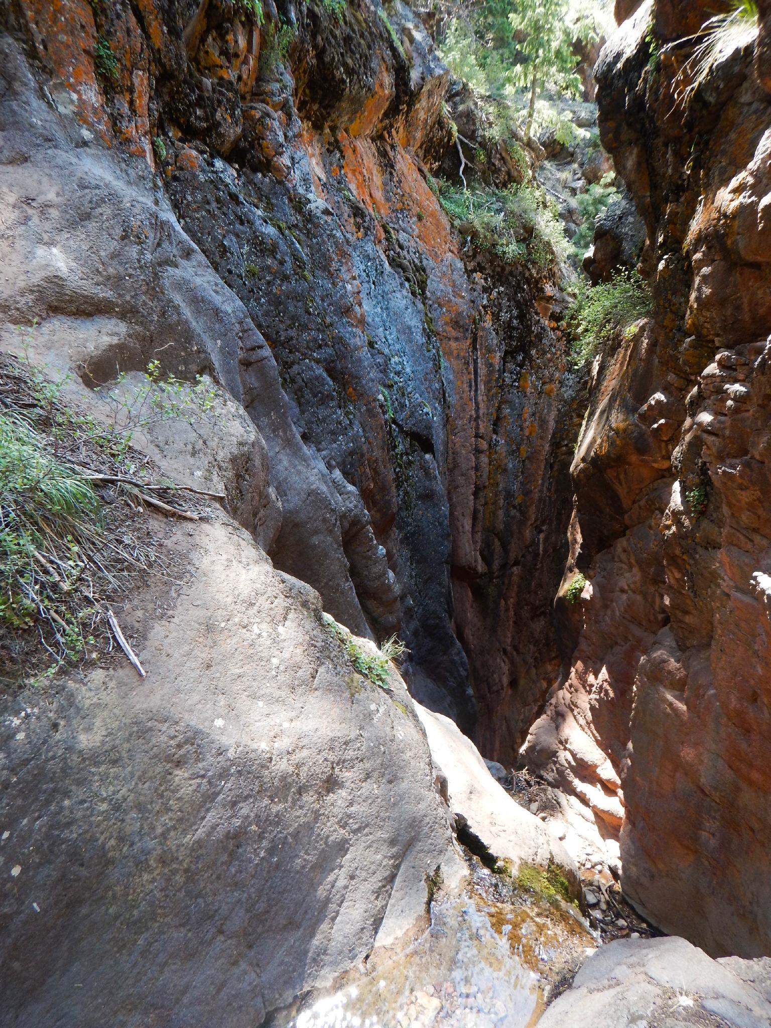
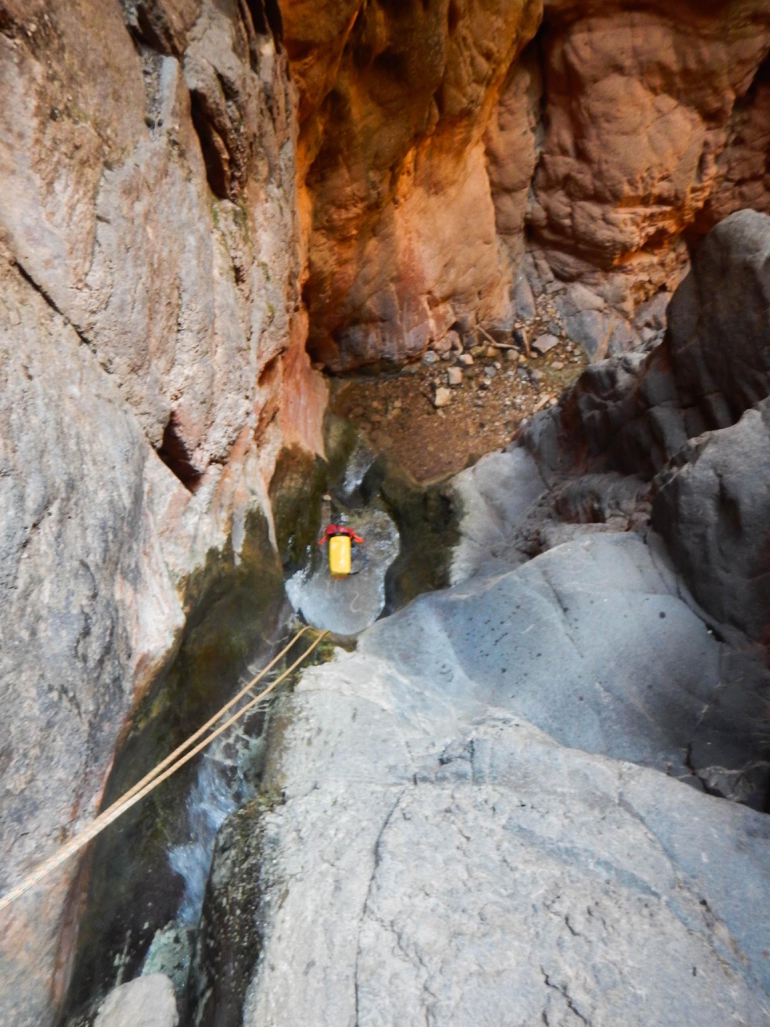
Once in the canyon bottom, it is an easy stroll to the slot and first rappel.
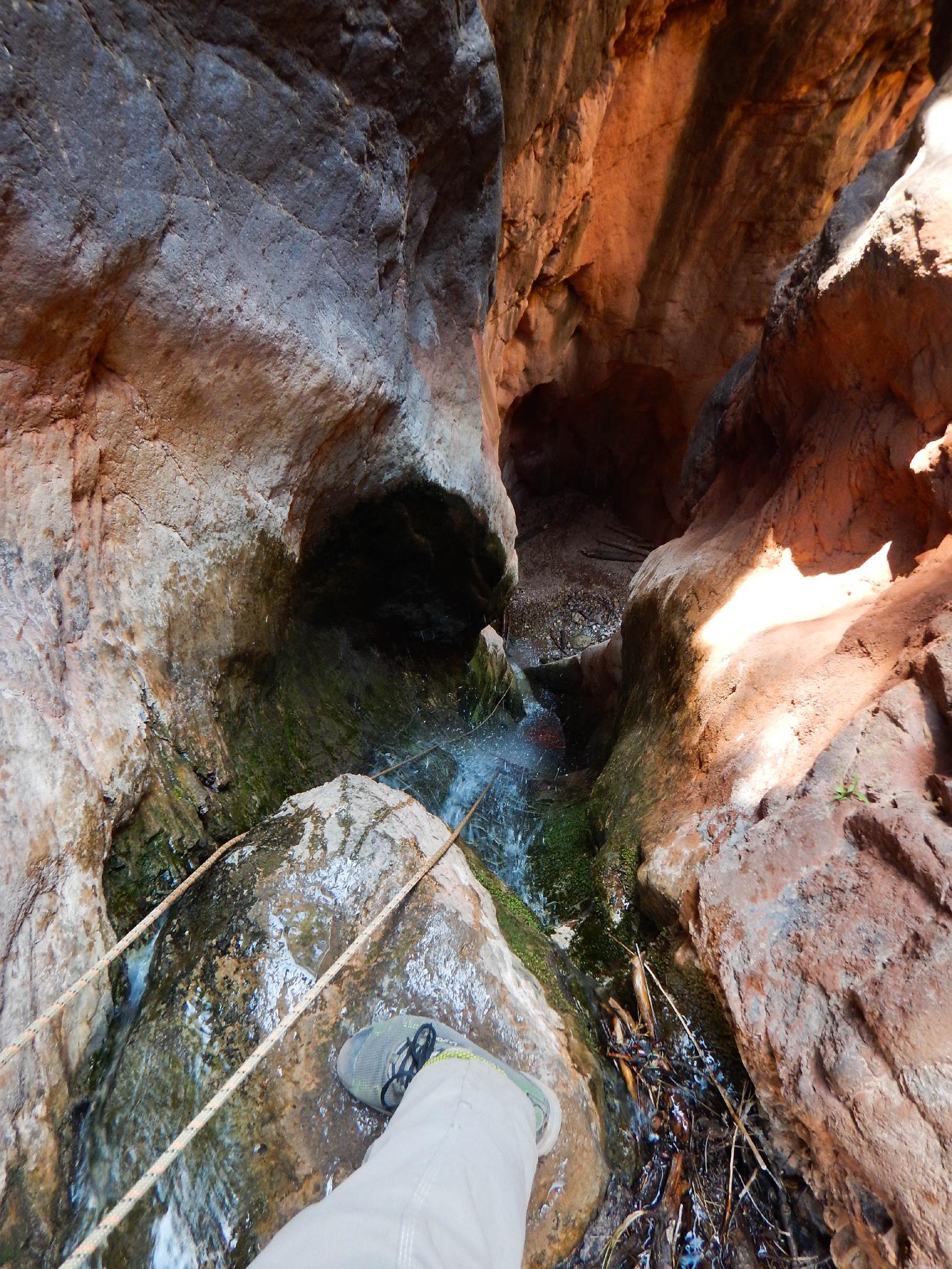
Canyon (30+ minutes)
R1 32 m ( 105 ft. ) - Off a tree on the left. A 60 m rope will not work doubled here. Make sure you have enough rope for a 32 m rappel! The rappel drops 4 m to a ledge, then continues down.
R2 13 m ( 43 ft. ) - Right after rappel 1 is a bolted anchor on the right for a two stage 13 m ( 43 ft. ) rappel. Stunning section.
R3 16 m ( 53 ft. ) - The canyon is easy walking for a few minutes to where it slots up again at rappel 3. The drop is about 12 m ( 40 ft. ), but the anchor is 4 m ( 14 ft. ) back from the edge.
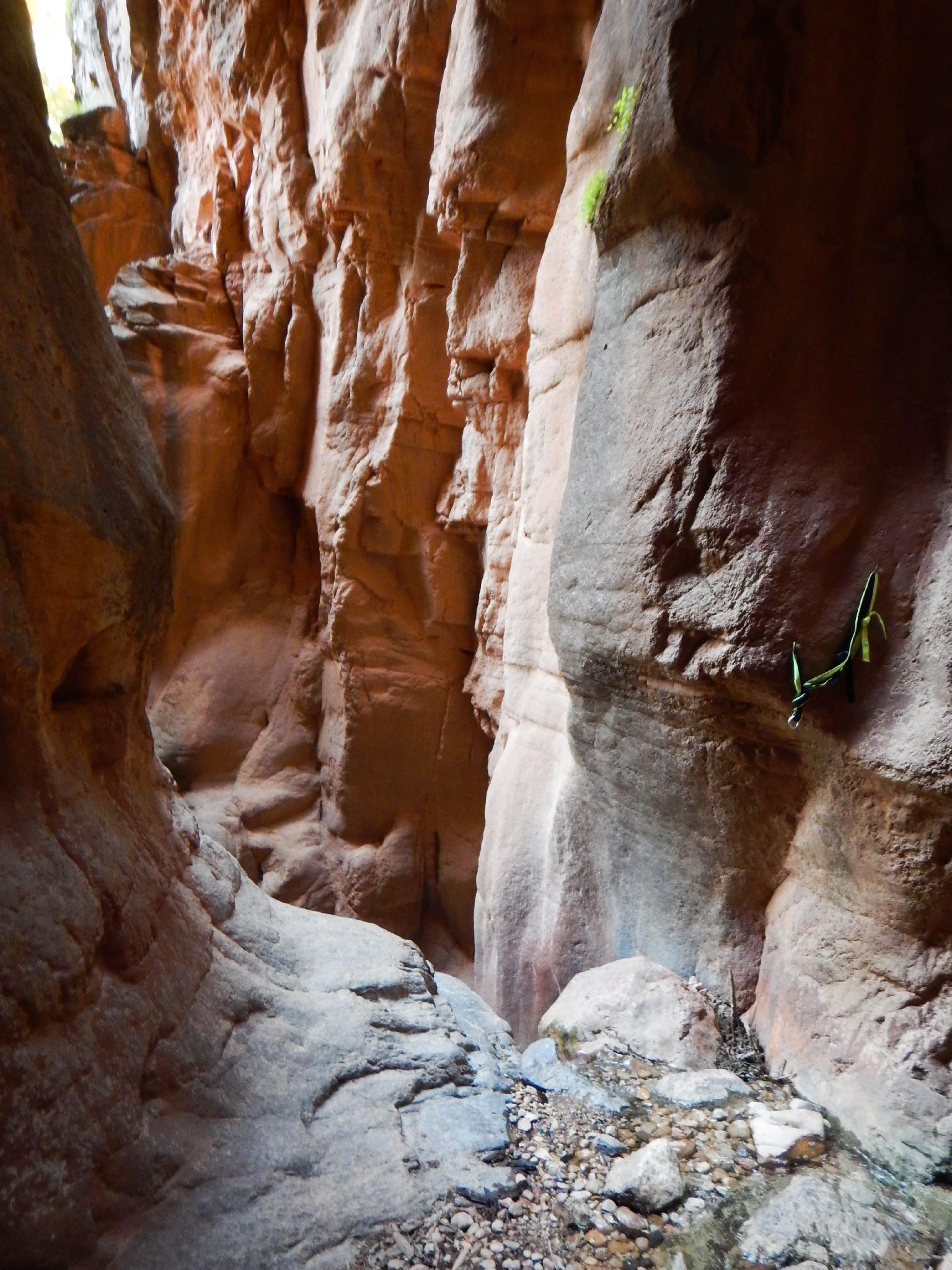
R4 13 m ( 43 ft. ) - The final rappel is shortly down canyon from rappel 3. This is the waterfall that is reached by hikers. Rappelling off the tree on the left is highly recommended as it puts you near the flow of the waterfall. There is another anchor on the right wall that avoids the waterfall altogether but doesn't seem like much fun.
A couple of fixed pieces (piton and bolt) on the left side of the waterfall make me wonder if this is occasionally climbed.
From the bottom of the waterfall, follow the trail a few minutes down to the junction, then back to the trailhead.
Photos
Videos
Benson Creek Canyoneering Aug 2024

Benson Creek
Benson Creek June 2025
Maps

12S 337910E 4182134N
37°46'20"N 112°50'26"W
12S 338082E 4182422N
37°46'29"N 112°50'19"W
12S 338117E 4182446N
37°46'30"N 112°50'17"W
12S 338169E 4182429N
37°46'30"N 112°50'15"W
12S 338347E 4182203N
37°46'22"N 112°50'08"W
12S 338736E 4181968N
37°46'15"N 112°49'52"W
12S 338574E 4182099N
37°46'19"N 112°49'58"W