
 Floating
Sand Island to Mexican Hat
Floating
Sand Island to Mexican Hat
San Juan River
Overview


San Juan River was one of my most sought after trips that took me a long time to actually do! The section described here, from Sand Island to Mexican Hat, is a 27-mile float through both geological wonder and Native American rock art and ruins that are absolutely stunning to behold. This is one of the finest floats in Utah and very family friendly.
Permit: The trip requires a permit. The permit system is a lottery that is drawn months in advance. For details on the lottery, or to enter, see the Recreation.gov site. I am never good at planning that far ahead, so have never entered the lottery.
When: This section is generally float-able year round. Spring and fall would be my preferred seasons for more moderate temperatures. Summer will be hot, but you have the river to cool off in.
Bugs can be a problem at the put-in during spring through fall, but typically don't seem to be a problem below the put-in. I would still bring bug spray just in case.
Trip Length: Some people float this section in one day, others take 4+ days. I believe there is a lot to see, so would recommend at least 3 days. We took 4 and didn't get all the side hikes in I had hoped to.
Water: The BLM recommends bringing all the water you will need for the trip. The San Juan is both silty, and possibly contaminated from mining in the area. Be sure, especially in hotter times of the year, to bring plenty. We brought a gallon per person per day, and it was more than enough for a cool spring trip, but in the heat of summer, I probably would have brought more.
Flows: The BLM recommends 500 CFS, though I saw a few reports of people who had floated it as low as 350 CFS. Our trip was between 500 and 600 CFS in a moderately loaded 16' cataraft. I would, personally, likely not want to go below 500 CFS in that size raft. Higher flows will be a faster float, at 500-600CFS, we averaged about 2.5 MPH with little rowing.
Some canoe this section, but if canoeing, remember it is class II. I, with a fair bit of class I and some class II canoe experience, was glad we had not tried to do it in a canoe. This is not a section I would recommend for those without at least a little Class II canoe experience first. Duckies would work great and be a lot of fun.
On the other end of the spectrum, reports as high as 7,000+ CFS seem to indicate it can be fast and pushy in very high water, but still do-able. For beginning rafters, I would probably recommend 2,000 or less CFS.
Shuttle Logistics: The float requires a shuttle from Mexican Hat to Sand Island. The route is paved and about 22 miles, all but a short dirt section to the Mexican Hat Ramp on pavement.
If you want help with the shuttle, Wild Expeditions in Bluff does them, as does Val's in Mexican Hat.
We got a permit for our trip and felt it was very worthwhile. There are many great campsites and side hikes on the Navajo side of the river.
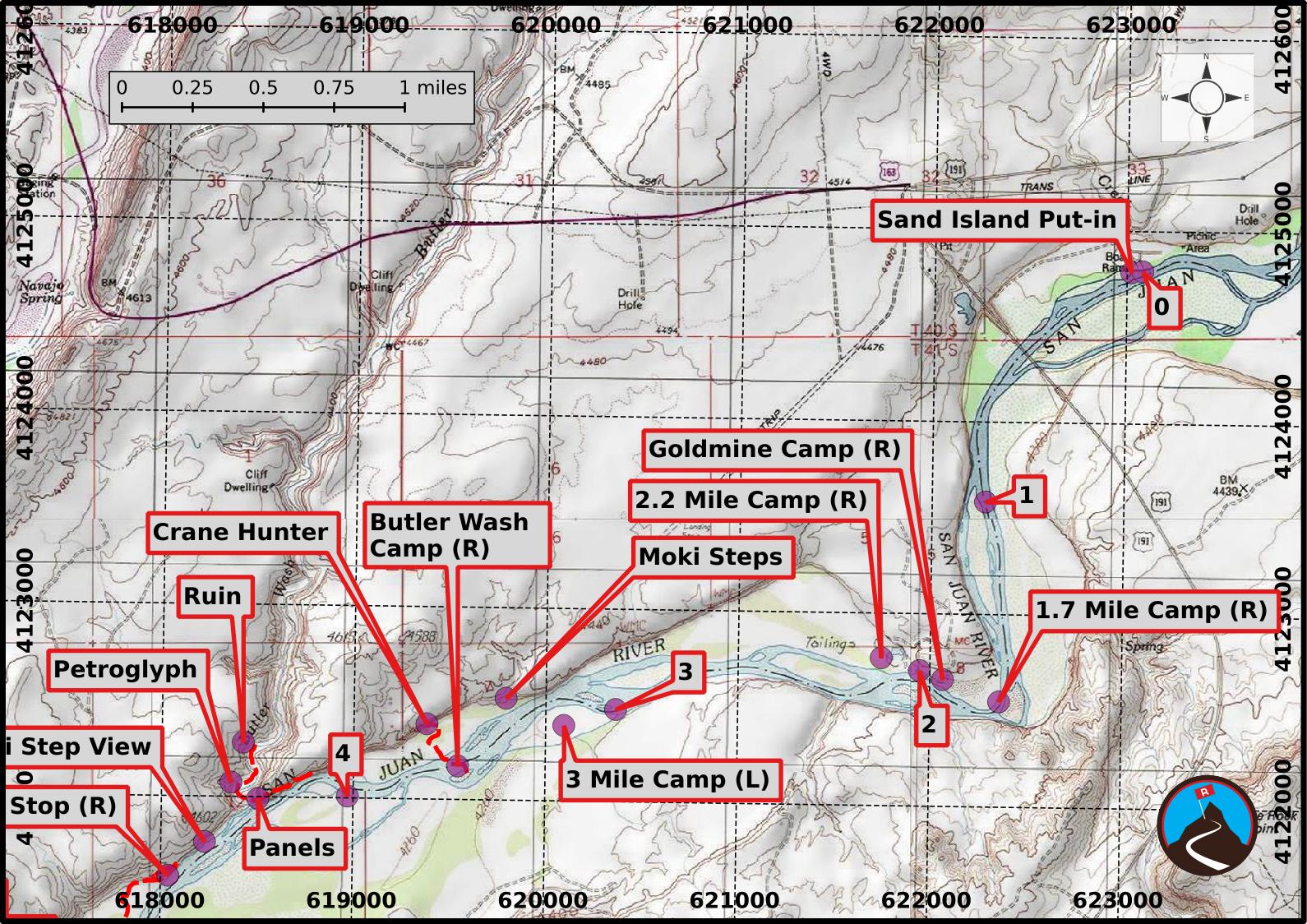
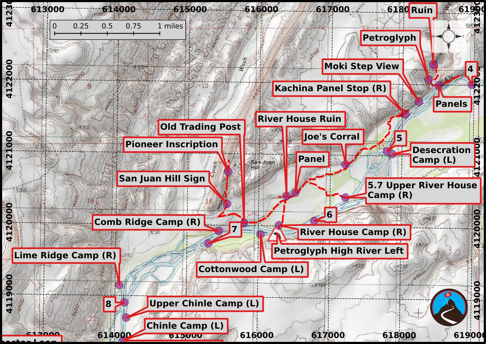
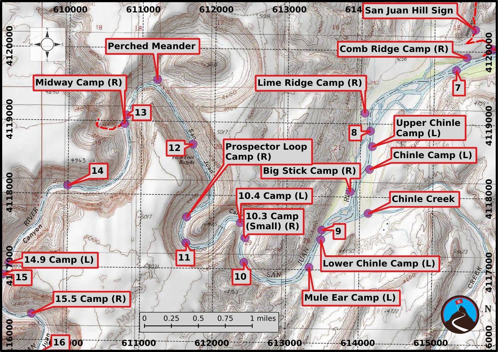
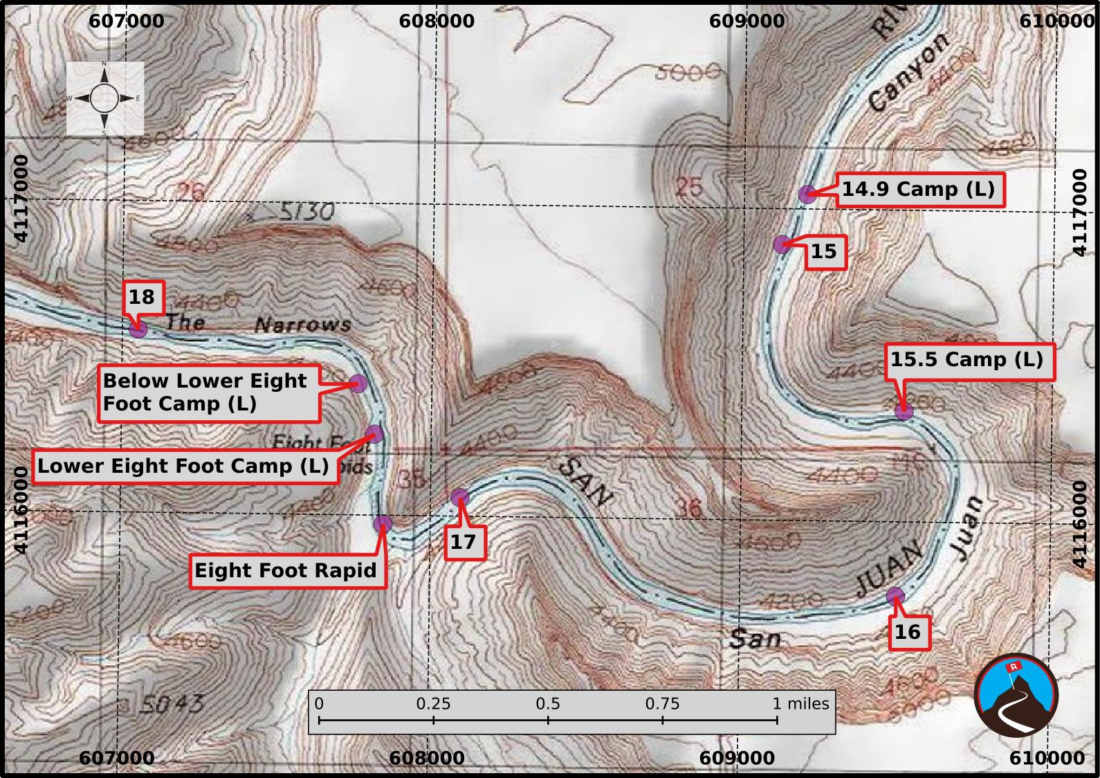
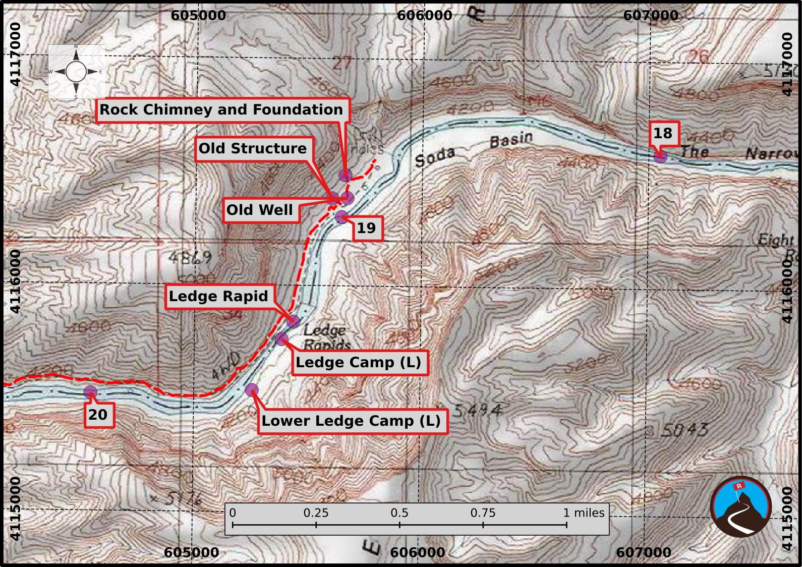
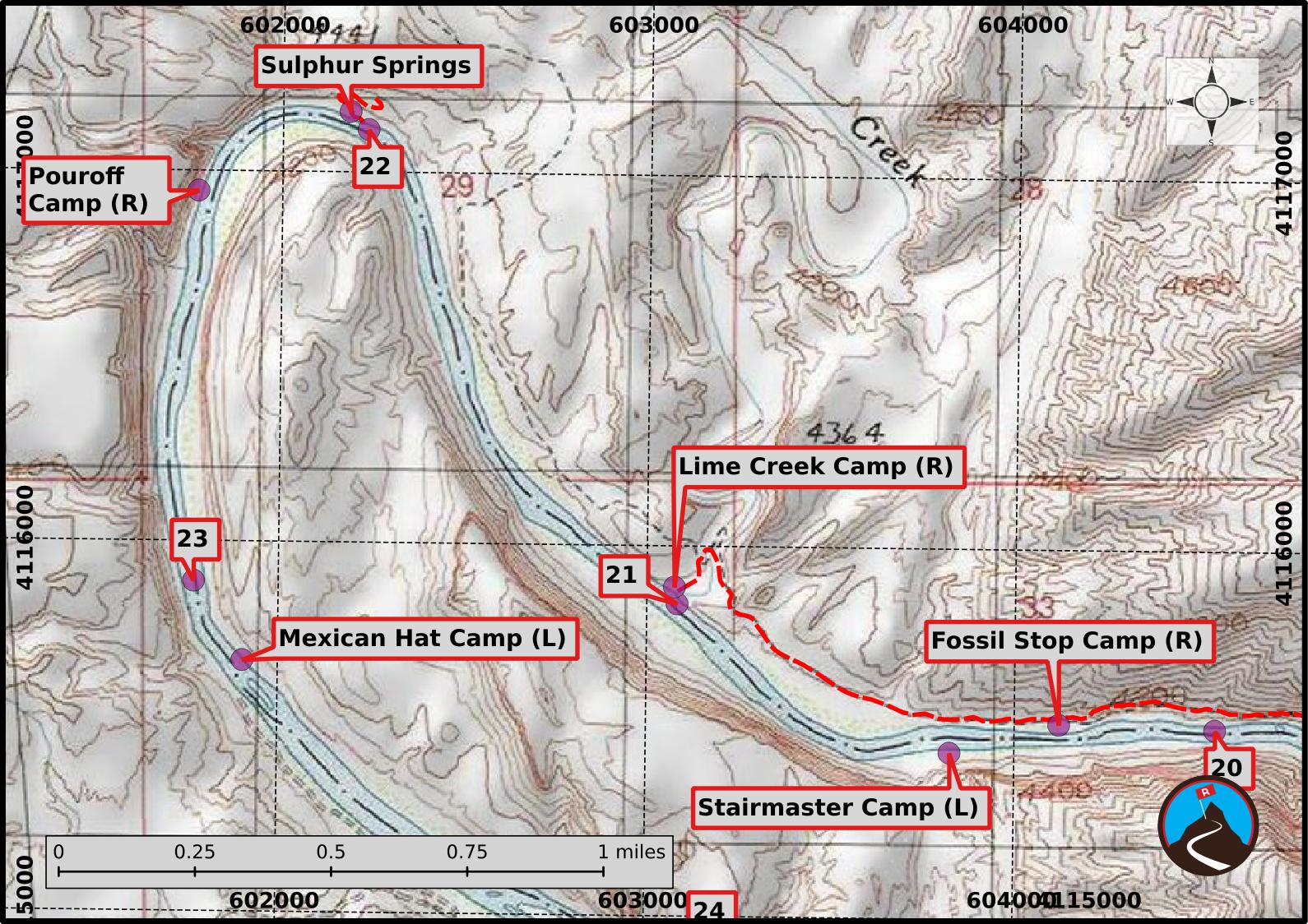
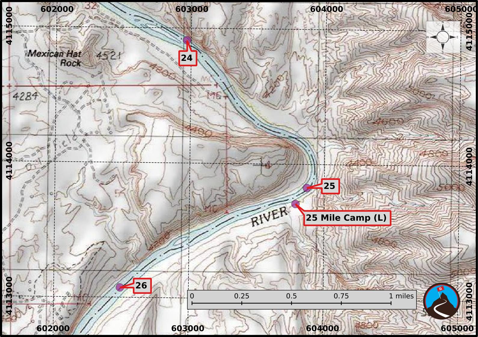
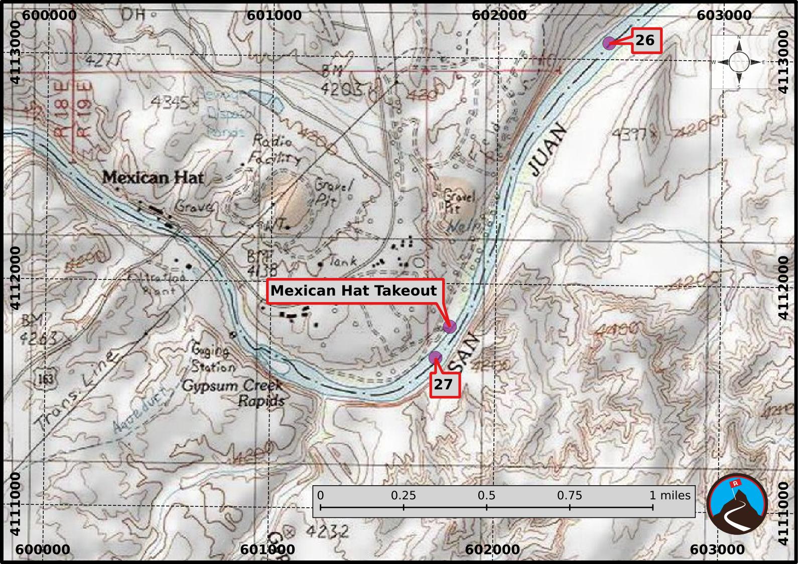
River Miles and Camping: The map shows river miles, with the put-in, Sand Island boat ramp, being mile 0. Keep an eye on the map to make sure you don't miss any of the excellent side hikes, rock art, or ruins.
Camp sites shown on the map are the larger, more common sites. The ones shown on the map should all be able to hold medium groups. You can, however, camp outside these sites, anywhere that strikes your fancy. Smaller groups will have no shortage of small sites they can find that will be delightful.
We camped the first night at Upper River House Ruin, the second night at Midway, and the third at Fossil Stop, which seemed like a good mix of rafting and having time to explore along the way.
Getting There
Put-In
The put-in is at Sand Island Campground and boat ramp. This is about 4 miles west of Bluff on US-191 heading towards Mexican Hat.
Take-out
From Sand Island, continue heading west on US-191. It soon reaches a junction. Stay straight toward Mexican Hat. The road is now US-163. Just as you reach Mexican Hat, the boat ramp is down a dirt road on the left (south) side of the road. This is at mile marker 21.55, and just before the large gas station on the right. Follow the dirt road down to the river.
Route Description
Rock art and historic sites are fragile, non-renewable cultural resources that, once damaged, can never be replaced. To ensure they are protected, please:
- Avoid Touching the Petroglyphs: Look and observe, BUT DO NOT TOUCH!
- Stay on the Trails: Stay on the most used trails when visiting sites, and don't create new trails or trample vegetation.
- Photography and Sketching is Allowed: Do not introduce any foreign substance to enhance the carved and pecked images for photographic or drawing purposes. Altering, defacing, or damaging the petroglyphs is against the law -- even if the damage is unintentional.
- Pets: Keep pets on a leash and clean up after them.
- Artifacts: If you happen to come across sherds (broken pottery) or lithics (flakes of stone tools), leave them where you see them. Once they are moved or removed, a piece of the past is forever lost.
The description below mentions the sites that, we thought, were particularly noteworthy. Keep an eye on the map, especially the first 6-7 miles, there is a lot there to stop and see.
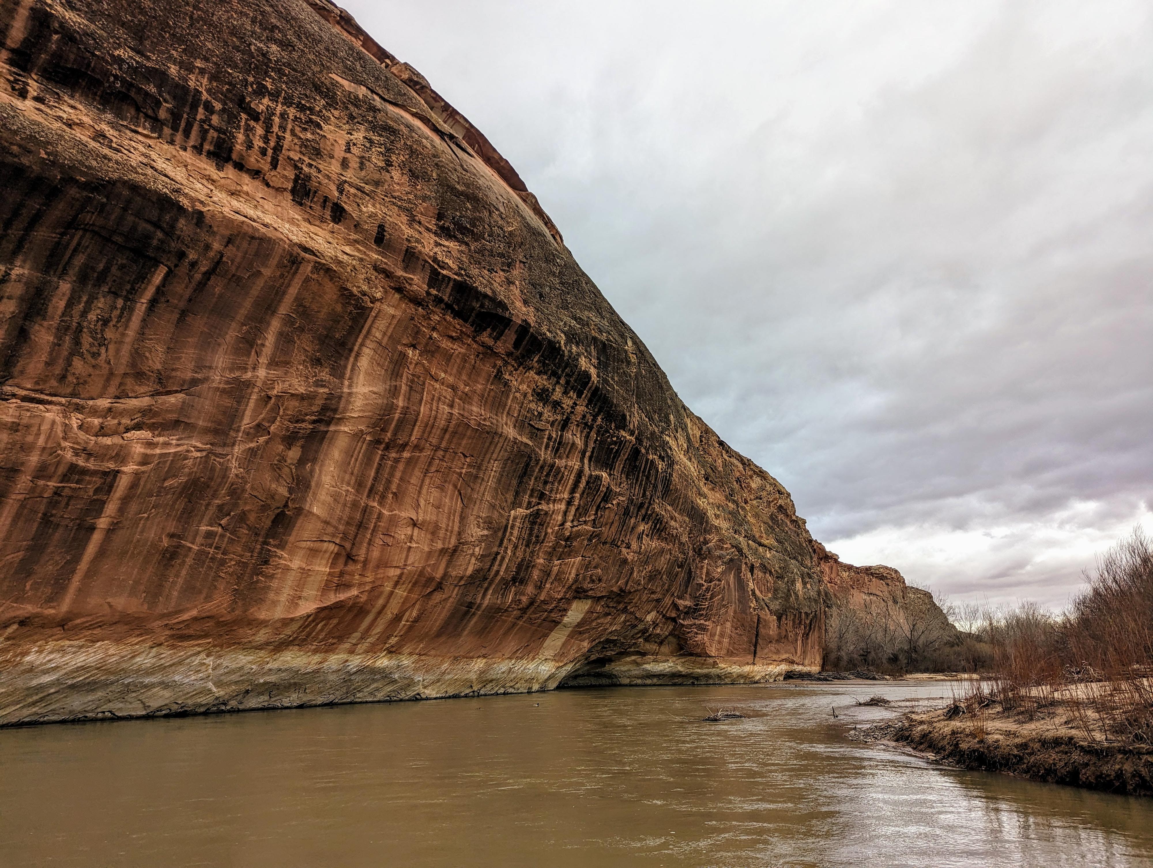
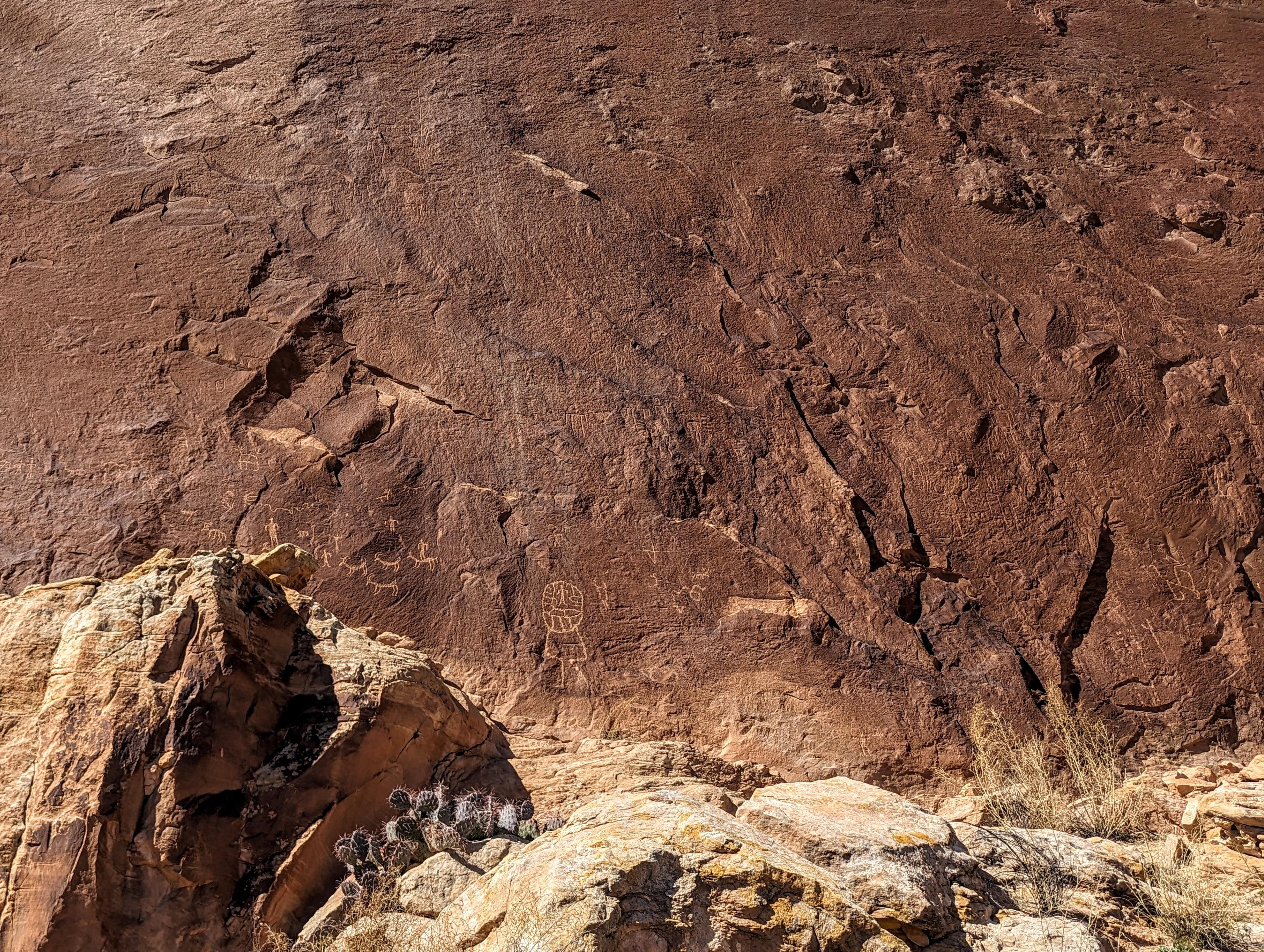
Tiger striped wall near mile 1.7
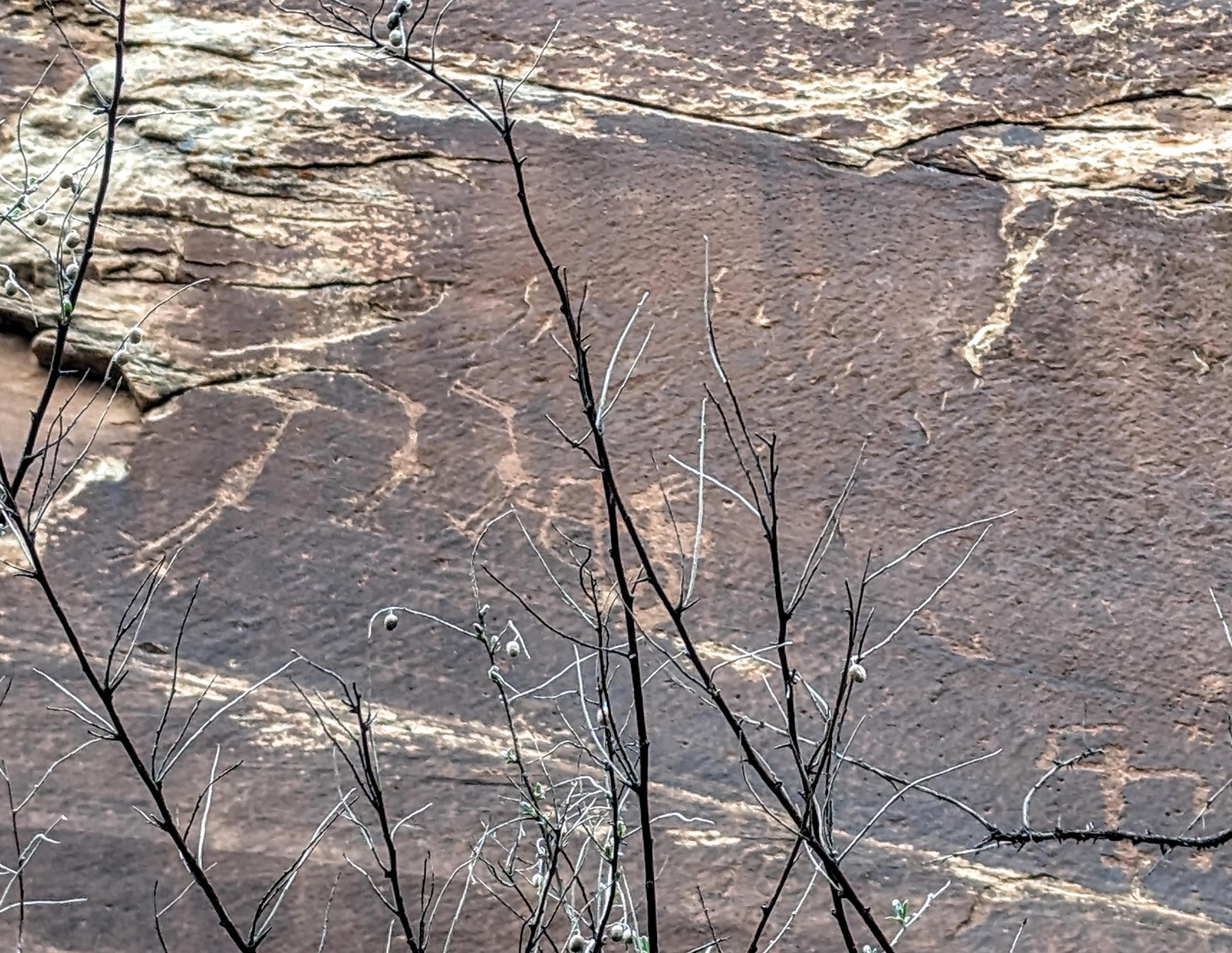
Crane Panel near Butler Camp
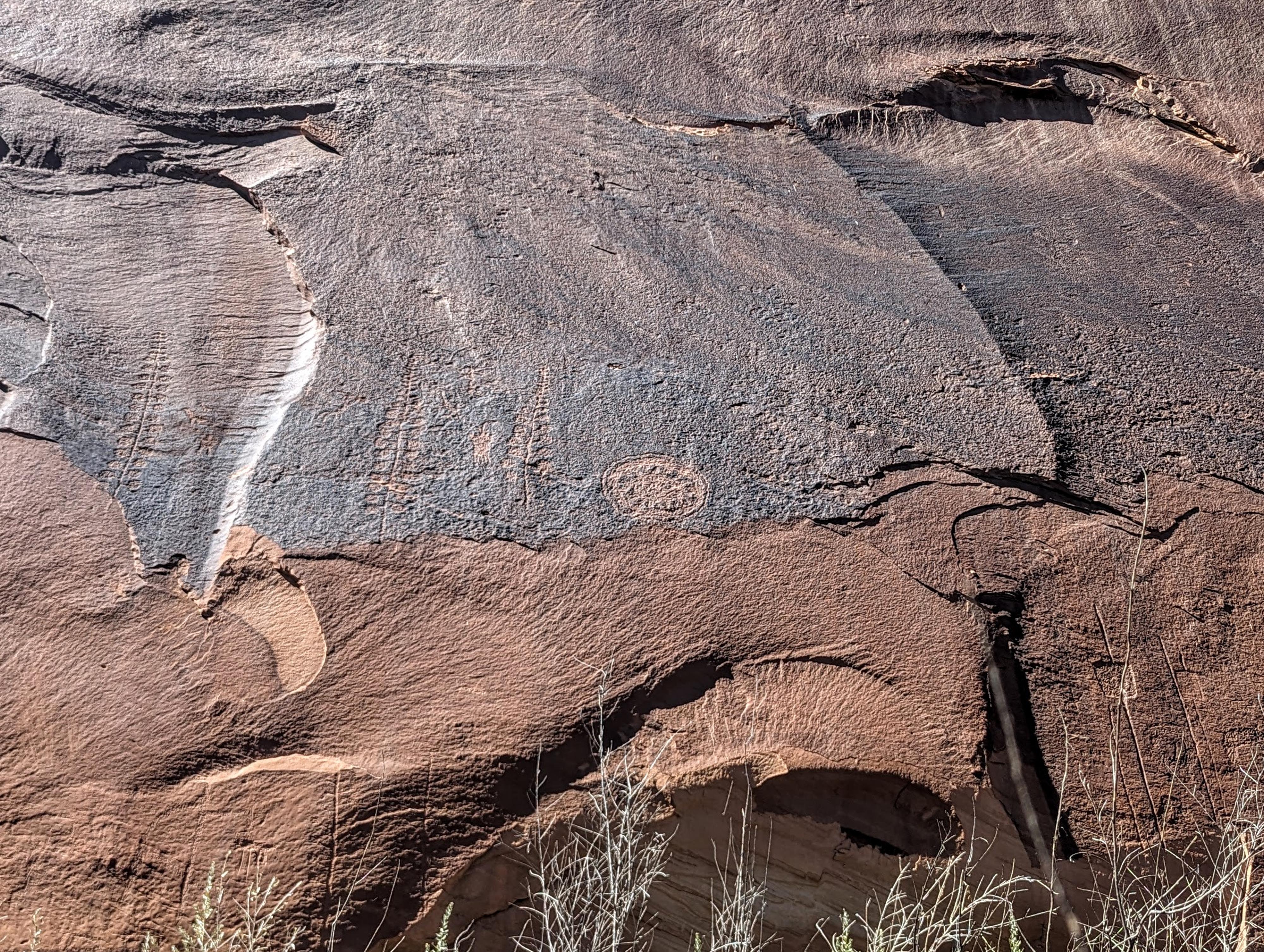
Part of the panel near Butler Wash
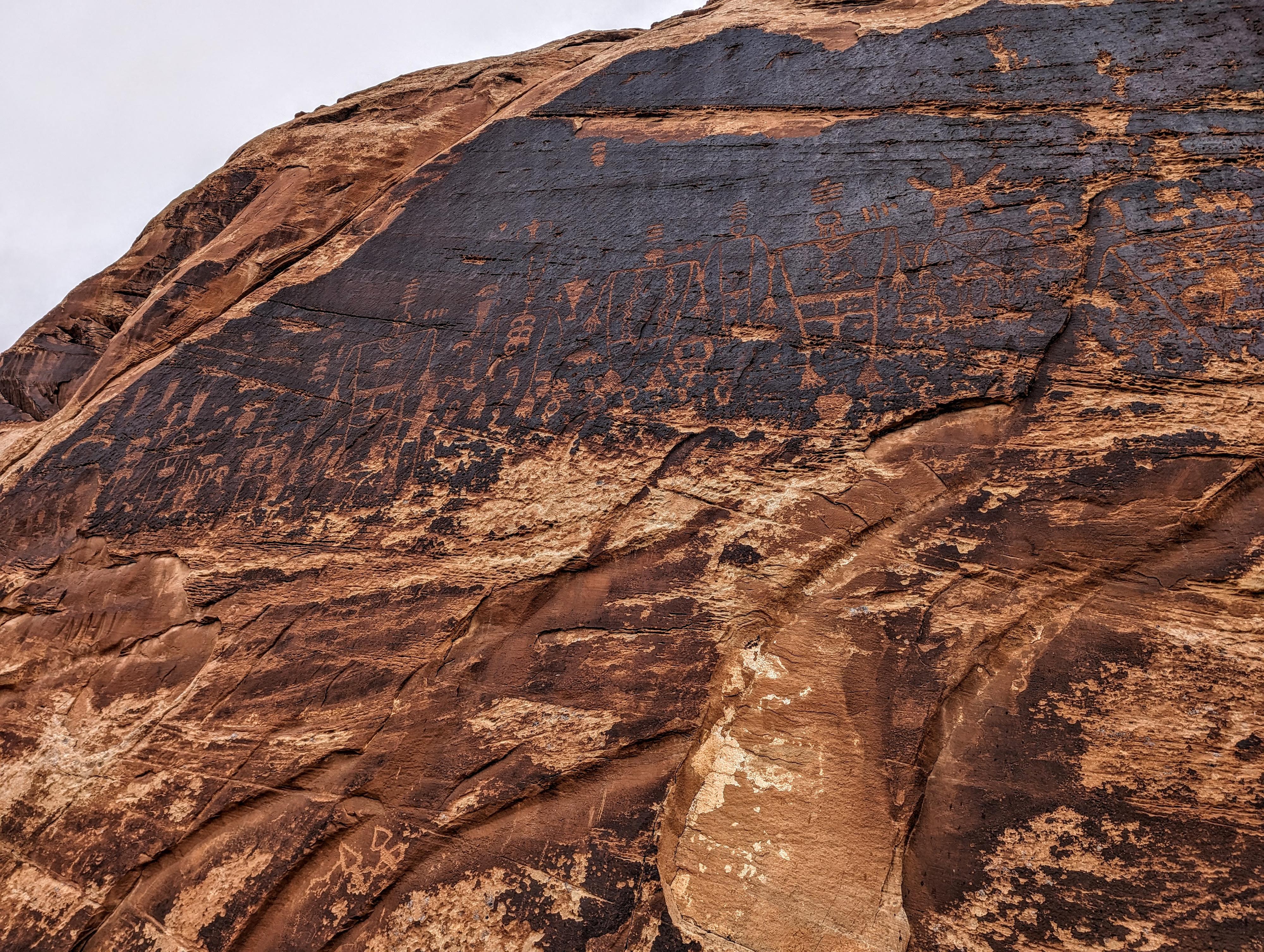
Another part of the Butler Wash Panel
Part of the Kachina Panel
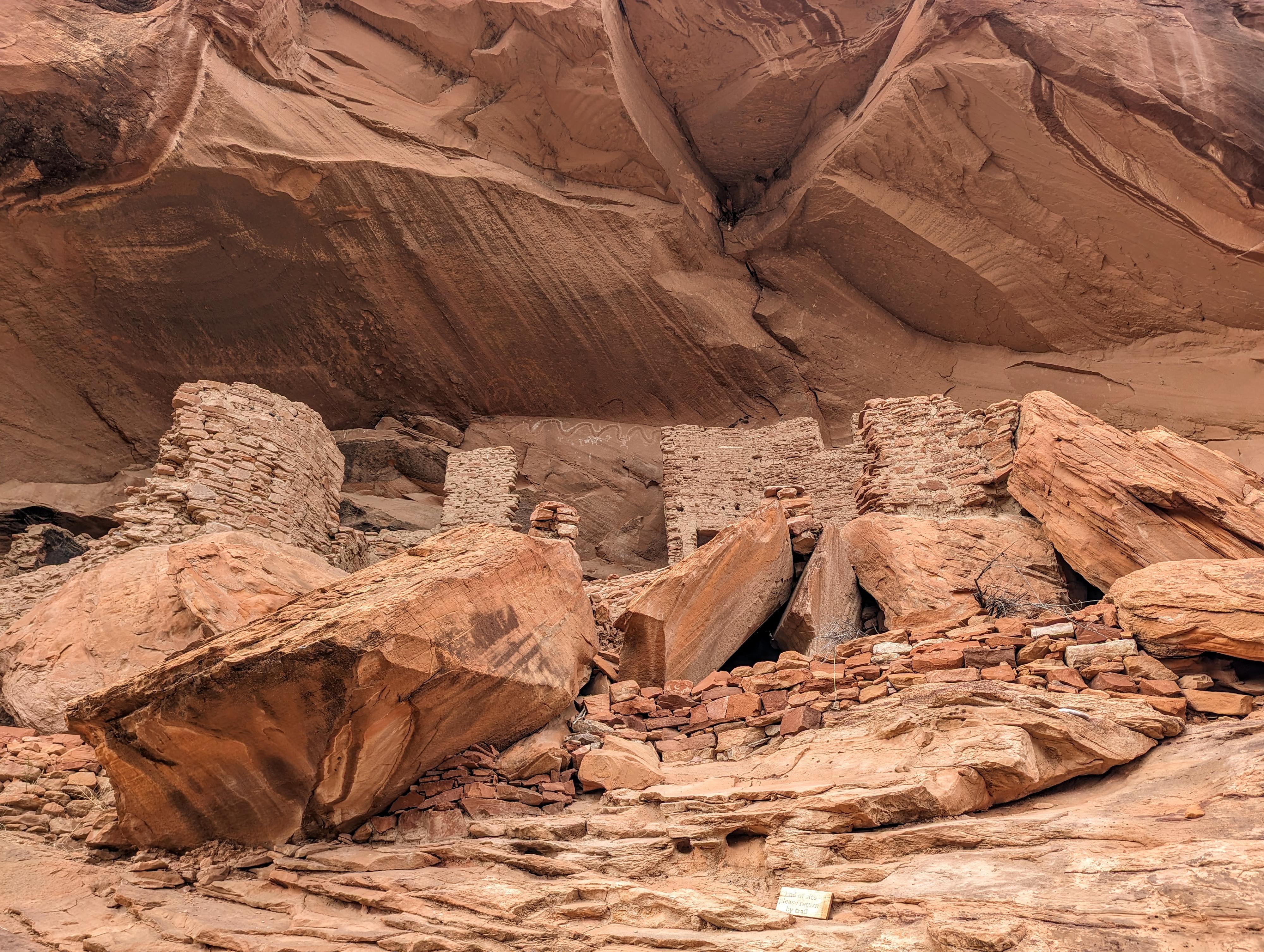
River House Ruin
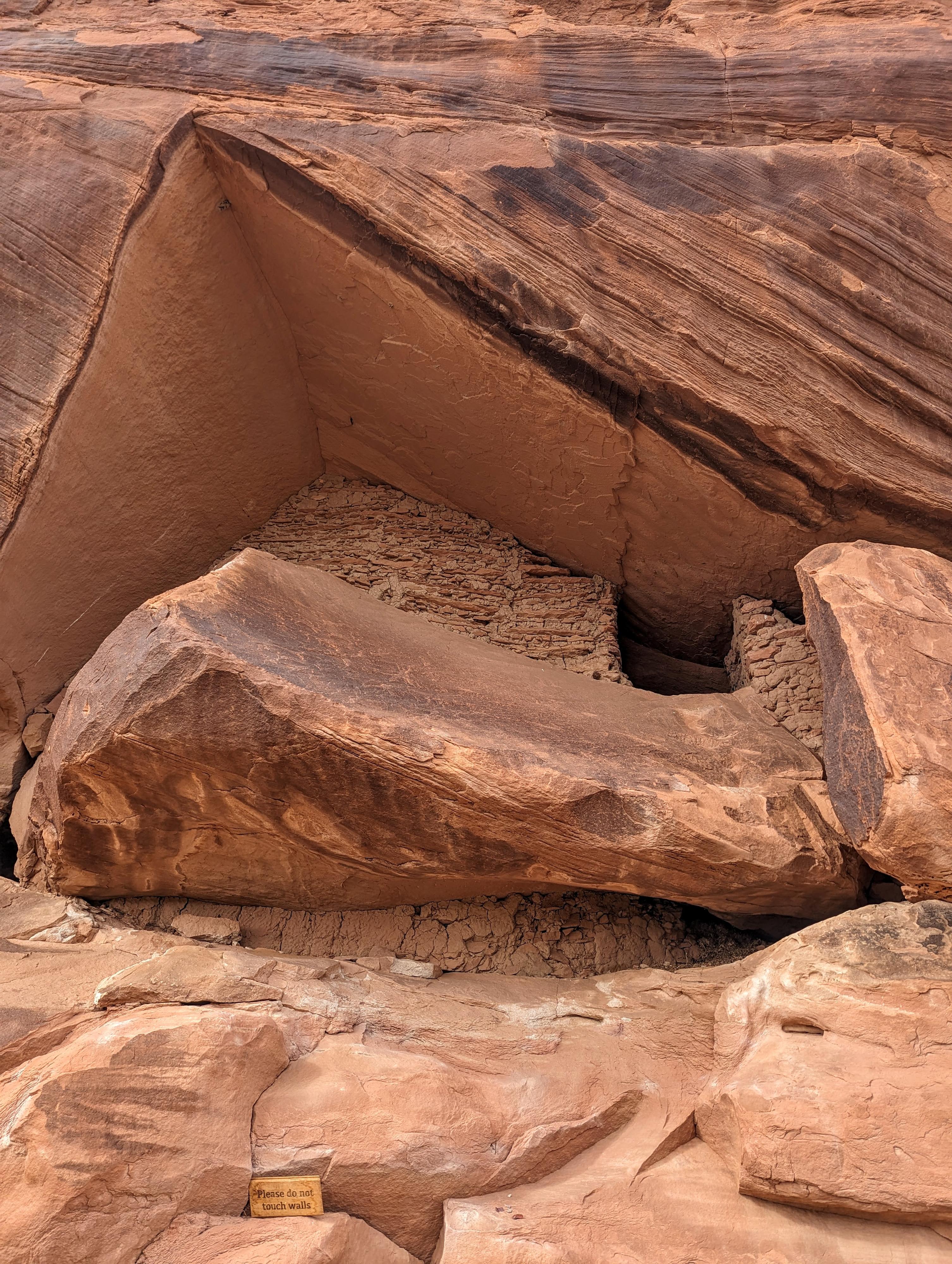
A beautiful ruin just west of River House. I love the lines and way it fits in.
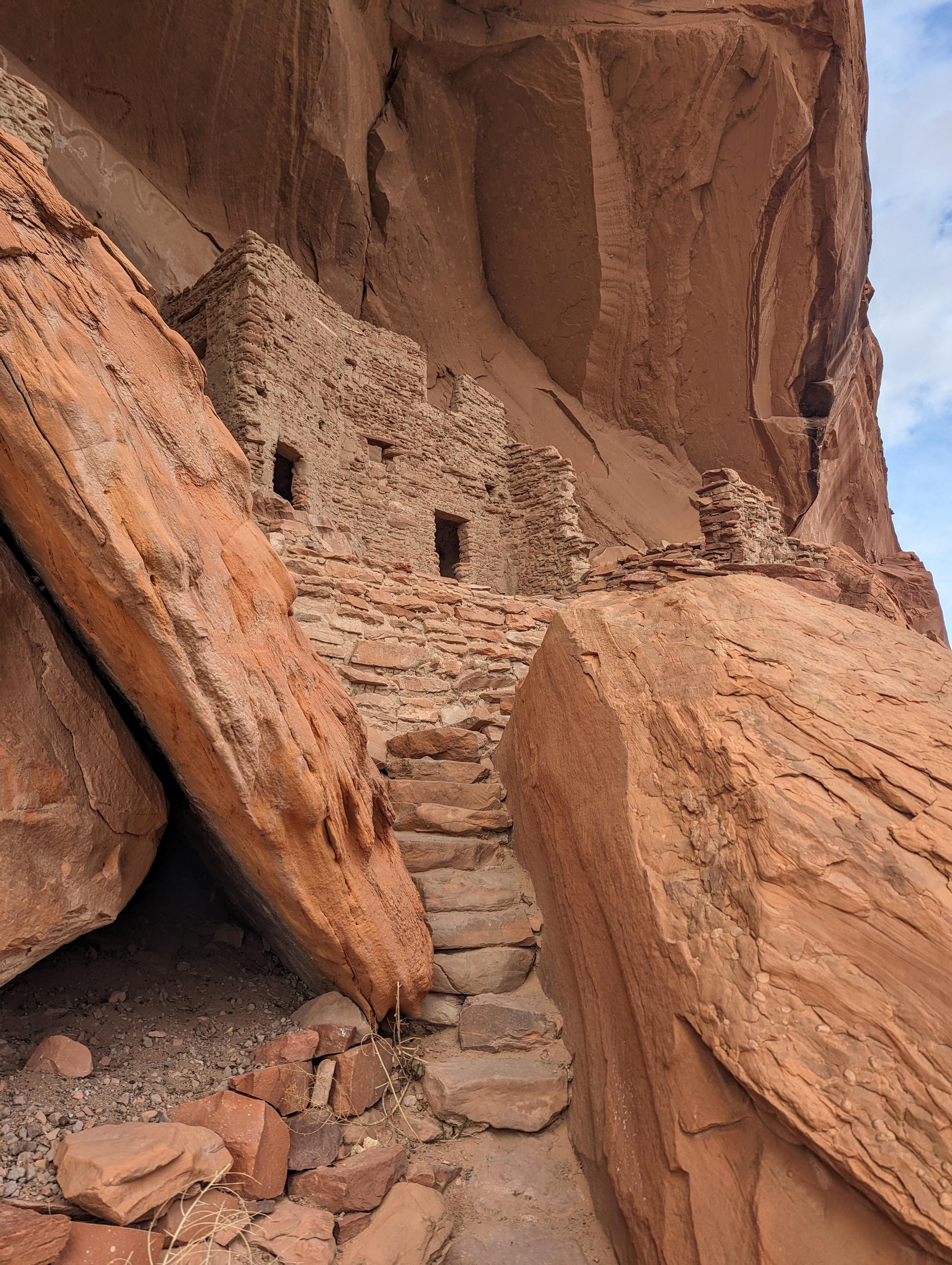
The staircase heading up to River House Ruin
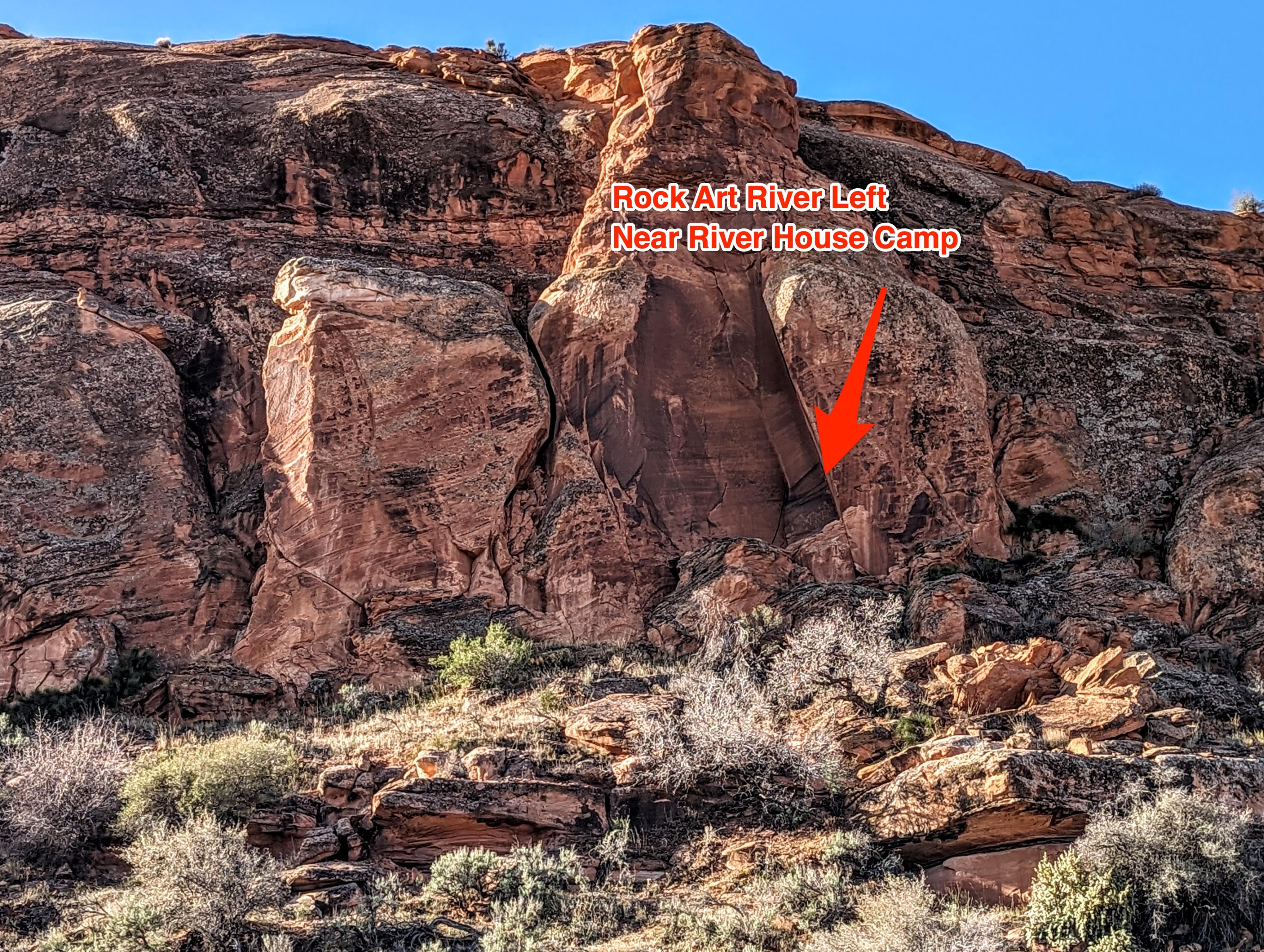
Rock art river left near River House Camp
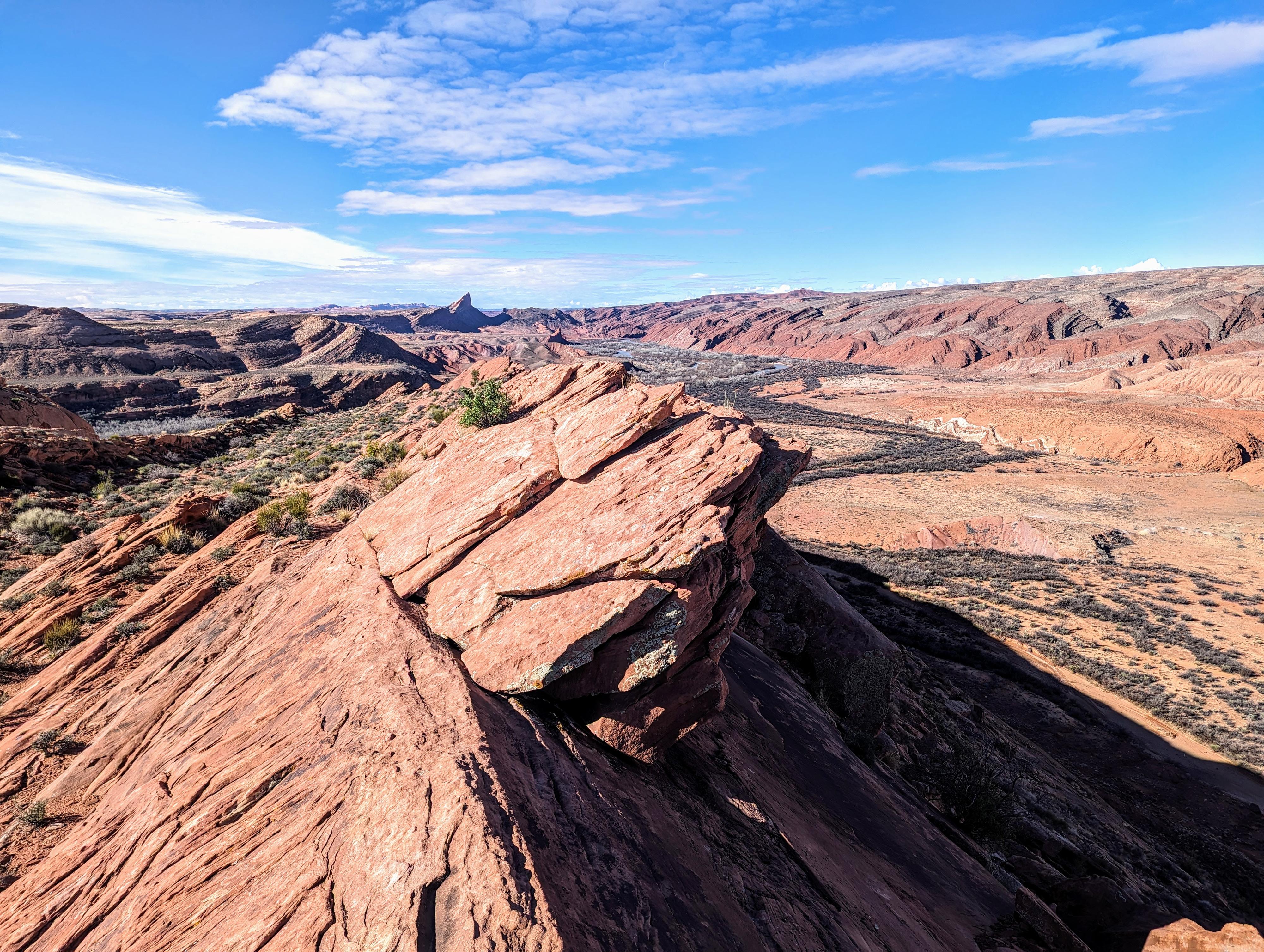
View from up on the old wagon trail up Comb Ridge. Mule Ear visible in the distance.
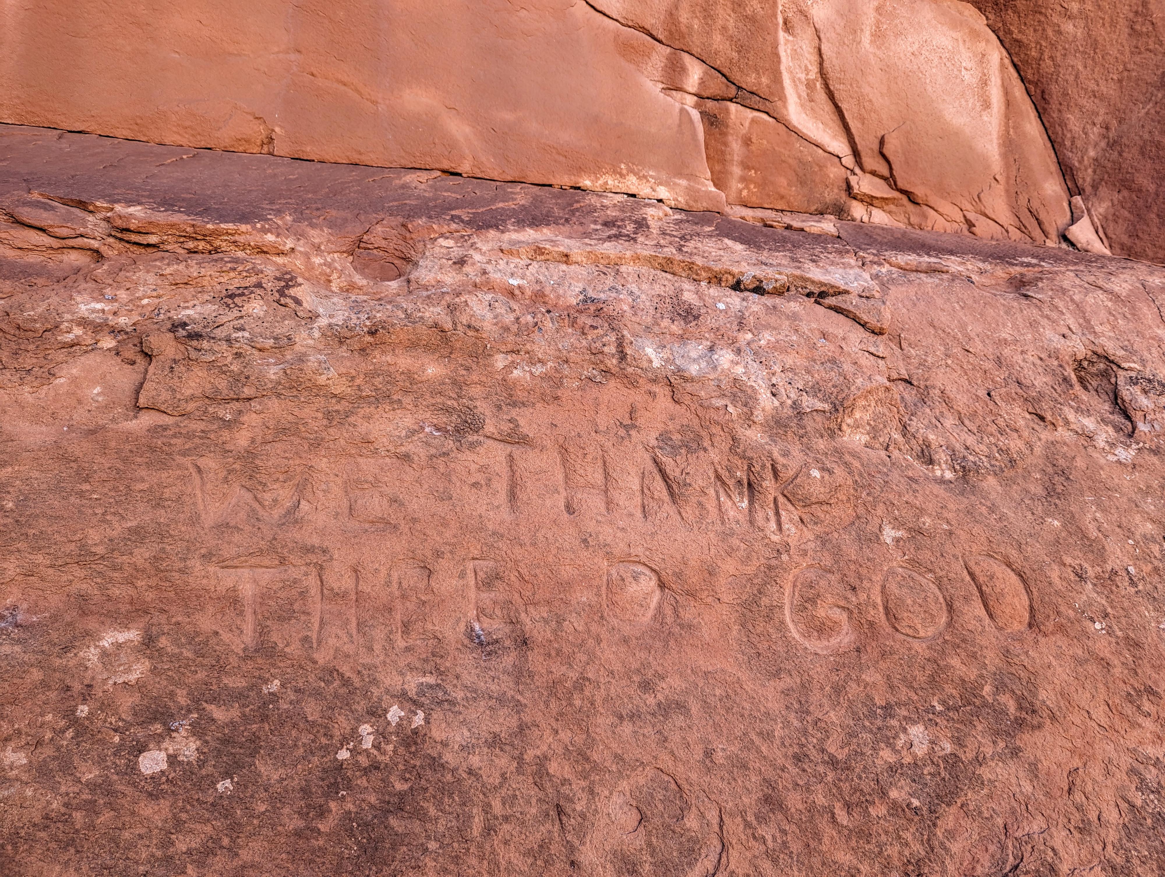
Inscription from the wagon company.
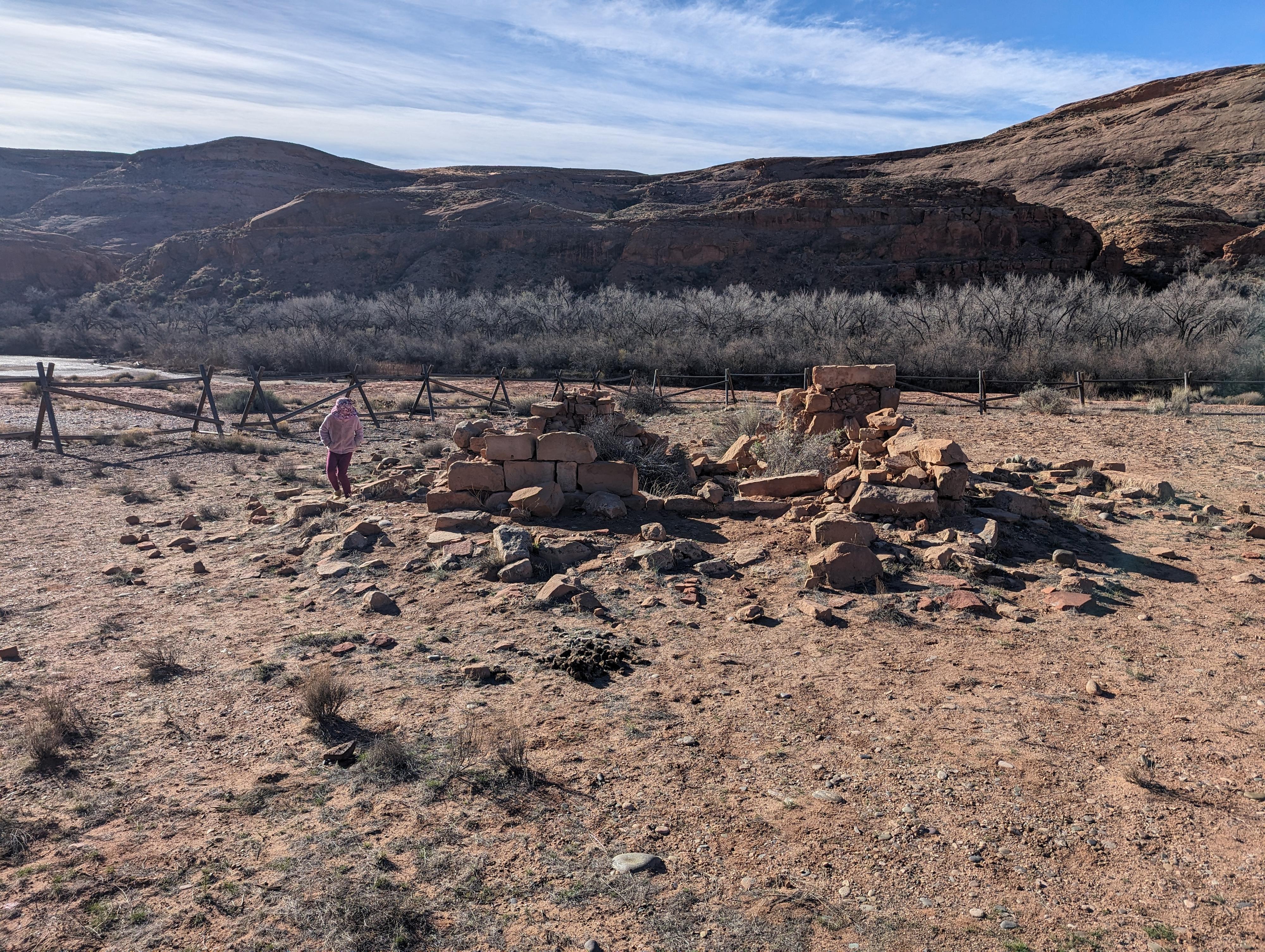
What little remains of the old trading post.
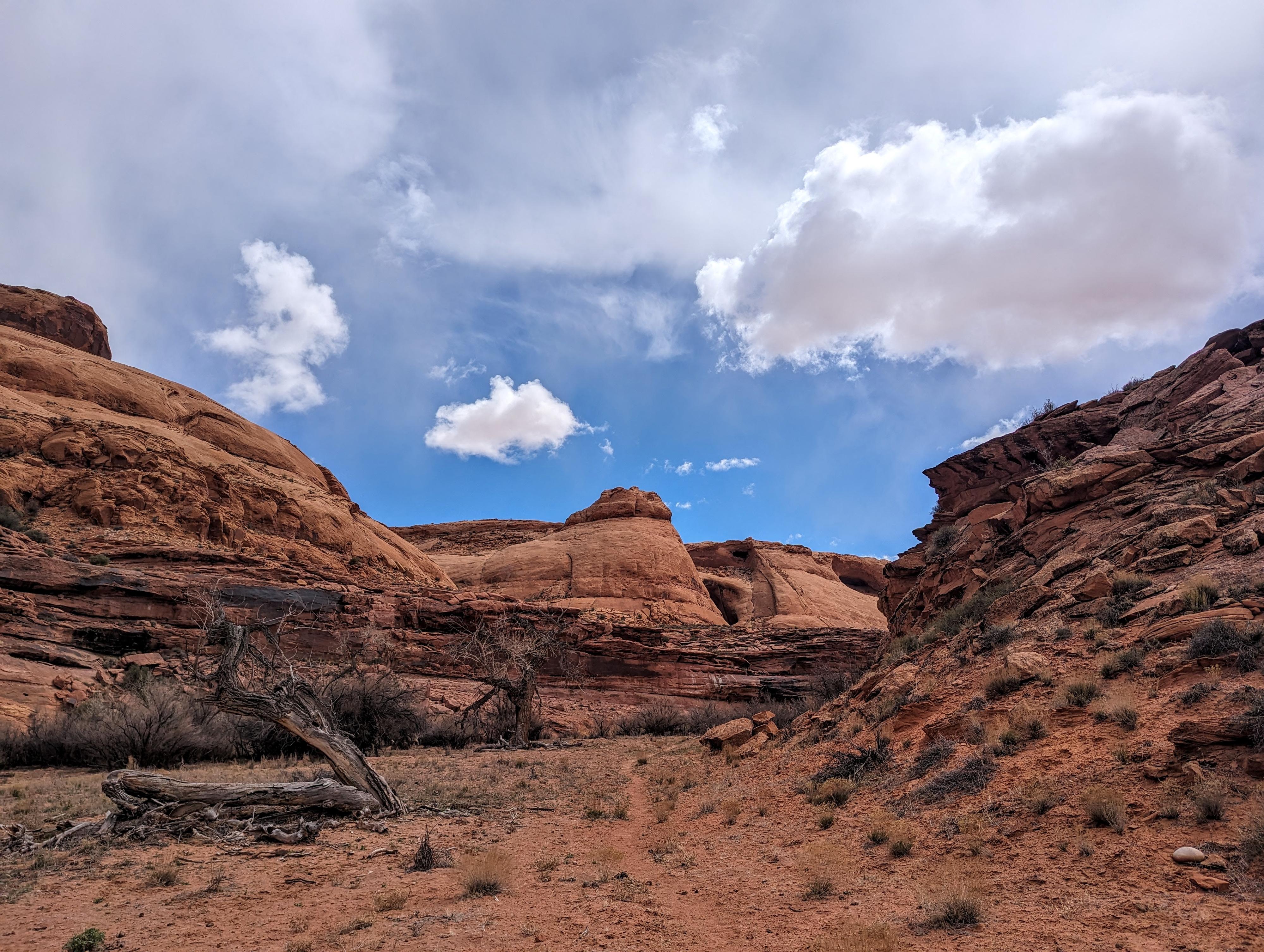
Views while hiking in Chinle Creek
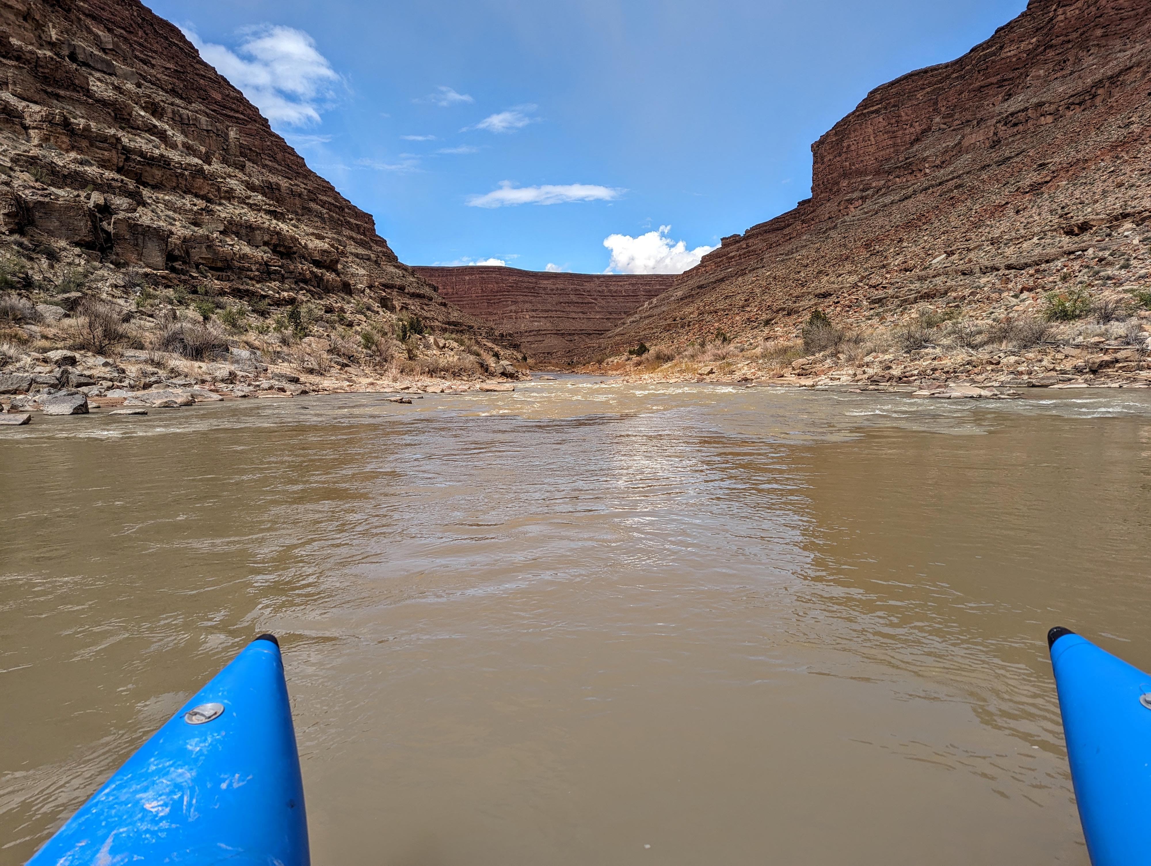
Heading into the canyon about mile 10.
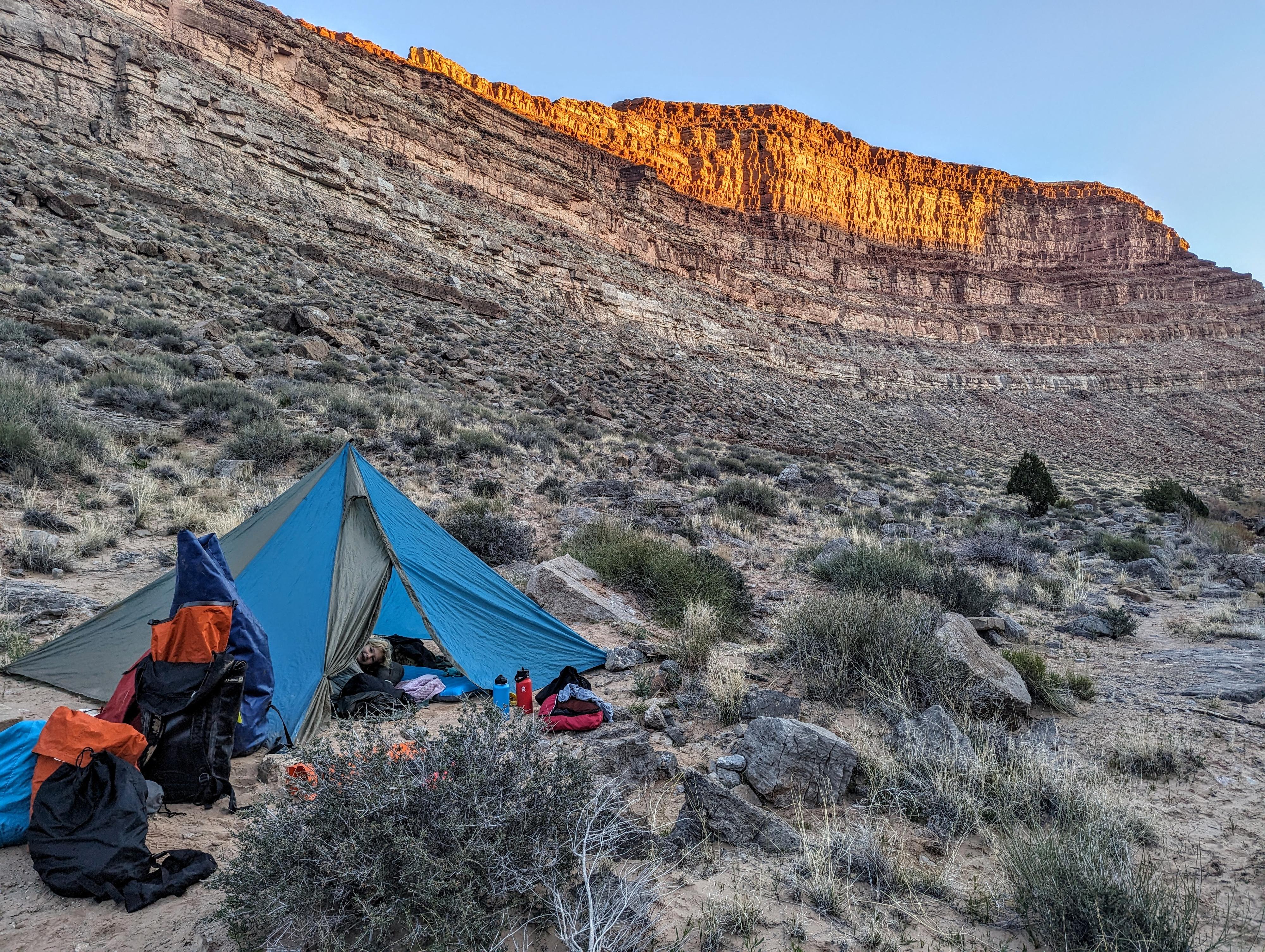
Sunrise at Midway camp.
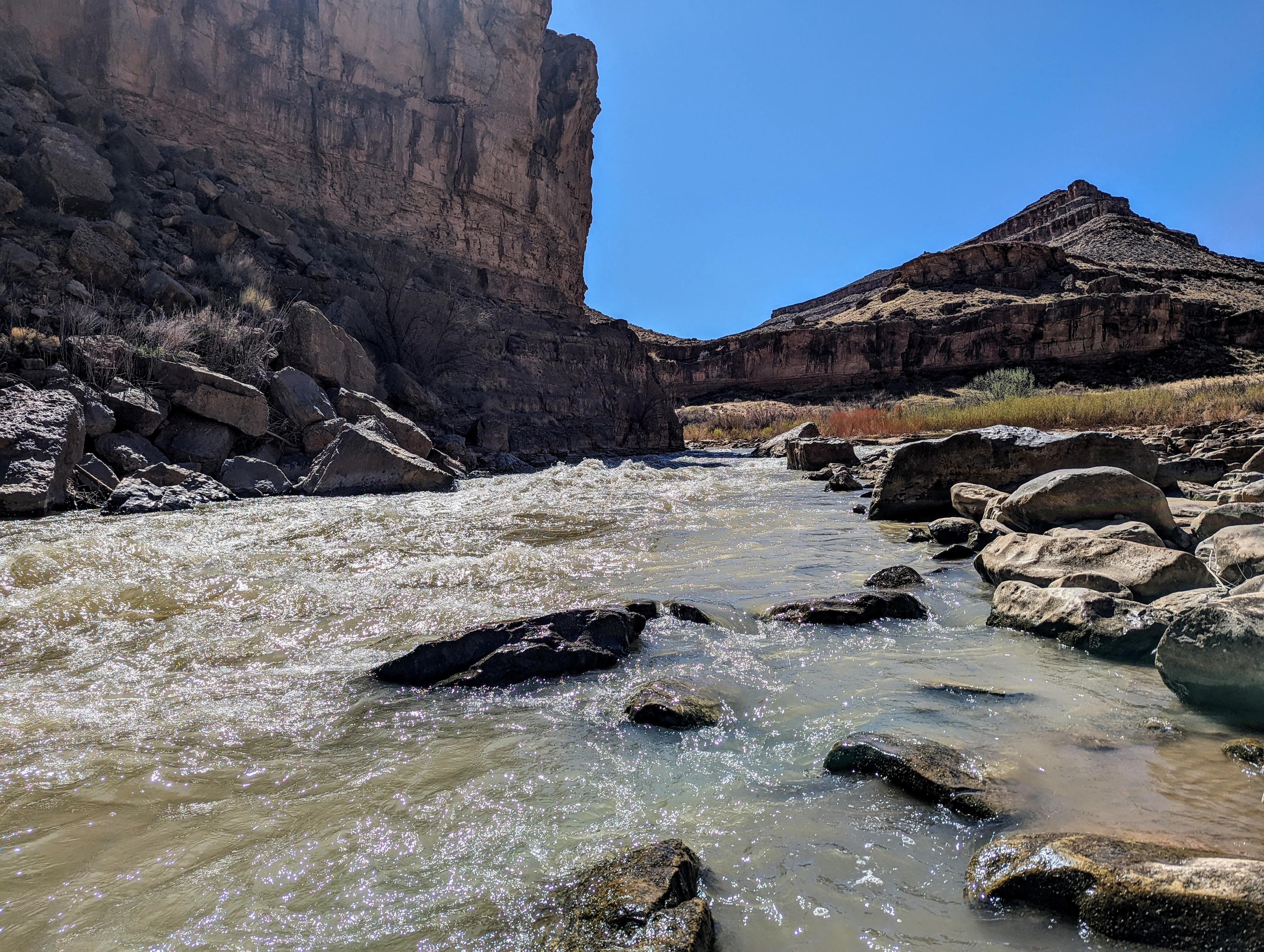
Eight Foot Rapid from the bottom. You can see the big boulder you need to go river right of.
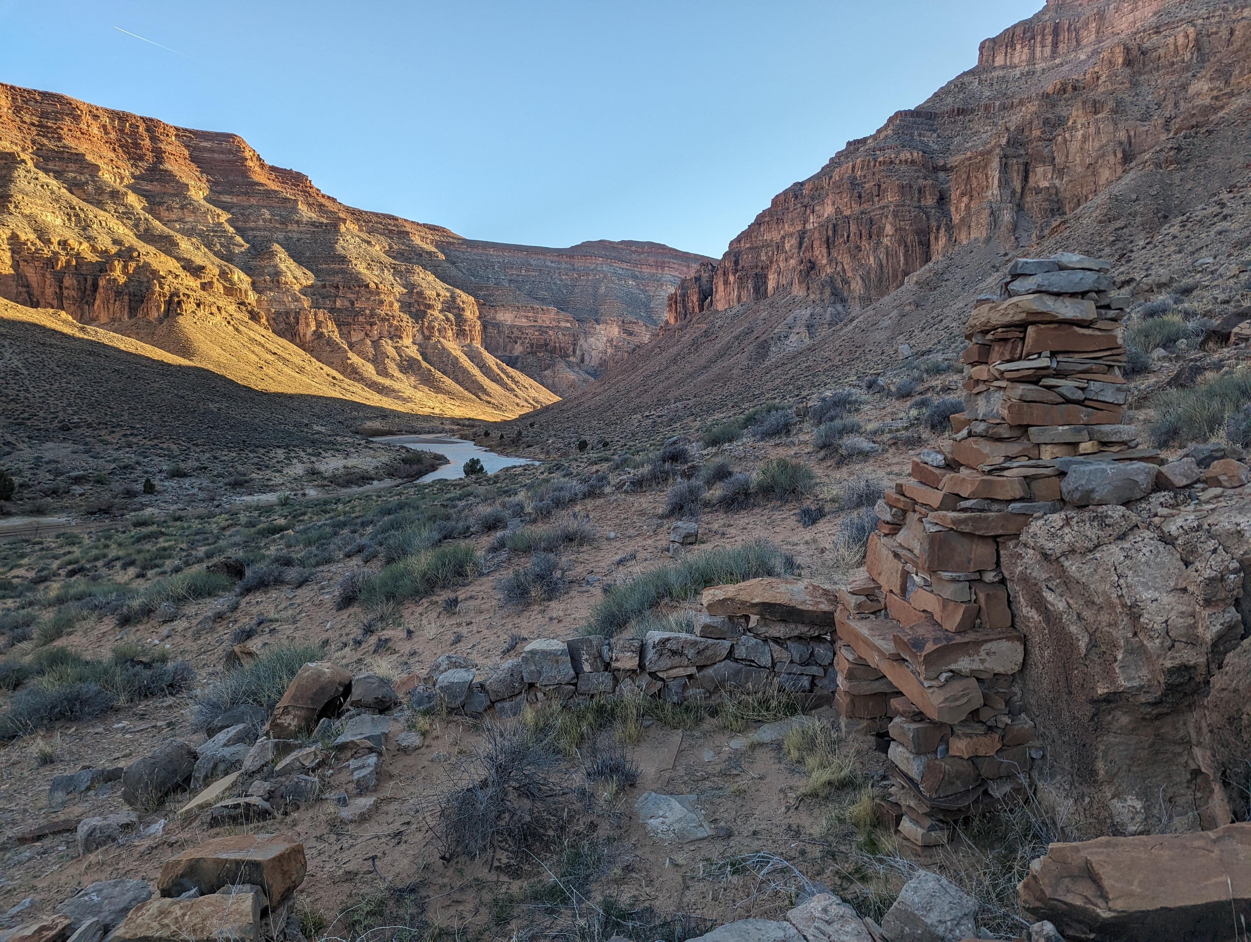
Old stone chimney in Soda Basin.
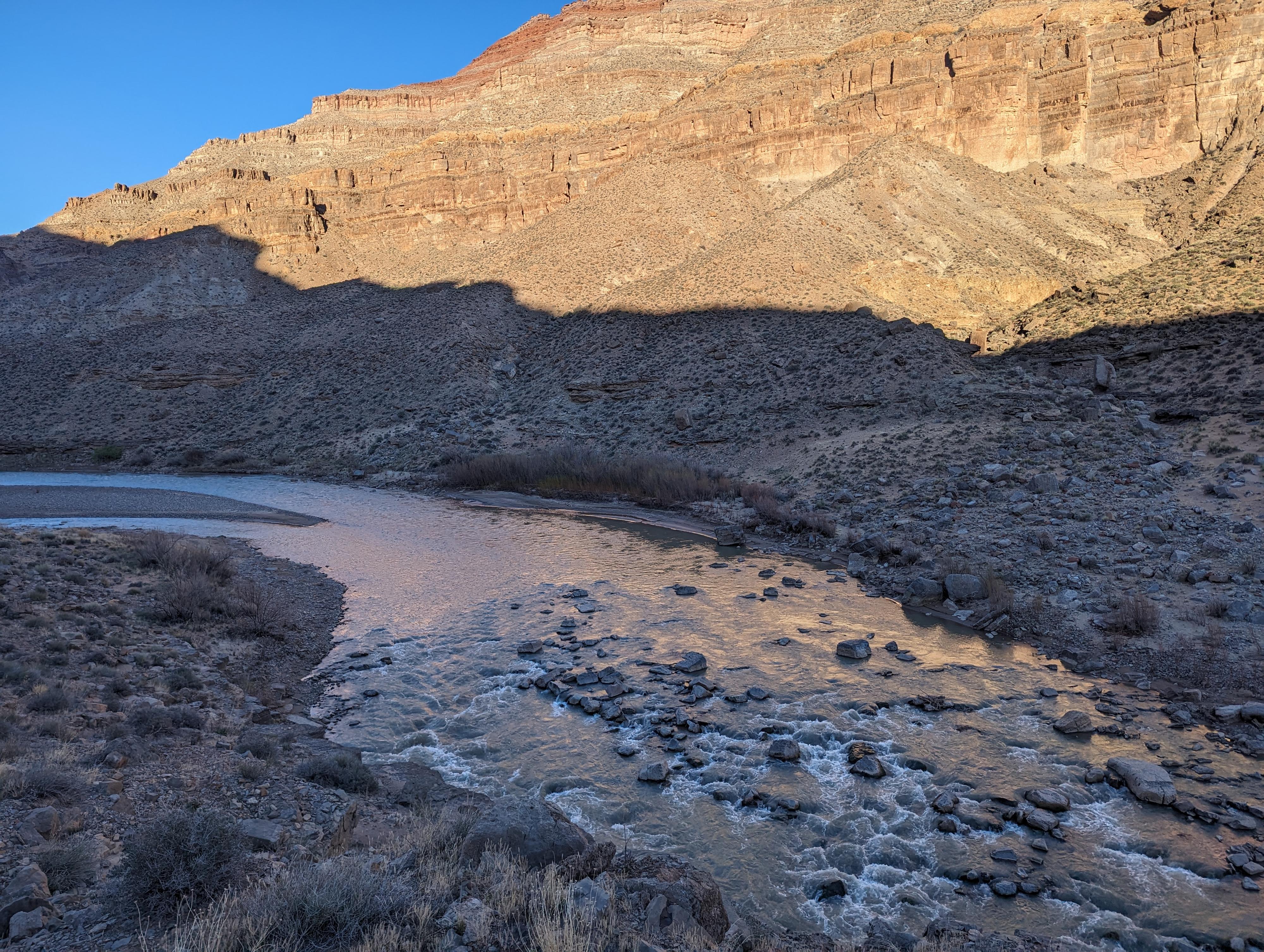
Ledge Rapid from above.
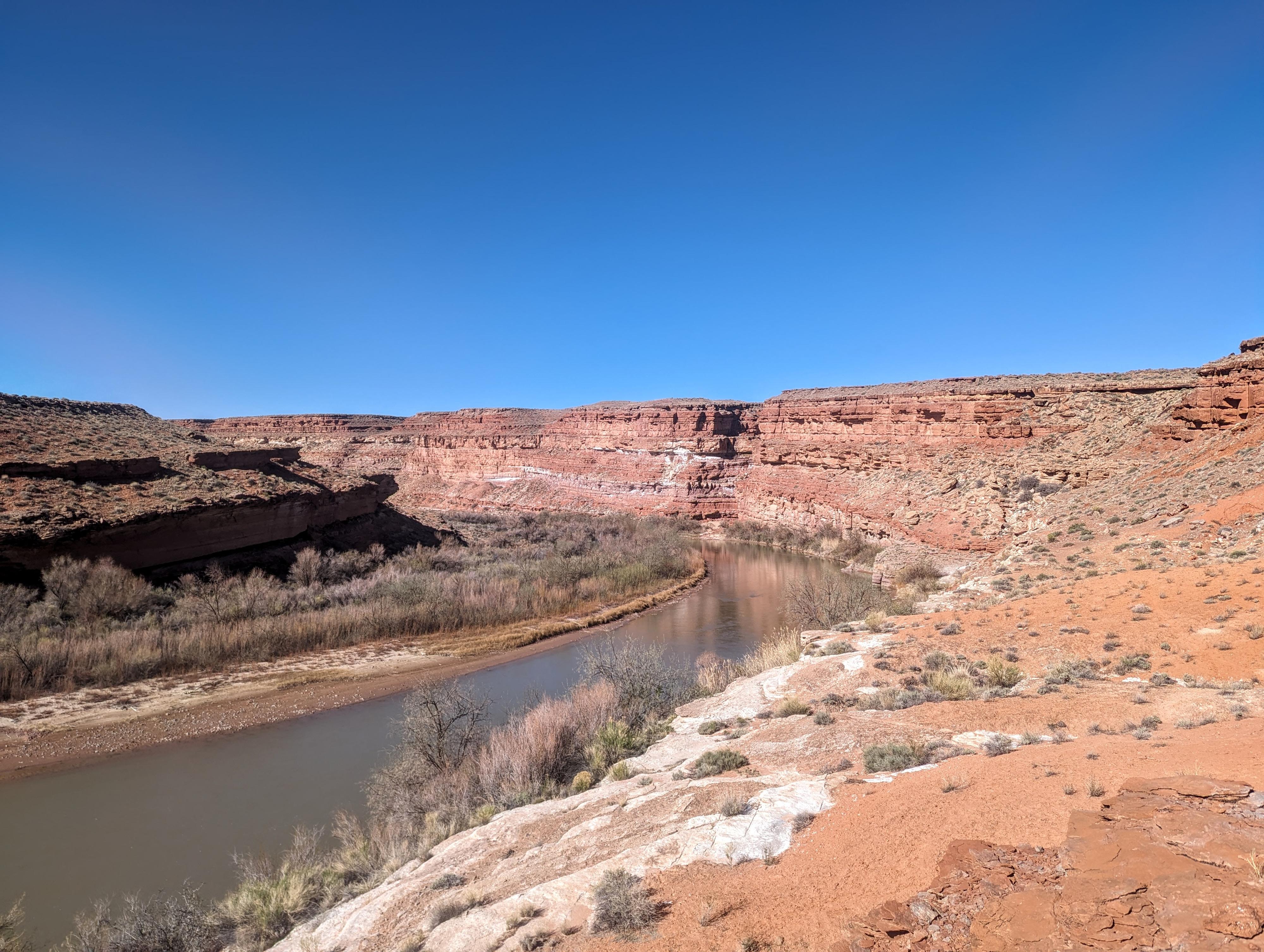
From the sulfur spring area of the river below.
Photos
Maps
12S 623023E 4124785N
37°15'41"N 109°36'45"W
12S 622362E 4122544N
37°14'29"N 109°37'14"W
12S 622068E 4122657N
37°14'33"N 109°37'25"W
12S 621746E 4122765N
37°14'37"N 109°37'38"W
12S 620095E 4122390N
37°14'25"N 109°38'46"W
12S 619792E 4122527N
37°14'30"N 109°38'58"W
12S 619545E 4122171N
37°14'18"N 109°39'08"W
12S 619381E 4122388N
37°14'25"N 109°39'15"W
12S 618424E 4122279N
37°14'22"N 109°39'53"W
12S 618362E 4122071N
37°14'16"N 109°39'56"W
12S 618505E 4121987N
37°14'13"N 109°39'50"W
12S 618229E 4121761N
37°14'06"N 109°40'02"W
12S 618040E 4121583N
37°13'60"N 109°40'09"W
12S 617866E 4121023N
37°13'42"N 109°40'17"W
12S 617217E 4120407N
37°13'22"N 109°40'44"W
12S 616289E 4120007N
37°13'10"N 109°41'21"W
12S 616264E 4119906N
37°13'06"N 109°41'22"W
12S 616390E 4120420N
37°13'23"N 109°41'17"W
12S 616514E 4120466N
37°13'24"N 109°41'12"W
12S 617213E 4120869N
37°13'37"N 109°40'43"W
12S 616034E 4119877N
37°13'05"N 109°41'32"W
12S 615799E 4120033N
37°13'11"N 109°41'41"W
12S 615557E 4120296N
37°13'19"N 109°41'51"W
12S 615567E 4120748N
37°13'34"N 109°41'50"W
12S 615446E 4119916N
37°13'07"N 109°41'56"W
12S 614058E 4119143N
37°12'43"N 109°42'52"W
12S 614164E 4118689N
37°12'28"N 109°42'48"W
12S 614128E 4118378N
37°12'18"N 109°42'50"W
12S 613869E 4118070N
37°12'08"N 109°43'01"W
12S 614118E 4117778N
37°11'58"N 109°42'51"W
12S 613475E 4117410N
37°11'47"N 109°43'17"W
12S 613317E 4117030N
37°11'34"N 109°43'24"W
12S 612436E 4117423N
37°11'47"N 109°43'59"W
12S 612369E 4117628N
37°11'54"N 109°44'02"W
12S 611632E 4117698N
37°11'57"N 109°44'32"W
12S 611211E 4119565N
37°12'57"N 109°44'48"W
12S 610767E 4118958N
37°12'38"N 109°45'06"W
12S 609203E 4117044N
37°11'37"N 109°46'10"W
12S 609524E 4116353N
37°11'14"N 109°45'58"W
12S 607848E 4115970N
37°11'02"N 109°47'06"W
12S 607818E 4116258N
37°11'12"N 109°47'07"W
12S 607762E 4116419N
37°11'17"N 109°47'09"W
12S 605670E 4116385N
37°11'17"N 109°48'34"W
12S 605603E 4116383N
37°11'17"N 109°48'37"W
12S 605660E 4116485N
37°11'20"N 109°48'34"W
12S 605437E 4115838N
37°10'59"N 109°48'44"W
12S 605386E 4115761N
37°10'56"N 109°48'46"W
12S 605257E 4115535N
37°10'49"N 109°48'51"W
12S 604121E 4115526N
37°10'49"N 109°49'37"W
12S 603824E 4115447N
37°10'47"N 109°49'49"W
12S 603075E 4115888N
37°11'02"N 109°50'20"W
12S 602182E 4117162N
37°11'43"N 109°50'55"W
12S 601773E 4116944N
37°11'36"N 109°51'12"W
12S 601905E 4115677N
37°10'55"N 109°51'07"W
12S 603787E 4113705N
37°09'50"N 109°49'52"W
12S 601798E 4111808N
37°08'50"N 109°51'13"W