 Hiking
City Creek Canyon
Hiking
City Creek Canyon
Salt Lake City
Overview
A stone's throw from Salt Lake City, City Creek canyon feels a world away. The pioneers, when they settled Salt Lake, used water from City Creek to irrigate their fields, and help develop the budding city. The canyon is still used as part of the city’s water supply today, with a water treatment plant situated several miles up the canyon. Historical fun fact, the upper reaches of the canyon have both a mining history, and a bootlegging history.
City Creek Canyon is one of my favorite quick outings in the city. The gentle but unrelenting uphill paved road makes for excellent running, biking, or just taking a stroll. From the gate, dogs are allowed about 3 miles to where the canyon becomes a watershed. Beyond that, dogs are not allowed. The trail can be busy during prime weekends, but generally most seem to stay in the lower canyon. Once you get 1.5 or 2 miles up, the number of people greatly subsides. My favorite parts of the canyon are near the top, about 5.5 miles from the trailhead.
A few notes for visiting:
- The canyon is gated and closed to vehicles except on even days between Memorial Day and the last even day in September. Hikers and runners are welcome anytime. Bikers are allowed on odd days between Memorial Day and the last even day in September, and anytime October through Memorial Day. There is small fee to drive up the canyon, currently $3 (2020) but hikers and bikers do not pay a fee.
- During the summer, when cars are allowed, picnic sites are available by reservation from Salt Lake County ( https://www.slc.gov/utilities/city-creek-canyon/ ). This is a great place for an evening picnic during the summer, and typically not very busy.
- In summer months, there are several restrooms and water fountains available along the paved road.
- A single-track dirt trail parallels the road for about 3 miles. This is accessible via many short side trails from the paved road. Bikes are not allowed on the single track. Be mindful in the summer, as this trail seems to have a fair number of rattlesnakes.
- In the winter, the canyon road is plowed about 3 miles to the water treatment plant. This is an excellent bike or run when everything else is covered in snow. Service vehicles do use the road in the winter, but typically low volume. Beyond the water treatment plant, the road is not plowed in the winter.
- Parking at the trailhead can fill up quickly in busy times of the year. Parking at the State Capitol and walking down adds some distance (a bit under a mile each way) but is a reasonable option, especially for bikers.
Getting There
City Creek Canyon is reached via a one-way road connecting the Avenues neighborhood to the Marmalade Hill neighborhood. From downtown Salt Lake City, go east on South Temple to B Street. Go north up B Street to 11th Avenue. The left (west) on 11th Avenue. It curves and goes north into City Creek Canyon. Where the road curves back to head to the Capitol is a small side road on the right with a few parking spots This is the trailhead.
Route Description
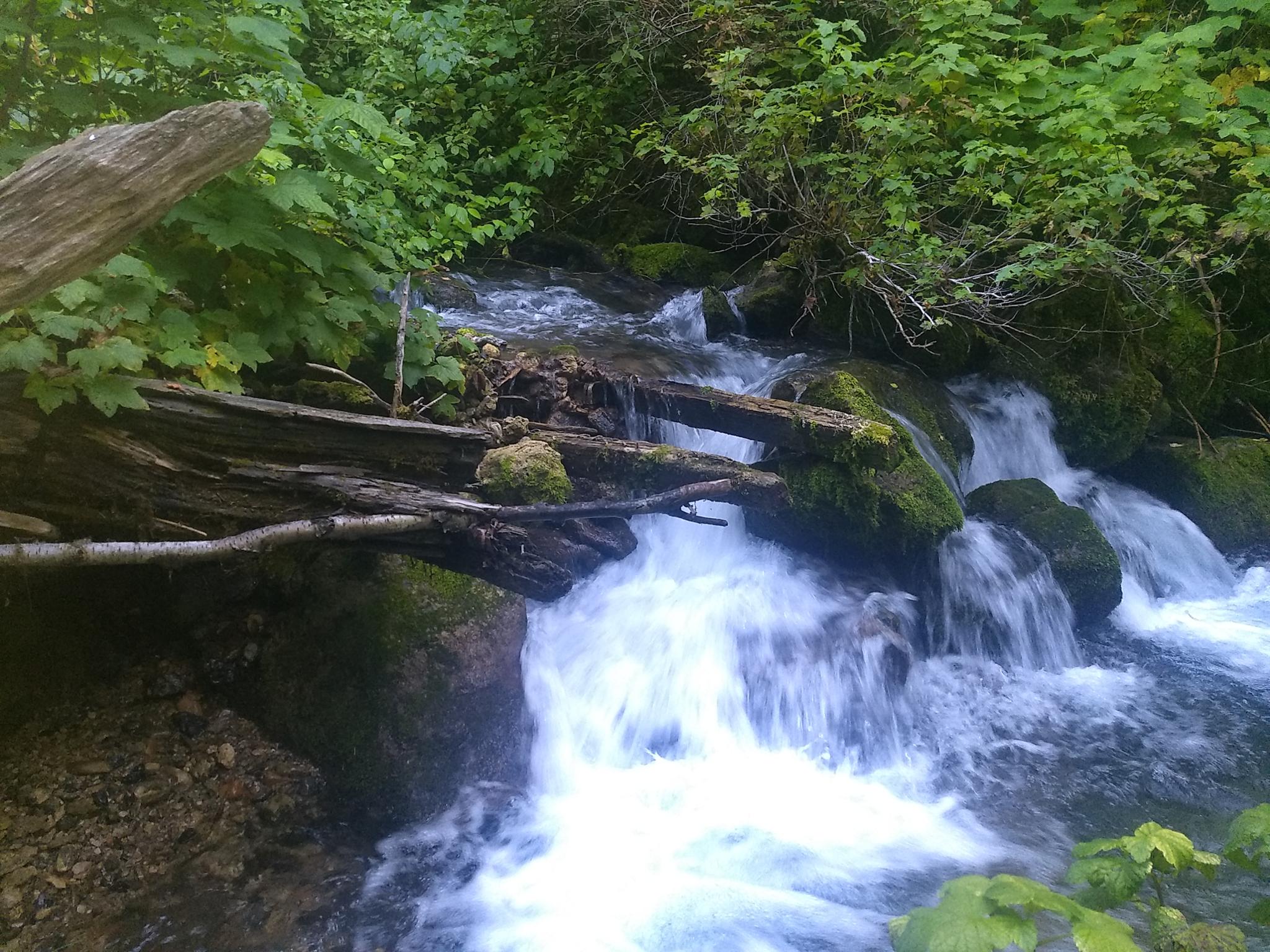
From the trailhead, head up the paved road. The first 2 miles or so meanders through the typical SLC foothill ecosystem, with conglomerate cliffs and boulders interspersed. The cooling babble of City Creek is a constant companion throughout.
Beyond about mile 2, conifer trees slowly become more and more prominent. The watershed boundary, at 2.8 miles is the turnaround for those with dogs. Just beyond this, the dirt trail that has been paralleling the road joins the road at site 17.
The water treatment plant is just past site 17. Beyond the water treatment plant, the road surface gets a little rougher, and the canyon narrows and is more forest like. Rotary Park is marked by a large sign and restroom about 4.5 miles from the trailhead.
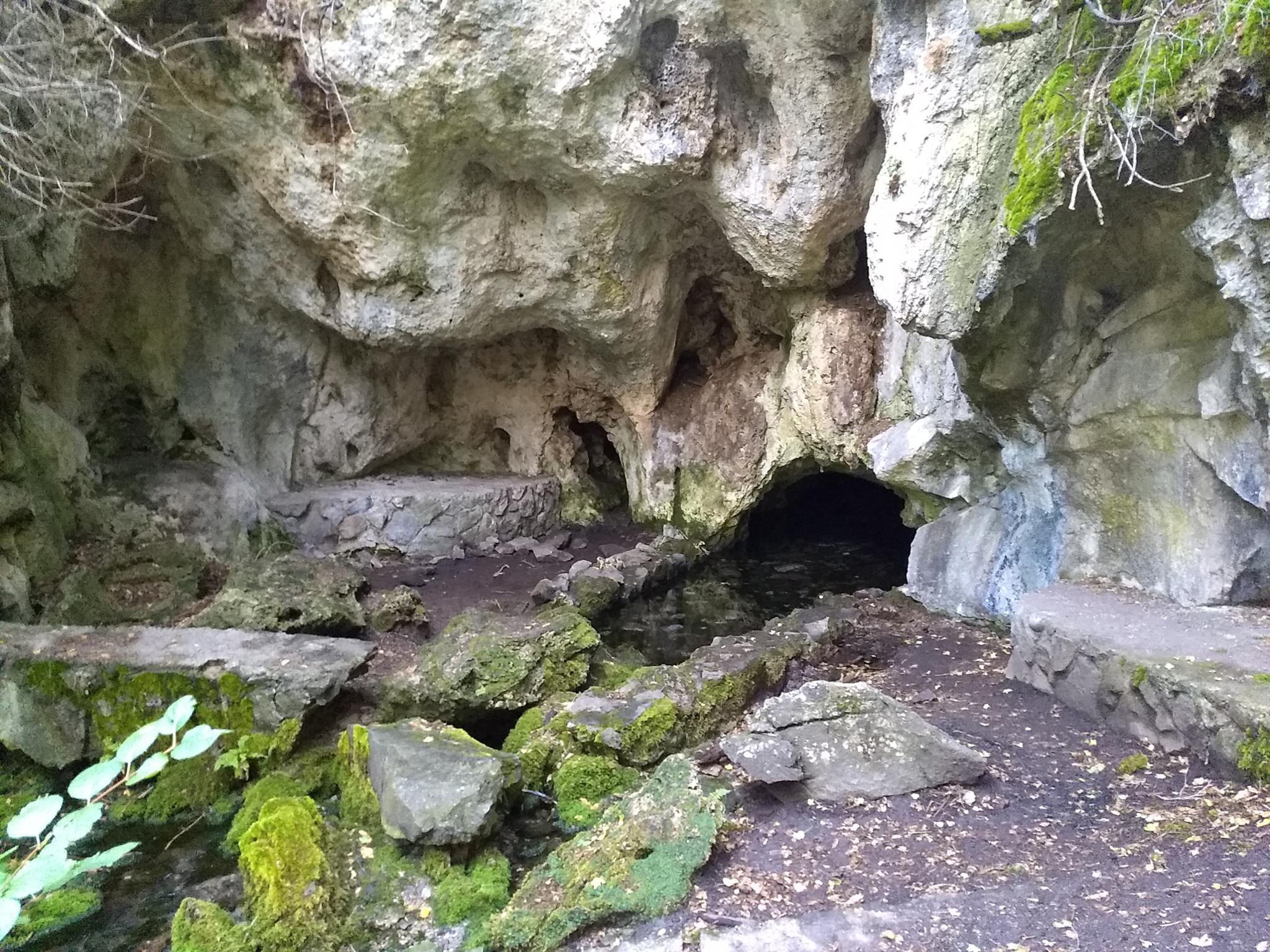
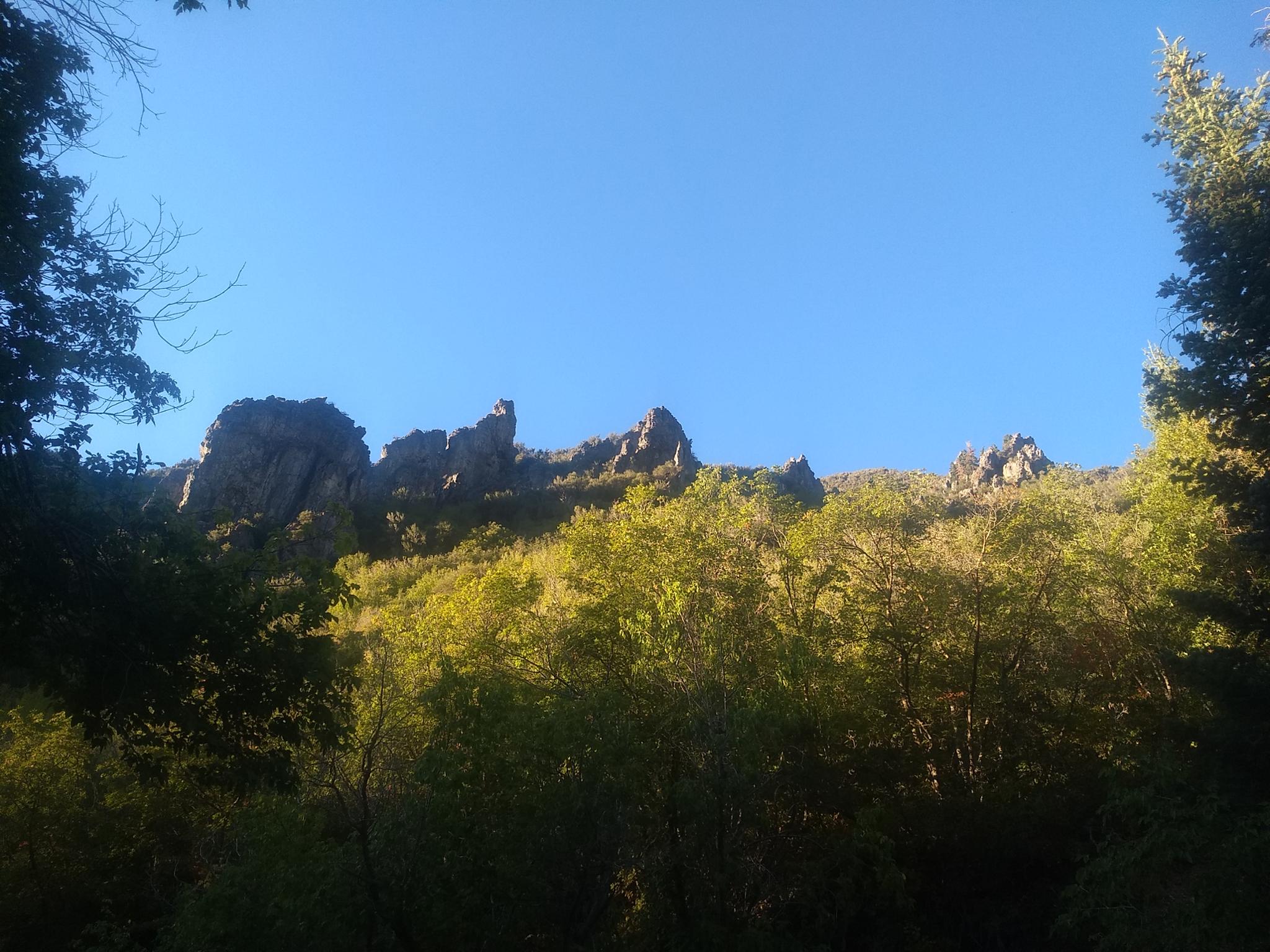
Rotary Park was completed in 1927 must have been quite the gathering place back when the canyon was open to motor vehicle all days. The park is still maintained, and the picnic sites available by reservation. The park extends about a mile with many picnic sites and two restrooms before the road ends. The area around the park is heavily wooded, with towering limestone pillars and cliffs. It is quite stunning. Where the road crosses city creek and set of stone stairs leads down a spring coming out of a cave in the rock.
A closed jeep road that becomes a dirt trail continues beyond the end of the park, but most return from here. The hillsides around the park were the site of several mines and bootlegging back in the late 1800s to early 1900s.
Maps
")
")
12T 425915E 4516030N
40°47'31"N 111°52'41"W
12T 426397E 4517090N
40°48'05"N 111°52'21"W
12T 426978E 4517404N
40°48'16"N 111°51'56"W
12T 429199E 4518248N
40°48'44"N 111°50'22"W
12T 429496E 4518360N
40°48'48"N 111°50'09"W
12T 429865E 4518564N
40°48'54"N 111°49'54"W
12T 431809E 4519294N
40°49'19"N 111°48'31"W
12T 433064E 4519583N
40°49'28"N 111°47'38"W