
 Hole-In-The-Rock
Hole In the Rock Road
Overview
The tale of Hole-In-The-Rock is likely known, to some extent, to most Utahns. This is one of the most dramatic and epic Mormon settlement stories of all time. Today, it is about a 56 mile journey down a bumpy dirt road to reach the namesake Hole-In-The-Rock where early Mormon pioneers toiled against incredible odds, enduring inhospitable weather to complete a journey that would become legend. The 56 mile journey to the site takes a couple of hours to drive to today, one way, but still can feel arduous and long. The improbable route they engineered down to the Colorado River is a sight to behold and worth the effort to see.
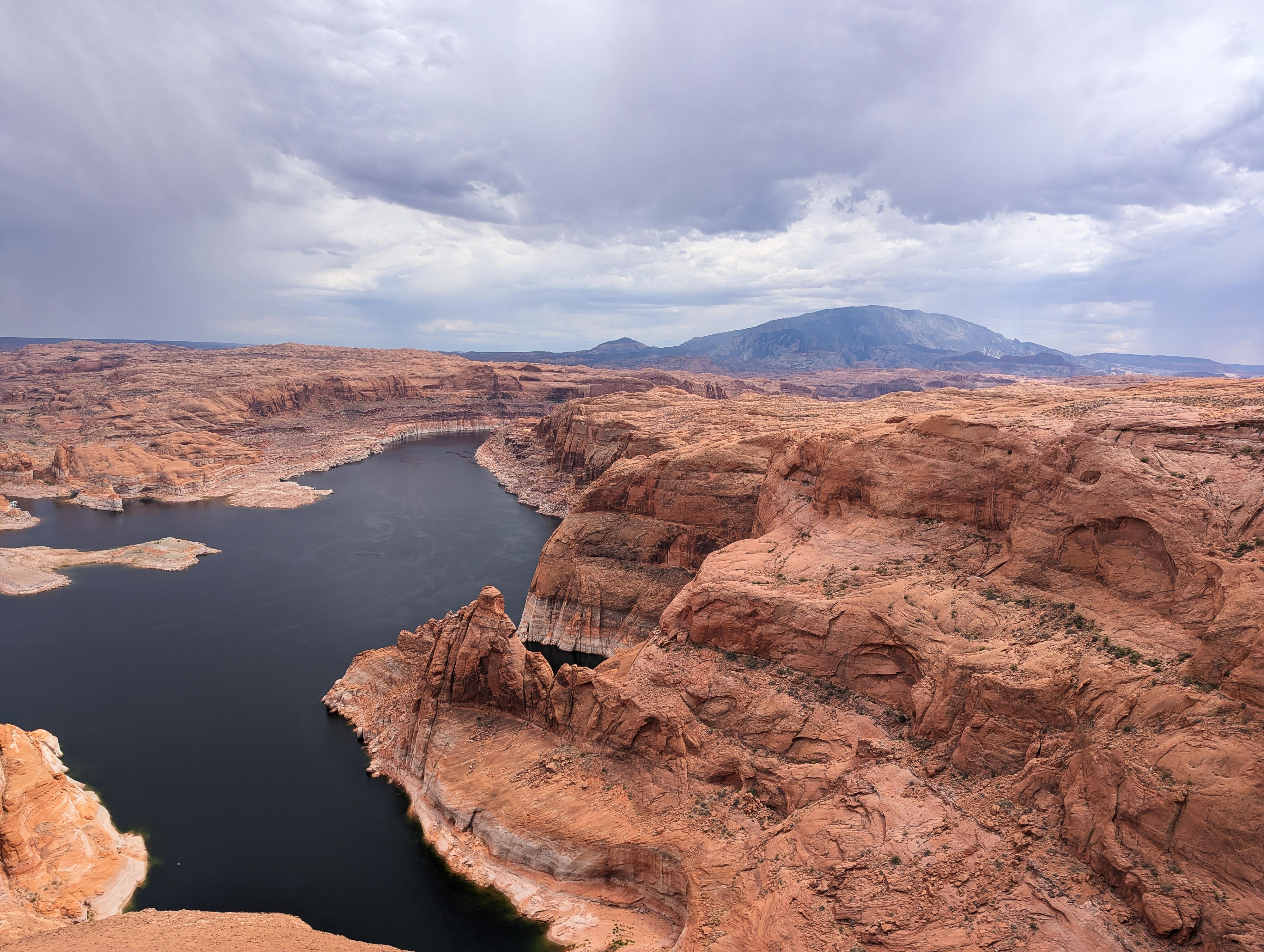
The party encountered immense obstacles as they traversed the rugged terrain of the Glen Canyon area. When they reached a sheer sandstone cliff overlooking the Colorado River, they found a narrow crevice—later called the Hole in the Rock—which they painstakingly widened with blasting powder and hand tools over several weeks. This engineering feat allowed them to lower their wagons down the 1,200-foot drop to the river below using ropes, manpower, and ingenuity. After crossing the river, they continued eastward through equally formidable canyons and mesas.
After nearly six months of grueling travel—far longer than the six weeks they had planned—the expedition finally reached their destination and established the town of Bluff in April 1880. Despite the harsh conditions and loss of livestock, the pioneers succeeded in creating a settlement that would become a vital outpost in southeastern Utah. The Hole in the Rock route has since become a symbol of determination and pioneer ingenuity, and it remains an important historical and recreational landmark today.
It is astounding, but there was no loss of human life, and in fact, three babies were added to the population during the journey.
Getting There
Head east out of the town of Escalante about 5 miles on highway 12 until the well signed Hole in the Rock road on the south side of highway 12. Reset the odometer as you turn onto this road.
Route Description
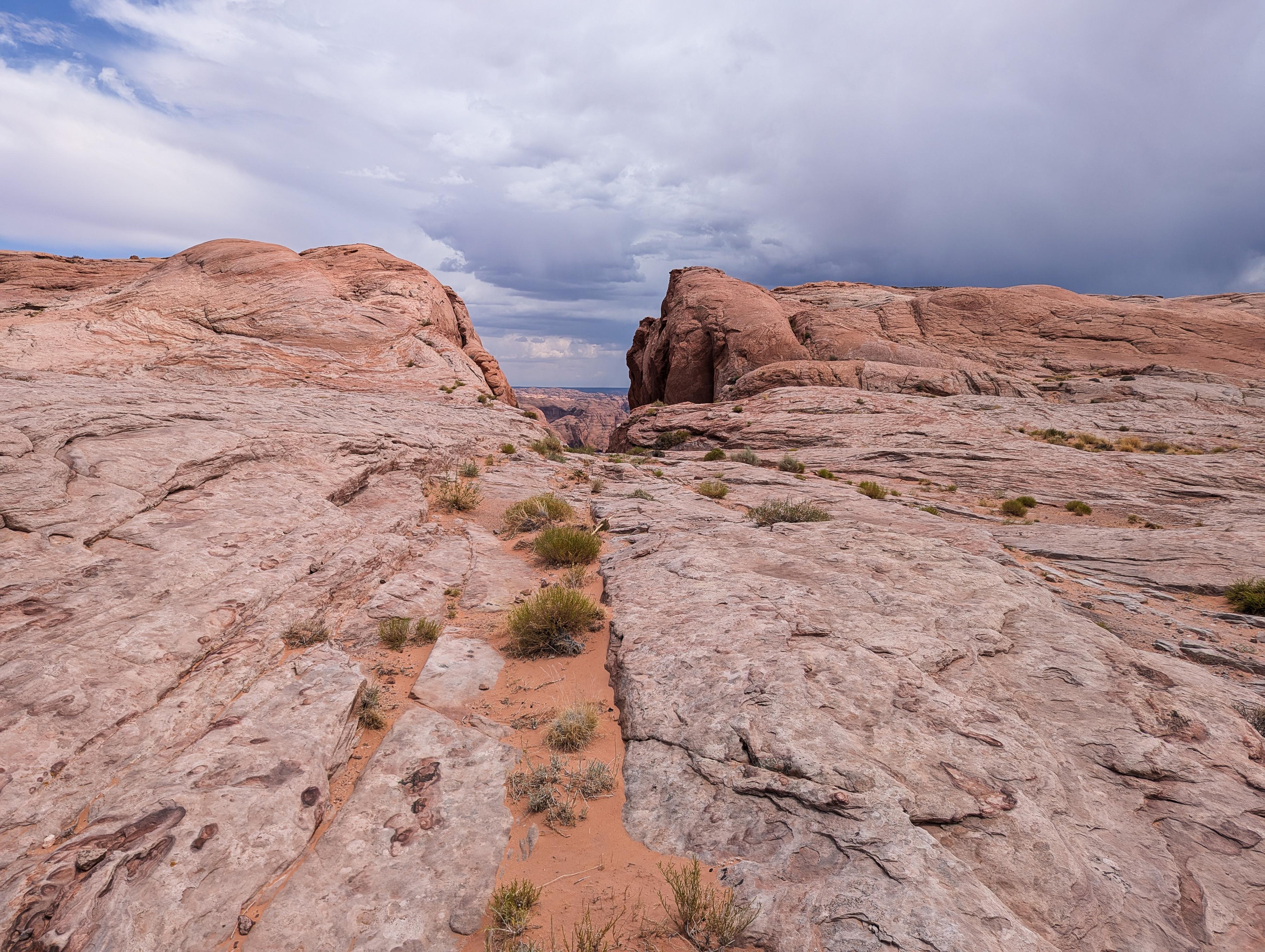
From the trailhead, it is a very short walk over to the cleft that is the Hole-In-The-Rock. If you have time, it is very worthwhile to hike the full trail down to the lake.
Though it had wagons descend it at one time, it has since washed out and requires a bit of scrambling and route finding. Simply head down from the top, finding the easiest path over and around obstacles. Keep an eye out on the left, near the top, for a long ledge with graffiti on it. Please don't add to the graffiti.
When the pioneers descended this, it is significant to note, they had filled the bottom with sand and rocks to make a path for the wagons. Their wagons were about 70" wide, so as you walk down, you can imagine how much fill had to be put in at some spots. Since construction, the sand and fill have washed out, but there are still spots where you can see some chisel marks up 3-4' on the walls where they had to widen the spots just a bit to fit.
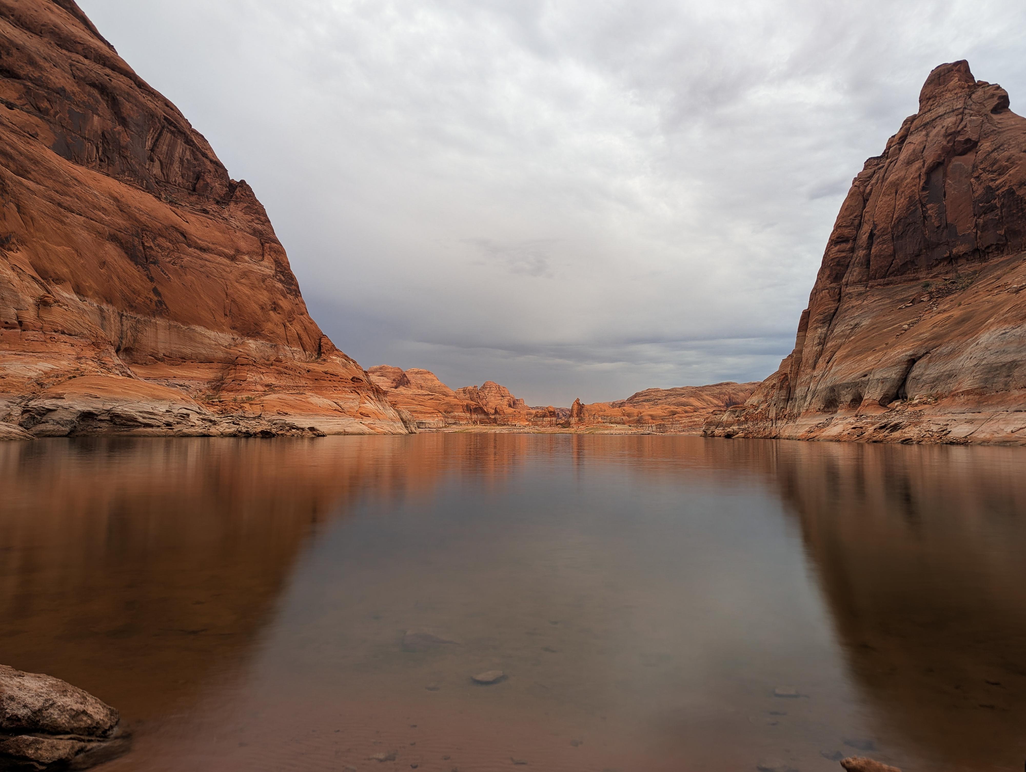
As the canyon widens a bit, the social trail heads left across the slope and some chiseled steps that came after the pioneers when the Hoskinini Mining Company was working in the area. It then descends to the lake In 2025, the lake edge had a nice sandy beach and another sign at the bottom. Return the same way.
Photos
Maps

12S 508775E 4123339N
37°15'24"N 110°54'04"W