 Hiking
The Y
Hiking
The Y
Provo
Overview
If you have ever passed through Utah Valley, you will have noticed the Y on the east side of the valley. The emblem of Brigham Young University, the Y on the hillside, has been an iconic feature of the valley for over 100 years and is a very popular hike. Having seen the Y hundreds of times as I passed through the finally, Diane and I finally took the time to visit it and do the hike.
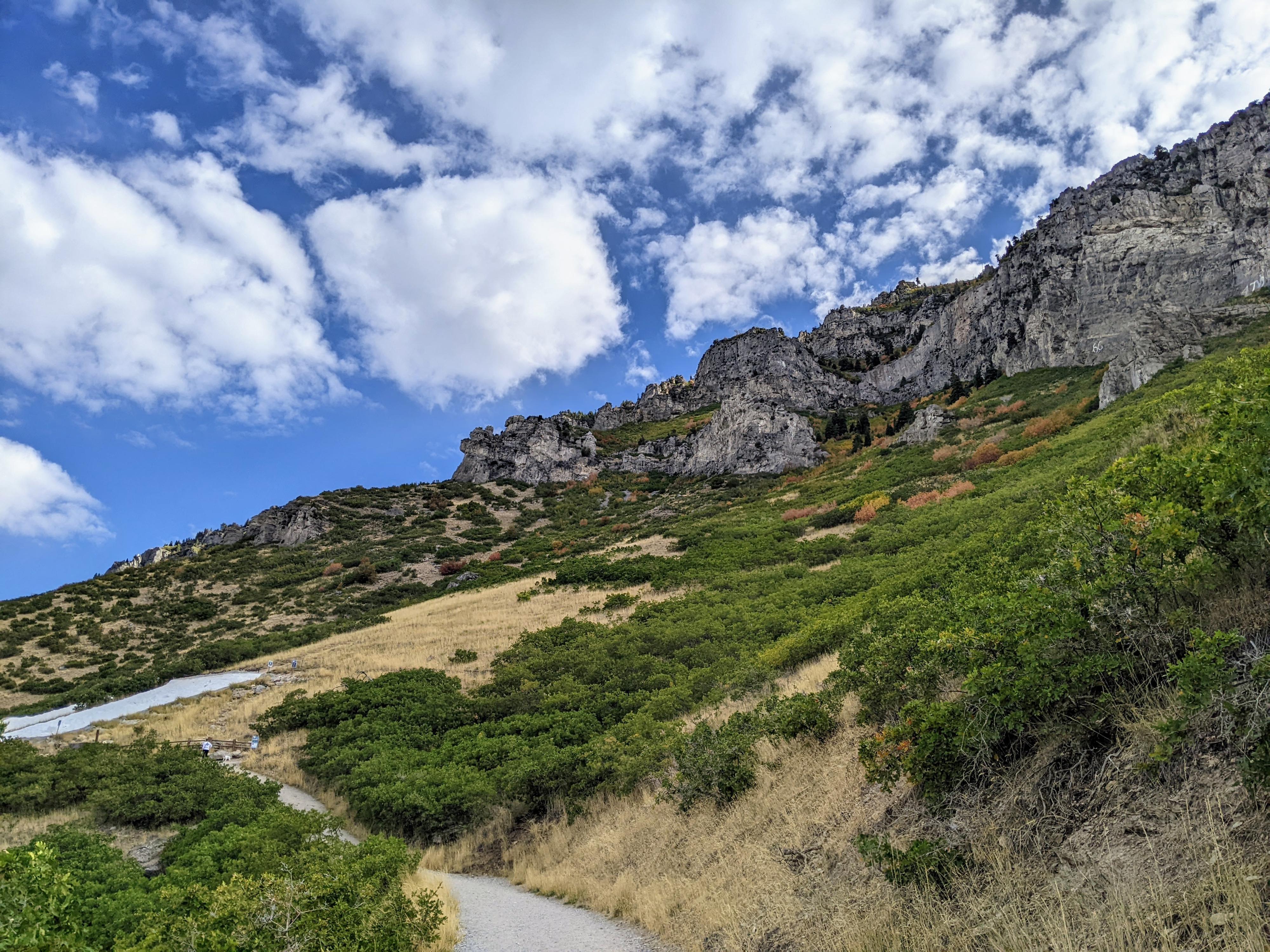
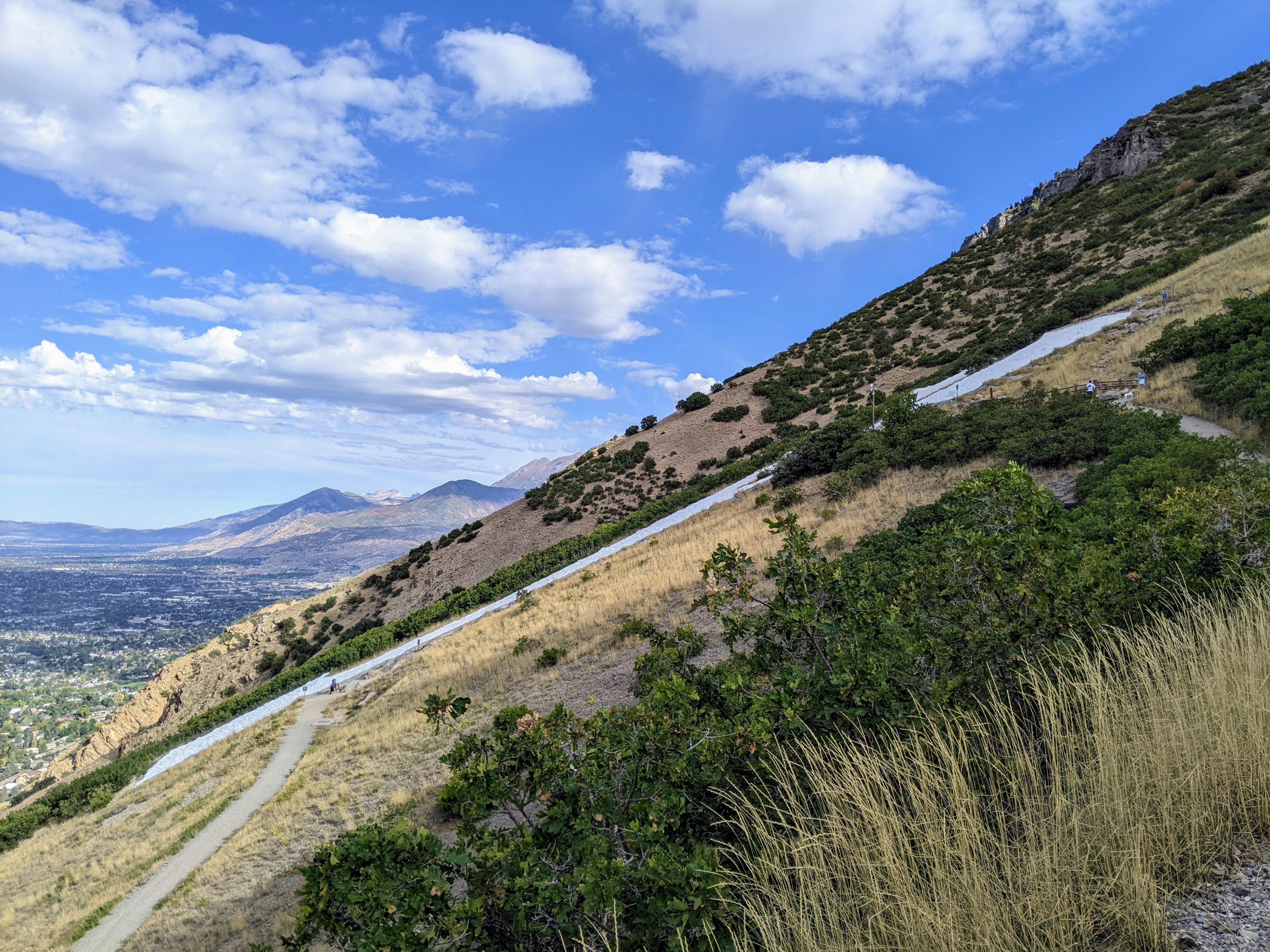
The hike is very popular, and done by all ages. That being said, it is a steep hike, gaining almost 1000 feet of elevation in just over a mile. The switchbacks, signs, and benches keep the hike interesting for kids and allow a spot to rest if needed. There is little shade on the hike, so be careful in hot summer temperatures.
From the informational sign at the trailhead:
”In 1906, the Junior Class of 1907 whitewashed their graduating year on the mountain east of campus. When other students saw these numbers on the mountain, a massive invasion by the Senior Class against the offenders began. The 1907 date on the mountain held out as long as it could, but was finally obliterated. To prevent further clashes, President Brimhall consented to send Ernest Partridge and three of his students, Elmer Jacobs, Clarence Jacob, and Harvey Fletcher, to survey the letters “B”, “Y”, and “U” on the mountain. After the letters were laid out, the entire student body joined together for the first Y-day to whitewash these letters onto the mountainside. Harvey Fletcher recalled that:
“The students stood in a zigzag line about 8 feet apart stretching from the bottom of the hill to the site of the “Y”. The first man took the bag of lime, sand, or rocks and carried it 8 feet and handed it to the second man. The second man carried it another 8 feet and handed it to a third man and thus the bag went up the hill, each man shuttling back and forth along his 8 foot portion of the trail. All the students started with enthusiasm as they expected to be through by 10 o’clock a.m. But it was a much bigger job than anyone expected. It was 4:00 p.m. before just the letter “Y” was covered with a thin layer of whitewash, so no attempt was ever made to cover the other two letters. It was very hard work and most of the boys had no breakfast and no dinner. No one cared to quit as it would break up the line. In the afternoon it was more than some of them could take and they fainted and had to be helped down the hill. I am sure those who worked in the line that day will never forget it. They were rewarded when they got back to campus and looked at the beautiful white “Y” and the mountainside in just the right proportions. It looked like it was standing in the air just above the ground"
The letter “Y”, composed of a thin coat of whitewash, needed constant repair which the students whole heartedly took on as a challenge. In 1908, the students added a layer of rock to the face of the letter. In 1910 or 1911, the shape was changed by adding the block shape to the top and bottom of the “y”- transforming it into the block letter we recognize today. In the fall of each year as part of their orientation activities, the freshmen students would bow every day at 9:00 am and 12:00 pm in anticipation of climbing to the letter and removing brush from the area.
On Y-day in the spring, the men met early in the morning for roll call. They would head up to the “Y” and the women would stay behind to prepare the lunch. The faculty cleared the trail, the freshmen hauled water from a spring, sophomores carried up the white wash and mixed it in wooden troughs, and the juniors and seniors poured it on the large letter. The band played music all day to keep the spirits of the workers up. The job required a minimum of 500 pounds of salt, 110 bags of lime, and 3000 gallons of water.
This tradition continued until 1972, when the University began using heavy equipment to carry the whitewash up the mountain. This change was made to reduce the environmental impact on the mountain caused by the yearly bucket brigade. In 1978, the face of the “Y” was coated with gunnite, a mixture of sand and cement. Over 100 cubic yards of sand, 56,400 pounds of cement and 10,000 gallons of water were used on the project, which took 10 days to complete. After the gunnite was applied, the annual whitewashings were no longer needed. The block letter “Y” is currently re-painted approximately every 5 years as needed. It takes 3 people 2 days to apply 200 gallons of paint.
In 1923, the “Y” letter was lit for the first time in order to burn back the vegetation which had over-grown the area. It was originally lit using cotton bales or mattress stuffing dipped in pitch. It was later illuminated by 25-watt light bulbs on a portable cord powered by a generator. It took 3 people 6 hours to put the lights up and another 3 hours to take them down.
In 2016 the property not already owned by BYU but associated with the “Y” and its access trail was purchased by the University from the Federal government. Permanent power, lighting, and trail improvements were added which included over I mile of conduit, trenching and wiring in addition to 65 yards of new gunnite to complete the project. Lighting the “Y” now happens electronically from campus. The restoration and lighting project took over 4 months to complete and was possible due to the dedication and hard work of hundreds of university employees.
What a sight to see! The majestic “Y” greets all who arrive in Utah Valley and metaphorically gives light to all the world. Although the “Y” is only lit on special occasions, it has special meaning for new students who, upon entering BYU, have the letter lit especially for them, and by the same token, a student’s college career culminates with the lighting of the “Y” at graduation. Like the sun with her spectacular sunrise and glowing sunset, the lighting of the “Y” represents the rise of the incoming student and the setting of the graduating senior.
A GIFT FROM BYU STUDENTS”
Getting There
Head east on Center Street in Provo to 900 East and turn left/north on 900 East. For 900 East north for 0.8 miles to 820 North. Turn right on 820 North and follow it east for 0.6 to where it curves and becomes Oakmont Lane. Continue on Oakmont Lane to the first right that is Oak Cliff Drive. Follow Oak Cliff Drive as it meanders east for 0.2 miles and reaches a T junction with Terrace Drive. Go right on Terrace Drive. The trailhead is up the side road on the left and well signed. There are many parking spots and a restroom at the trailhead.
Route Description
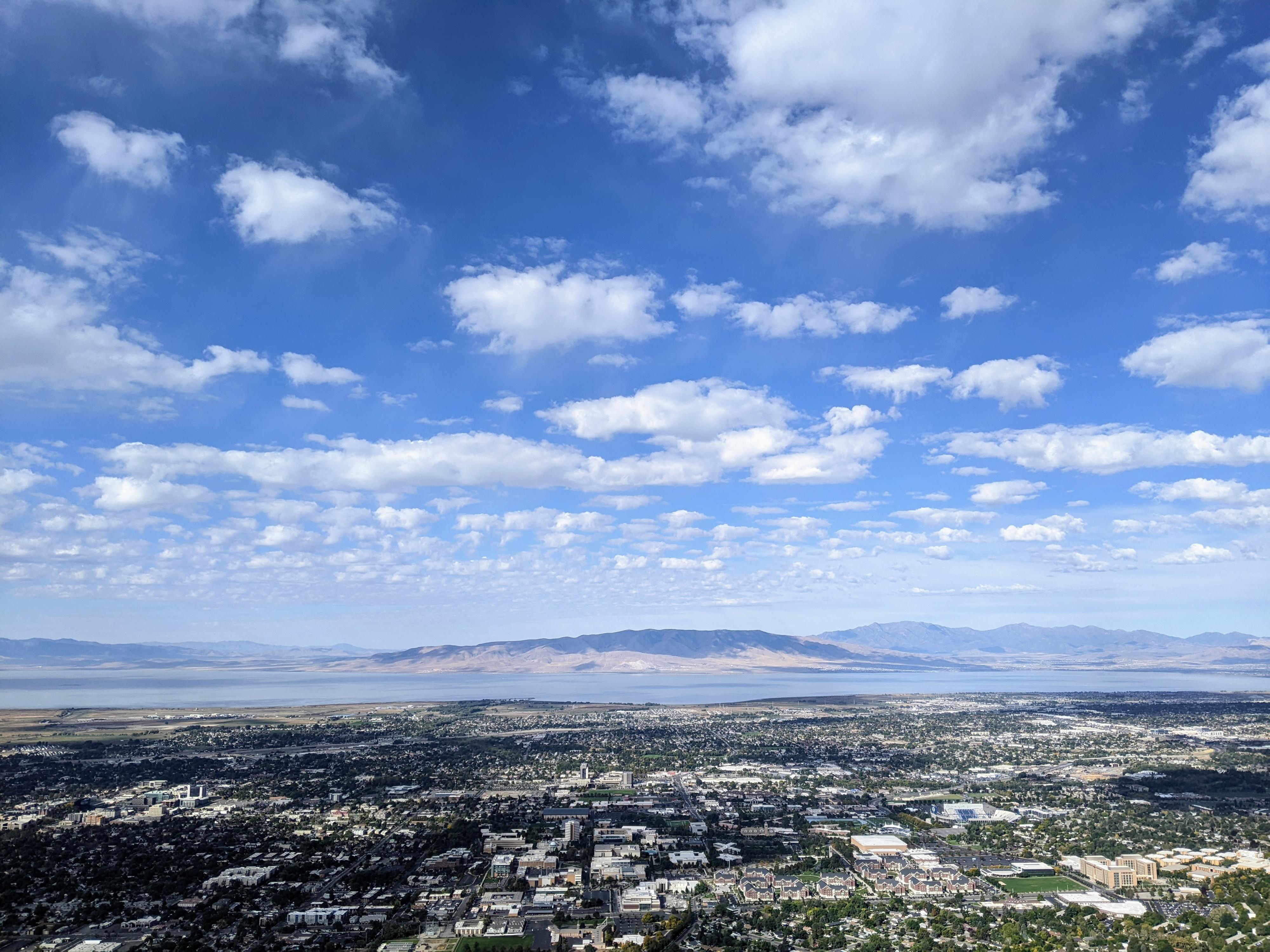
Follow the trail through the gate and up the wide path. Signs at each switchback will help encourage those that need it. There are thirteen switchbacks to go all the way to the top of the Y, and 10 if you want to stop at the base of the Y. It is a lovely and fun hike, with great views of the mountains, Utah Valley, and Utah Lake.
Maps
12T 446647E 4455120N
40°14'41"N 111°37'38"W
12T 447134E 4455332N
40°14'48"N 111°37'18"W
12T 447263E 4455489N
40°14'54"N 111°37'12"W