 Hiking
The Red Ledges Cave
Hiking
The Red Ledges Cave
Western Swell
Overview
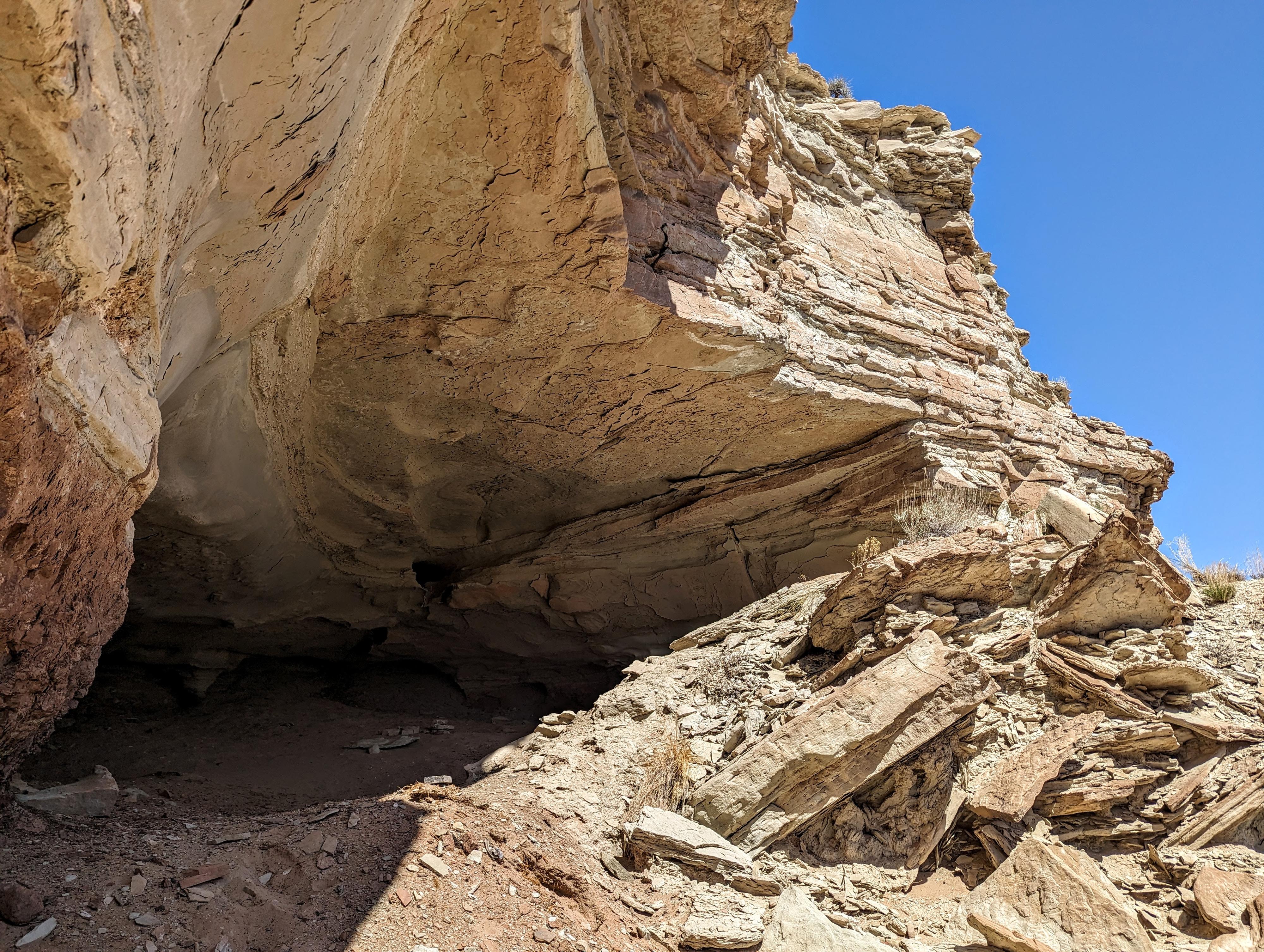
The Red Ledges Cave is a deep overhang in Red Ledges. The "cave" isn't visible from a distance, and is quite hidden in a small side canyon. I would have assumed, given the rock art nearby, that Native Americans would have occasionally used the cave at least as shelter. There isn't, that I could see, any signs of Native American use, however.
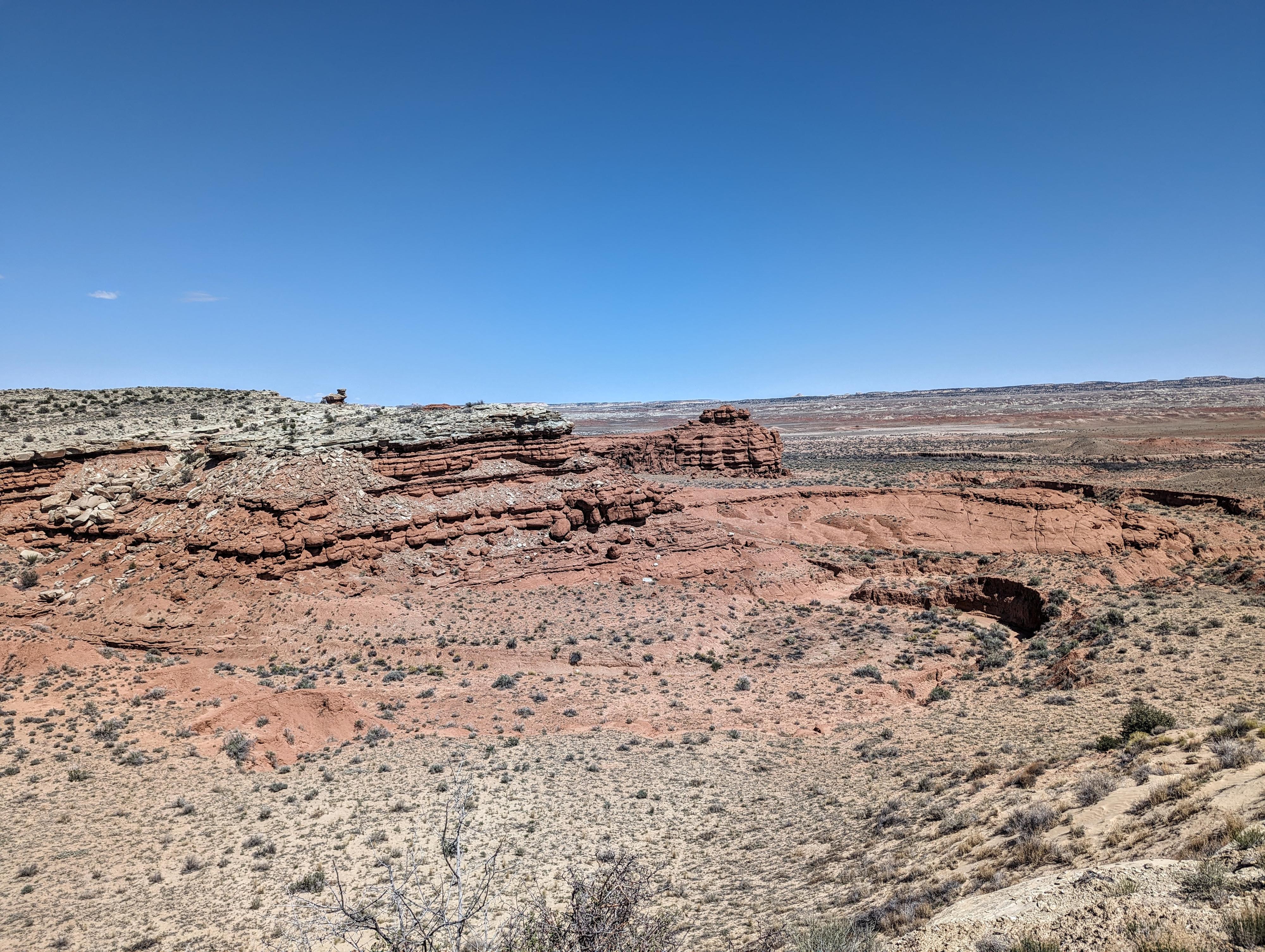
It is a short hike to visit the cave, so I recommend it if you are in the area and have a few minutes, though it is not a hike I would go out of my way to visit. The trail, a well-worn cattle trail, has nice broad views of the western Swell and was probably my favorite part of this short adventure.
Getting There
The first step is getting to Moore. This tiny community is about 50 miles south of Price Utah on UT-10, or just north of I-70, past the town of Emery. From Moore, take the Moore cutoff road that connects Moore to I-70. This is a paved, 2 lane road. Follow it about 8.5 miles from Moore to where a side road comes in on the left (north) side of the road just past mile marker 11. This is on a stretch section of the paved road. Reset your odometer as you turn off the paved road.
Route Description
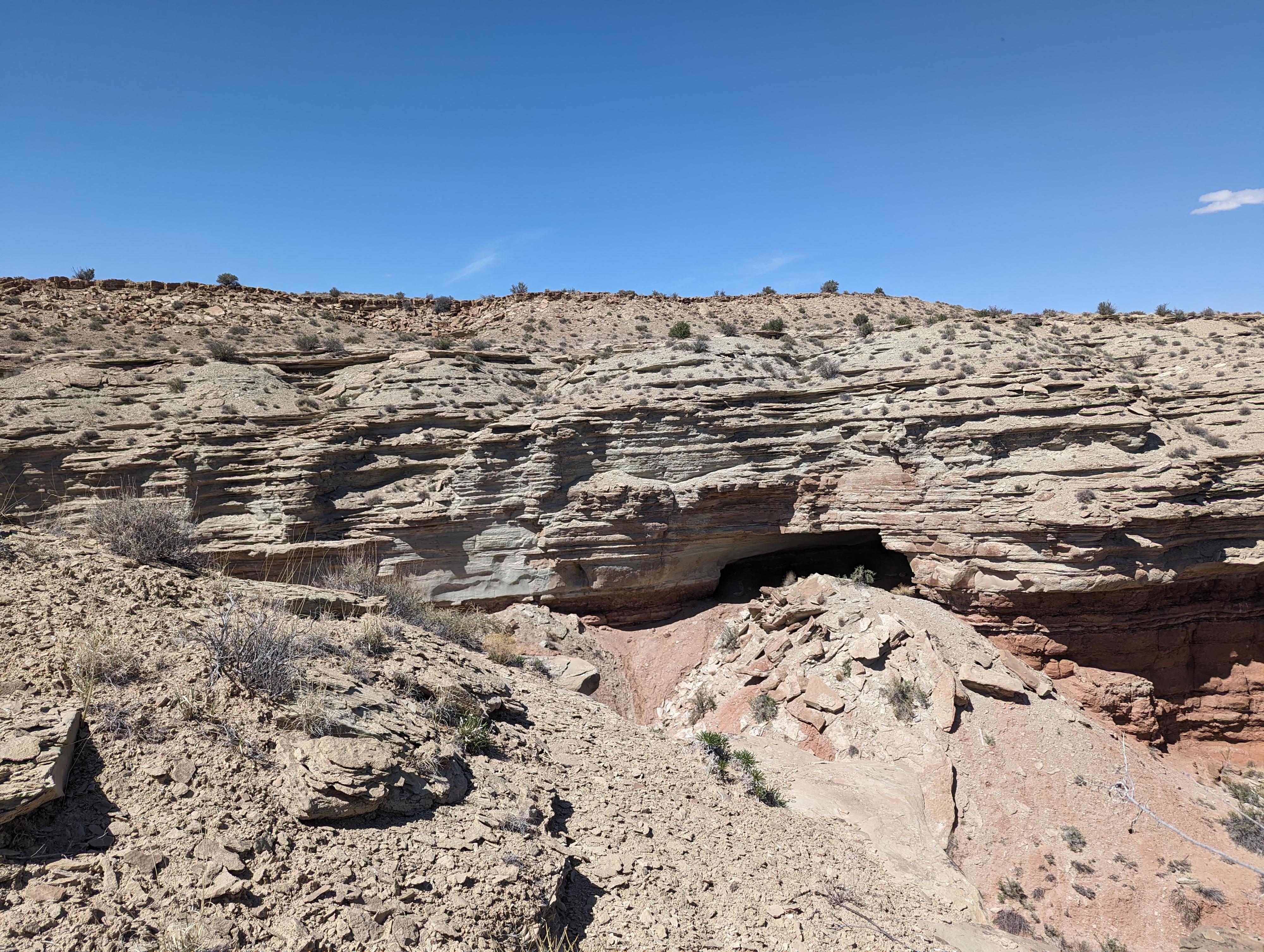
From the reservoir, follow the wash that comes out of the reservoir downstream. In a few minutes, it begins to drop quickly, and a cow trail crosses the wash. Follow the cow trail out the right (south) side of the wash. It heads southeast a short distance, then descends a steep sandy slope down The Red Ledges.
Once down, head left (north) along the base of the cliffs to the first drainage. This is the same drainage you were coming down earlier, but you have to detour on the cow trail to bypass obstacles.
Go left up the drainage, the cave is on the right a little above the stream level and difficult to spot until you are right to it.
Return the same way.
Maps

12S 500180E 4313294N
38°58'07"N 110°59'53"W
12S 500623E 4313187N
38°58'04"N 110°59'34"W
12S 500702E 4313340N
38°58'09"N 110°59'31"W