 Hiking
Alien Tower
Hiking
Alien Tower
Draper
Overview
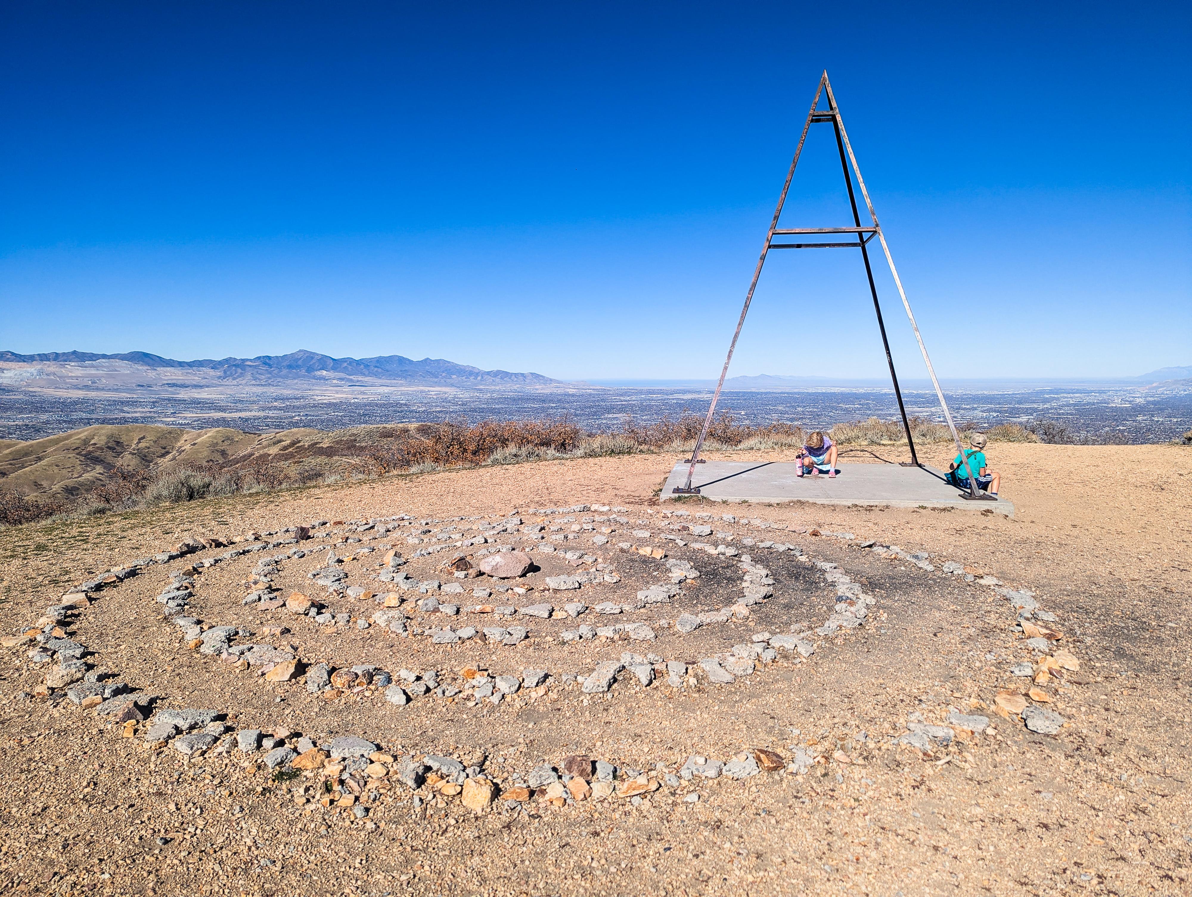
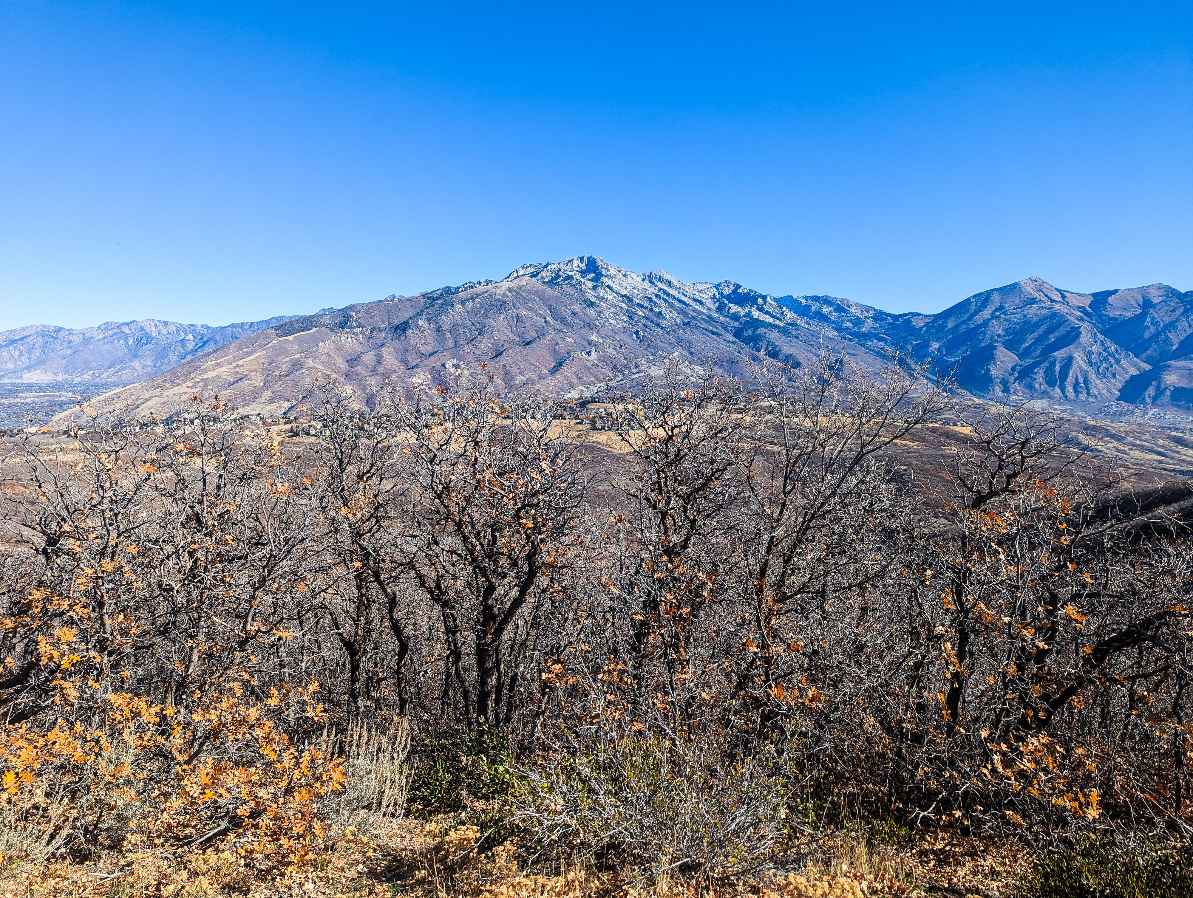
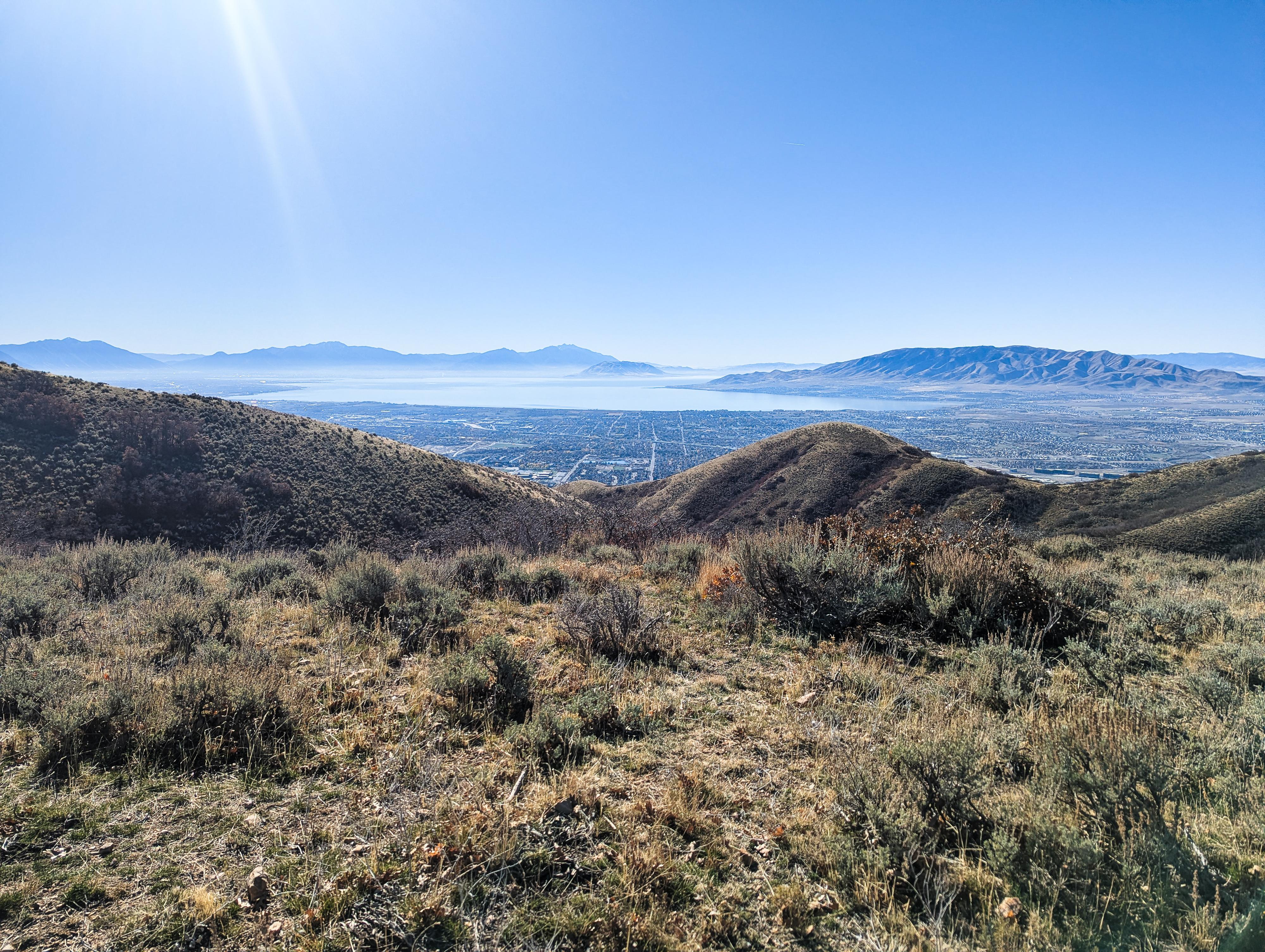
The Alien Tower is a pleasant family-friendly hike with some really nice views. You can see Great Salt Lake to the north and Utah Lake to the south. You also get a dramatic view of Lone Peak. The trail heads up a wide gravel path to the Alien Tower, which is an open metal pyramid on a concrete pad. When I was there, someone had made a stone labyrinth to wander through next to the tower. The only potential downsides of the hike are the lack of shade and the looseness of the gravel, which caused a few slips on our hike. Avoid this trail in the summer and watch your step and you will enjoy a nice little outing. As an added bonus, dogs are allowed off-leash on most of the hike.
The Alien Tower is a triangulation tower used to help surveyors accurately measure and map large areas of land. By placing these towers on high points, surveyors could see and measure the angles between them over long distances. This process, called triangulation, helped determine exact locations and distances on maps before the use of satellites or GPS. The tower on this hike is called View 2 by the National Geodetic Survey.
Getting There
The trailhead, Deer Ridge Off-Leash Dog Trailhead, is in the foothills above Draper. To reach it:
- Take exit 288 from I-15 S and head east off the highway on Highland Drive.
- About 1 mile from the highway, turn right onto Traverse Ridge Road.
- Follow Traverse Ridge Road for about 3.4 miles to Deer Ridge Drive.
- Follow Deer Ridge Drive about a mile to its end at the trailhead.
Route Description
From the parking area, head up on the wide gravel road/trail. Stay on the obvious wide path as you pass multiple junctions with smaller trails. You will walk in a counterclockwise direction heading gradually uphill until you can see the Alien Tower off to the southeast. Pass by the first spur trail you see and take the second, at about 1 mile from the trailhead.. This second trail heads off south from the gravel road and leads up the ridge to the Alien Tower.
When done visiting the tower, head back to the junction with the wide trail and keep walking in a counter-clockwise direction to finish the loop. Just before the wide trail comes to a dead end, head north on a narrow trail that will loop east and then north. We enjoyed looking at the Far Side Comics on some of the trail signs in this area that explain the origins of the names of the spur trails. After a few minutes, you will join up with the wide gravel trail that you began on. Take a right to return to the parking area.
Maps

12T 427941E 4480740N
40°28'27"N 111°51'00"W
12T 427390E 4479930N
40°28'01"N 111°51'23"W
12T 427671E 4479501N
40°27'47"N 111°51'11"W