
 Mouses Tank
Valley of Fire
Overview
Mouse’s Tank is one of my favorite hikes in Valley of the Fire State Park. Not only is the hike itself interesting, with petroglyphs and two potholes, the whole area is tempting for off-trail scrambling. I squeezed up a very short slot, saw two arches, and scrambled on slickrock, all off trail.
Mouse’s Tank is named for two potholes used by a Southern Paiute Indian (Little Mouse) who hid out in the area in the 1890s after being accused of killing two prospectors and other crimes. He was eventually found and killed while trying to escape his pursuers.
Getting There
Reach the park visitor center by taking exit 93 from I-15 if coming from the east ,or exit 75 if coming from the west (Las Vegas). From the highway, the route to the park is well signed. There is a fee to enter the park ($10 as of 2018 for day use).
From the Visitor Center, go north on the Mouse's Tank Rd/White Domes Rd for 1.2 miles to a well signed parking area on the right, and another parking area/picnic are on the left side of the road. This is the trailhead.
Route Description
Rock art and historic sites are fragile, non-renewable cultural resources that, once damaged, can never be replaced. To ensure they are protected, please:
- Avoid Touching the Petroglyphs: Look and observe, BUT DO NOT TOUCH!
- Stay on the Trails: Stay on the most used trails when visiting sites, and don't create new trails or trample vegetation.
- Photography and Sketching is Allowed: Do not introduce any foreign substance to enhance the carved and pecked images for photographic or drawing purposes. Altering, defacing, or damaging the petroglyphs is against the law -- even if the damage is unintentional.
- Pets: Keep pets on a leash and clean up after them.
- Artifacts: If you happen to come across sherds (broken pottery) or lithics (flakes of stone tools), leave them where you see them. Once they are moved or removed, a piece of the past is forever lost.
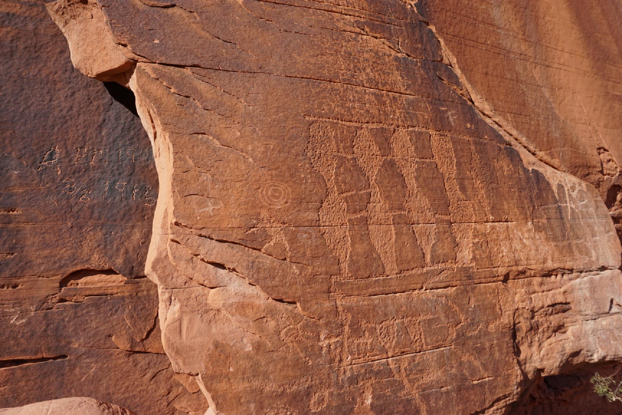
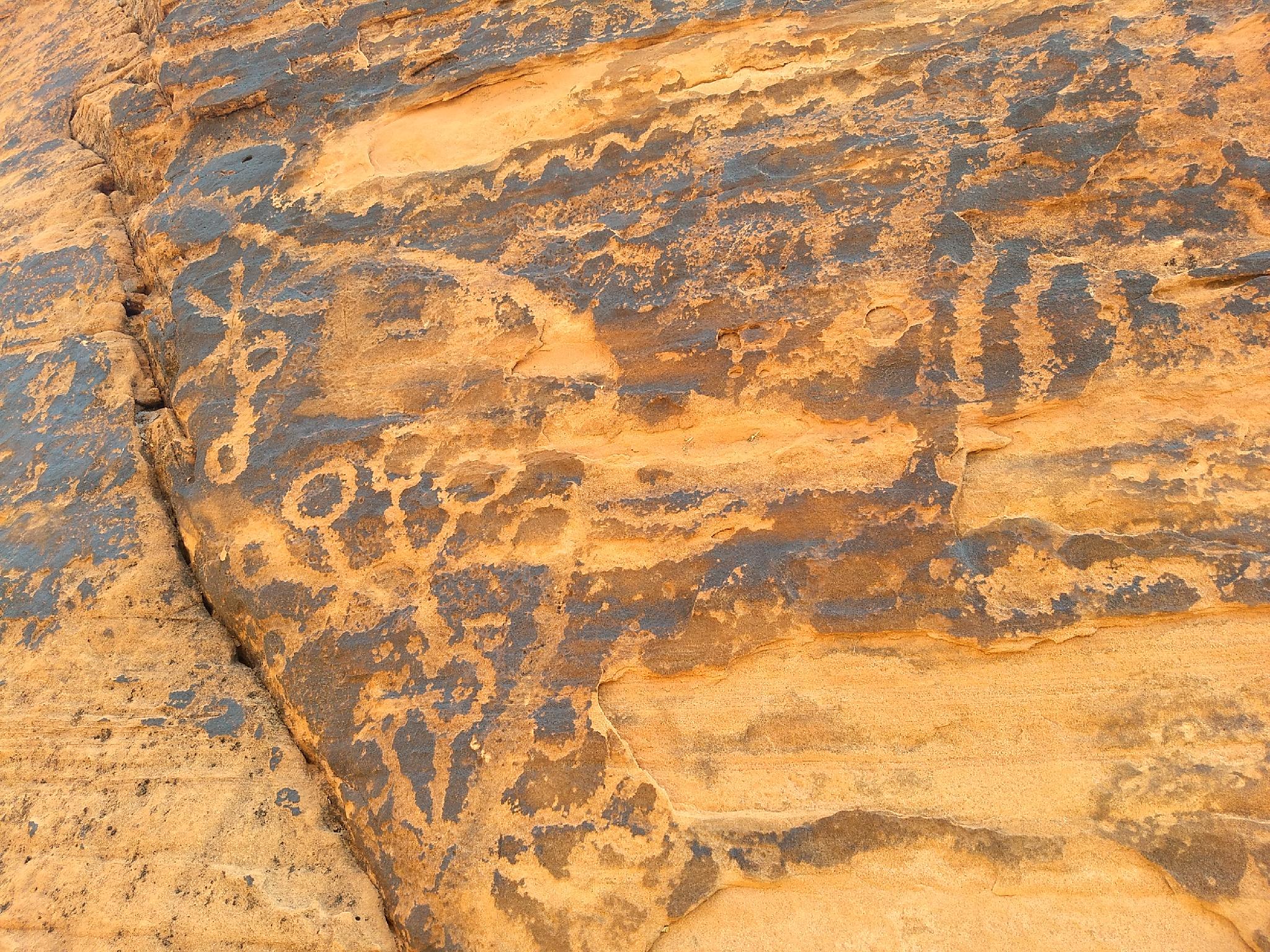
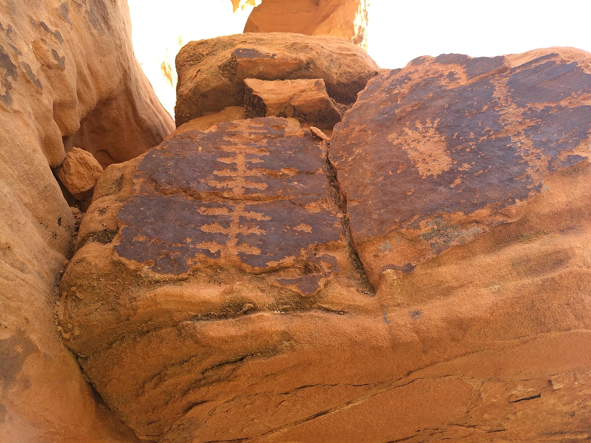
From the trailhead, follow the trail east. The trail is on loose sand through a shallow canyon. Keep an eye out for petroglyphs as you hike; the ones I saw were all on the left side and visible from the trail. Most are on black patina and are fairly weathered. There are a lot geometric designs as well as handprints, animals, and people.
Soon you will reach a sign indicating that the trail ends soon. Head left here to a large open sandy area. Look into the narrow gap between the sandstone to see the tanks. Both were quite full when I was there in December; the tanks are well shaded and likely hold water most of the year most years. You can scramble up the rock to the left of the tanks to get a view down into the tanks.
After enjoying the tanks, head back to the trail and continue up the canyon a few minutes further. There will be a short slot with an arch up to your right. The temptation to keep scrambling is high.
Maps

11S 722607E 4035730N
36°26'28"N 114°30'59"W
11S 722969E 4035350N
36°26'15"N 114°30'45"W
11S 722990E 4035393N
36°26'16"N 114°30'44"W
11S 723008E 4035302N
36°26'13"N 114°30'43"W