 Canyoneering
Fallen Angel Canyon
Canyoneering
Fallen Angel Canyon
Angel Cove
Overview
Fallen Angel is my least favorite of the Angel Slots. The canyon is short, with quite a bit of crumbly rock and somewhat light anchors. There were no recent signs of passage on our descent, and several anchors required placement or replacement. Because of this, it is probably best left for intermediate or better canyoneers with decent natural anchor skills.
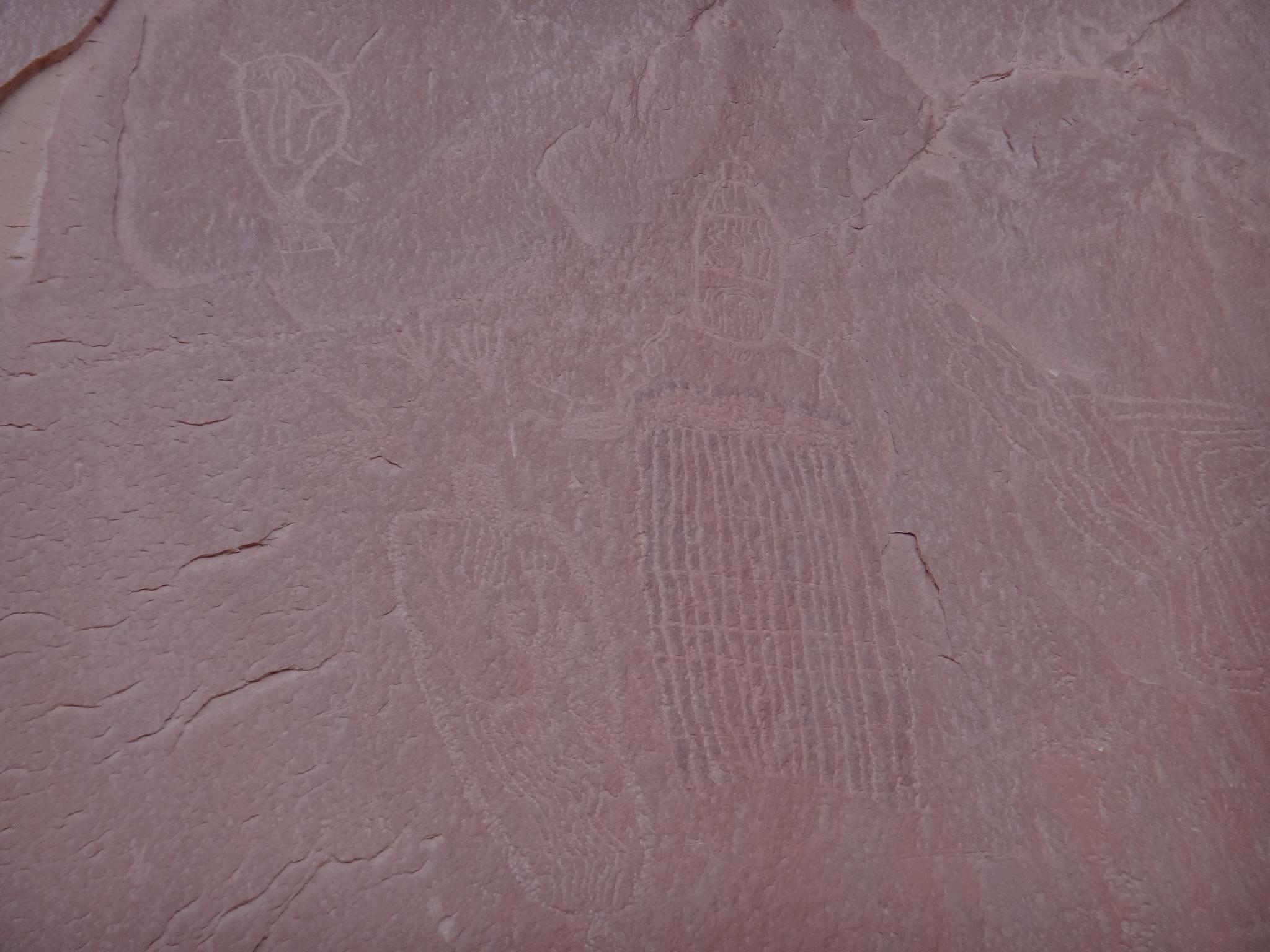
Once down the short canyon, the exit hike is marvelous, passing a pictograph and petroglyph panel along the Dirty Devil before climbing an elegant exit route up the slickrock back to the trailhead. This is the same exit as Angel Cove Slot.
Getting There
Go south out of Hanksville on Highway 95 toward Hite for 10 miles. Just after mile marker 10, on the left (east) side of the road is a dirt road signed Angel Point. Stay on the main road unless directions indicate otherwise.
Route Description
Rock art and historic sites are fragile, non-renewable cultural resources that, once damaged, can never be replaced. To ensure they are protected, please:
- Avoid Touching the Petroglyphs: Look and observe, BUT DO NOT TOUCH!
- Stay on the Trails: Stay on the most used trails when visiting sites, and don't create new trails or trample vegetation.
- Photography and Sketching is Allowed: Do not introduce any foreign substance to enhance the carved and pecked images for photographic or drawing purposes. Altering, defacing, or damaging the petroglyphs is against the law -- even if the damage is unintentional.
- Pets: Keep pets on a leash and clean up after them.
- Artifacts: If you happen to come across sherds (broken pottery) or lithics (flakes of stone tools), leave them where you see them. Once they are moved or removed, a piece of the past is forever lost.
Approach (20-30 minutes)
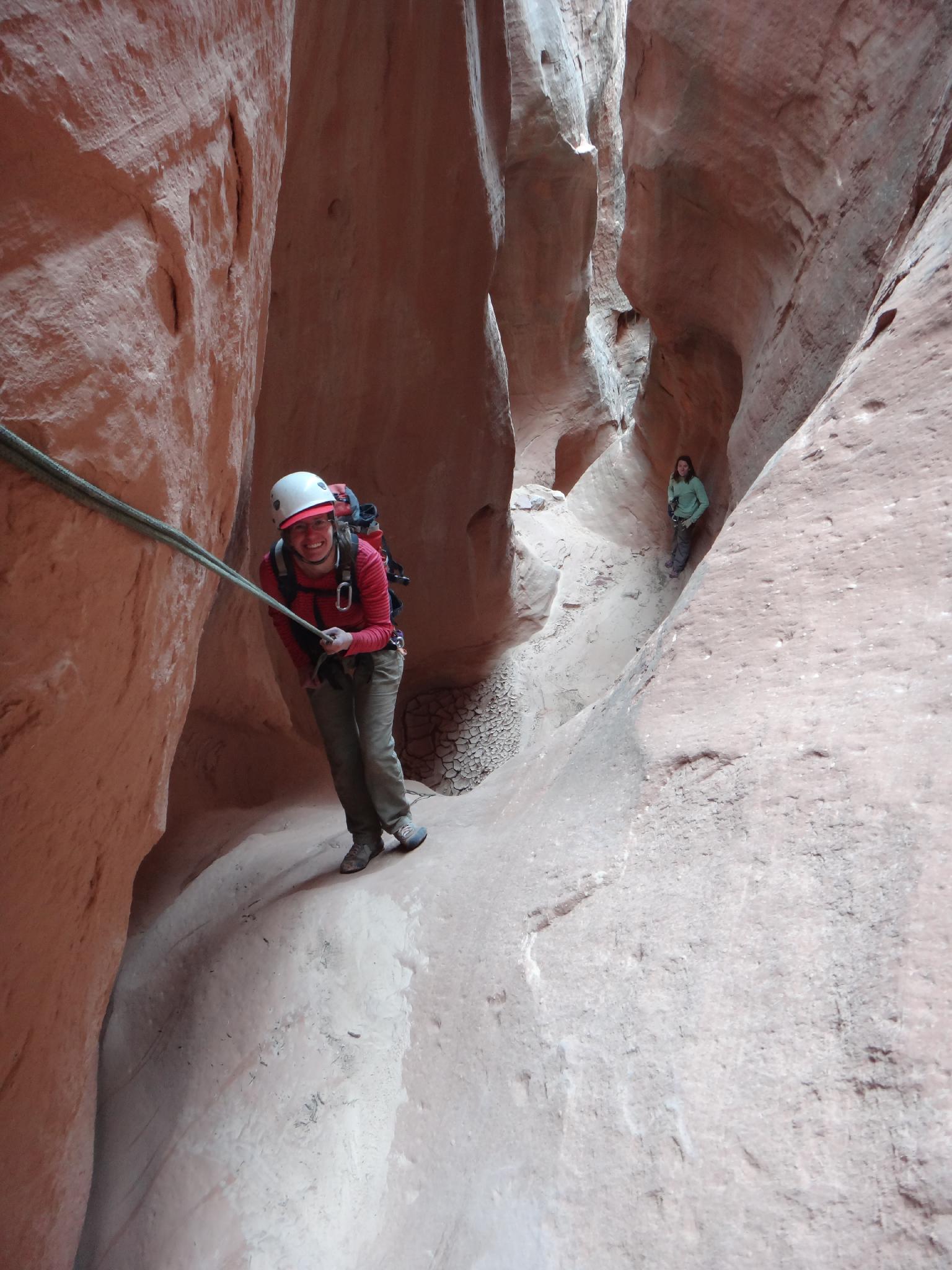
From the trailhead, follow the well worn trail down, across Angel Cove Slot, and north east as it meanders along. After passing a small hill on your left, where the trail begins heading due east to the Dirty Devil, leave the trail and hike due north, up a small hill just before Fallen Angel Canyon.
A short descent off the hill leads to the head of Fallen Angel, with the first rappel a minute or two down canyon where the canyon drops into slickrock.
Canyon
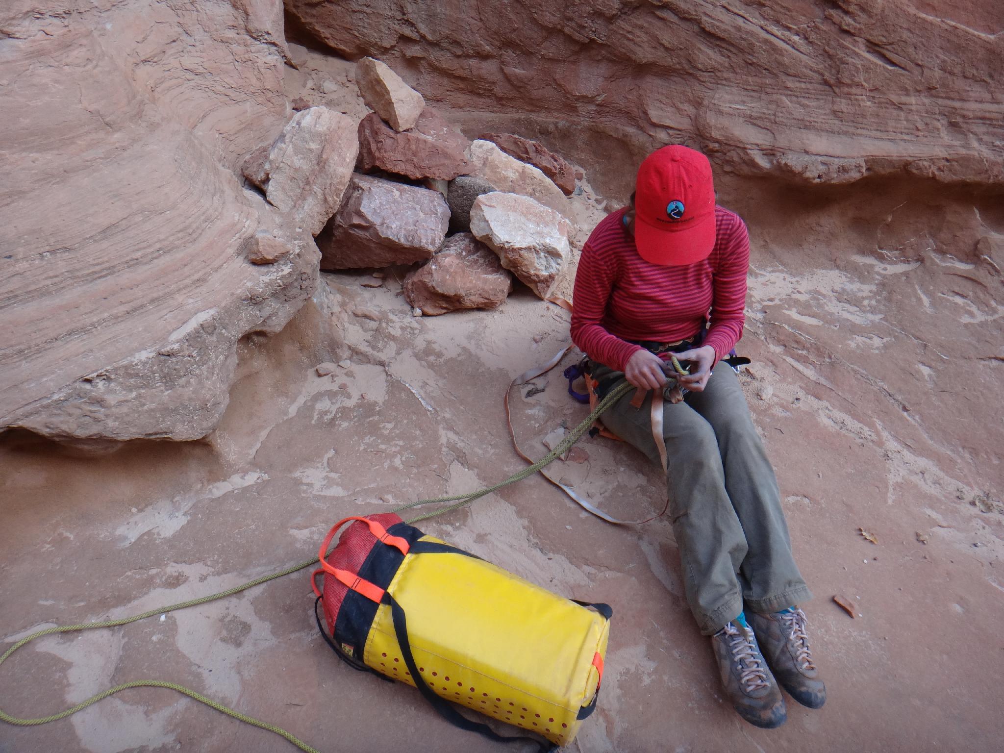
Let the fun begin, with about a 27 m ( 89 ft. ) rappel into the canyon head. Choose a good anchor here. There are lots of boulders, but also lots of crumbly rock. The canyon is wide at this point.
Rappel 2 is shortly down canyon, and about 10 m ( 33 ft. ) where the canyon begins to deepen.
Rappel 3 is about 20 m ( 66 ft. ) off a boulder.
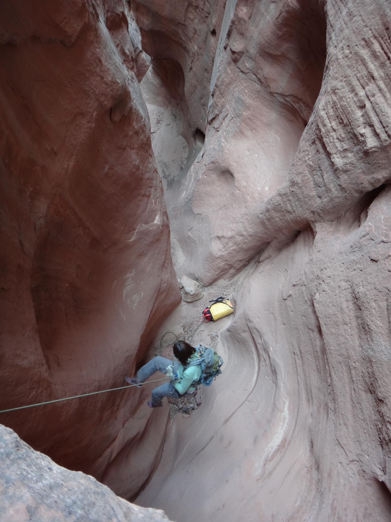
Rappel 4 is 30 m ( 99 ft. ), and two stages. It ends with a steep slide. Many may want a hand-line for this, though it is not as bad as it looks. A partner assist downclimb just after the slide puts you at rappel 5.
Rappel 5 is about 22 m ( 73 ft. ), down 2 stages. Just after this rappel, the canyon opens broadly.
Strolling down a couple of minutes leads to the final 22 m ( 73 ft. ) rappel. Just below this is a short drop. It could be rappelled, but can also be downclimbed on the left with a bit of skill, or short jump.
Exit
Head down canyon to the edge of the willows along the Dirty Devil, and follow an emerging trail downstream. It stays near the cliff base. As you pass under the tallest cliff (this has been B.A.S.E. jumped), look for a pictograph and petroglyph panel. The pictograph panel is first, and on the downstream side of the cliff in an arch type feature near the ground. The petroglyph panel is just past this on the same wall.
Continuing on, you may spot another small petroglyph panel just after Angel Slot comes in on the right. This is an important land mark, the exit route leaves the Dirty Devil just after Angel Cove Slot. Go downstream a short distance (5 minutes) until you can climb out on the right up a level and to a small wash.
The trail splits. The easiest path (left fork) is to go up the wash, to where it is possible to climb out on the right up the first section of slickrock. (Class 3 with a move or two or 4-). The right fork climbs a small slab (easy fifth class) up a level directly, then traverses south to rejoin the wash at its head where the steep slickrock begins.
Up the first section of slickrock, notice the large overhang on the skyline. The goal is to get to the base of it. The easiest way is to traverse right to the ridge, then follow the slickrock ridge line up. There is a 4th class move or two to get onto the ridge, then it is class 3 if you find the path of least resistance. Once below the large overhang/cave, traverse right 1-2 minutes until you can find a way up the slickrock. The final red cliff band is 2 m ( 7 ft. ) tall, and is easier than it looks to surmount. (Class 4)
Once on the mesa, follow the rim of the south fork to its head, then go north / northwest back to the trailhead.
Photos
Maps

12S 539591E 4241070N
38°19'01"N 110°32'50"W
12S 539996E 4241810N
38°19'25"N 110°32'33"W
12S 540463E 4241283N
38°19'08"N 110°32'14"W
12S 540709E 4241126N
38°19'02"N 110°32'04"W
12S 540380E 4240938N
38°18'56"N 110°32'17"W