 Hiking
Lower Calf Creek Falls
Hiking
Lower Calf Creek Falls
Escalante
Overview
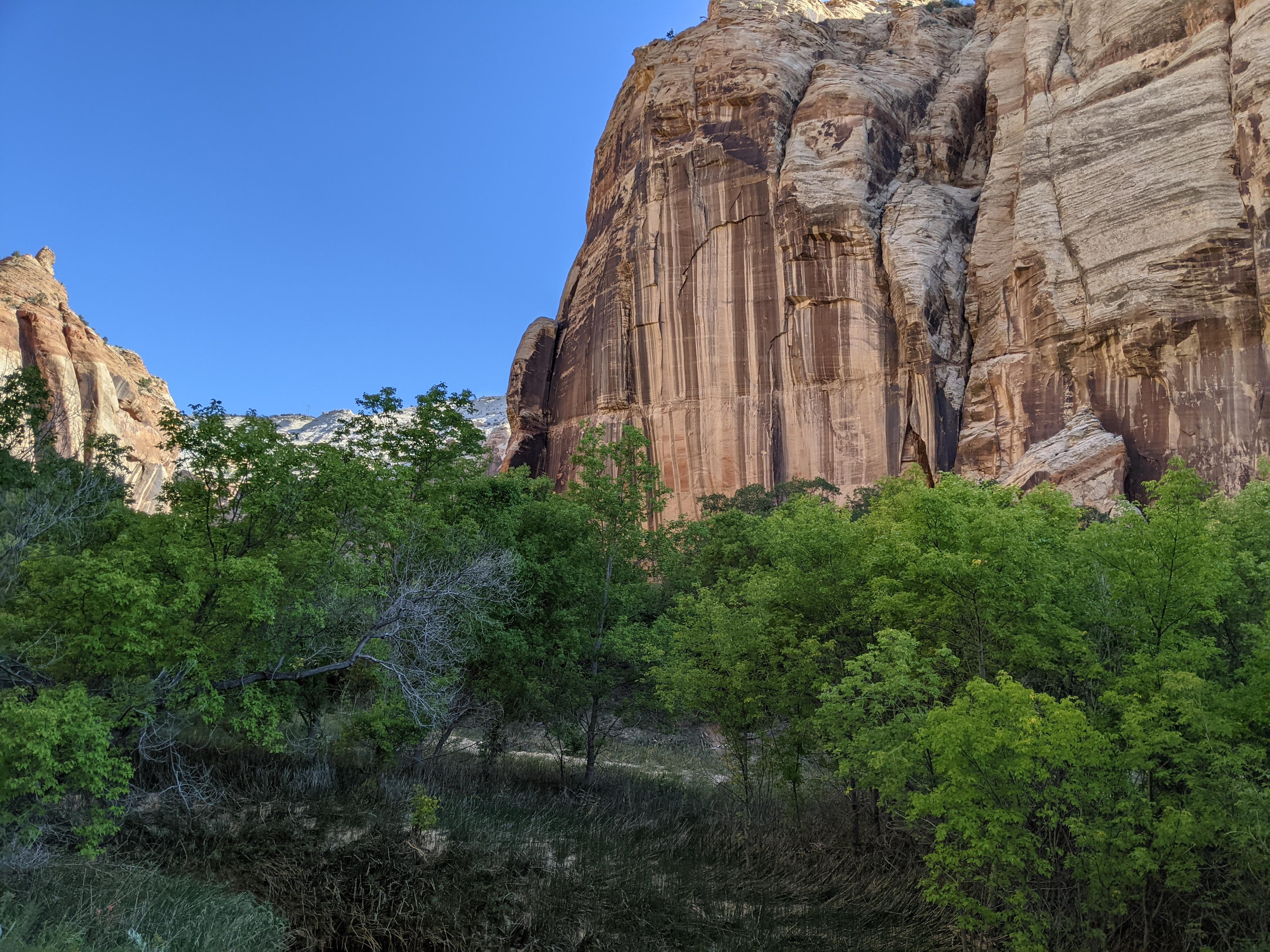
The 38 m ( 125 ft. ) Lower Calf Creek Falls is likely the most photographed and visited waterfall on the Colorado Plateau. It is a gem! The hike to the falls is stunning. At a bit over 7 miles with about 500’ of elevation change, the hike is popular with all, including families. Interpretive signs along the trail, at least to my preschooler, really kept the hike engaging and. Interesting. She was excited to hear each short bit of information and help hunt down the signs.
The hike does get full sun during much of the day with intermittent spots to rest in the shade. This is NOT a hike to do mid-day on a hot summer unless you are very heat tolerant and carry lots of water. I have done the hike many times over the years. My recommendation is to hike it early in the morning in Spring, Summer, and Fall. The lighting in those seasons is stunning in the morning and you will be back before the heat of the day sets in. Winter hikes I prefer mid-day when hopefully a bit of warm enters the canyon.
Because it is popular, busy seasons can find the trailhead packed with cars parking all the way back to and along highway 12. An early start will likely ensure easier parking and far less crowds. On my last busy fall visit we started the hike at 8:30AM and there were only 2 other groups at the falls. On the way out, however, we passed dozens of groups and the parking was quite congested.
Getting There
Head east out of the town of Escalante about 15 miles on highway 12 until mile marker 75. Lower Calf Creek campground is signed on the left. The trail starts at the campground.

Route Description
Rock art and historic sites are fragile, non-renewable cultural resources that, once damaged, can never be replaced. To ensure they are protected, please:
- Avoid Touching the Petroglyphs: Look and observe, BUT DO NOT TOUCH!
- Stay on the Trails: Stay on the most used trails when visiting sites, and don't create new trails or trample vegetation.
- Photography and Sketching is Allowed: Do not introduce any foreign substance to enhance the carved and pecked images for photographic or drawing purposes. Altering, defacing, or damaging the petroglyphs is against the law -- even if the damage is unintentional.
- Pets: Keep pets on a leash and clean up after them.
- Artifacts: If you happen to come across sherds (broken pottery) or lithics (flakes of stone tools), leave them where you see them. Once they are moved or removed, a piece of the past is forever lost.
From the parking area, follow the campground road a few hundred yards to the trail proper on the left before the campground round crosses Calf Creek. The trail climbs a short bit, then levels out as it meanders up the canyon bottom.
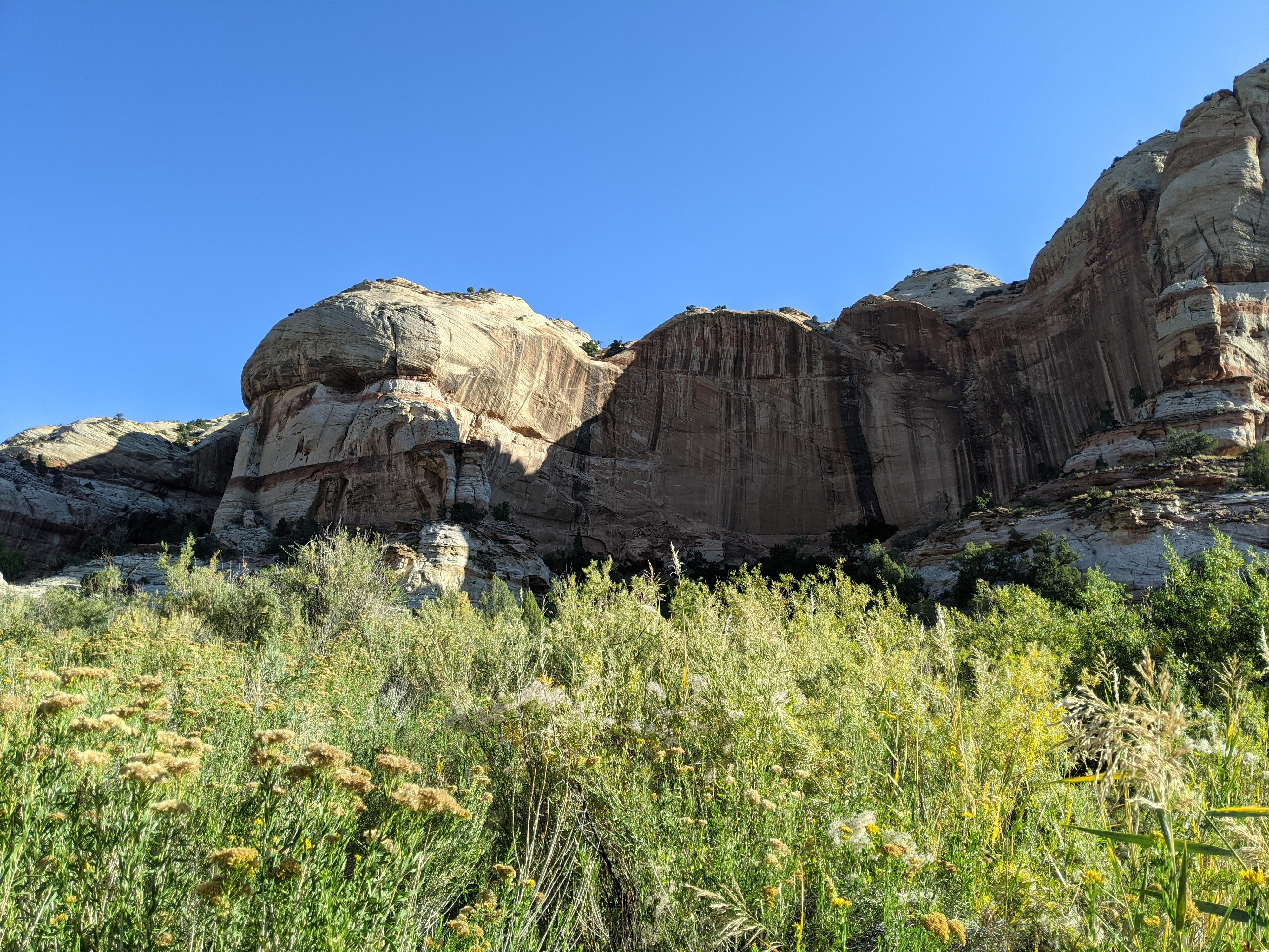
About 1.25 miles from the parking is interpretative marker 5. This is one not to miss! Across the canyon, on the east side, are several granaries. These are very high on the cliff and take most groups a few minutes to spot. Binoculars helpful.
About 1.8 miles from the parking area is interpretative marker 8. This is another one not to miss. Across the canyon, near the base of the cliff, are 3 red pictograph figures. These are visible with the naked eye, but binoculars give a better view.
The falls are, according to my track, about 3.1 miles from the trailhead and about 3.4 miles from the parking area. (6-7 miles round trip) The base of the falls is an excellent place to take in the views and spend a bit of time.
Photos
Maps

12S 463475E 4183027N
37°47'38"N 111°24'53"W
12S 463584E 4183231N
37°47'45"N 111°24'49"W
12S 463793E 4184521N
37°48'26"N 111°24'41"W
12S 463584E 4185096N
37°48'45"N 111°24'49"W
12S 463280E 4185364N
37°48'54"N 111°25'02"W
12S 463029E 4186945N
37°49'45"N 111°25'12"W