 Hiking
The Golden Cathedral
Hiking
The Golden Cathedral
Escalante
Overview
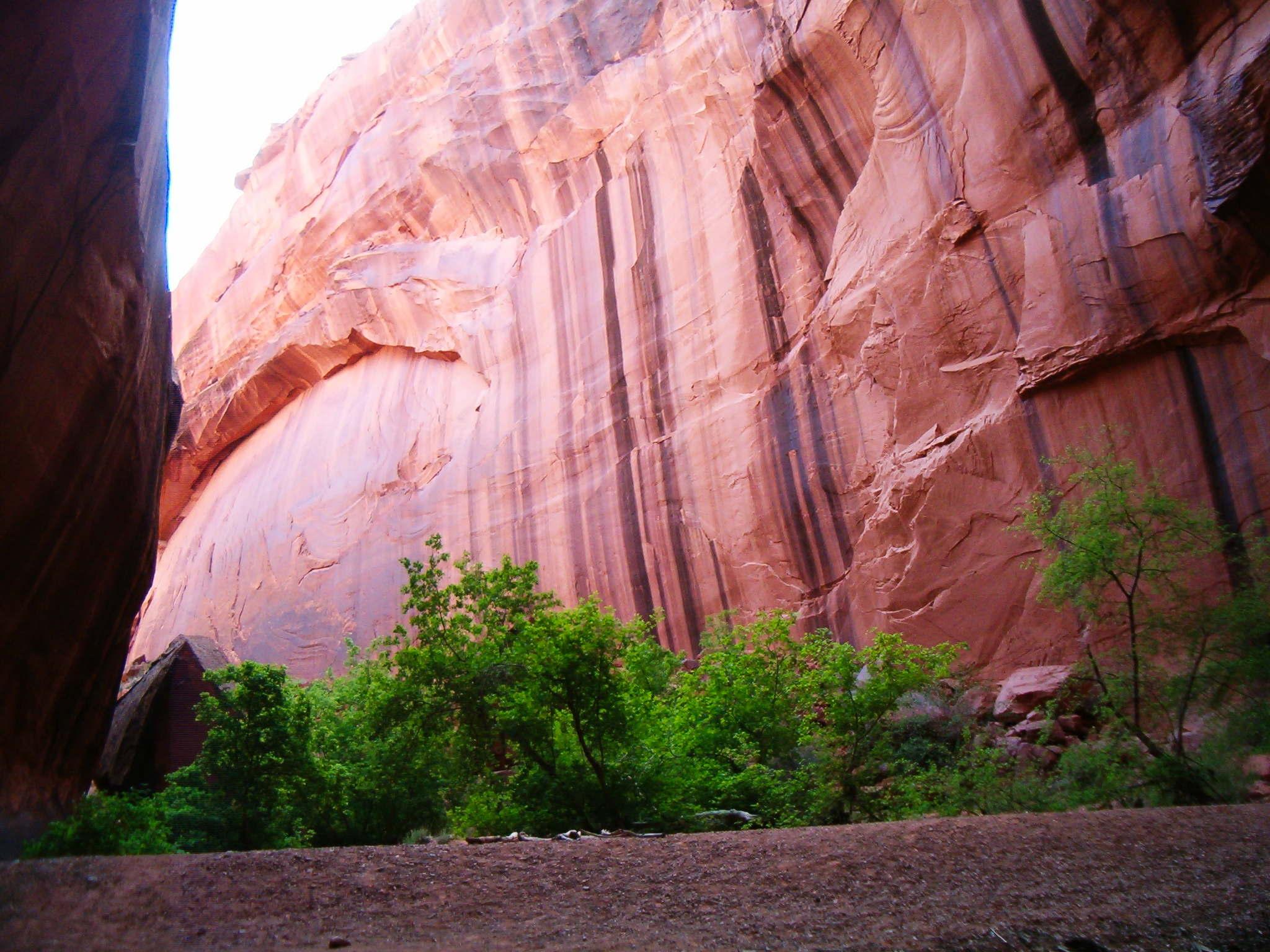
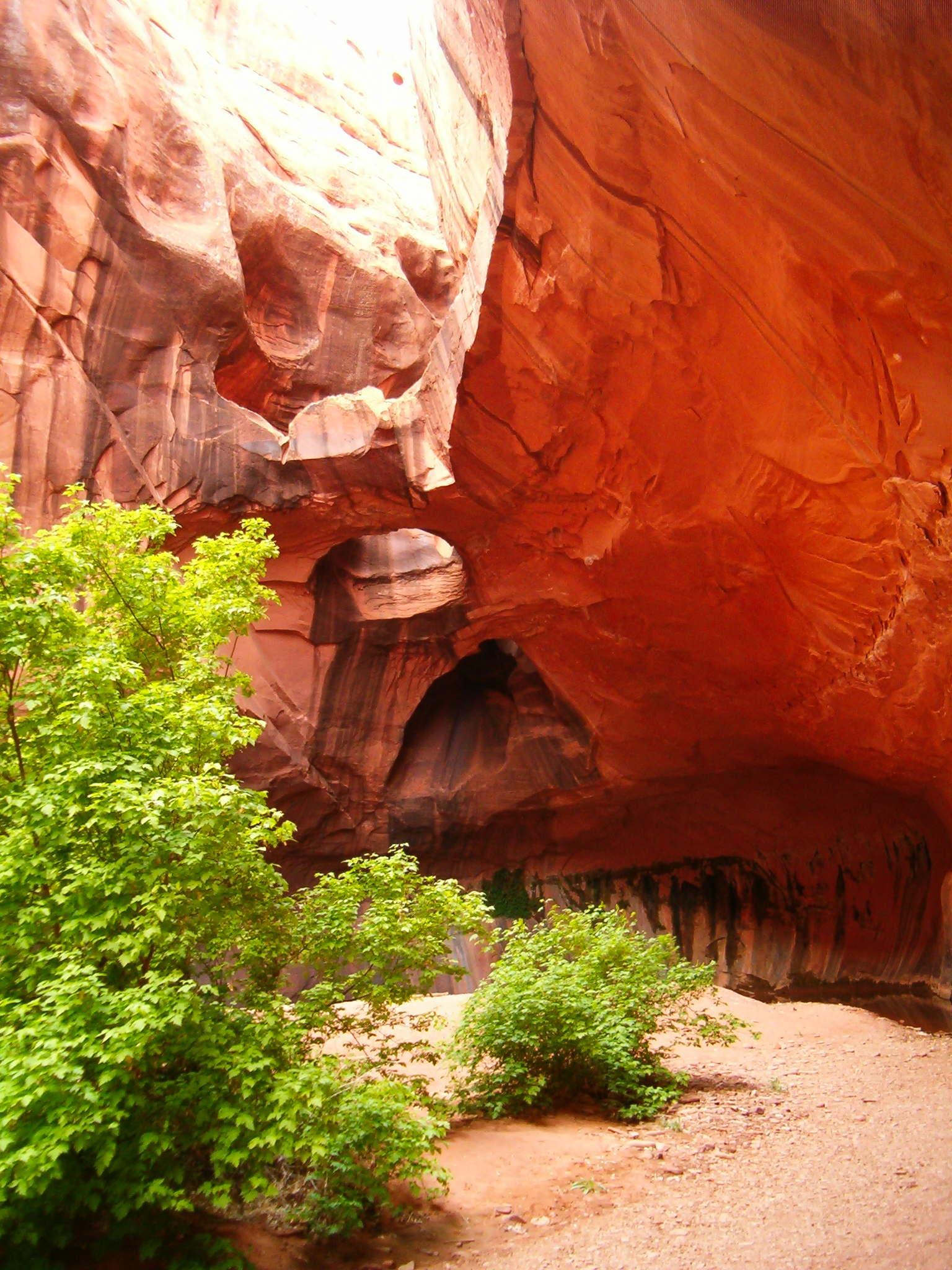
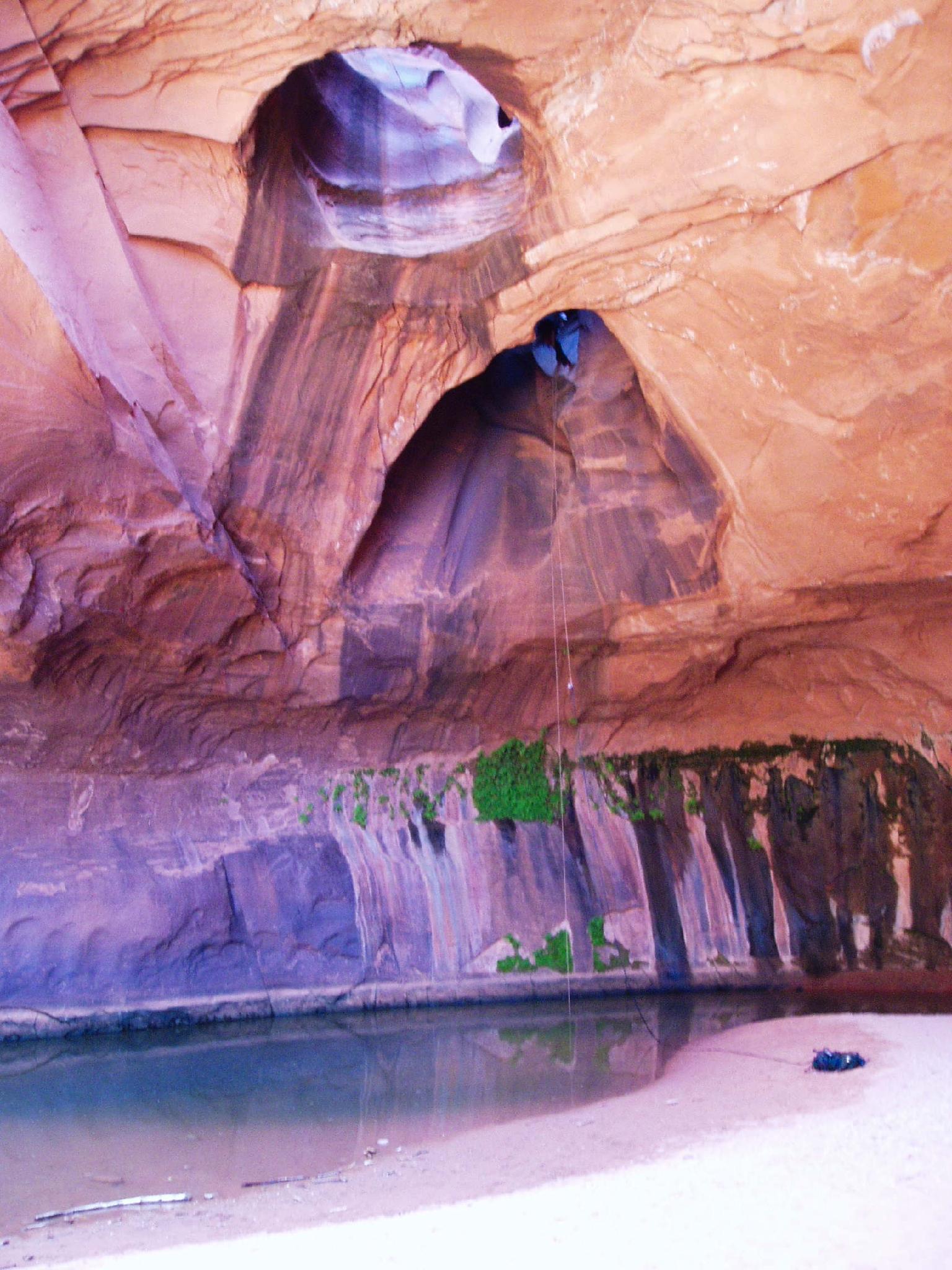
The Golden Cathedral is THE iconic photo of the Grand Staircase-Escalante area. This is the place you've seen in books, calendars, and posters. It is a stunning natural bridge in lower Neon Canyon that will take your breath away!
For canyoneers, see the Neon Canyon for doing the canyon as a technical canyoneering adventure. Hikers will find this a lovely amble from Egypt Bench, down to the Escalante River, and then a short hike up Neon Canyon to the Golden Cathedral proper. The hike CAN be done as a day hike but makes for an even more pleasant backpack. Camping along the river is sublime, and wandering up or down the river and visiting side canyons makes for a delightful wander.
Getting There
Head east out of the town of Escalante about 5 miles on highway 12 until the well signed Hole in the Rock road.
Route Description
There are two approaches to the Golden Cathedral, both start at Egypt Bench. The first approach, down Fence Canyon, is the most common and on a well-cairned trail. Camping near the river at Fence Canyon is excellent and recommended. The second approach is cross country directly to the river near Neon. This is less scenic and requires a bit more route finding, but is shorter. If doing this as a day hike, cross country is probably the ticket.
Fence Canyon
Find the well traveled and cairned trail heading down the slickrock to Fence Canyon. The trail is generally well cairned and easy to follow. Follow it about 1.5 hours down to the river. There are excellent campsites near the river.
From Fence Canyon, go right downstream. Neon Canyon is the first side canyon coming in on the left in about 0.8 miles. (20-30 minutes)
Cross Country
From the trailhead, locate the dome just to the right of Neon Canyon off in the distance (consult map/pictures below). Aim for the dome during the approach.
Find the well traveled and cairned trail heading down the slickrock to Fence Canyon. Follow this down off the initial steep slickrock, and then head cross country aiming for the dome. You will lose sight of the dome a time or two as the country dips down, but keep heading in that direction. Social trails you can follow appear off and on. As you near the river, a well-defined social trail drops steeply down a sand hill and deposits you just upstream from Neon Canyon. At a moderate pace, it should take 1-1.5 hours to reach the river from the car.
Up Neon
Hike up Neon Canyon. From its mouth, it is about 0.75 miles to the Golden Cathedral.
Maps

12S 480717E 4160722N
37°35'36"N 111°13'06"W
12S 485183E 4162201N
37°36'24"N 111°10'04"W
12S 484155E 4162838N
37°36'45"N 111°10'46"W