 Hiking
Fiftymile Creek
Hiking
Fiftymile Creek
Hole In The Rock Road
Overview
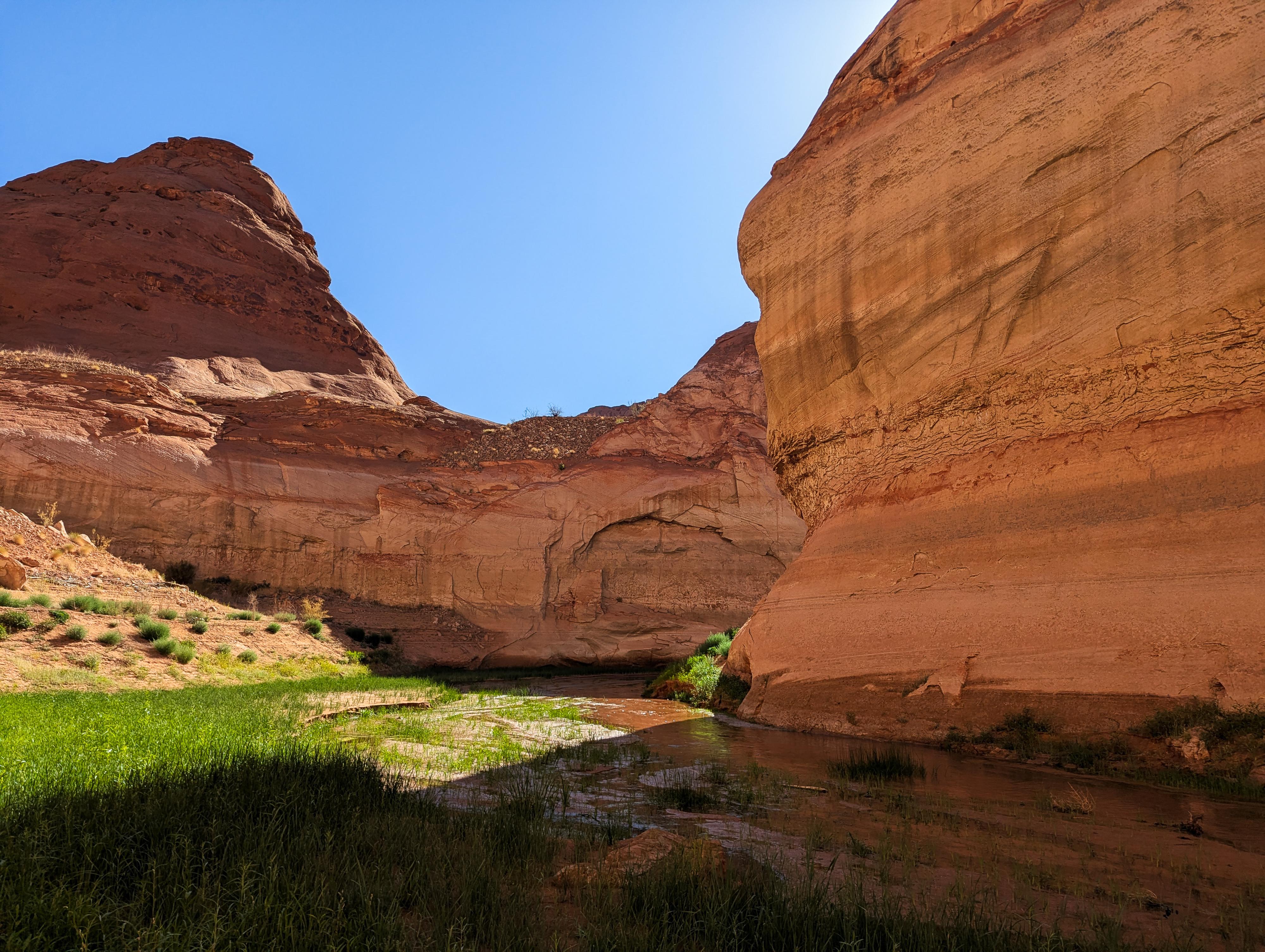
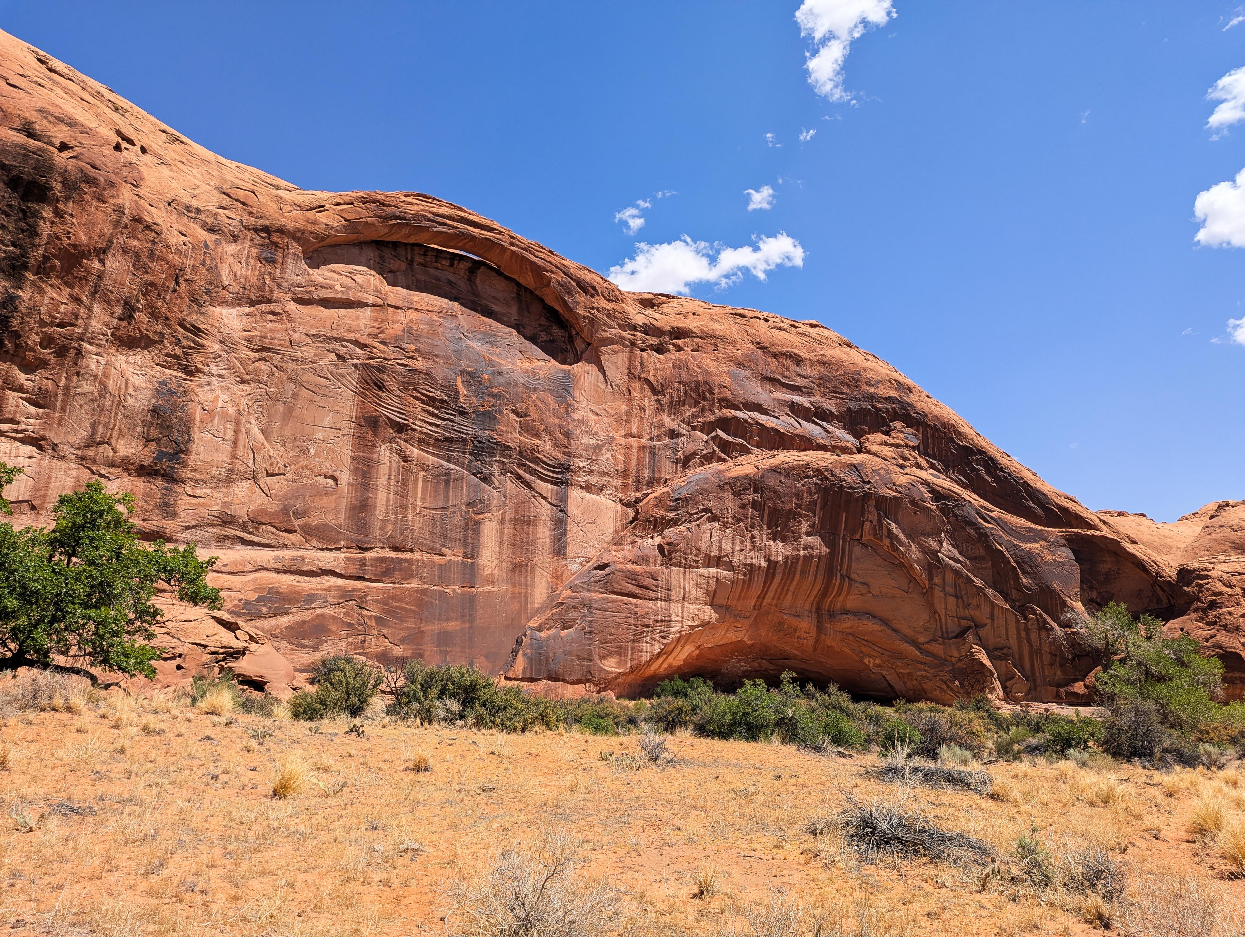
Tucked away in the rugged and remote Grand Staircase-Escalante National Monument, Fiftymile Creek is an often overlooked gem. This canyon, a tributary of the larger Escalante River and Lake Powell drainage system, has towering Navajo sandstone walls and sculpted narrow sections with riparian vegetation that adds a splash of green to the desert palette. There is even an extensive rock art panel and arch in the canyon. The hike into Fiftymile Creek is a classic Escalante experience: dramatic geological formations, challenging terrain, and a sense of timelessness found only in the most secluded corners of the Colorado Plateau.
Depending on the current level of Lake Powell, Fiftymile Creek can be a fairly long canyon. On my visit, with a lake level at 3,560', the round-trip distance from the trailhead to near the lake was a bit over 16 miles. The distance, coupled with terrain and some bushwacking, make this a very strenous day hike. It would be a more moderate overnight backpack. The best sections, to my eye, begin where the Lake Powell highwater mark is, about 5 miles one way from the trailhead.
Given the length and difficulty, this is an outing that is best suited to experienced desert hikers. If just going to the rock art panel and arch, then returning, it would be suitable to most and make for a great 3-4 hour hike.
Getting There
Head east out of the town of Escalante about 5 miles on highway 12 until the well signed Hole in the Rock road on the south side of highway 12. Reset the odometer as you turn onto this road.
Route Description
Rock art and historic sites are fragile, non-renewable cultural resources that, once damaged, can never be replaced. To ensure they are protected, please:
- Avoid Touching the Petroglyphs: Look and observe, BUT DO NOT TOUCH!
- Stay on the Trails: Stay on the most used trails when visiting sites, and don't create new trails or trample vegetation.
- Photography and Sketching is Allowed: Do not introduce any foreign substance to enhance the carved and pecked images for photographic or drawing purposes. Altering, defacing, or damaging the petroglyphs is against the law -- even if the damage is unintentional.
- Pets: Keep pets on a leash and clean up after them.
- Artifacts: If you happen to come across sherds (broken pottery) or lithics (flakes of stone tools), leave them where you see them. Once they are moved or removed, a piece of the past is forever lost.
To the Panel and Arch (3.6 miles)
From the trailhead, walk down the shallow canyon. Cow and hiker trails make the walking fairly easy. About 1.2 miles from the trailhead, the canyon cuts into sandstone at a dryfall. Follow a social trail and cairns on the left rim down canyon a couple of minutes to where it descends back into the canyon bottom and continue hiking down the canyon.
About 2.2 miles from the trailhead, there is an overhang/cave on the left. Some have said this shows signs of habitation from native peoples, but I didn't notice any. A few minutes down the the cave, a side fork join in on the right.
From where the side canyon comes in on the right, Fiftymile Creek slowly begins to change as water starts to intermittently flow and vegitation becomes more and more prevalant.
About 3.2 miles from the trailhead, an arch is visible high on the left rim, with a deep overhang just downstream from the arch. The wall directly underneath the arch is home to a large petroglyph panel. Some figures are 15+ feet off the ground! It is complex and large site. I visited in the early morning when it was in shade, then revisited it later in the day when it was in full sun. For viewing and photographing, I think full sun is better.
Arch to the Sandslide Exit (0.5 miles)
Continuing down from the arch, in about 1/2 a mile, a large sand hill comes in on the right. This is known as the sand hill exit, and allows access in or out of the canyon. It seems easy to climb by starting on the upstream side of the sandhill. There are many options.
Sandslide to Lake Powell High Water Mark (1.35 miles)
Fiftymile Creek is quite riparian now, with a fair bit of wandering through dense vegetation. Sometimes it seems easiest to stay in the watercourse, sometimes to try and cut corners.
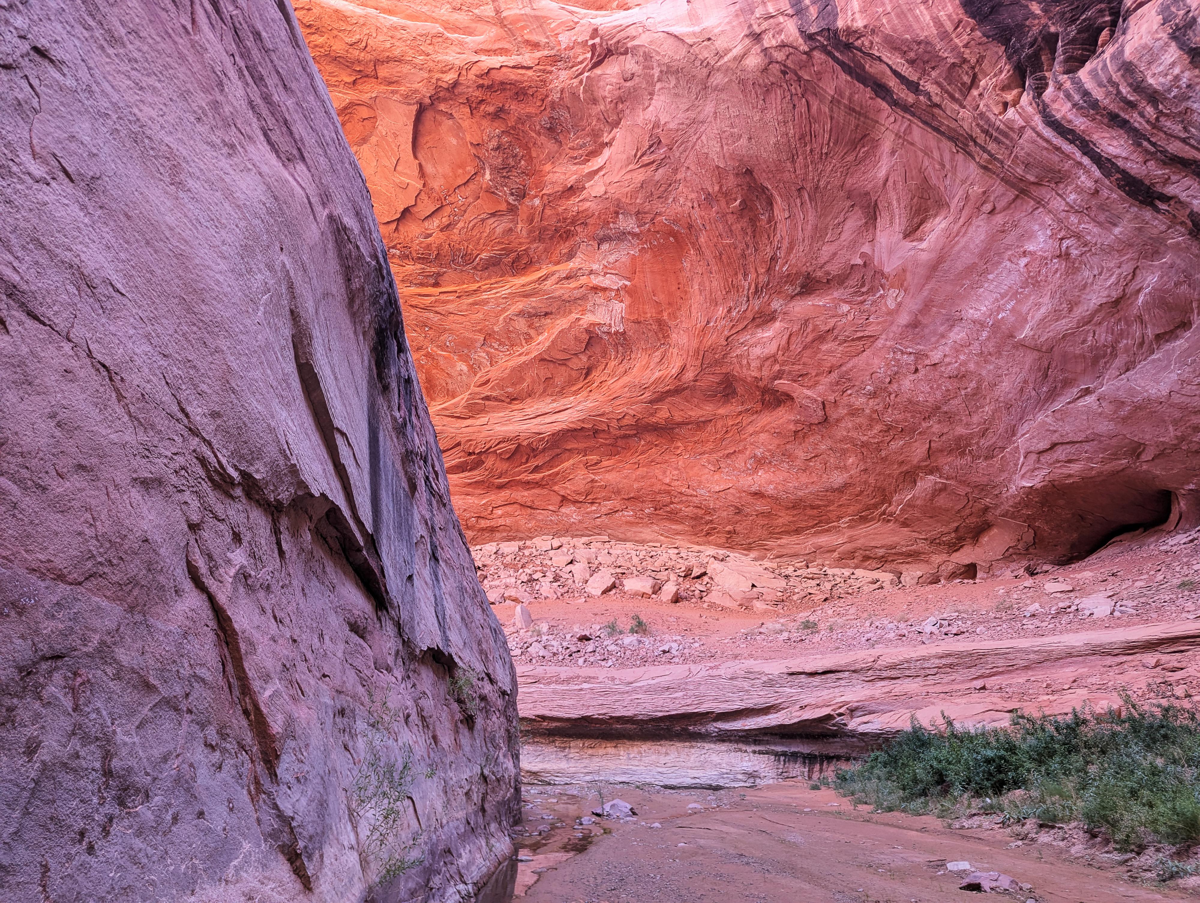
About the high water mark, the canyon narrows dramatically, and, on my visit, there was the first waist-deep wade. If backpacking, I would consider camping just above high water mark.
High Water Mark to the Lake (depends on water levels; at 3,560', this was a bit over 3 miles one way)
At High Water Mark, the canyon settles into a rhythm. There are narrow sections with wading on many of the bends, with more open riparian sections in between. There are some beautiful and big undercuts along the way as well.
At about 2.8 miles, on my trip, the canyon opened more broadly and became silt-floored from lake deposits. Walking on the silt plain is easy until you get near where the lake recently dried up; then, in my experience, the silt plain gets muddy and becomes difficult going. I turned around a bit over 3 miles from the high water mark when the mud got to be over ankle deep and the lose of a shoe seemed immeninent.
Photos
Videos
Fiftymile Creek - Hole In The Rock Road
Maps
 - Hiking Map")
 - Hiking Map")
12S 498116E 4127094N
37°17'26"N 111°01'16"W
12S 499170E 4127944N
37°17'53"N 111°00'34"W
12S 499328E 4128133N
37°17'59"N 111°00'27"W
12S 500442E 4128503N
37°18'11"N 110°59'42"W
12S 501388E 4129325N
37°18'38"N 110°59'04"W
12S 502140E 4129333N
37°18'38"N 110°58'33"W
12S 503067E 4130349N
37°19'11"N 110°57'55"W
12S 505399E 4131446N
37°19'47"N 110°56'21"W