 Roadside Attraction
Icebox Canyon
Roadside Attraction
Icebox Canyon
Moab
Overview
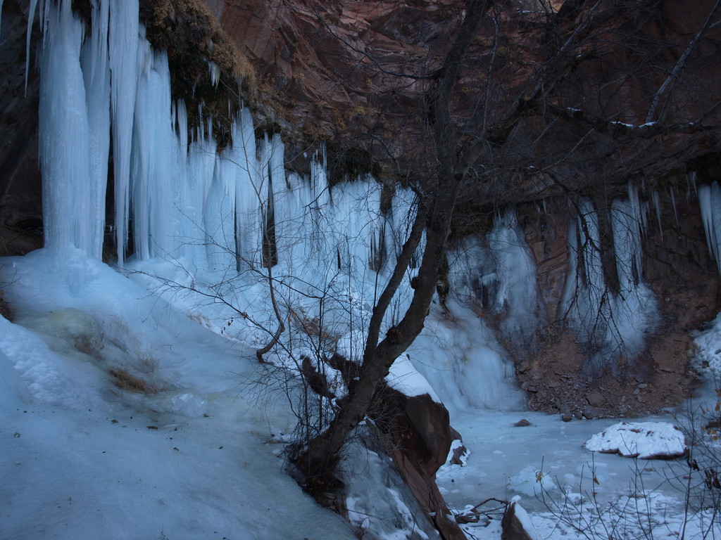
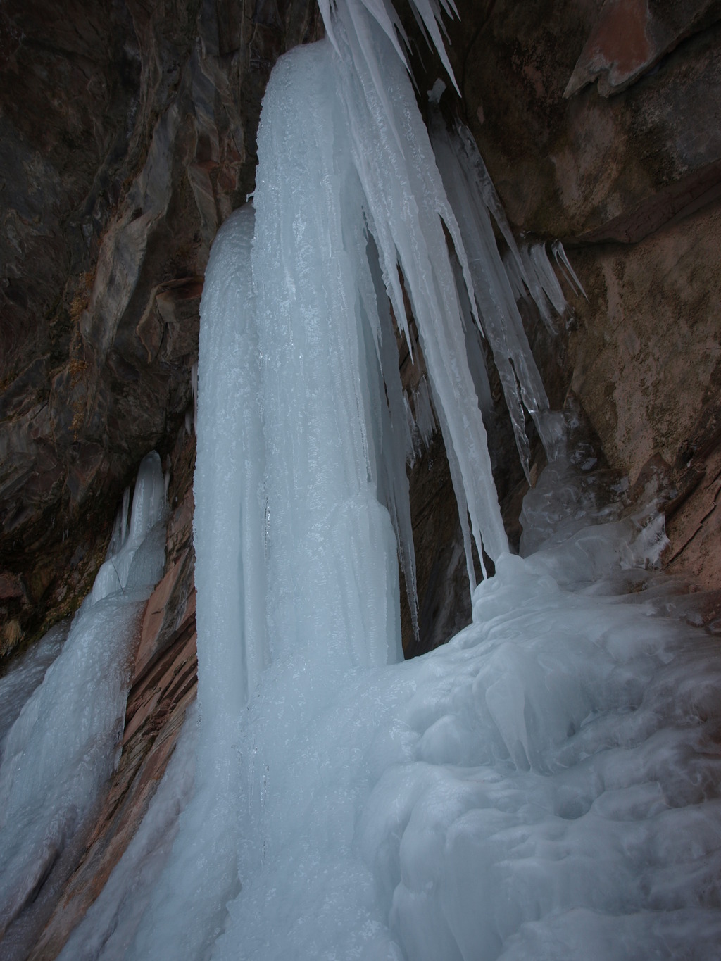
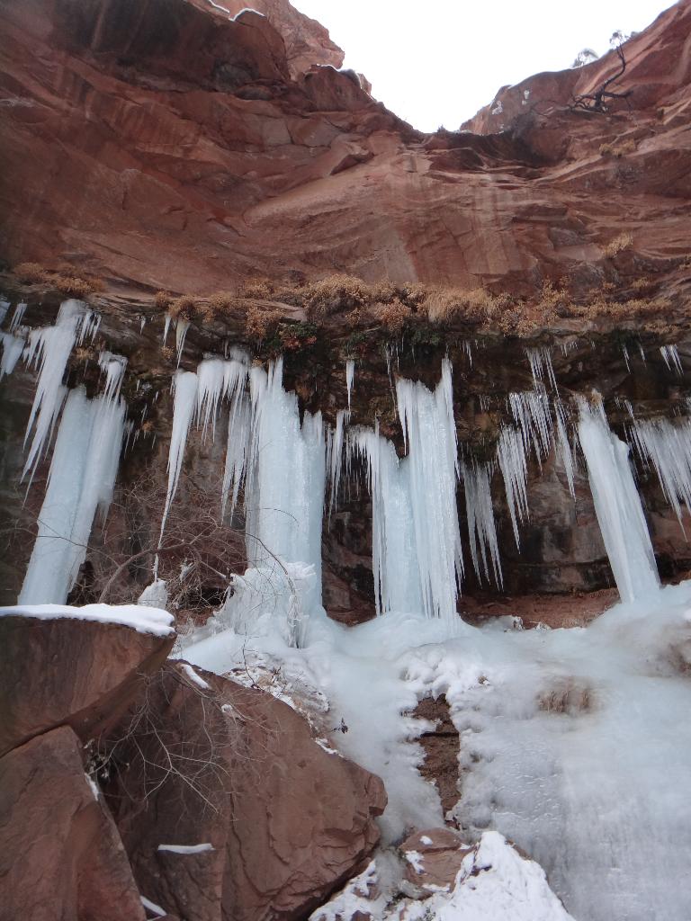
Icebox Canyon, as the Moab locals know it, makes a great, short roadside attraction that is accessible to the whole family. In most seasons, the canyon provides a good example of a riparian environment typical of those scatters across the nooks and crannies of the desert. The seeps and springs in the canyon make this a cool and refreshing side trip even in the heat of the summer.
If you happen to be in Moab during the coldest months of the year, however, Icebox can hold a very special treasure. The seeps and springs can freeze into immense columns of ice. The contrast between the red rock canyon walls and blue ice columns is striking!
Getting There
To reach the trailhead, travel north out of Moab on highway 191. Just outside of town is the junction with State Route 128, before the bridge over the Colorado River. Take SR128 2.7 miles. Icebox canyon is on the right side of the road as you travel up river. There is a parking spot 100 yards before the canyon, or 0.1 miles after the canyon, both spots are on the river side of the road. If you reach the Grandstaff Canyon Trailhead, you have gone too far, backtrack 0.4 miles.
Route Description
From the highway, simply hike up the canyon. Easy hiking brings you to a large dryfall and riparian alcove about 15 minutes or so from the road. Return the way you came.
Maps

12S 627136E 4274216N
38°36'26"N 109°32'23"W