 Roadside Attraction
Hole-In-The-Ground
Roadside Attraction
Hole-In-The-Ground
Snake Valley
Overview
I don't think my family took me literally when I told them we were going to visit a Hole-In-The-Ground. Some intense questioning followed by an inquisitive 6-year-old, wanting to know how deep, how wide, what would be at the bottom, etc… It turned out to be a rather amusing drive!
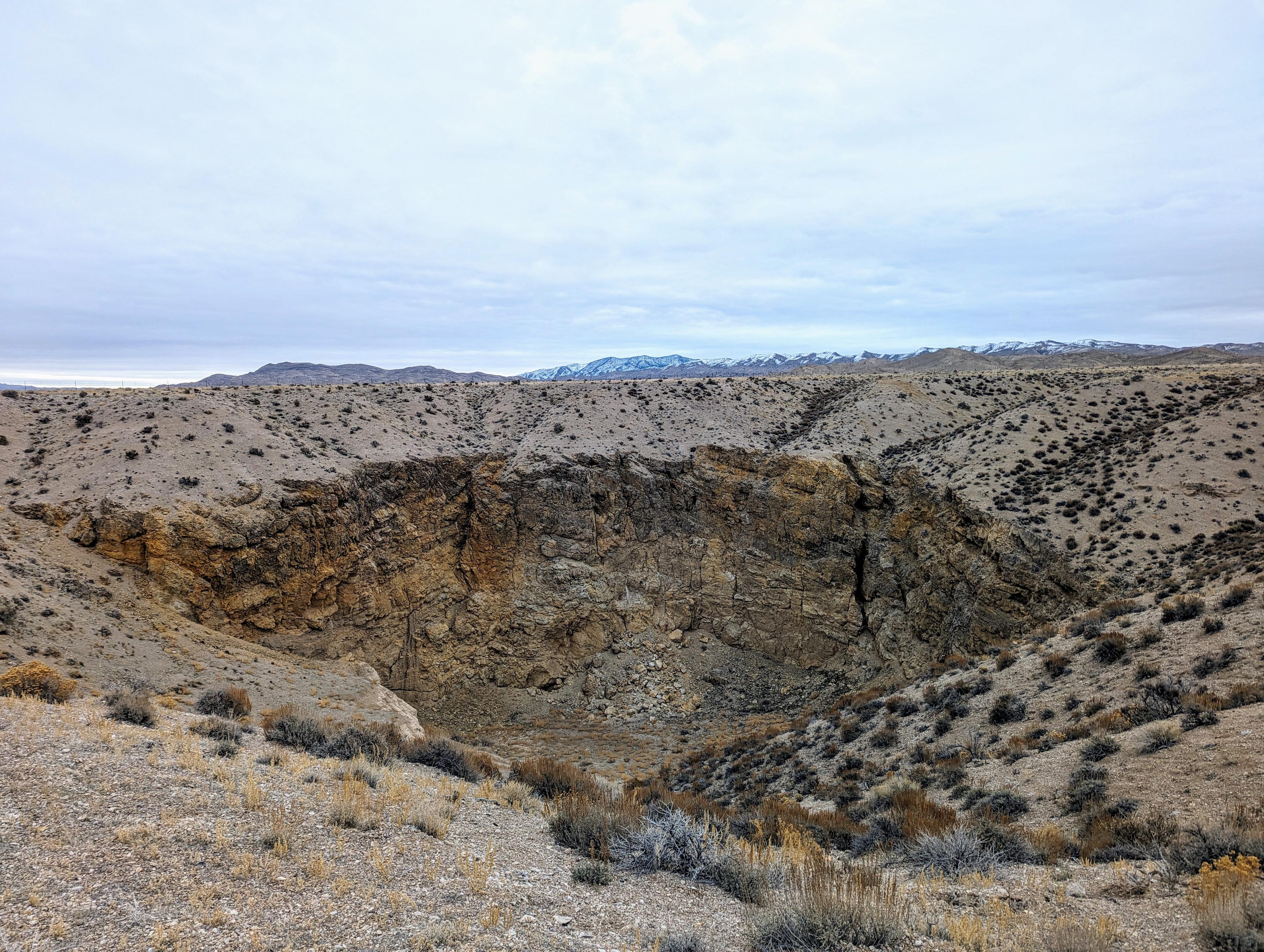
This is, indeed, a LITERAL Hole-In-The-Ground! To answer the common questions of a 6-year-old, the hole is an impressive 250+ feet wide and up to 110 feet deep. It stands out in the otherwise mostly flat Snake Valley.
This is NOT an attraction I would drive too far out of my way to visit. As it happened, we were heading near the area anyway, and the short 10-minute side trip was worth satisfying my, and my daughter's curiosity about what a Hole-In-The-Ground would be like.
Getting There
On highway 6, near the Utah/Nevada border, turn north on the paved road to Eskdale that leaves highway 6 at milepost 4.75. This is about 84 miles west of Delta, UT or 11 miles east of Baker, NV.
After 3.7 miles, turn right on to Eskdale Road.
After 0.4 miles, turn left, which takes you through the small commity of Eskdale.
In 0.8 miles, after leaving Eskdale, turn left onto a county road running north/south.
Just a few hundred feet later, turn right.
After 0.8 miles, turn left onto Adam Rd/Knoll Springs Rd.
Follow the Knoll Springs road for 4.5 miles to a small two-track road leaving on the right.
Take the two-track 0.75 mile to where it splits. Go right a few hundred feet to the fenced Hole-In-The-Ground.
Route Description
The sinkhole is fenced to help prevent livestock and people from inadvertently falling in. A step over gate on the southwest corner provides easy access.
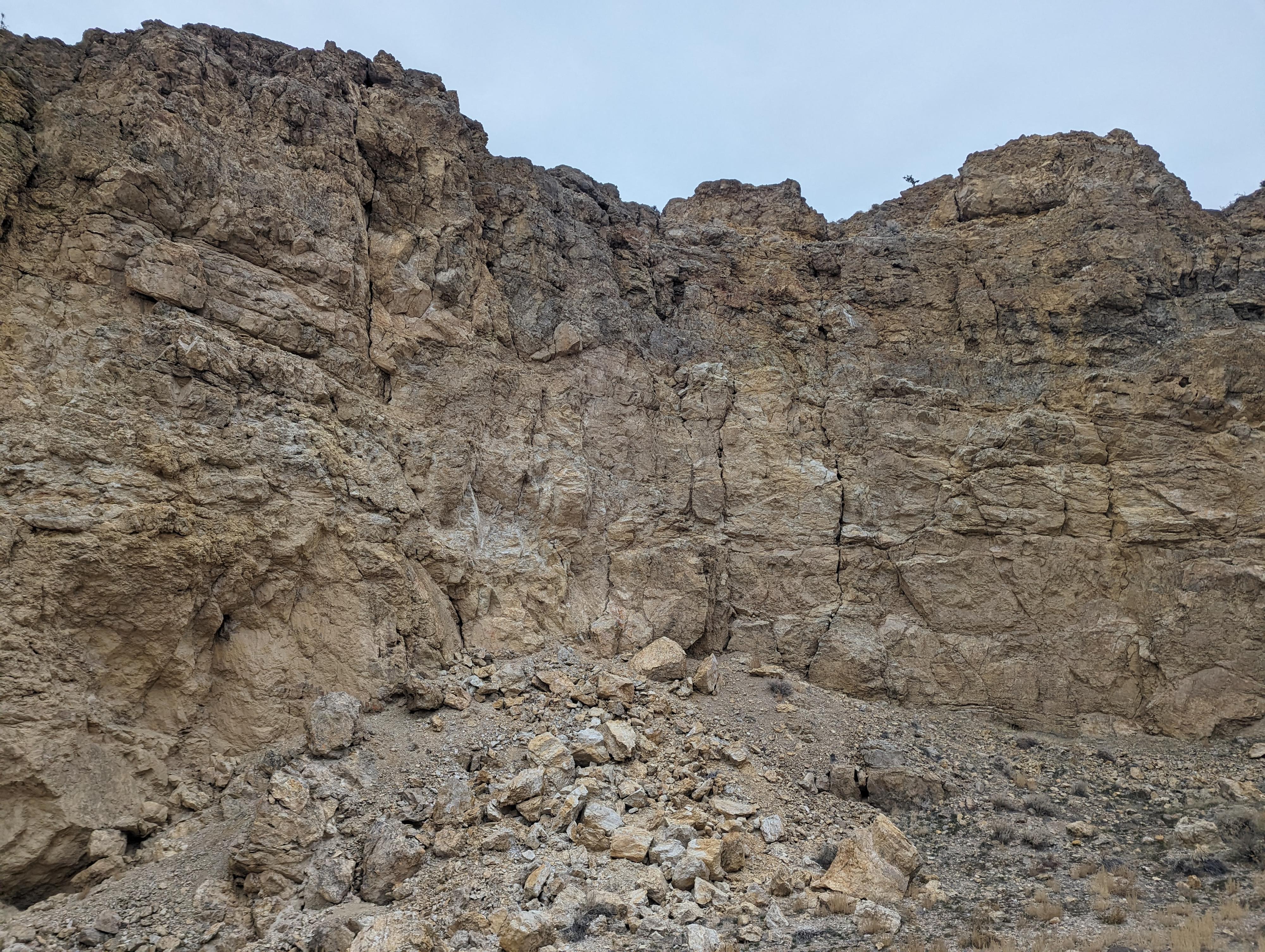
You can, carefully, hike down to the bottom of the sinkhole via the steep dirt slopes.
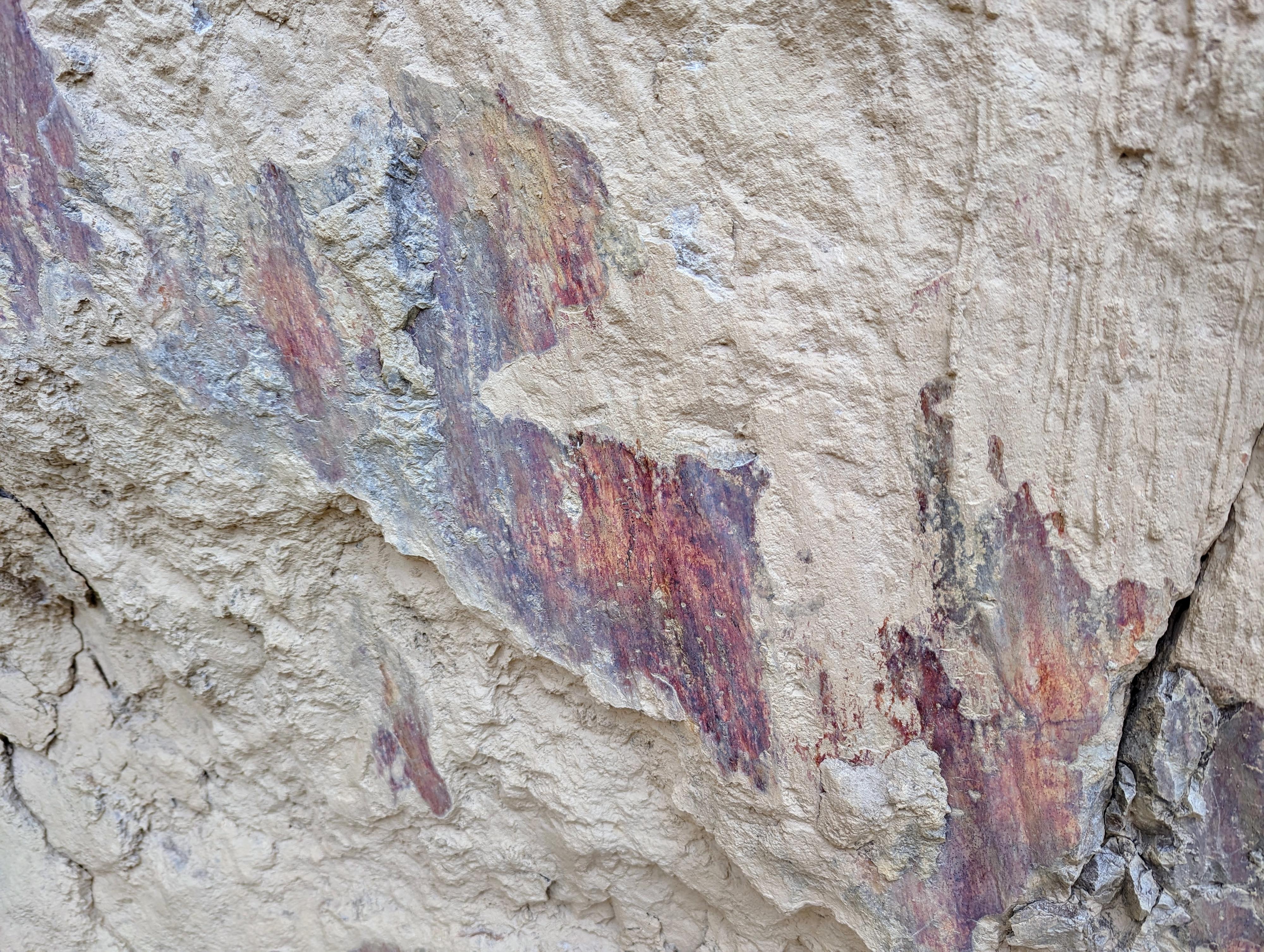
If you go to the bottom, be sure to take a close look at the vertical walls. There are some interesting rock colors and textures.
Photos
Maps

12S 248246E 4340838N
39°10'49"N 113°54'52"W
12S 249178E 4340149N
39°10'28"N 113°54'13"W