 Canyoneering
Moonflower Canyon
Canyoneering
Moonflower Canyon
Kane Creek
Overview
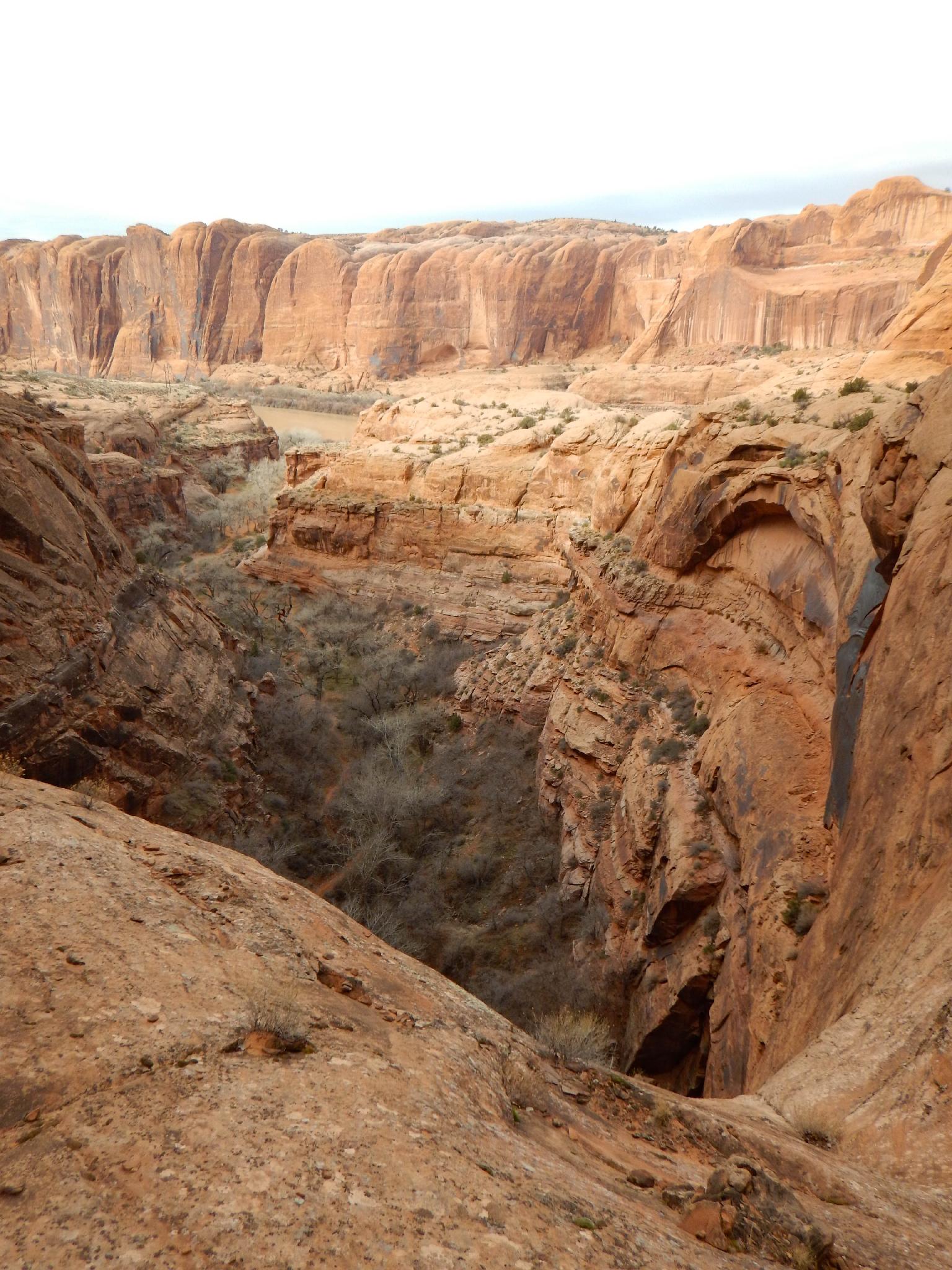
A short canyon with a big elevation gain on the approach! Moonflower Canyon is likely best known and most often visited for the impressive rock art panel at its confluence with Kane Creek. There is also a BLM walk-in campground available.
Recently, the canyon has become a bit more popular with canyoneers. The canyoneering route has about 1000 feet of elevation gain on its approach but quickly loses that in a series of two big drops. The actual canyon section is very short, but the views from the top of the mandatory rappel are breathtaking, and likely what has made this a popular outing.
Getting There
From downtown Moab, head to south to Kane Creek Blvd. Turn right on Kane Creek Blvd. (This is currently where the McDonald's and Burger King are.)
Route Description
Rock art and historic sites are fragile, non-renewable cultural resources that, once damaged, can never be replaced. To ensure they are protected, please:
- Avoid Touching the Petroglyphs: Look and observe, BUT DO NOT TOUCH!
- Stay on the Trails: Stay on the most used trails when visiting sites, and don't create new trails or trample vegetation.
- Photography and Sketching is Allowed: Do not introduce any foreign substance to enhance the carved and pecked images for photographic or drawing purposes. Altering, defacing, or damaging the petroglyphs is against the law -- even if the damage is unintentional.
- Pets: Keep pets on a leash and clean up after them.
- Artifacts: If you happen to come across sherds (broken pottery) or lithics (flakes of stone tools), leave them where you see them. Once they are moved or removed, a piece of the past is forever lost.
Approach (1-2 hours)
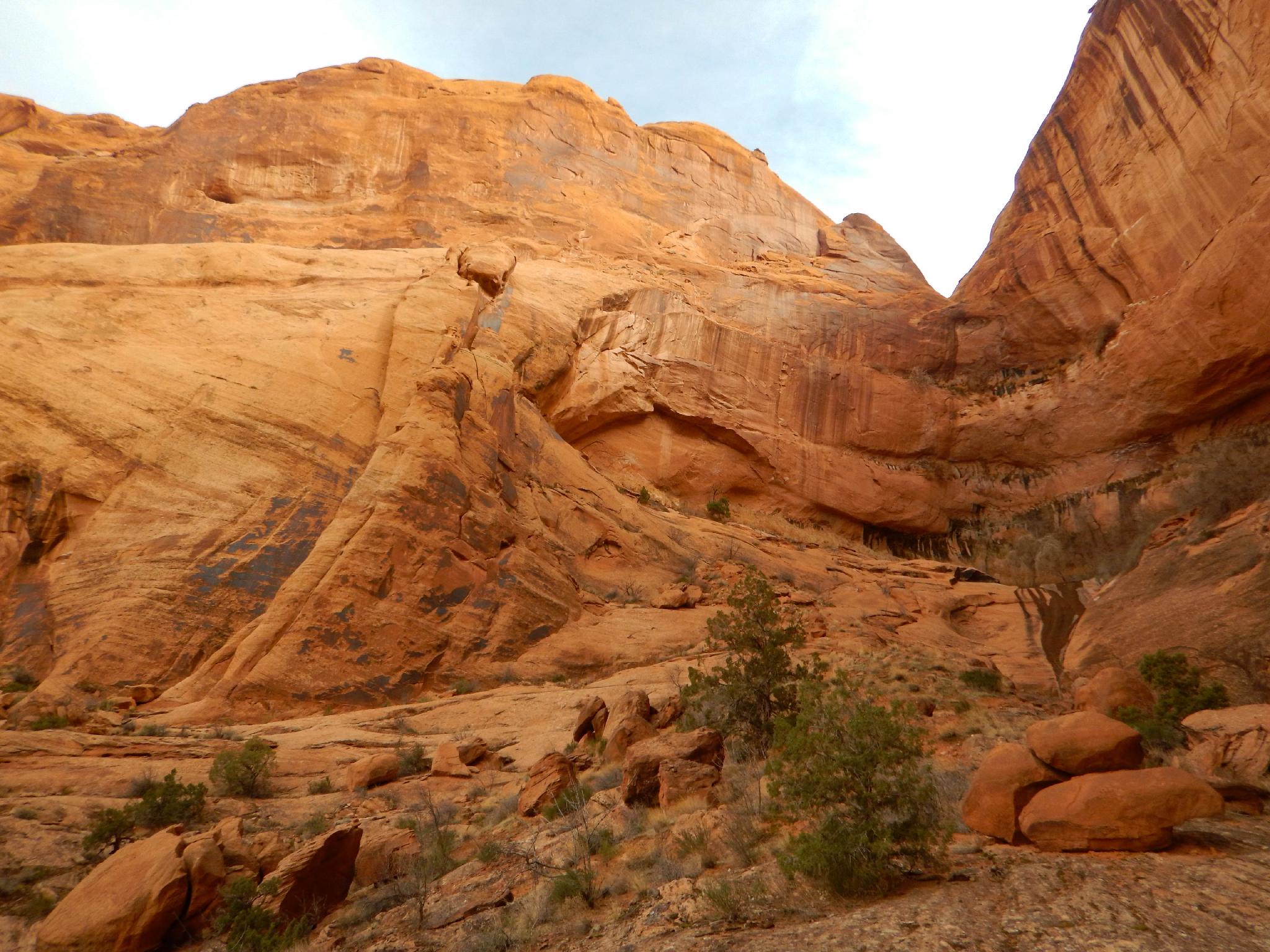
From the trailhead, either hike up the Moab Rim Jeep Trail, or the Stairmaster Trail that parallels it. For my money, the Stairmaster is a bit better. After 0.8 miles, the jeep road and hiking trail merge near the top of the mesa. Continue on the jeep road but not before taking in the amazing views of Moab, the La Sal Mountains, and even Arches National Park off in the far distance to the northeast.
The jeep road meanders around the slickrock cliffs and reaches a major junction. Go right here, following the jeep road as it descends to Moonflower Canyon. This is easy to recognize. The descent ends at the Moonflower Canyon drainage, with the jeep road continue up out of the drainage, but you will stay here.
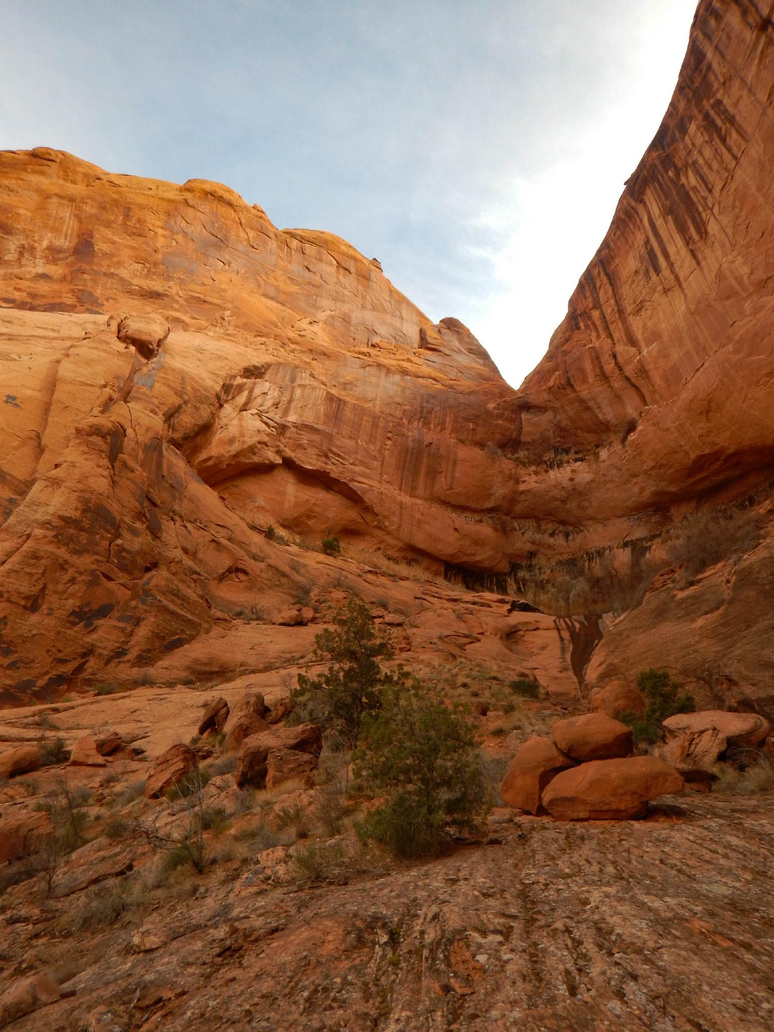
Canyon (1 hour)
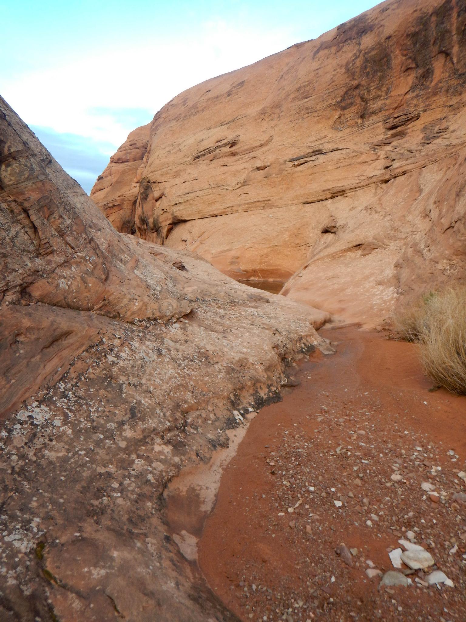
Head down Moonflower Canyon. It is shallow and fairly wide here. A few small pools are interspersed but are avoidable by hiking around the sides.
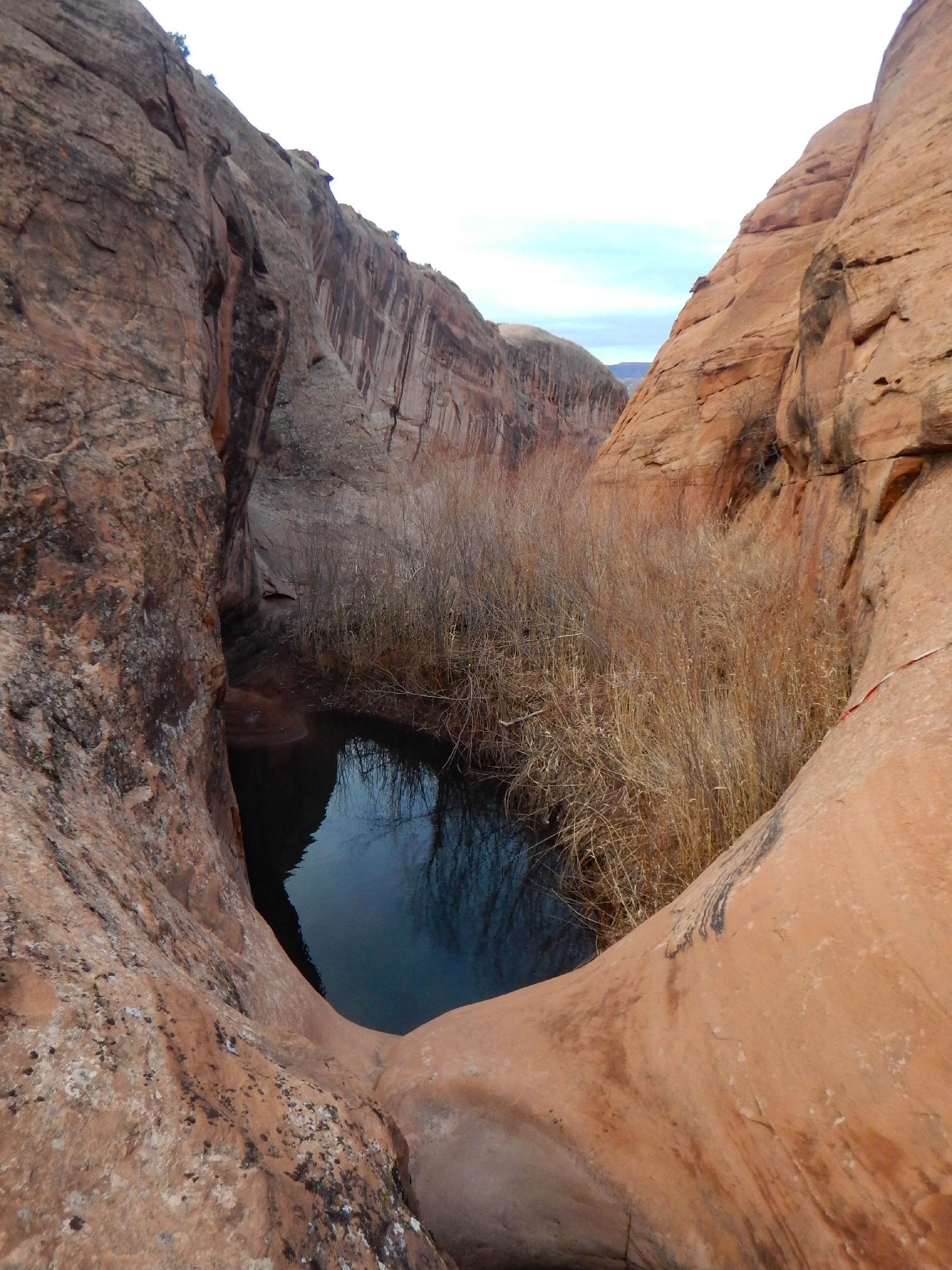
At a large pool with a 3 m ( 10 ft. ) drop into it, the technical section is reached. This drop can be downclimbed but is often into a deep pool. As of 2017, a single bolt on the right allows rappelling to the side of the pool to avoid getting wet.
One minute past the pool is the mandatory 60 m ( 197 ft. ) rappel. As of 2017, this also had bolts as an anchor. Be sure to have someone in your group check the anchor before pulling the rope on the previous drop. There isn't much to work with here if a new anchor needed to be built.
R1 - 60 m ( 197 ft. ) - A big, airy rappel! Make sure the webbing is extended to the edge of the rappel or it may be over 60 m.
From the bottom of R1, go right (looking down canyon) and easily make your way down to the next drop.
For the recommended exit, walk on the left rim of the canyon (looking down canyon). Stay relatively close to the rim until a dirt patch on the right is visible up near the rim. This is almost to where Moonflower Canyon and Kane Creek meet. Work down to the dirt patch, then follow a social trail that zig-zags down to the canyon floor. This is class 3, so if you are finding it exposed or difficult look around.
Exit
From the Moonflower Campground, it is a short walk along the Kane Creek road back to the trailhead.
Maps

12S 623474E 4268774N
38°33'32"N 109°34'58"W
12S 623495E 4268833N
38°33'34"N 109°34'57"W
12S 624456E 4269615N
38°33'59"N 109°34'17"W
12S 624482E 4268655N
38°33'27"N 109°34'17"W
12S 624129E 4268338N
38°33'17"N 109°34'31"W
12S 623805E 4268266N
38°33'15"N 109°34'45"W
12S 623639E 4268231N
38°33'14"N 109°34'52"W
12S 623281E 4268164N
38°33'12"N 109°35'07"W
12S 623120E 4268263N
38°33'15"N 109°35'13"W