Nations Natural Bridge |

Blanding

Canyoneering Nations Natural Bridge - BlandingHiking Nations Natural Bridge - BlandingRoadside Attraction Nations Natural Bridge - Blanding Nations Natural Bridge

Blanding

Overview

RATING: Easy hike
MAPS: BLANDING SOUTH, UT

Tue

Sunny, with a high near 72. West northwest wind 5 to 15 mph, with gusts as high as 25 mph.

72 | 45

Wed

Sunny, with a high near 70.

70 | 46

Thu

Sunny, with a high near 59.

59 | 35

Fri

Sunny, with a high near 67.

67 | 37

Sat

Sunny, with a high near 73.

73 | 44

View Full Weather Details
SEASON: Any, although summers can be very hot. Difficult if there is snow on the ground.
GEAR: Standard Hiking Gear
RAPPELS: 1 Optional to less than 15 m ( 50 ft. )
WATER: Bring all you need for drinking, the stream could be filtered but there are livestock in the area.

Tue

Sunny, with a high near 72. West northwest wind 5 to 15 mph, with gusts as high as 25 mph.

72 | 45

Wed

Sunny, with a high near 70.

70 | 46

Thu

Sunny, with a high near 59.

59 | 35

Fri

Sunny, with a high near 67.

67 | 37

Sat

Sunny, with a high near 73.

73 | 44

View Full Weather Details
Looking from under Nations Natural Bridge

Looking from under Nations Natural Bridge

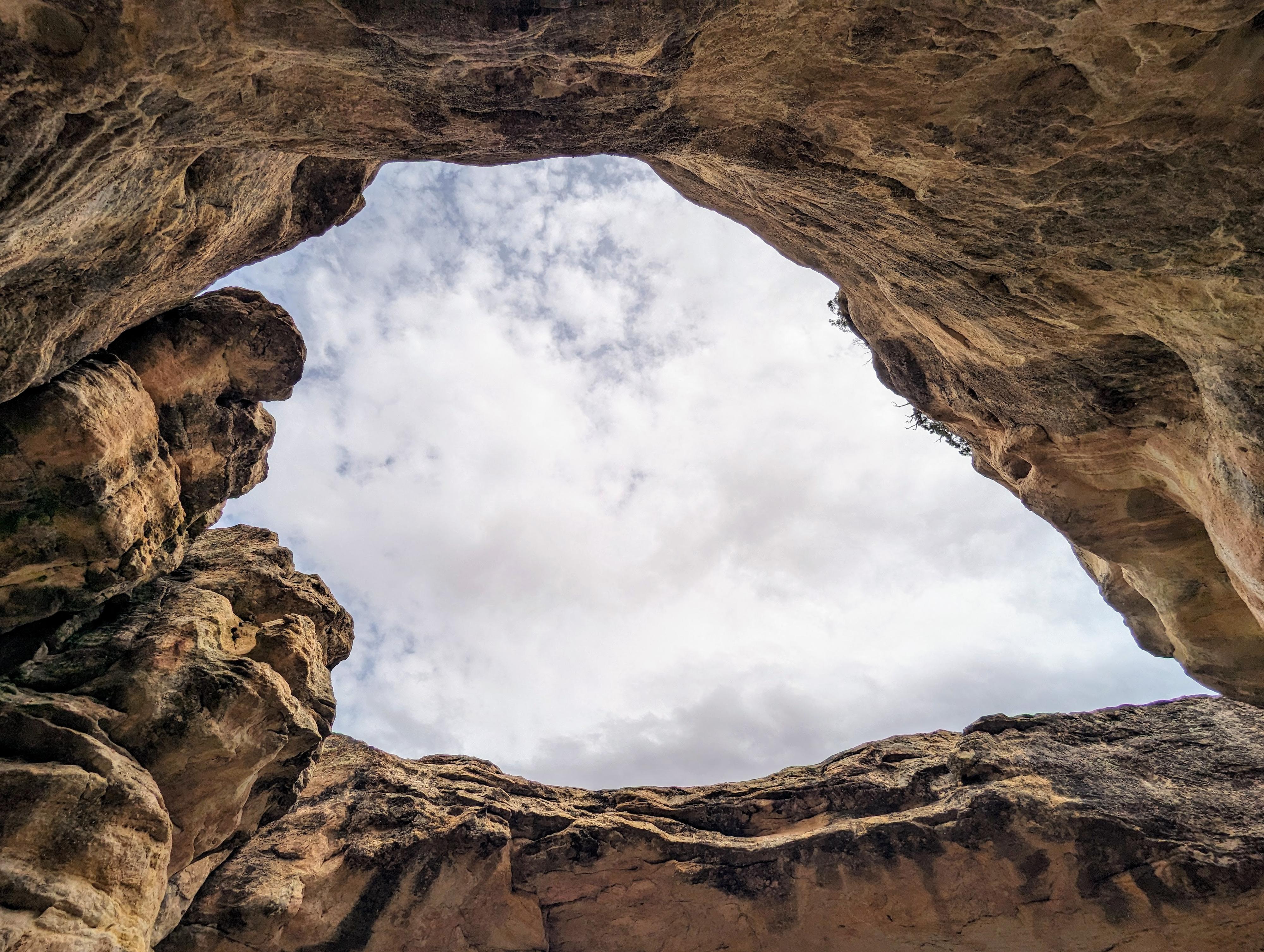
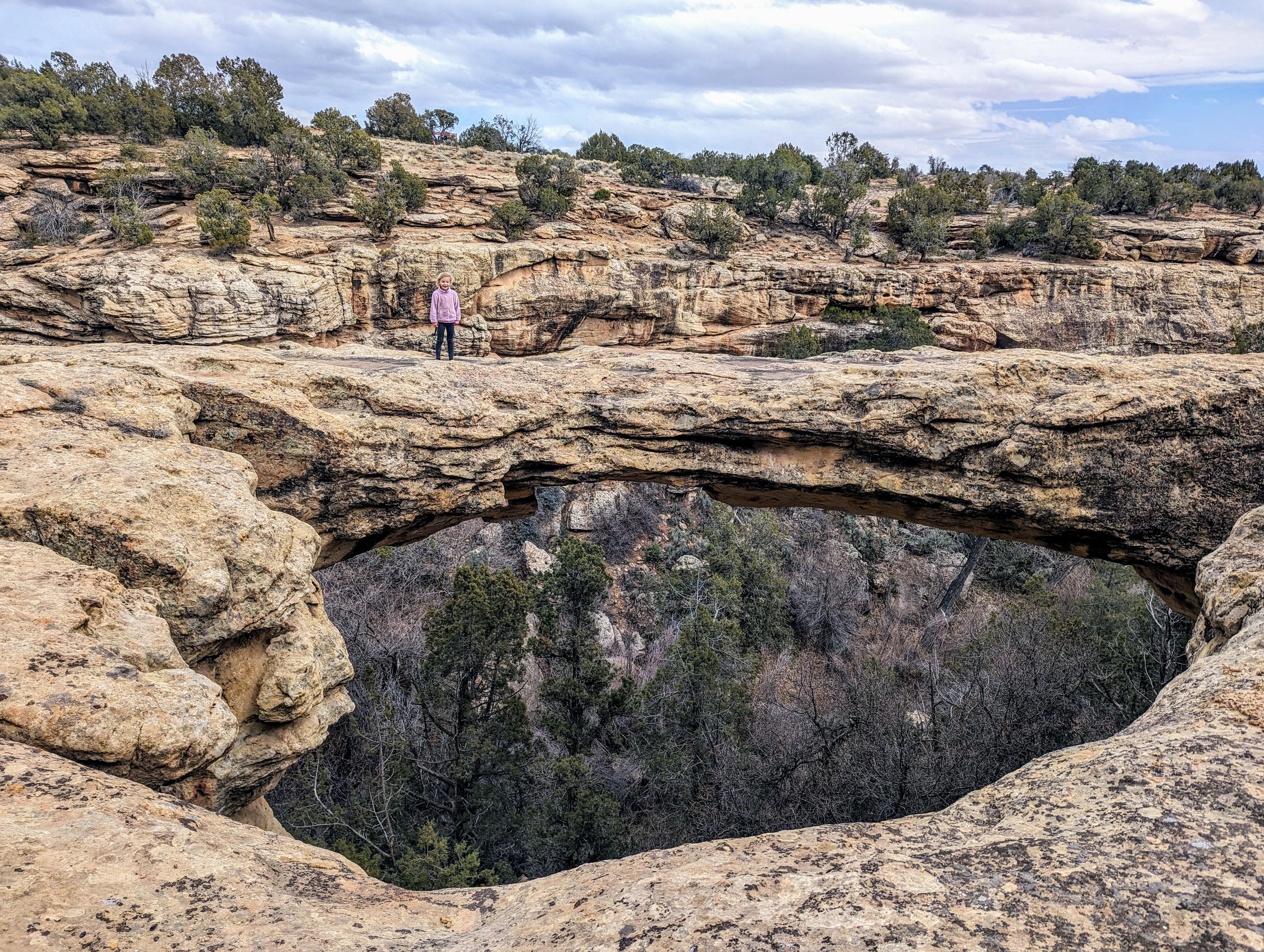
Nations Natural Bridge was a surprise on our visit to Five Kiva Pueblo. En route to the Five Kiva trailhead, we passed a sign for Nations Natural Bridge trailhead and had to stop off after hiking Five Kiva Pueblo to check it out. The bridge is visible across the canyon from the road, but the short trail that visits the bridge up-close is a well worth the effort. The trail is short, and you can visit the bottom of the natural bridge, the top of the natural bridge, or both. Visiting the bottom of the natural bridge is a bit brushy in spots, but not terrible. The trail seems to be getting more popular, and I would expect it to become easier over time as more people use it.

Canyoneers Note: I was very surprised to find numerous bolts, both old and new, on top of the natural bridge. This is apparently rappelled fairly frequently. I assume it is used for training by some groups. We did not rappel the bridge, but if you'd like to, bring enough rope for a <span class="metersHeight">15 m</span> rappel. The actual drop height looks like about <span class="metersHeight">10 m</span>, but you may want more rope depending on how you rig it. On our visit, there were about 3 different sets of anchors you could use. Some look fairly old, one very new, inspect carefully before using.
The sign at the overlook. The bridge barely visible in the picture behind the sign.

The sign at the overlook. The bridge barely visible in the picture behind the sign.

Getting There

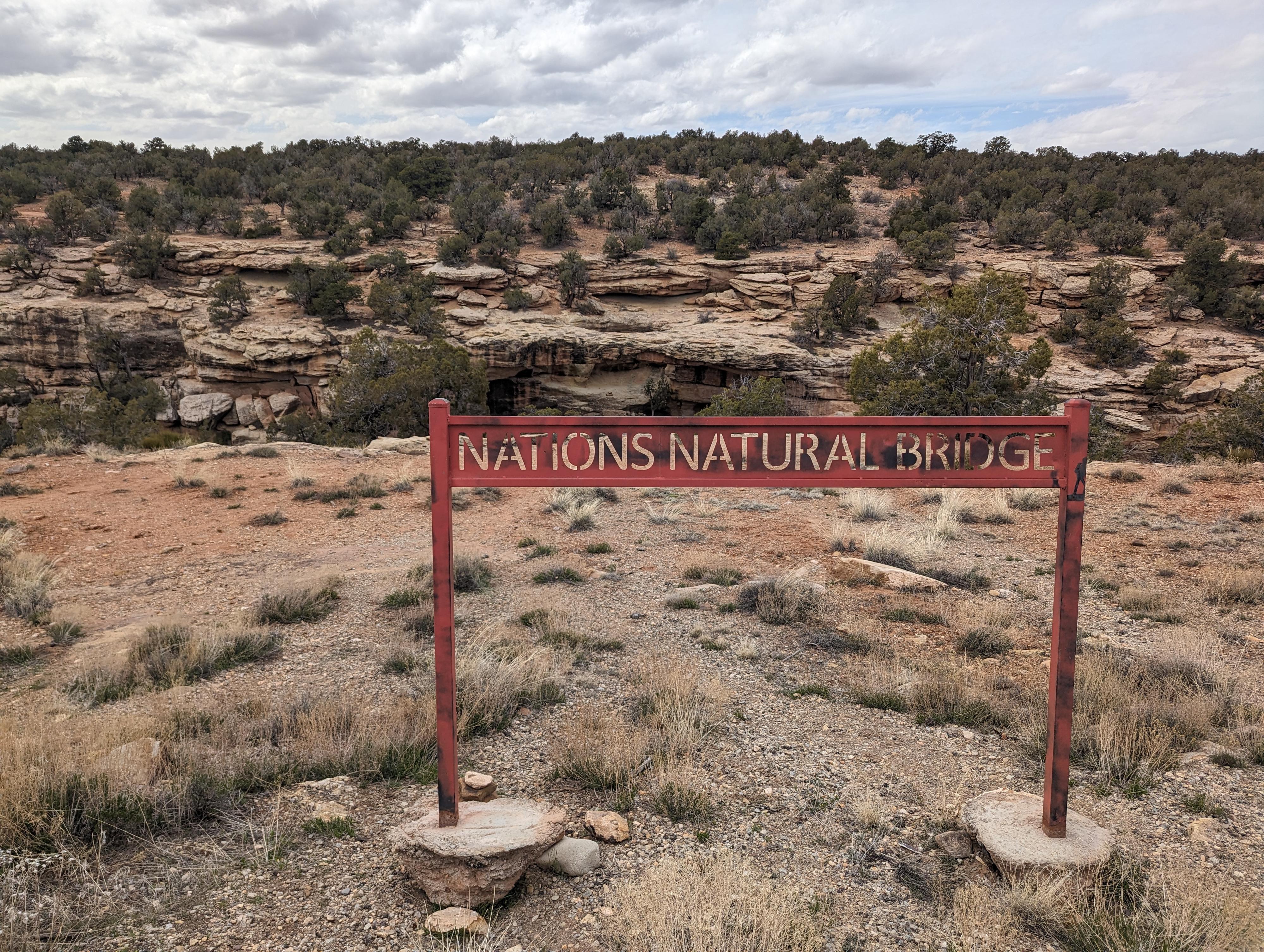
From downtown Blanding, head south on US-191 toward Bluff for about 1.5 miles to Ruin Road on the right. This is about 0.2 miles past mile marker 50. Follow Ruin Road for 1.1 miles. The trailhead is signed on the right just before the road bends and heads south.

Note: You can continue another 0.1 miles to a pull-out on the right that overlooks Nations Natural Bridge from across the canyon. This is a good way to start so you have an idea of the route.
R hanging out on top of the bridge.

R hanging out on top of the bridge.

Route

From the trailhead, follow the trail. It quickly splits at a junction that is relatively easy to miss. Be sure you are soon heading down toward the canyon bottom. The trail reaches the canyon bottom, crosses a bridge, then heads left downstream toward the bridge. As the trail heads downstream, it becomes a bit less defined and a bit brushy in spots. In general, it stays very closes to the cliff wall.

Visit The Top
If you want to visit the natural bridge from the top, look for a spot to climb out as soon as you cross the bridge. There are many places. The spot we used is shown on the map, but there are many options early on. One up on top of the cliff band, rim walk down canyon. The bridge is just a few minutes down canyon from the bridge.

From The Bottom
Stay on the social trail along the cliff base. It is brushy in spots, but not terrible. It is only a few minutes to the natural bridge, where you can scramble up under the bridge.

Return the same way.


Maps

Route / 0.50 miles / Elevation Range 5,773 - 5,881 ft.
Printable Maps:
Nations Natural Bridge Trailhead

12S 632697mE 4162274mN

N37° 35' 53" W109° 29' 49"

Nations Natural Bridge

12S 632521mE 4162161mN

N37° 35' 49" W109° 29' 56"

Exit

12S 632564mE 4162239mN

N37° 35' 52" W109° 29' 54"

Nations Natural Bridge Overlook

12S 632577mE 4162136mN

N37° 35' 48" W109° 29' 53"

Comments

Want to make a comment? Login and let yourself be heard.