 Hiking
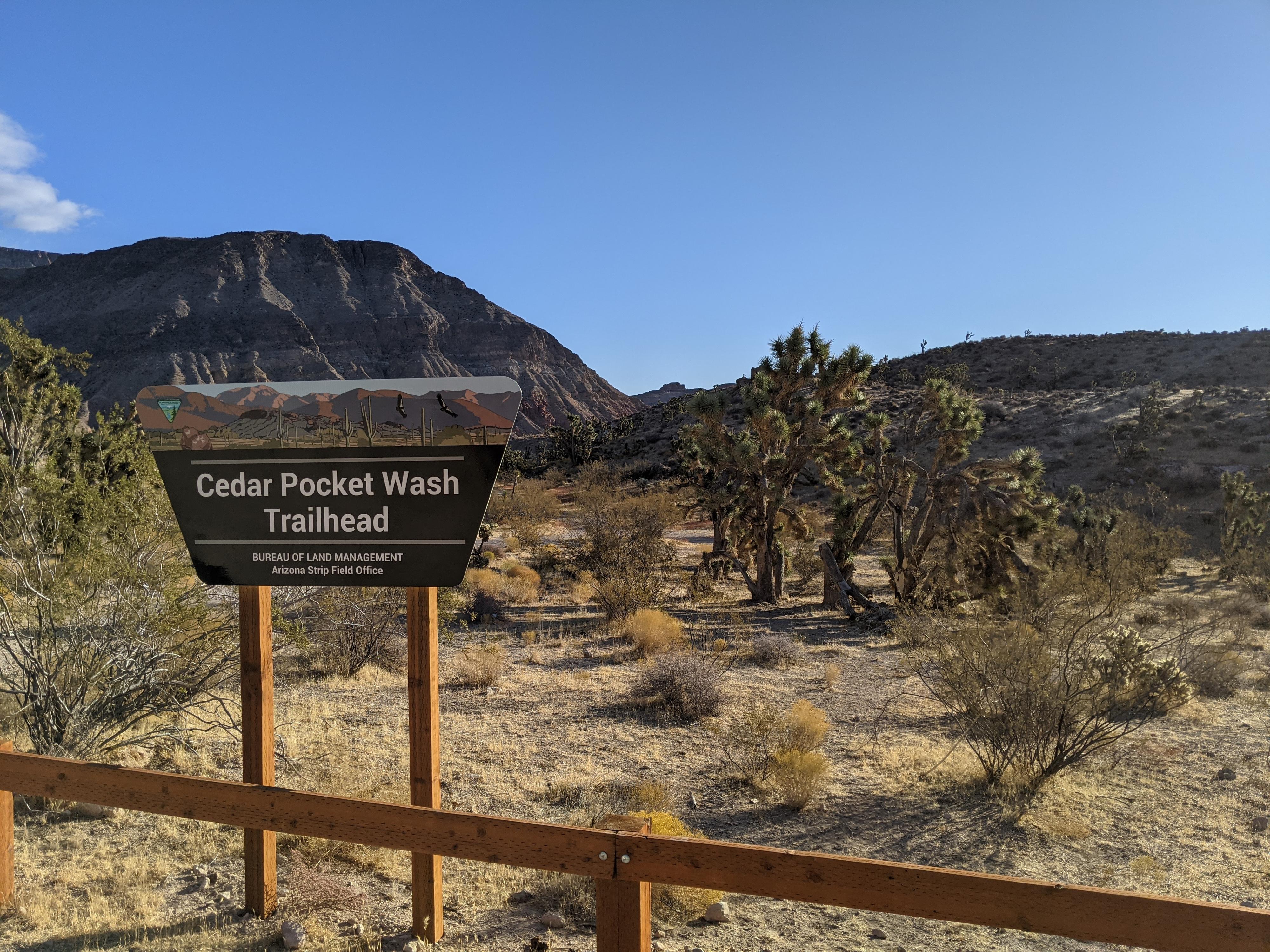
Cedar Pocket Wash
Hiking
Cedar Pocket Wash
Virgin River Gorge
Overview
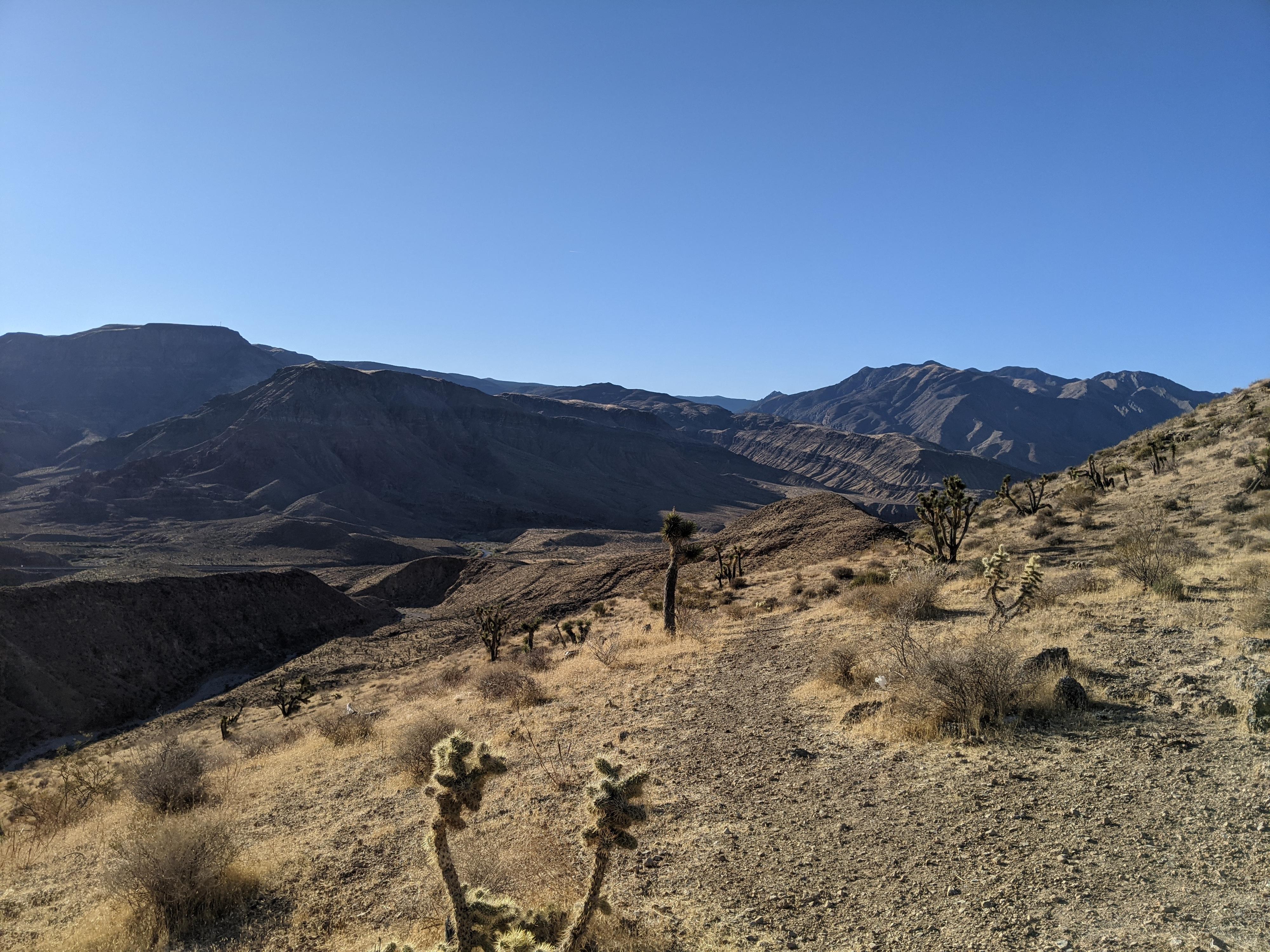
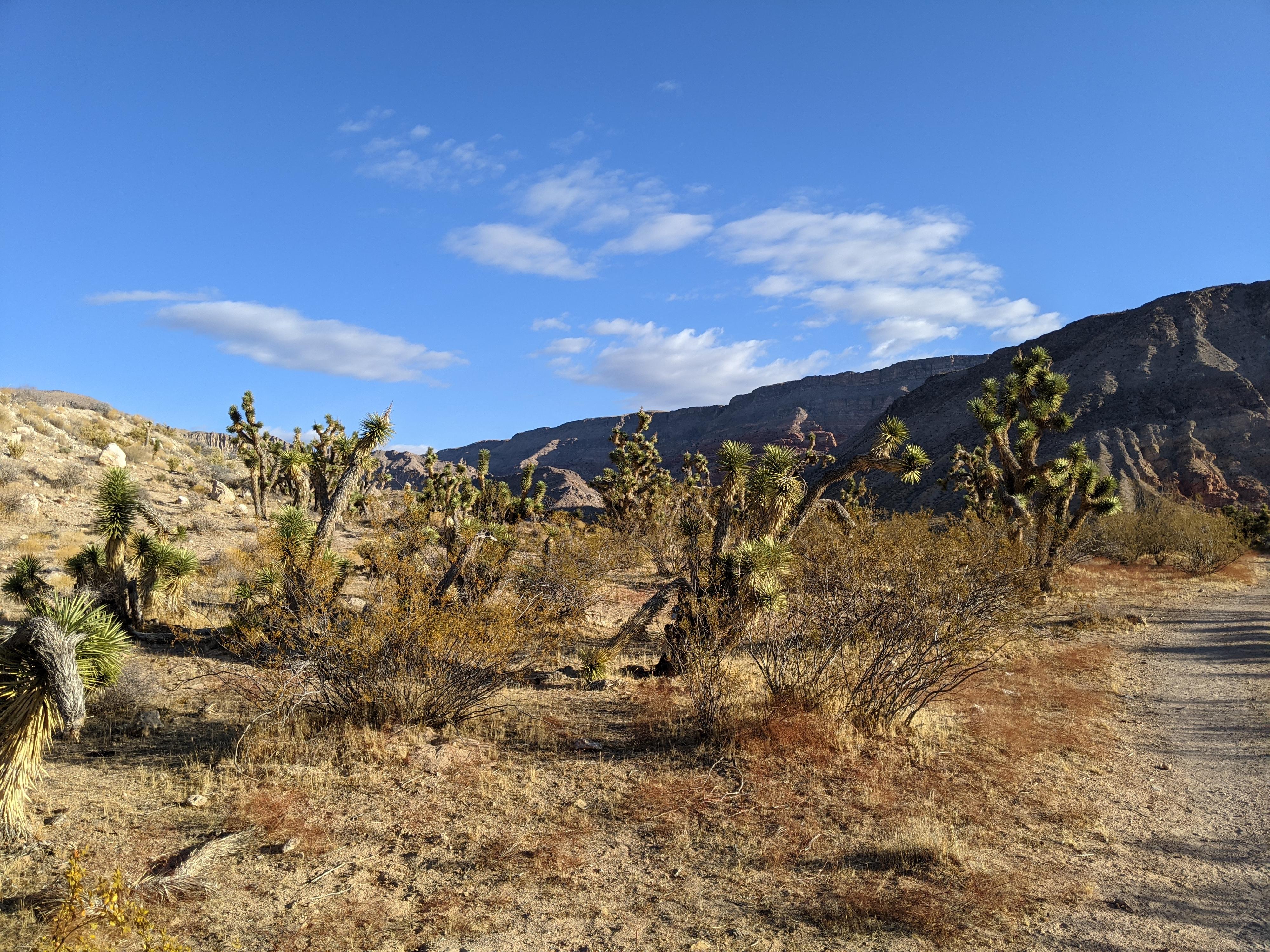
There are not a lot of trail hiking opportunities in the Virgin River Gorge. The Cedar Pocket Wash trail was added in 2019 or 2020 and is an excellent family friendly outing not too far from the highway. The hike has two destinations. The first, an overlook, has views of Cedar Pocket and south to the Virgin River and interstate. It is a good overlook, but the second destination, the Cedar Pocket Narrows, is by far my favorite. The steep hike visits a short section of narrows in Cedar Pocket Wash. The narrows, though not a slot canyon, are relatively deep and lovely. It was an adventure my wife and I enjoyed, as well as our preschooler.
The short distance and easy access make this an excellent family outing when visiting the Virgin River Gorge. The overlook is easy with not much elevation change. The narrows, in contrast, requires a steep descent and ascent on the return. It is suitable for most but recommended only in cooler times of the year. Both trails are well defined and marked, making navigation easy.
Getting There
The trailhead is off the Cedar Pockets road in the Virgin River Gorge. This is exit 18 from I-15 about 17 miles west of St. George or 20 miles east of Mesquite NV. This is the same exit for the Virgin River Gorge Campground,
Route Description
From the trailhead, the trail follows an old road past a now closed camping area east for about 0.25 miles to a junction. Right goes to the overlook in about 0.2 miles. The overlook has good views east of the sandstone cliffs around Cedar Pocket and the Virgin River and easter edge of the Virgin River Gorge.
Left goes to the Cedar Pocket Wash Narrows. Follow the trail as it quickly and steeply descends to the bottom of Cedar Pocket Wash. Once at the wash, go right. The wash heads east for a few minutes, then turns south and enters the narrows. A couple of minor obstacles present themselves while heading down the narrows. None are particularly difficult, but a spot or helping hand can be helpful.
All too soon the narrows give way to open desert. Return the same way.
Photos
Maps

12S 250882E 4095451N
36°58'20"N 113°47'55"W
12S 251174E 4095489N
36°58'22"N 113°47'43"W
12S 251264E 4095280N
36°58'15"N 113°47'39"W
12S 251481E 4095600N
36°58'25"N 113°47'31"W
12S 251309E 4095655N
36°58'27"N 113°47'38"W