 Roadside Attraction
Horn Silver Gulch
Roadside Attraction
Horn Silver Gulch
Western San Rafael Swell
Overview
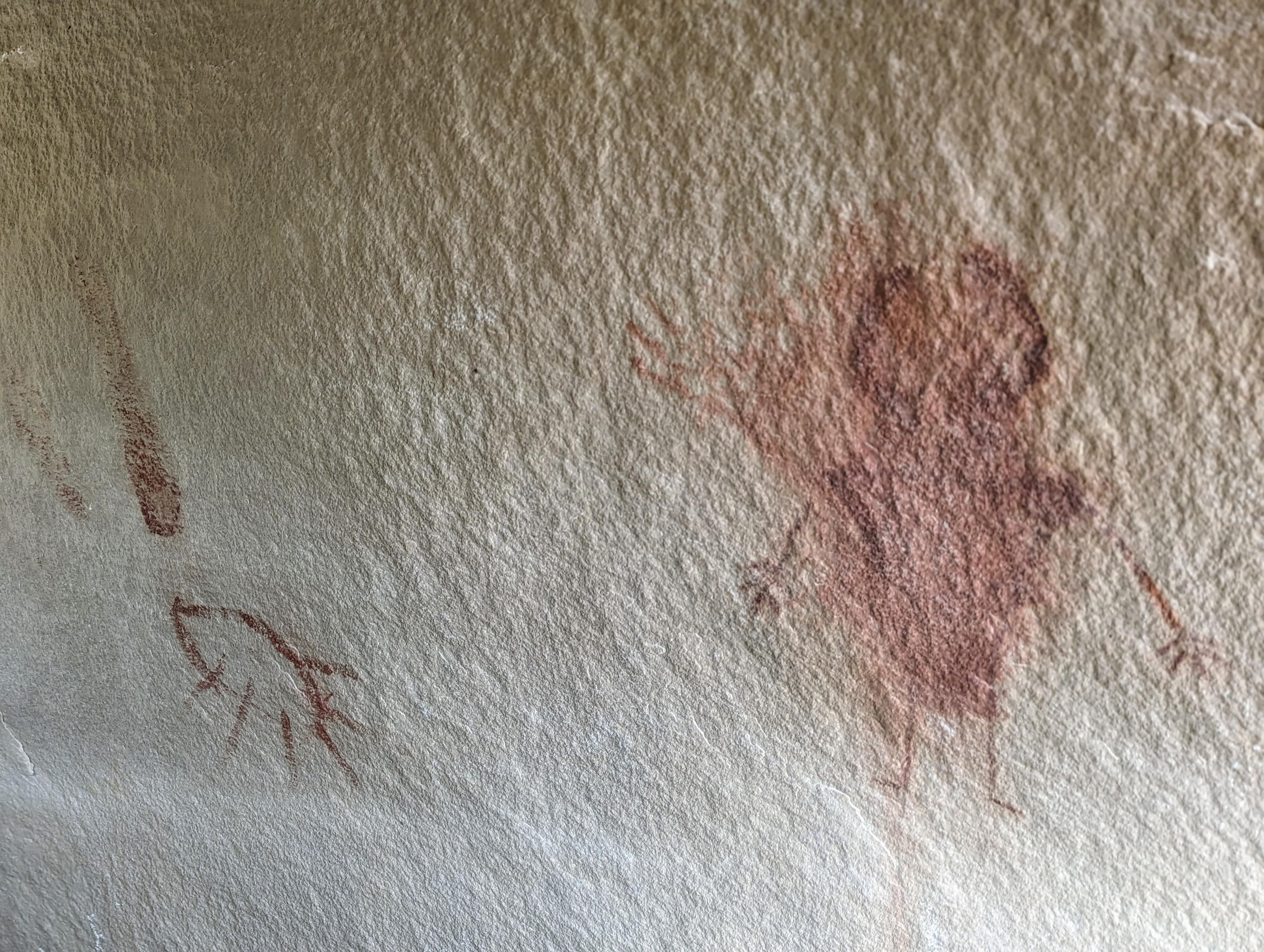
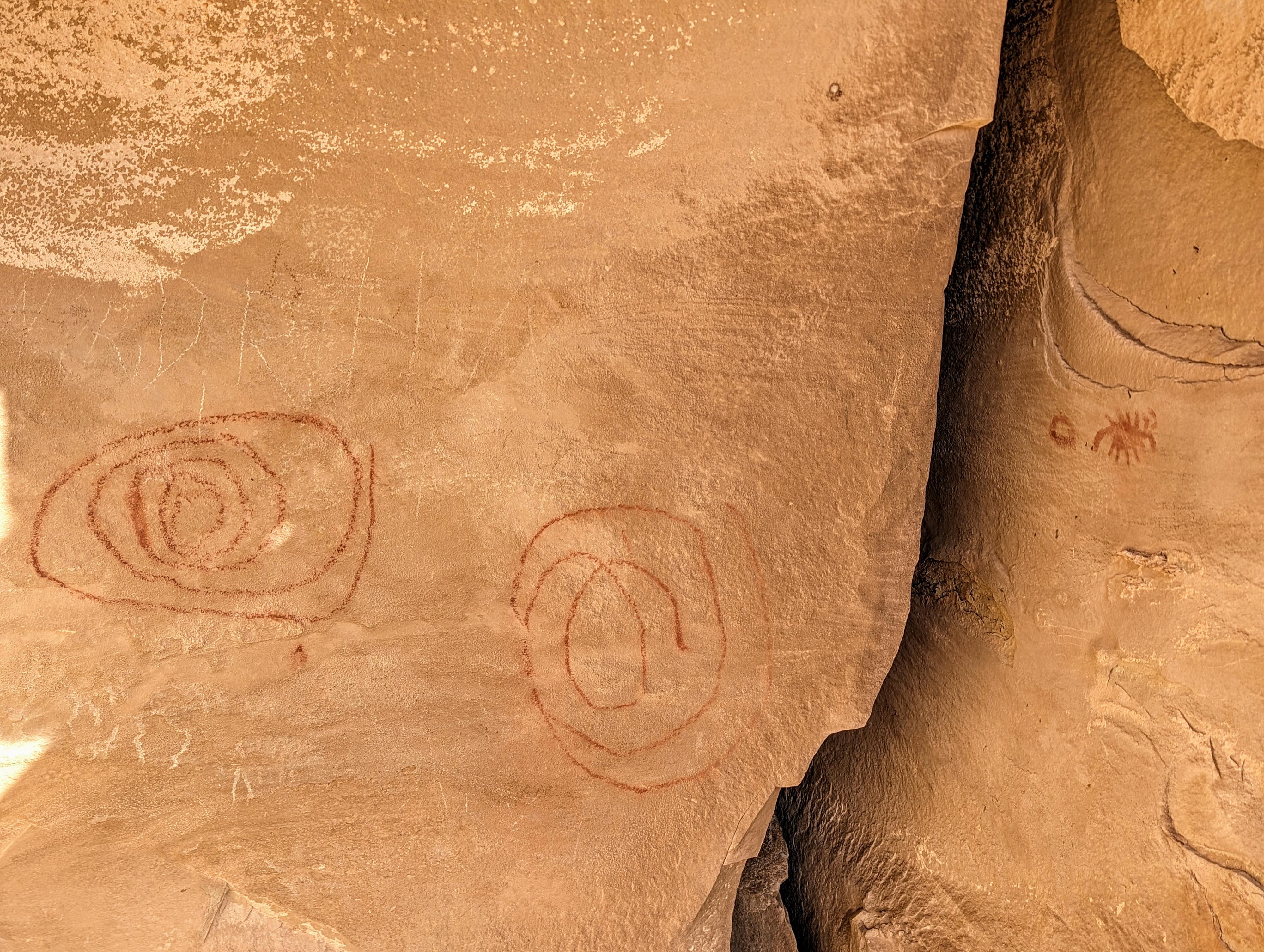
Horn Silver Gulch, on the western side of the San Rafael Swell, is home to a few small but interesting rock art sites. The area, within a stone's throw of the road, has several red pictograph designs, a couple of petroglyphs, and more modern cowboy graffiti from the early 1900s. The site is fairly small, and not one I would recommend travelling far out of the way to visit, but its easy access makes it a great short stop if in the area. It is not too far from King's Crown, and worth visiting both at the same time.
The area was, likely, a seasonal transition path used by native peoples when moving from the lower elevation areas of the San Rafael Swell to the higher and cooler mountain areas west of Ferron and vice versa.
Getting There
From Ferron, UT, head east on 100 S (Molen Road). This is across the road from the Millsite Recreation Sign. Reset your odometer as you turn off main street and onto 100 S.
- 3.0 - 4 way junction. Go right, toward Dutch Flat Desert.
- 3.3 - Road turns to dirt.
- 4.3 - Stay straight on main road through 4 way junction. The road begins heading east.
- 5.6 - Stay straight (don't take the lesser right)
- 7.5 - A side road goes off on each side of the road. These are for the Kings Crown Panel and the Ferron Box Panels panels, which are worth visiting if you have time. Otherwise, stay on the main Dutch Flat road, continuing east. The road descends and crosses open badlands
-
13.3 - Cattleguard as the road passes through a canyon section of Horn Silver Gulch. The cattleguard is the trailhead.
Route Description
Rock art and historic sites are fragile, non-renewable cultural resources that, once damaged, can never be replaced. To ensure they are protected, please:
- Avoid Touching the Petroglyphs: Look and observe, BUT DO NOT TOUCH!
- Stay on the Trails: Stay on the most used trails when visiting sites, and don't create new trails or trample vegetation.
- Photography and Sketching is Allowed: Do not introduce any foreign substance to enhance the carved and pecked images for photographic or drawing purposes. Altering, defacing, or damaging the petroglyphs is against the law -- even if the damage is unintentional.
- Pets: Keep pets on a leash and clean up after them.
- Artifacts: If you happen to come across sherds (broken pottery) or lithics (flakes of stone tools), leave them where you see them. Once they are moved or removed, a piece of the past is forever lost.
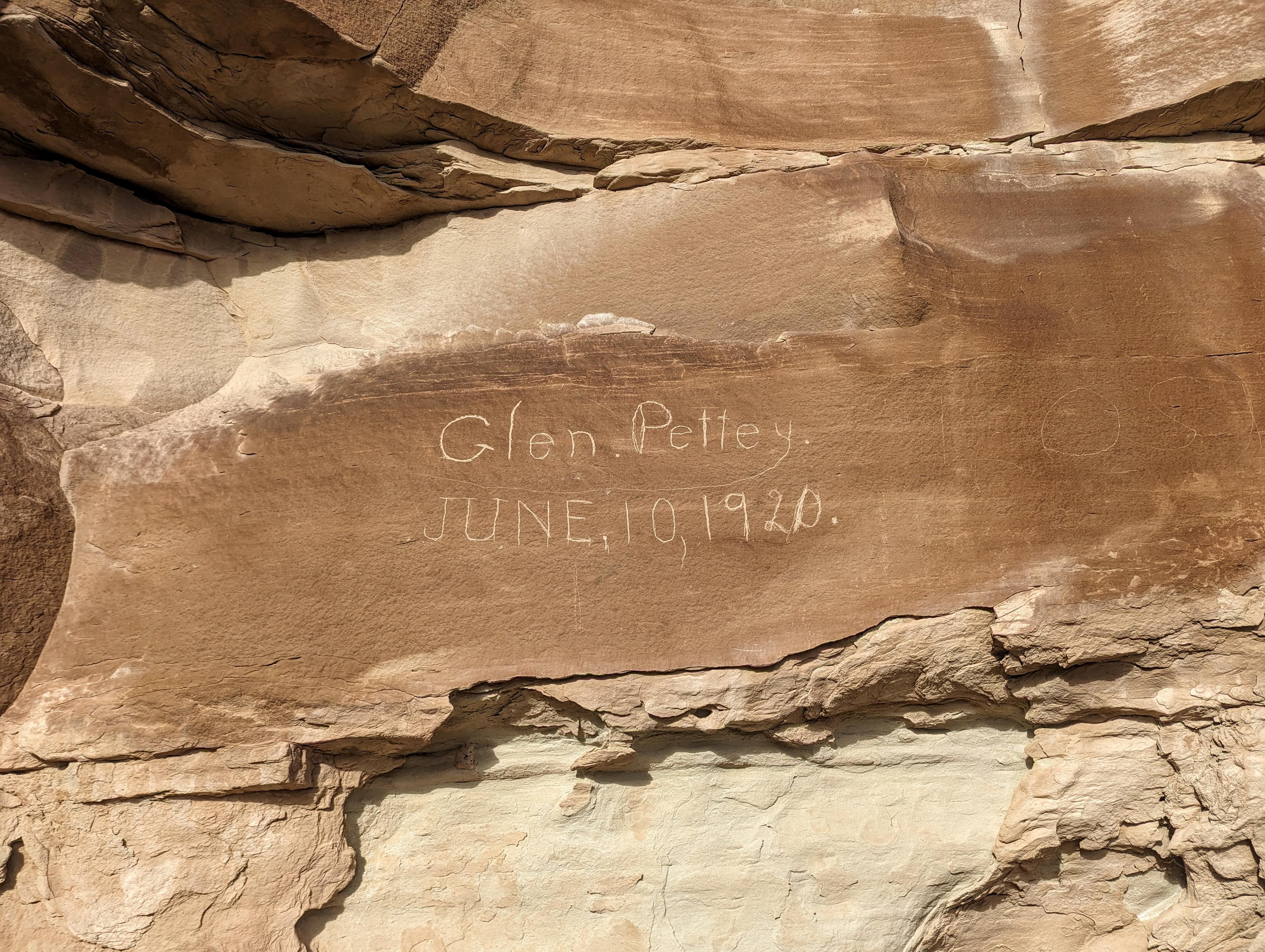
From the cattle guard, walk up the west side of the fence line. There is a small pictograph and petroglyph panel under the overhang. Go back and up the east side of the fence, and follow the cliff band east for several more rock art sites and Glen Pettey's signature from 1920. I continued east along the cliff band for a bit after the Pettey signature but did not see any additional panels.
Maps

12S 503805E 4320987N
39°02'17"N 110°57'22"W
12S 503769E 4321013N
39°02'17"N 110°57'23"W
12S 503786E 4321021N
39°02'18"N 110°57'22"W
12S 503827E 4321080N
39°02'20"N 110°57'21"W