Moss Ledge Waterfall |

Big Cottonwood Canyon

Hiking Moss Ledge Waterfall - Big Cottonwood Canyon Hiking Moss Ledge Waterfall

Big Cottonwood Canyon

Overview

RATING: Moderate Hike
MAPS: MOUNT AIRE, UT

Fri

Rain and a chance of thunderstorms. Cloudy, with a high near 43. West wind around 8 mph. Chance of precipitation is 100%.

43 | 38

Sat

Snow showers before noon, then rain and snow showers. Cloudy, with a high near 42. Chance of precipitation is 90%. New snow accumulation of less than one inch possible.

42 | 33

Sun

A chance of snow showers before noon, then a chance of rain showers. Partly sunny, with a high near 48.

48 | 33

Mon

A slight chance of rain showers after noon. Mostly sunny, with a high near 57.

57 | 35

Tue

A slight chance of rain showers after noon. Mostly sunny, with a high near 58.

58 | 39

View Full Weather Details
SEASON: Late Spring through Fall
GEAR: Standard Hiking Gear

Fri

Rain and a chance of thunderstorms. Cloudy, with a high near 43. West wind around 8 mph. Chance of precipitation is 100%.

43 | 38

Sat

Snow showers before noon, then rain and snow showers. Cloudy, with a high near 42. Chance of precipitation is 90%. New snow accumulation of less than one inch possible.

42 | 33

Sun

A chance of snow showers before noon, then a chance of rain showers. Partly sunny, with a high near 48.

48 | 33

Mon

A slight chance of rain showers after noon. Mostly sunny, with a high near 57.

57 | 35

Tue

A slight chance of rain showers after noon. Mostly sunny, with a high near 58.

58 | 39

View Full Weather Details
Heading up Elbow Fork to the falls.

Heading up Elbow Fork to the falls.

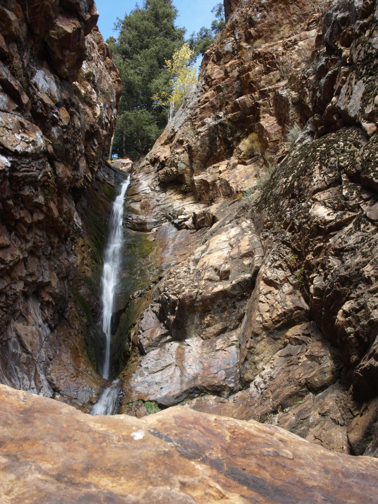
A true hidden gem! Tucked just a short distance from the Big Cottonwood road, the waterfall feels a world away from the hustle and bustle of many other areas in Big Cottonwood. The falls are, surprisingly, not well known or frequently visited, making them a great short outing when you want to get away from the crowds a bit. The trailhead area used to be a picnic area but was reclaimed a few years ago. Few remnants remain from when it was a picnic area, aside from the parking area.

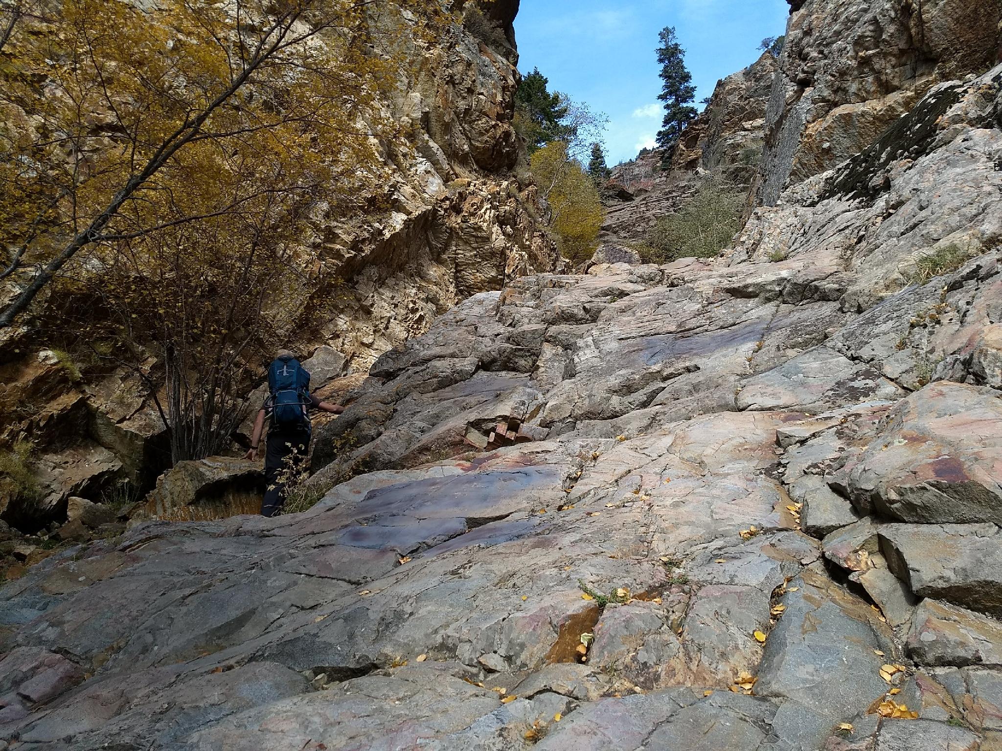
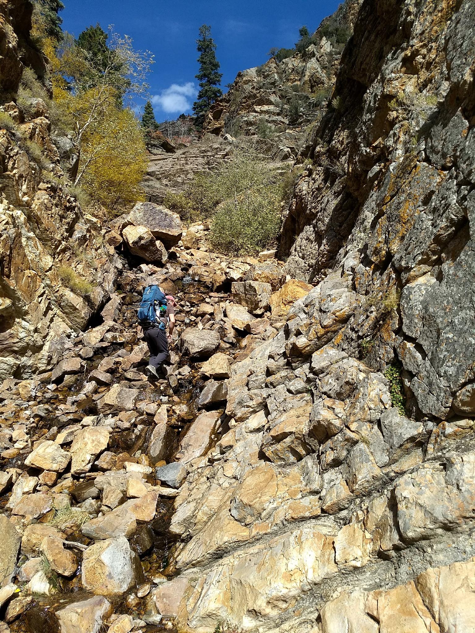
Though hike to Moss Ledge is short, it is rocky with some scrambling in spots. This is not a hike for everyone, but if you like a few minor route finding obstacles and rock hopping, you are likely to enjoy this one. I may have thought it a bit harder than it is, having a 30lb pack with a toddler on your back can do that!

Note: This hike can be done spring through fall, but can have high water during early spring runoff. The trail is mostly near the stream bottom and could be difficult or even dangerous if flows are high. Summer and fall are perfect times to visit when the flow is low.
Moss Ledge Waterfall

Moss Ledge Waterfall

Rocky hiking on the way to the falls.

Rocky hiking on the way to the falls.

Getting There

Big Cottonwood Canyon is on the east side of the Salt Lake City Valley. Get there by taking I-215 to the east, taking exit 6 off the interstate and heading east.

Follow 6200 South which becomes Wasatch Blvd for 1.8 miles to the stop light and signs for Big Cottonwood Canyon.

Turn left at the light and reset your odometer.

Drive up Big Cottonwood Canyon about 5.7 miles to mile post 7. A parking area at mile post 7 on the left is the trailhead. This used to be the site of the Moss Ledge Picnic Area that has since been reclaimed.

Diane and Ruby enjoying the falls.

Diane and Ruby enjoying the falls.

Another view of the falls.

Another view of the falls.

Route

From the parking area, follow the trail that angles up to the old picnic area. It is well defined at first. Once upon the bench, the trail meanders next to the stream, on the right side of the stream.

Working upstream, it becomes rockier and narrower. A small steep section can be passed on the right, or up the stream bed proper. Above this obstacle, stay on the right side of the stream bed, as the social trail and evidence of constructed steps make the going easier on that side.

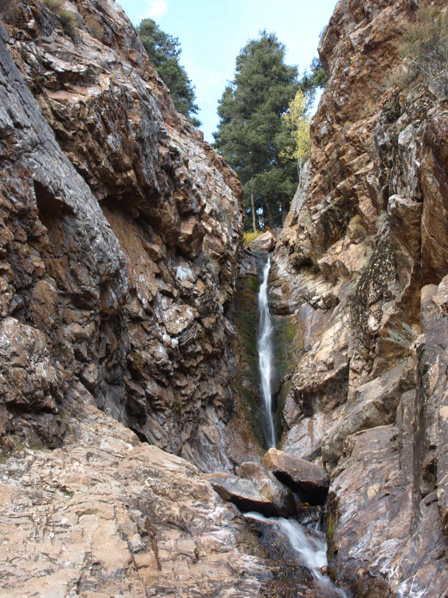
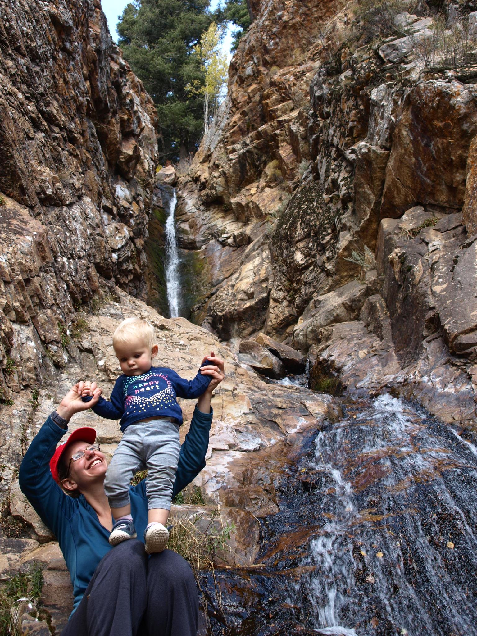
The falls don't come into view until you are almost at them. The two-tiered falls make an excellent place to hang out at on a hot day. Return the same way.


Maps

Route / 0.43 miles / Elevation Range 6,538 - 6,930 ft.
Printable Maps:
Trailhead

12T 439831mE 4498395mN

N40° 38' 03" W111° 42' 41"

Falls

12T 439795mE 4498664mN

N40° 38' 12" W111° 42' 43"

Comments

Want to make a comment? Login and let yourself be heard.