 Hiking
Mill D South (Cardiff Fork)
Hiking
Mill D South (Cardiff Fork)
Big Cottonwood
Overview
Mill D South Fork is also commonly known as Cardiff Fork, and home to the frequently visited Donut Falls. Though the canyon is a mix of private and forest service land, with the upper section almost entirely private, the lower section is a lovely place for a hike. The hike ambles up the Mill D South mining road. Navigation is easy, views excellent, and a fair bit less traffic than some of the other nearby trails. It is a charming place.
The downside to Cardiff Fork is that just when the trees begin to open to high alpine splendor, the land becomes private and it is time to turn around! The forest service has put much work into gaining public access on the road. Be respectful of private property by staying on the road and out of all posted areas. Though tempting to continue up to Cardiff Pass, there is no legal access. The junction to Montreal Hill and Cardiff Mine is the best turn around spot.
Getting There
Big Cottonwood Canyon is on the east side of the Salt Lake City Valley. Get there by taking I-215 to the east, taking exit 6 off the interstate and heading east.
Follow 6200 South which becomes Wasatch Blvd for 1.8 miles to the stop light and signs for Big Cottonwood Canyon.
Turn left at the light and reset your odometer.
Drive up Big Cottonwood Canyon. The trailhead is at 8.9 miles, where there is a large parking area on each side of the road. Park on the right side of the road. There is a toilet here and gated road (open in the summer) that heads south to the Jordan Pines Campground and Forest Service Donut Falls Trailhead.
It is 0.8 miles down the road to the south to the Forest Service Trailhead. I do not recommend driving to the Forest Service Trailhead. It is constantly full in the summer. Walking from the Big Cottonwood Canyon road adds a bit of distance but makes for a more enjoyable day.
Route Description
To the Forest Service Trailhead (20-30 minutes / 1.3 miles)
Walk the main road south. It crosses the stream over a bridge. A new trail, signed Donut Falls 1.5 miles, leaves the paved road shortly after the bridge on the left. This is a more enjoyable route than staying on the road and what I recommend. Follow the winding trail as it passes the Jordan Pines Campground, then climbs a bit and soon (20-30 minutes from the parking lot) reaches a pit toilet and the Forest Service Trailhead.
Above Forest Service Trailhead (2.2 miles to end of public access)
At the Forest Service Trailhead and Pit Toilet, get back on the dirt road. It crosses the stream and comes to a gate that is always closed to motor vehicles. Continue above the gate, with the road climbing at a steady rate.
A junction is soon reached. The road to the left becomes a trail and continues to Donut Falls. If you have not seen the falls, this is a great 20 minute (0.6 mile) round trip side trip. Stay right to continue up Mill D South.
There are a few minor side roads as you continue up, Stay on the main road. Also, there are many areas posted No Trespassing. Be sure to stay on the road through these areas.
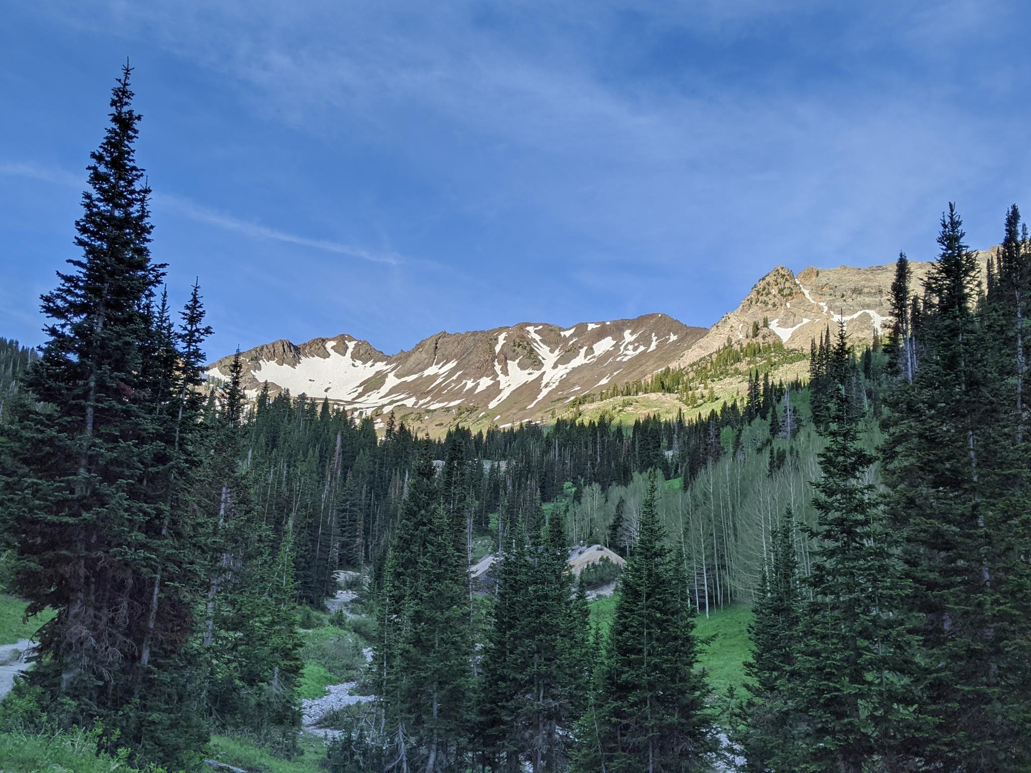
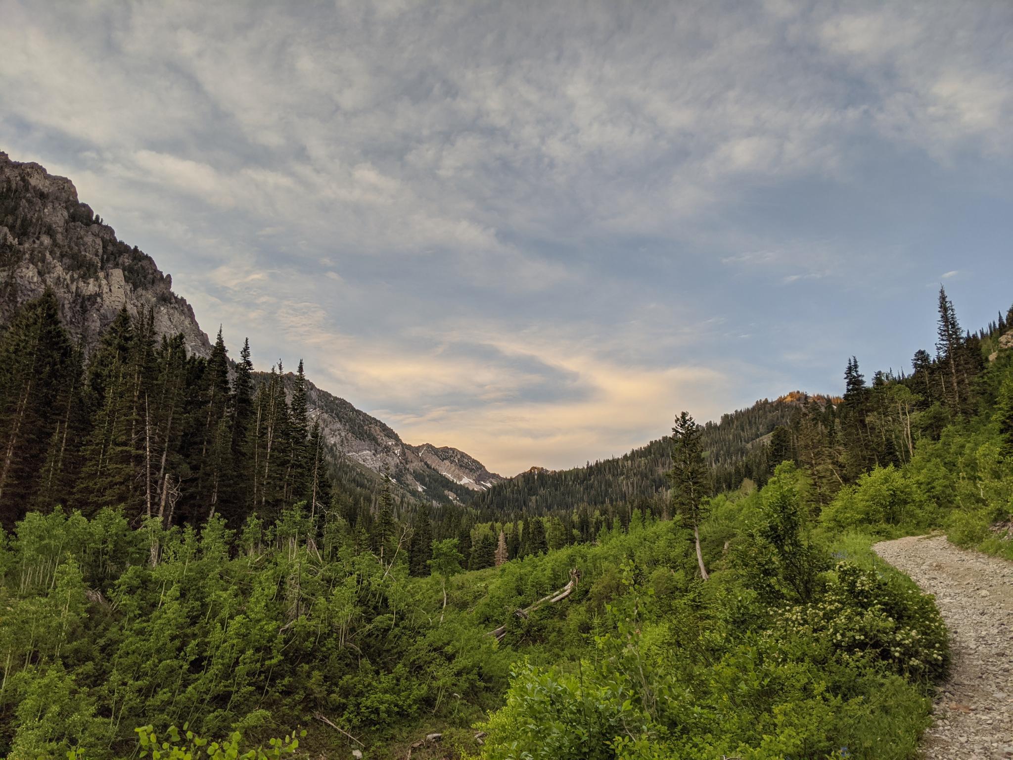
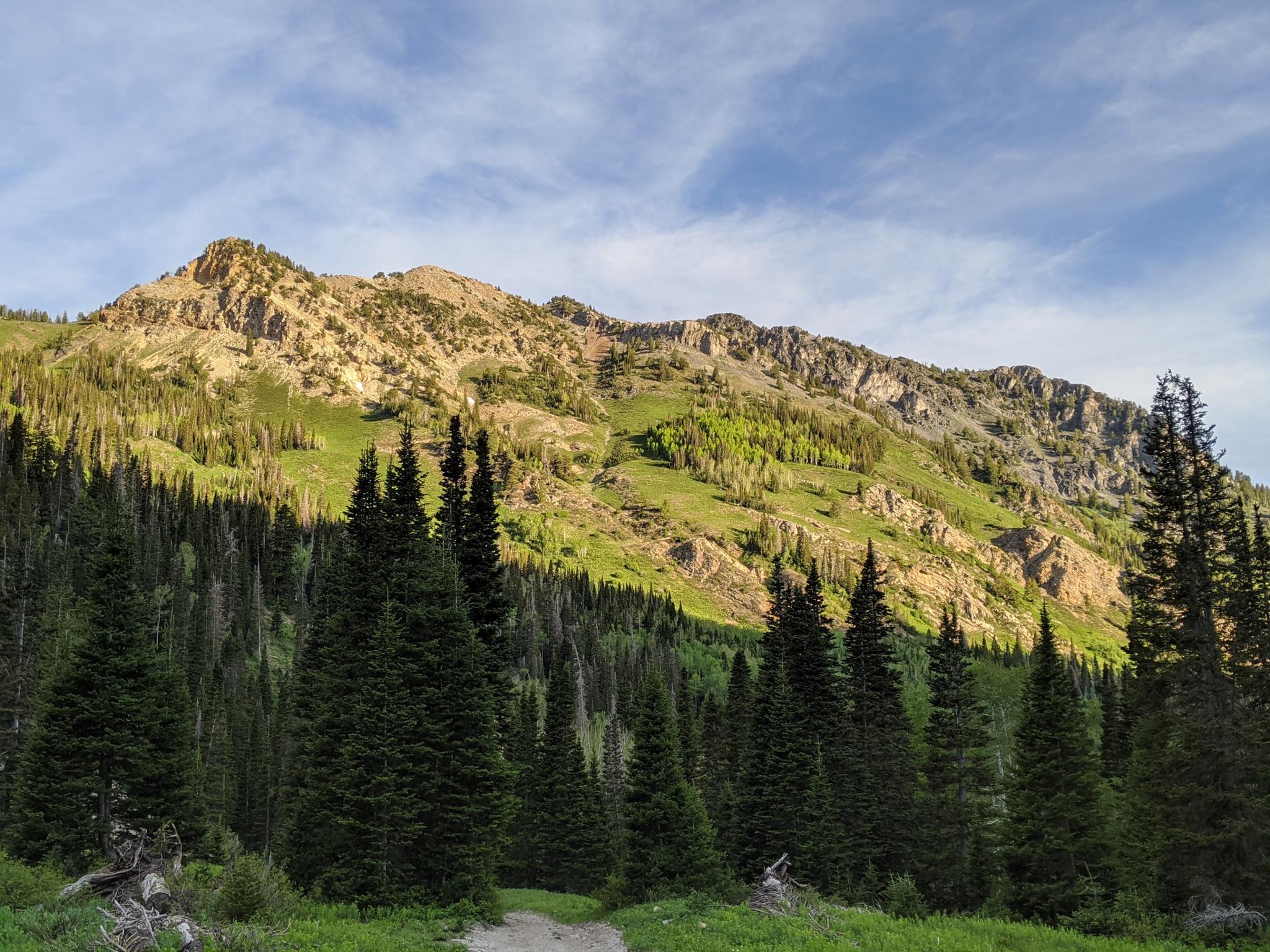
With Kessler Peak and ridge to the west (right) and an impressive cliff band on the left (east), Mill D South slowly narrows as it climbs. The road passes through idyllic meadows with bigger views, interspersed with more densely forested sections.
A mine tailings pile on the right and likely water across the road is a good landmark. Not far beyond, the road crosses the small stream (easily stepped over in most conditions). Once on the east side of the stream, the road climbs more steeply and becomes more forested before reaching a junction. The junction gives glimpses of the alpine areas above, but alas, private property blocks continuation. The junction is the turn-around spot. The road to the left goes to Cardiff Mine, while the road to the right goes to Montreal Hill and several mines. In all, over a half dozen mines are in this upper basin area. Return the same way.
Maps
 - Hiking Map")
12T 445126E 4500061N
40°38'59"N 111°38'57"W
12T 444933E 4498954N
40°38'23"N 111°39'04"W
12T 444856E 4498971N
40°38'23"N 111°39'08"W
12T 444707E 4498540N
40°38'09"N 111°39'14"W
12T 444787E 4495794N
40°36'40"N 111°39'10"W