 Hiking
Desolation Salt Lake Overlook
Hiking
Desolation Salt Lake Overlook
Millcreek
Overview
The Desolation Trail was initially designed to be a motorcycle trail connecting Desolation Lake in Big Cottonwood Canyon to Millcreek Canyon. Because of its intended use, it has long switchbacks to keep the grade low. The full trail length is about 18 miles one way from Millcreek to Desolation Lake in Big Cottonwood, but the hike to the overlook is a good introduction to the trail, and about 2.7 miles one-way (5.5 round-trip). It is long enough and has enough elevation gain that it feels like a good workout.
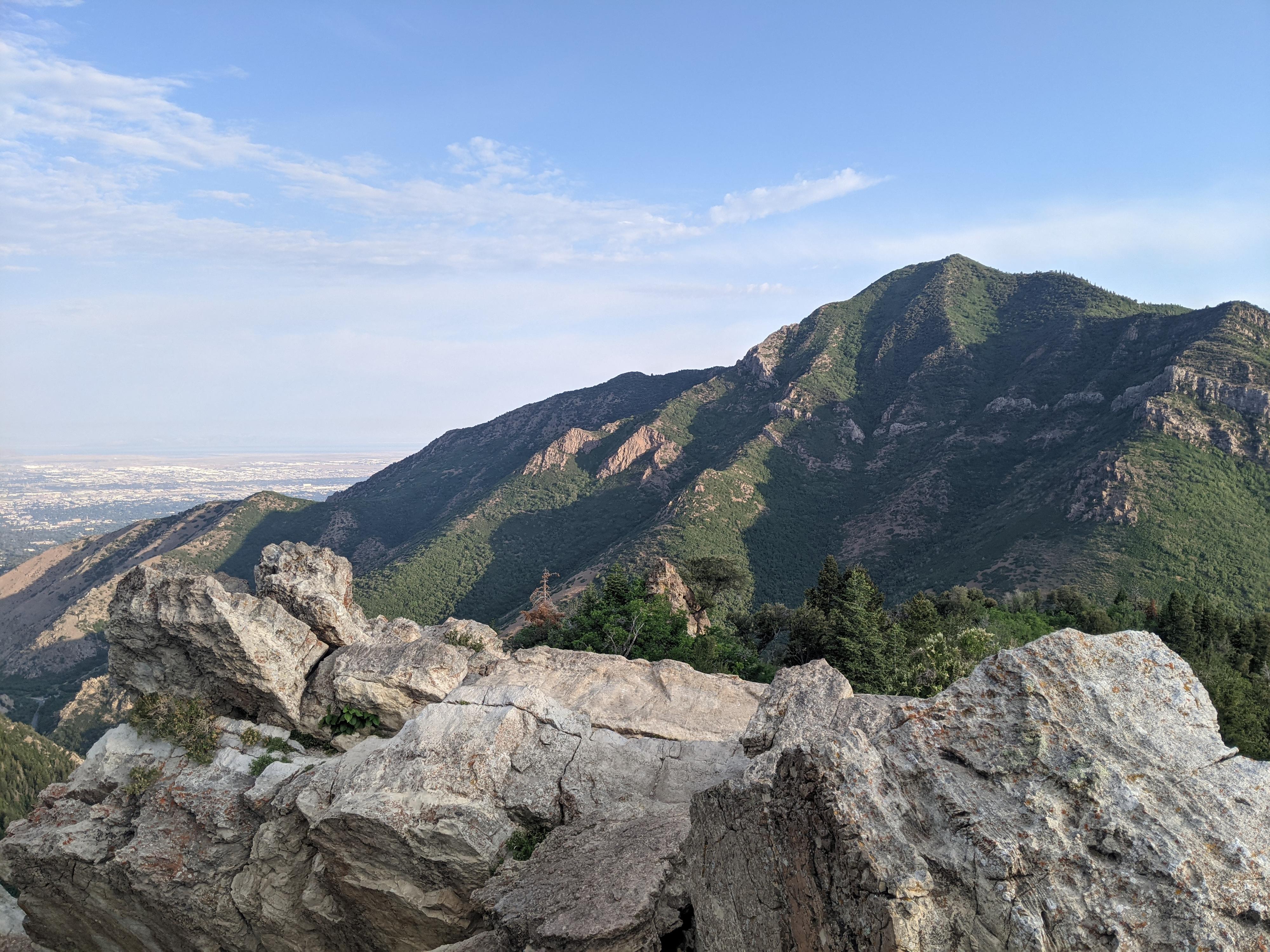
This overlook is longer and has a bit more elevation than the more popular Pipeline Overlook on the north side of Millcreek Canyon. Personally, I think this is the better hike between the two. The Desolation Trail ambles up lazy switchbacks with nice views and occasional shady spots to take a break in. The overlook proper does not have as good of views of the city but has better views of lower Millcreek Canyon and the steep slopes making up the canyon.
Getting There
Millcreek Canyon is on the east side of the Salt Lake Valley, just south of I-80 and Parleys Canyon. To get there, take I-215 South from I-80 and take exit 4 off of I-215 and go left (east) on 3900 South.
Turn left on Wasatch Blvd just after crossing under the highway, then the next right on Millcreek Canyon Road.
0.7 miles from the junction of Wasatch Blvd and Millcreek Canyon Road is the entrance to Millcreek Canyon and the pay booth.
Mileage below is from the pay booth.
- 0.7 miles - Pipeline Trailhead on the left (north).
- 2.4 miles - Church Fork Trailhead on the left (north).
- 2.5 miles - Desolation on the right (south). This is the trailhead.
Route Description
From the trailhead, follow the signed Desolation Trail/Thayne Canyon trail south. In just a few minutes it divides. Right is the Desolation Trail proper. If you want to keep the grade low, go right on the Desolation Trail here. If you want a little steeper and little shorter hike, continue straight on the Thayne Canyon trail a few more minutes to a second Desolation Trail junction and go right at this second junction.
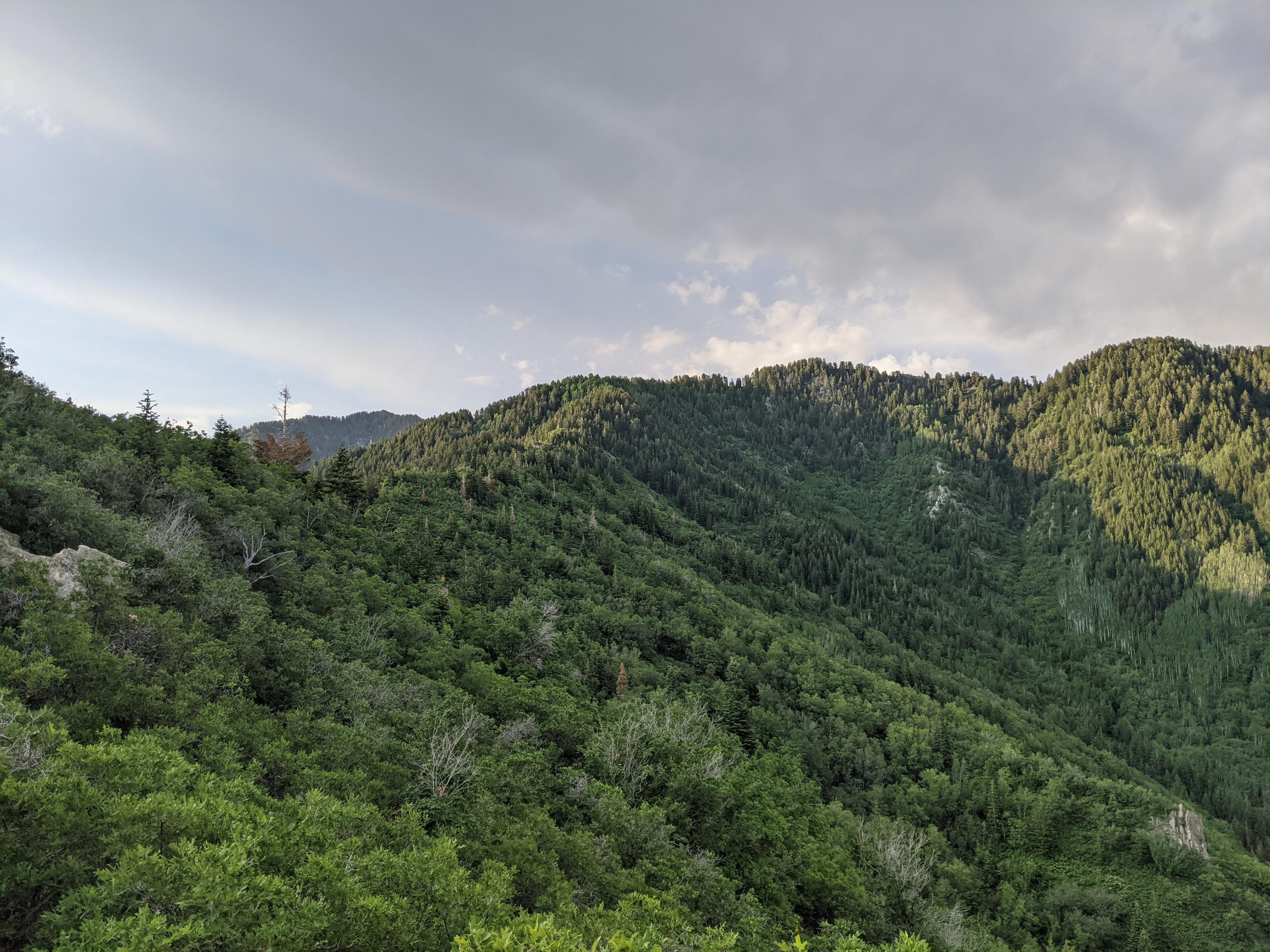
The Desolation Trail meanders up the slope on long switchbacks with ever changing views of Millcreek Canyon. After a series of 4 quicker switchbacks, the trail reaches the ridge and views west of Salt Lake City. This is the overlook, where a short side trail goes to a rocky outcrop. Grandeur Peak is the tallest peak across the canyon, which the overlook provides a great view of.
Return the same way.
Maps

12T 437479E 4505454N
40°41'51"N 111°44'24"W
12T 437434E 4505414N
40°41'50"N 111°44'26"W
12T 437693E 4504857N
40°41'32"N 111°44'15"W
12T 437223E 4504489N
40°41'20"N 111°44'35"W