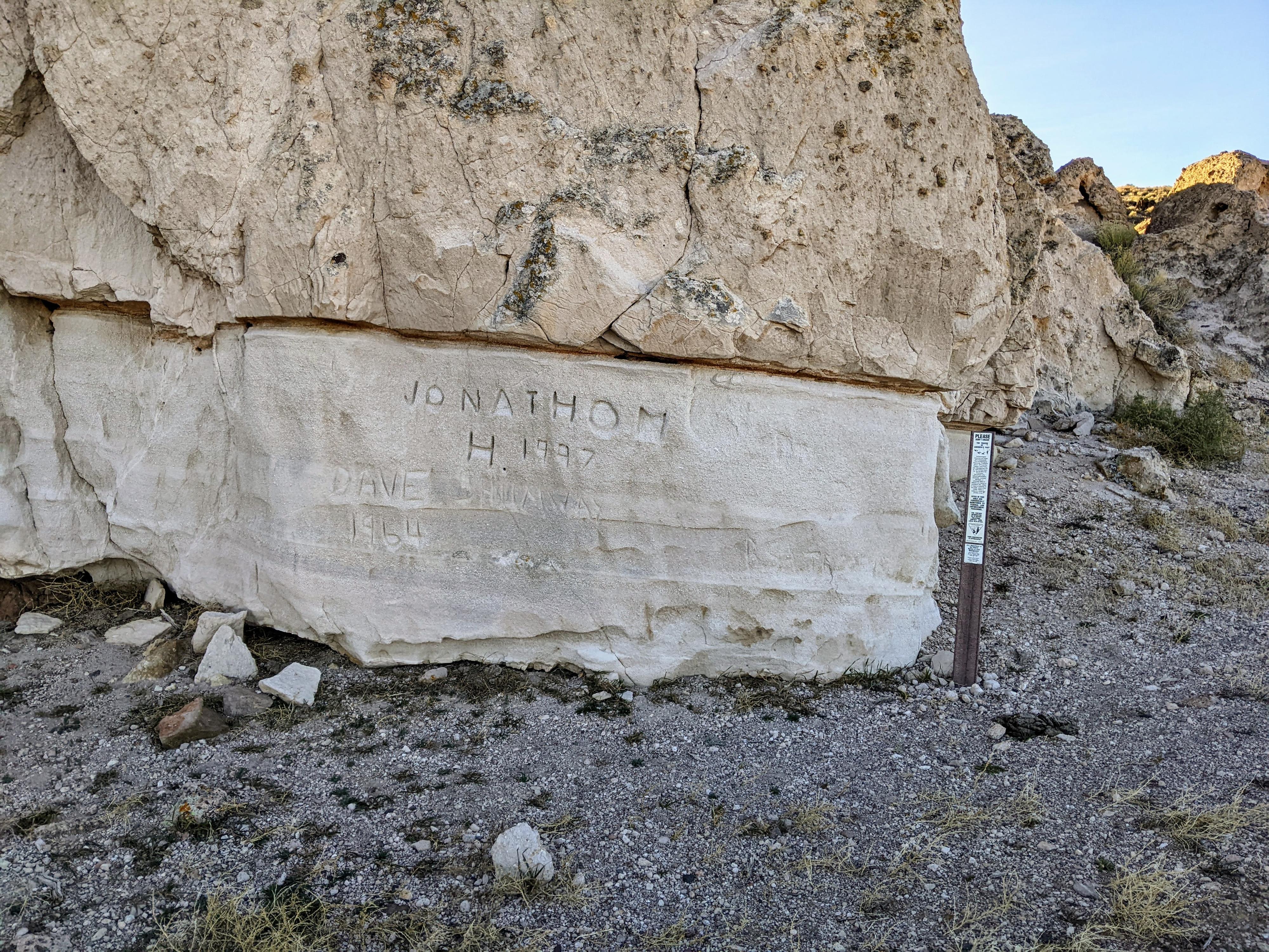
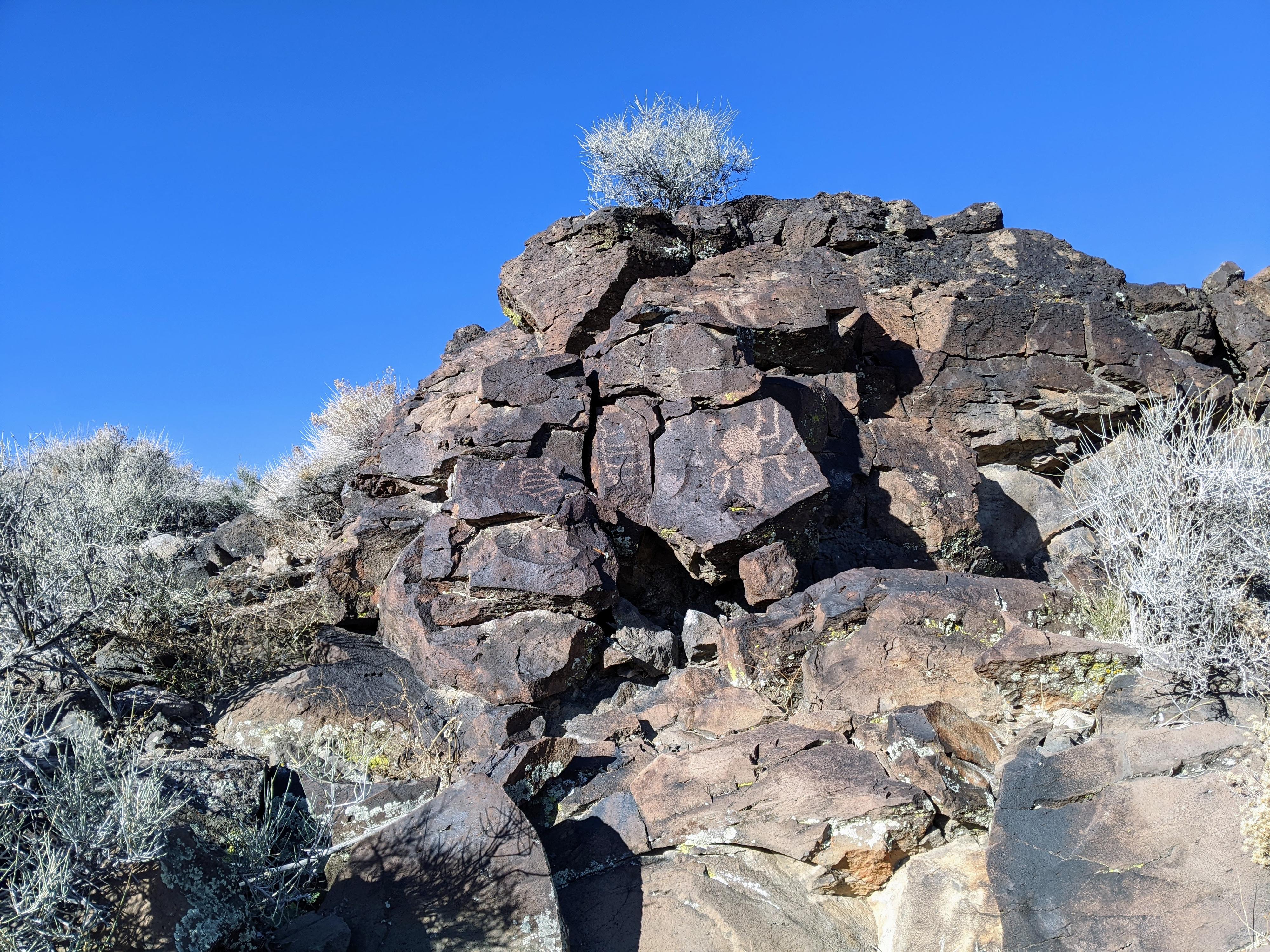
White River Narrows |

Basin and Range Monument

Roadside Attraction White River Narrows - Basin and Range Monument Roadside Attraction White River Narrows

Basin and Range Monument

Overview

RATING: Roadside Attraction / Short Hikes
LENGTH: 1+ hours
MAPS: WHITE RIVER NARROWS, NV

Thu

A chance of showers and thunderstorms after 11am. Mostly sunny, with a high near 69. Southwest wind 3 to 13 mph, with gusts as high as 18 mph. Chance of precipitation is 30%.

69 | 46

Fri

A chance of rain showers before 11am, then showers and thunderstorms likely. Mostly cloudy, with a high near 63. Chance of precipitation is 70%.

63 | 46

Sat

Sunny, with a high near 64.

64 | 41

Sun

Sunny, with a high near 71.

71 | 42

Mon

Sunny, with a high near 78.

78 | 46

View Full Weather Details
SEASON: Any, hot in the summer
WATER: None, bring all you need.
NOTES: Reaching some of the panels requires a high clearance vehicles. This can be walked if needed. Stay off the roads if they are wet.

Thu

A chance of showers and thunderstorms after 11am. Mostly sunny, with a high near 69. Southwest wind 3 to 13 mph, with gusts as high as 18 mph. Chance of precipitation is 30%.

69 | 46

Fri

A chance of rain showers before 11am, then showers and thunderstorms likely. Mostly cloudy, with a high near 63. Chance of precipitation is 70%.

63 | 46

Sat

Sunny, with a high near 64.

64 | 41

Sun

Sunny, with a high near 71.

71 | 42

Mon

Sunny, with a high near 78.

78 | 46

View Full Weather Details

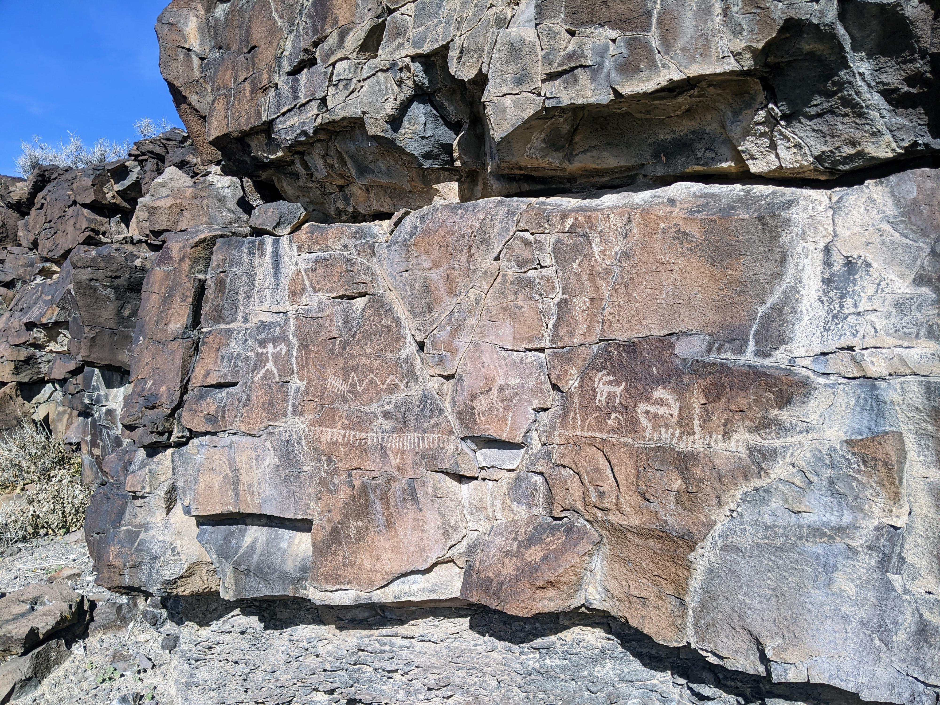
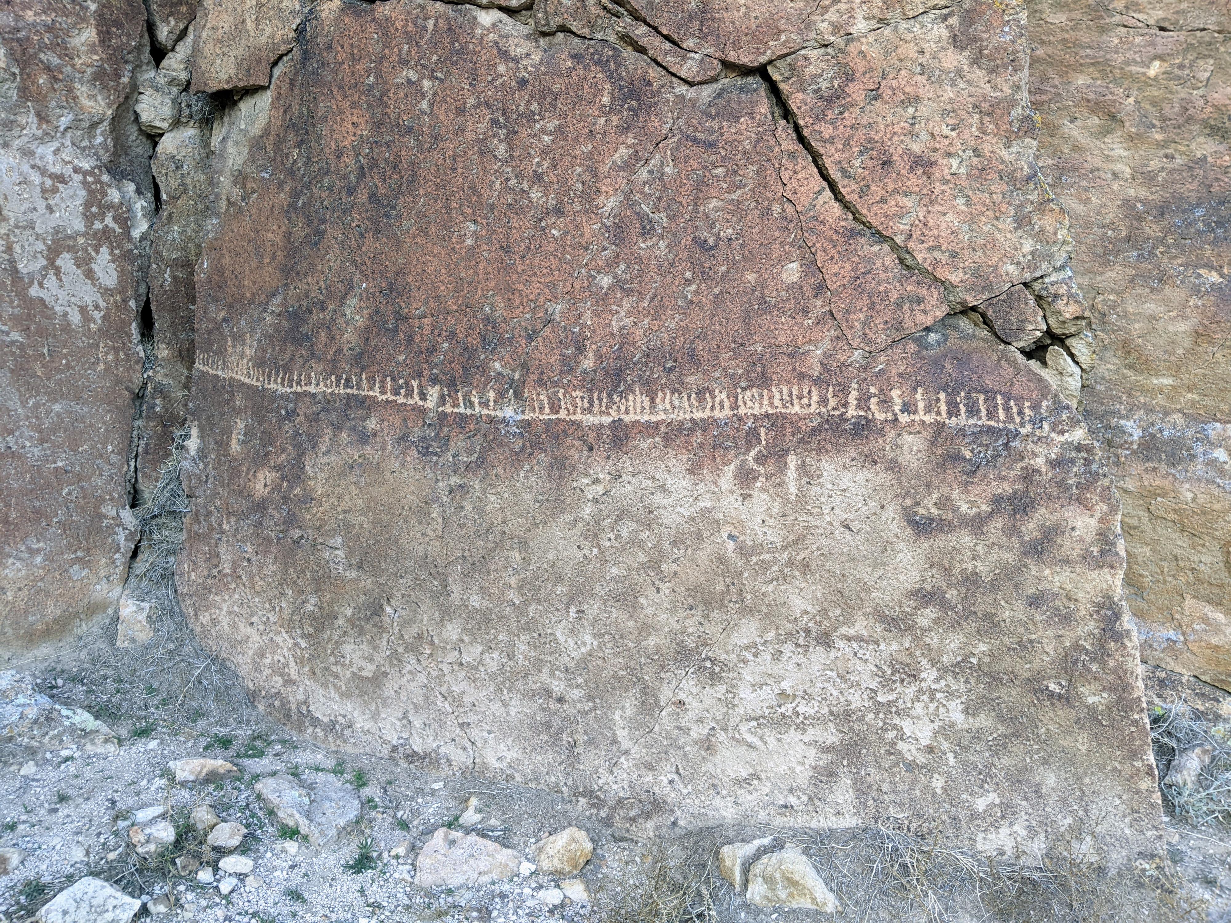
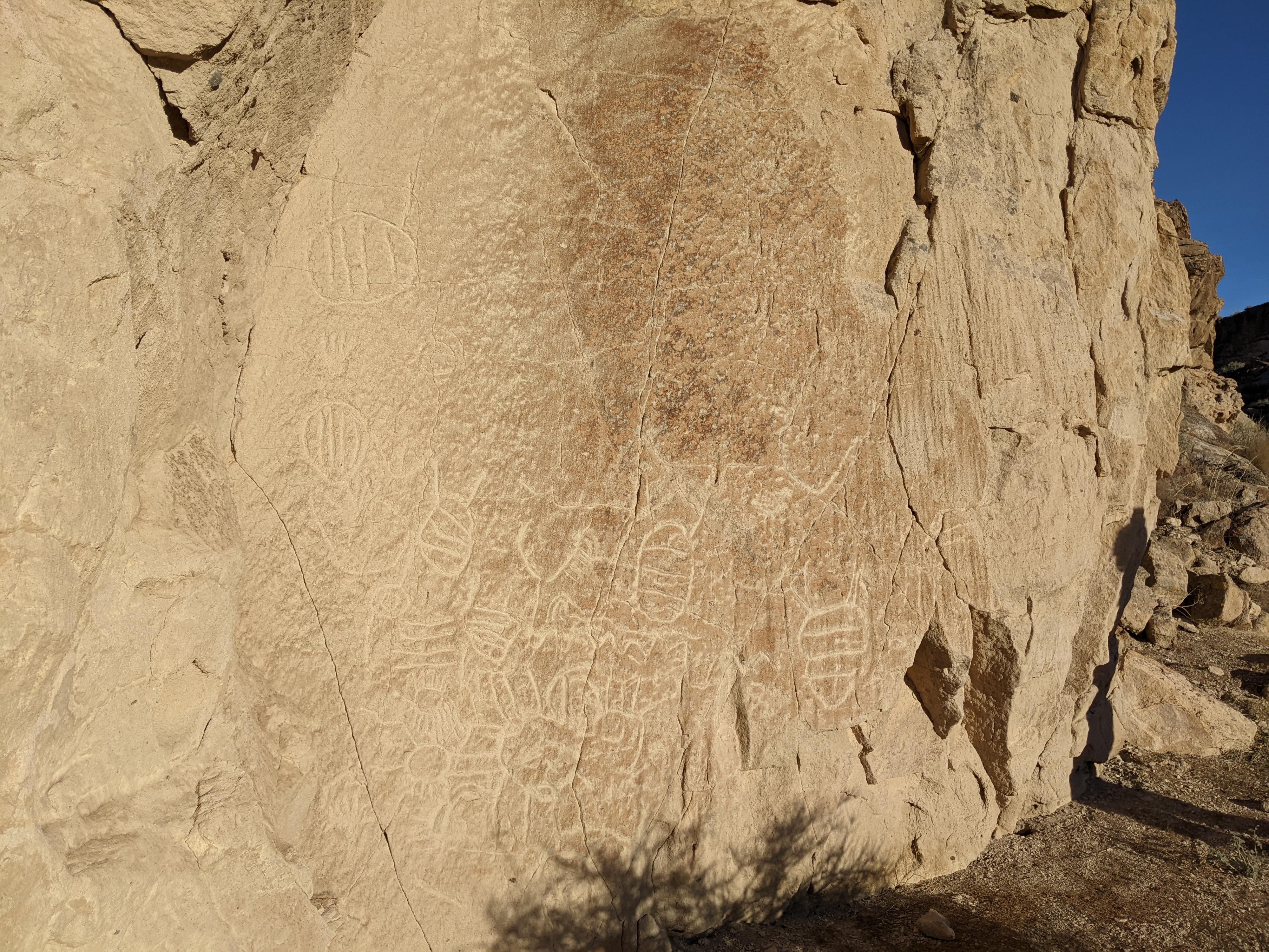
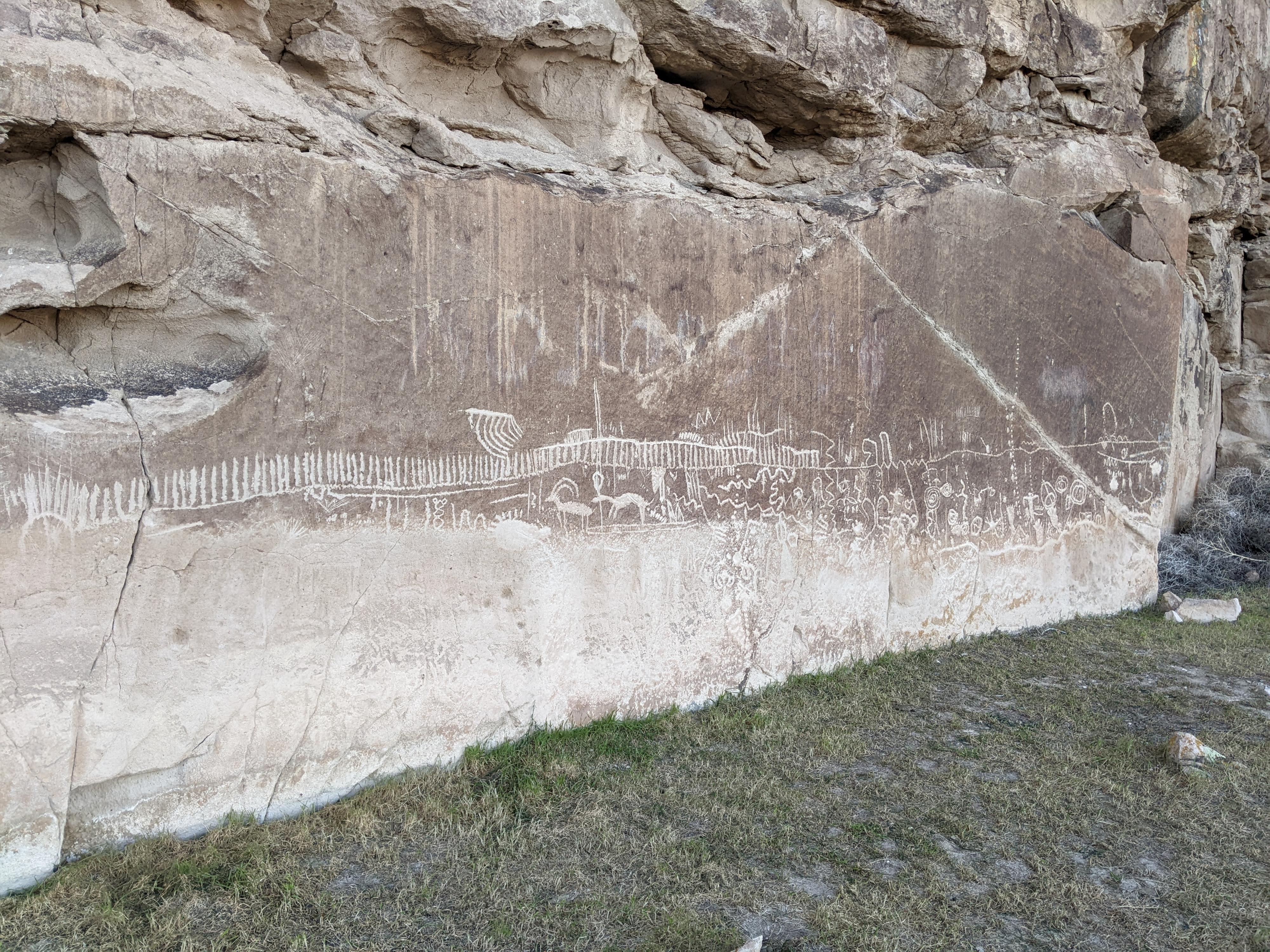
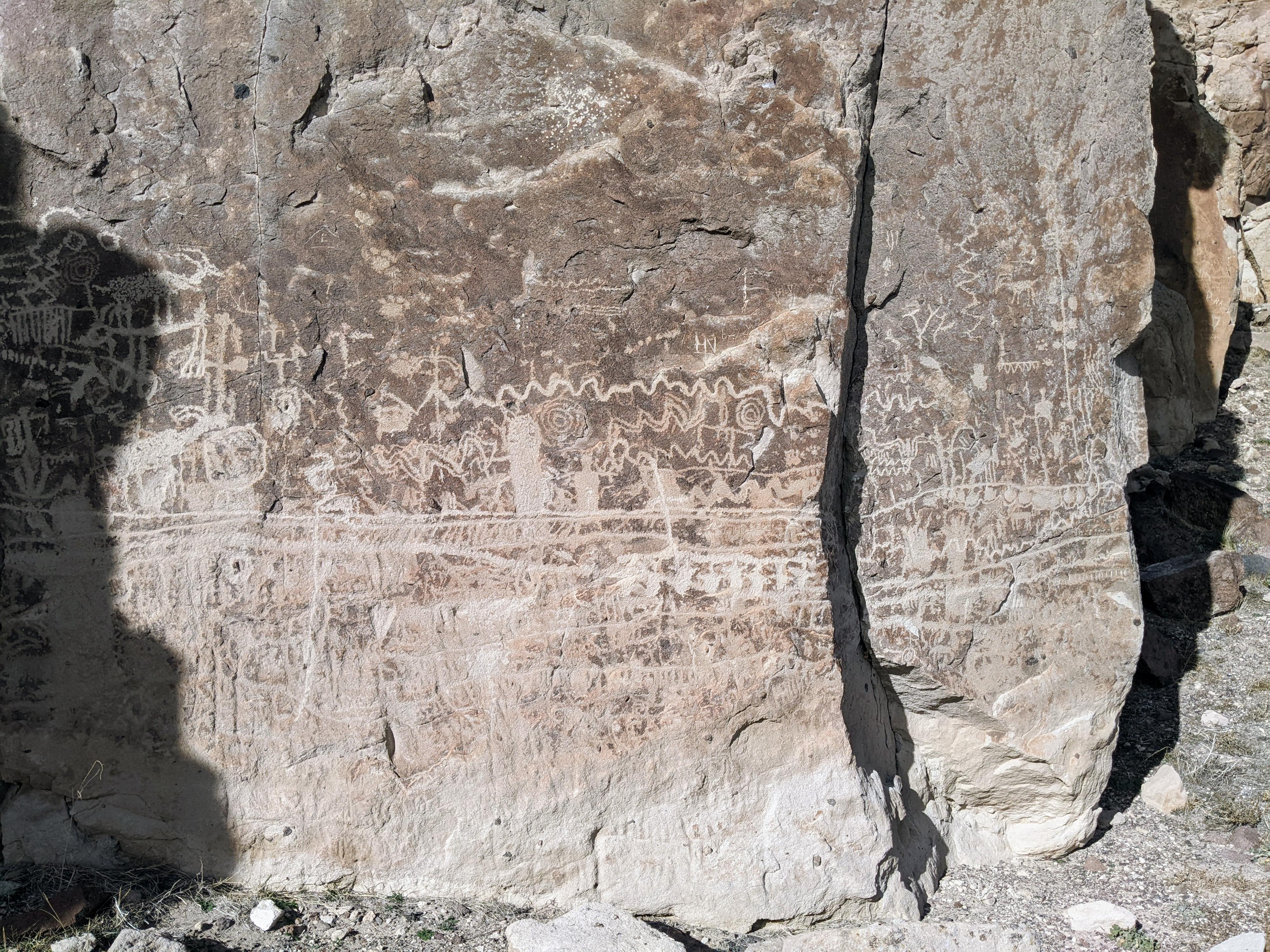
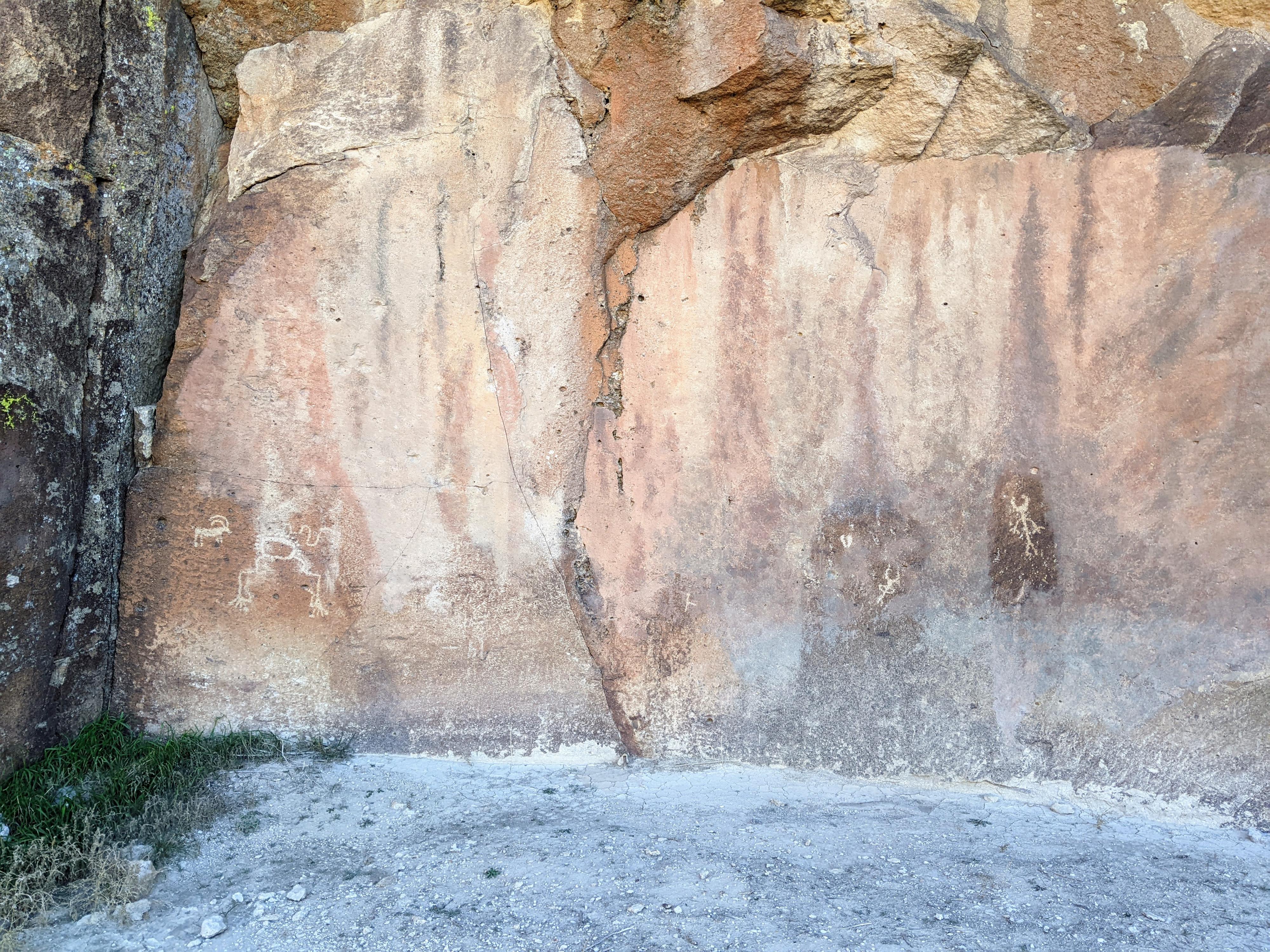
The White River Valley has been home to Native American peoples for millennia. The valley was integral to their hunter-gatherer culture and provided the resources needed to survive and thrive in the arid area known as the Great Basin. Much of the White River Valley is wide and open, however, one short section carves its way through rock creating a cliff lined canyon. This short section, known as the White River Narrows, was clearly an important place for Native American peoples, as they have left petroglyphs and pictographs along its walls.

After the coming of the Euro-American settlers in the 1800s, the Native American peoples left the area. Their rock art remains as a part of their long history and legacy in the area. For those that enjoy visiting and pondering rock art, White River Narrows should be high on your list to visit. The narrows contain hundreds of figures in both the Fremont style or the older hunter-gatherer style.

A few notes on visiting:

  • The BLM discusses the sites via the numbers I-VI. I have used the same numbers that they used to reference the sites.
  • Visiting requires a high-clearance vehicle or the willingness to walk to a few of the panels. On our visit, we didn’t use 4-wheel drive but had a couple of wash crossing that required high clearance.
  • I describe the panels in the order that I think makes the best experience visiting them, but obviously they can be visited in any order.
  • You could see all the panels described in an hour if you are hurried, but most will want a half to full day to take in all the amazing art.

Getting There

The trailhead is reached off of NV-318, the state route that connects Crystal Wash in the south to US-6 in the north. From Crystal Wash NV, go north on 318 for about 24 miles to where a dirt road leaves on the right (east) side of NV-318. There is a BLM kiosk just off the highway. Turn off the highway and reset your odometer.

NOTE: The USGS topo maps do NOT correctly show NV-318. Mile markers (MM) shown below are on the actual highway path even though the highway itself is not shown correctly on the USGS map.

Route

Rock Art and Historic Site Etiquette
Rock art and historic sites are fragile, non-renewable cultural resources that, once damaged, can never be replaced. To ensure they are protected, please:
  • Avoid Touching the Petroglyphs: Look and observe, BUT DO NOT TOUCH!
  • Stay on the Trails: Stay on the most used trails when visiting sites, and don't create new trails or trample vegetation.
  • Photography and Sketching is Allowed: Do not introduce any foreign substance to enhance the carved and pecked images for photographic or drawing purposes. Altering, defacing, or damaging the petroglyphs is against the law -- even if the damage is unintentional.
  • Pets: Keep pets on a leash and clean up after them.
  • Artifacts: If you happen to come across sherds (broken pottery) or lithics (flakes of stone tools), leave them where you see them. Once they are moved or removed, a piece of the past is forever lost.

From the highway, drive east about 600 ft to the first junction. Go left here, reaching a second junction almost immediately (Jct 1 on the map).


BLM Site 4
From Jct 1, go straight. The road in on a dike and ends when it reaches the hillside. Site 4 is along the base of the hill to the east at the obvious point of rocks. There are several large panels at this point. The panels are mostly the Basin and Range (hunter-gatherer) style.

BLM Site 4 (11S 671682mE 4187505mN / N37° 49' 08" W115° 02' 58")

To visit the other sites, from Jct 1, go left. The road climbs a rocky hill section, then descends back down to the flats, crosses a wash, and reaches Jct 2. Continue straight at this junction. About 0.9 miles from the highway, a small side road leaves on the right. This goes to Site 1.

BLM Site 1
There is one prominent petroglyph on this site, a long horizontal line with smaller vertical lines extending from its top in a rake type figure. Some believe this signifies a fence used to trap game in the narrow section of the canyon here. Alternatively, some believe this is a solstice marker because during summer solstice a shadow falls in the middle of the panel.

BLM Site 1 (11S 672393mE 4187772mN / N37° 49' 16" W115° 02' 29")

Continuing on from Site 1, the road continues east, then curves and heads north along the west wall of the canyon. About 1.5 miles from the highway, another spur road leaves, this time on the left, and curves over to a parking spot near the west cliff wall.

BLM Site 2
This site, known as BLM Site 2 and has 4 panels, 3 of which are near the base of the cliff and on near the top of the cliff. These panels are also of the Basin and Range (hunter-gather) style.

BLM Site 2 (11S 672265mE 4188630mN / N37° 49' 44" W115° 02' 33")

Continuing along the dirt road, it continues north, contouring along the base of the west wall of the canyon before ending about 2.1 miles from where you left the highway. This is, however, within just a few hundred feet of the highway you can see as it comes down and into White River Narrows. The road does not allow access back to the highway from here. This is Site 3.

BLM Site 3
Site 3 was one of my personal favorites. There is a register at the trailhead, then follow the trail along the base of the cliffs. There are many interesting panels along the cliff, mostly in the Basin and Range style, although there are a couple of Fremont style figures as well.

BLM Site 3 (11S 672323mE 4189222mN / N37° 50' 03" W115° 02' 30")

Return back along the road to Junction 2. From junction 2, instead of staying straight to go back to the highway, go left. Follow this two-track about 1/3 of a mile to where it gets close to the pale cliff band.

Additional Panel
Though not a numbered BLM site, there is a weathered panel here as well.

Additional Site (11S 671889mE 4187354mN / N37° 49' 03" W115° 02' 50")

From the Additional Site panel, continue a short distance south to the junction with the Valley of Faces road, a wide graded dirt road. Go right here, keeping an eye out on the left side of the graded road for the first rock outcropping next to the road. This is Site 5.

BLM Site 5
Site 5 is a relatively small site of abstract designs.

BLM Site 5 (11S 671667mE 4187387mN / N37° 49' 04" W115° 02' 59")

From site 5, continue straight west on the graded road to get back to the highway.

BLM Site 6
Site 6 was our favorite of the sites. To visit it, head north on NV-318 to mile marker 27, which is on the north end of the White River Narrows. Go left (north) here on a dirt road.

Follow this road about 0.8 miles to the obvious panel right next to the road. This is a very large panel with many figures. We spent the most time here out of all the panels. The road to the panel is two-track, but should be suitable for most vehicles.

BLM Site 6 (11S 674213mE 4192349mN / N37° 51' 43" W115° 01' 10")

Highway Panel
There is one more panel I think is not to be missed. It is on the north cliff wall almost directly across from mile marker 26 in the narrows. To visit it, head back south on NV-318 to a large pullout on the right between mile marker 27 and 26. Pull into the pullout and follow the 2-track dirt road south that goes along the canyon bottom. There is a large panel of modern signatures en route, but right where the two-track gets close to the cliff wall is an excellent small panel on the right. Return back to the pullout the same way.

Highway Panel (11S 673323mE 4189723mN / N37° 50' 19" W115° 01' 49")

Maps

Printable Maps:
Leave Highway

11S 670931mE 4187605mN

N37° 49' 11" W115° 03' 29"

Left

11S 671137mE 4187612mN

N37° 49' 12" W115° 03' 20"

Jct 1

11S 671265mE 4187587mN

N37° 49' 11" W115° 03' 15"

End of Road

11S 671576mE 4187557mN

N37° 49' 10" W115° 03' 02"

BLM Site 4

11S 671682mE 4187505mN

N37° 49' 08" W115° 02' 58"

Jct 2

11S 671878mE 4187734mN

N37° 49' 15" W115° 02' 50"

BLM Site 1

11S 672393mE 4187772mN

N37° 49' 16" W115° 02' 29"

BLM Site 2

11S 672265mE 4188630mN

N37° 49' 44" W115° 02' 33"

BLM Site 5

11S 671667mE 4187387mN

N37° 49' 04" W115° 02' 59"

Trailhead

11S 672528mE 4189244mN

N37° 50' 04" W115° 02' 22"

Additional Site

11S 671889mE 4187354mN

N37° 49' 03" W115° 02' 50"

BLM Site 3

11S 672323mE 4189222mN

N37° 50' 03" W115° 02' 30"

Parking pullout

11S 673705mE 4190339mN

N37° 50' 38" W115° 01' 33"

Highway Panel

11S 673323mE 4189723mN

N37° 50' 19" W115° 01' 49"

BLM Site 6

11S 674213mE 4192349mN

N37° 51' 43" W115° 01' 10"

MM24

11S 671054mE 4187823mN

N37° 49' 18" W115° 03' 23"

MM25

11S 671968mE 4189147mN

N37° 50' 01" W115° 02' 45"

MM26

11S 673381mE 4189702mN

N37° 50' 18" W115° 01' 47"

MM27

11S 674239mE 4191026mN

N37° 51' 00" W115° 01' 10"

Comments

Want to make a comment? Login and let yourself be heard.