 Hiking
Kyhv Peak
Hiking
Kyhv Peak
Provo
Overview
Kyhv Peak is a popular peak for hikers and trail runners near Provo. This trail reminds me a lot of Grandeur Peak near Salt Lake City, but it's just a bit longer and has a bit more elevation. On a busy summer weekend, the trail can see hundreds of hikers and trail runners on the trail!
The trail starts on the edge of Provo, heading up the quite scenic Rock Canyon, then ascending a steep canyon, First Left Fork, to the ridge and finally the summit. Though fairly shady, bring plenty of water. Many people underestimate the distance and elevation. Even during the driest part of the year, there is usually some flowing water in the stream about about a mile and a half from the trailhead. This is where the trail leaves the stream and heads up First Left Fork and can provide a drink for dogs. Even with this water stop, be sure to bring plenty for dogs if you bring them. From the last water to the summit is still a little over 2 miles and almost 2,000' more of elevation gain, then you have to descend back to reach water again.
Getting There
The Rock Canyon Trailhead was recently (2024) greatly improved. It is now fairly large with restrooms and a drinking fountain. To reach the park:
From I-15, take exit 269 for UT-265 toward University Parkway, heading east toward the mountains.
Continue on University Parkway for about 3.2 miles and turn left onto W 2230 N/N 550 W.
After 1.2 miles, turn left onto Turn left Temple Drive.
Follow Temple Drive east for about 0.8 miles to the trailhead.
Route Description
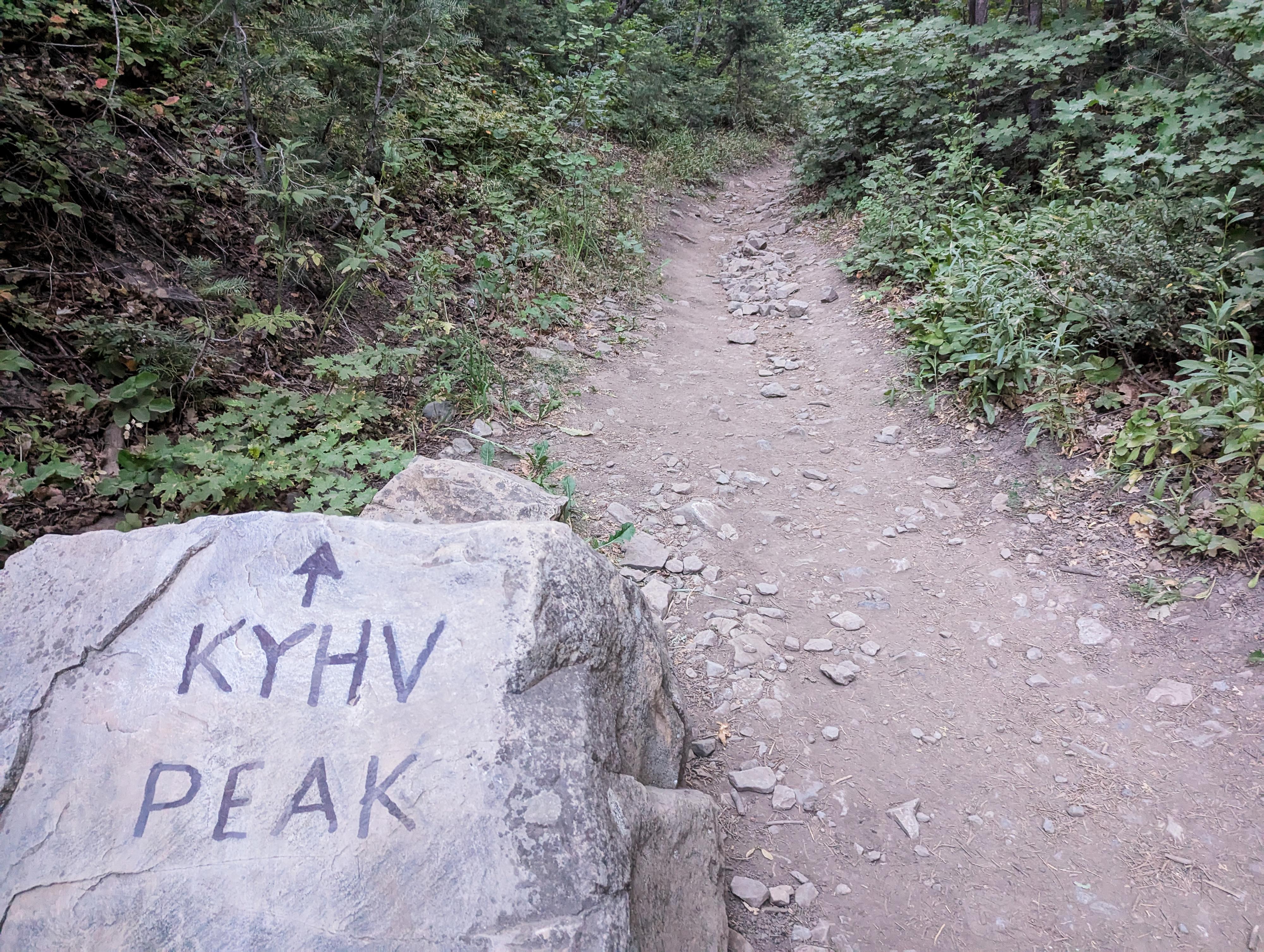
From the trailhead, head east up Rock Canyon on the wide, graded dirt road. There are many side trails, but simply stay on the wide dirt road as it heads east up into the craggy Rock Canyon. It is about 1.75 miles to the junction with First Left Fork Canyon. En route, you will cross 5 bridges, with the last few having numbers. The junction would be hard to miss, but keep an eye out a few minutes after bridge number 5. The nearby stream is the last place to get water for dogs until on the way down.
From the junction, go left and head up First Left Fork Canyon. Though the junction marks about the 1/2 way point mileage-wise to the summit, almost 2/3 of the elevation gain is between you and the summit. The trail becomes narrower and starts a relentless climb.
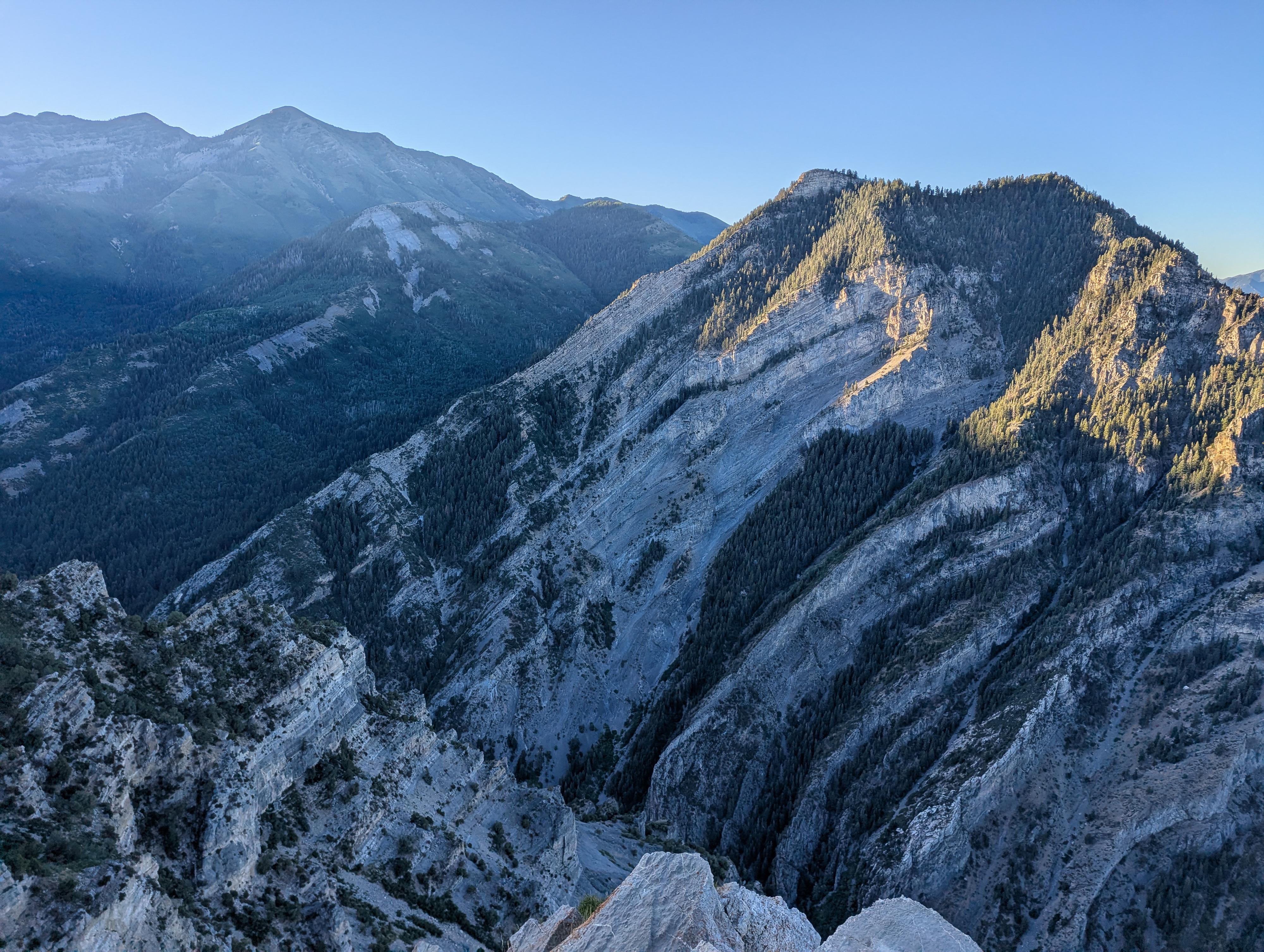
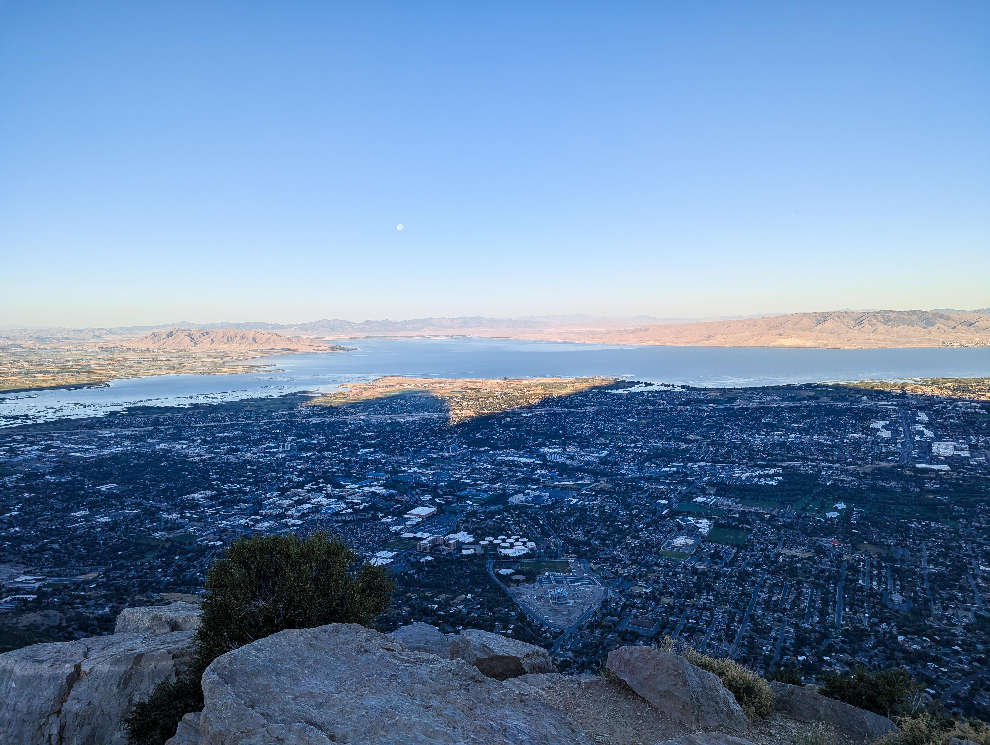
Near the top of the canyon, a large meadow is reached, and a somewhat flat section for a few minutes, then the trail then heads south and up to Kyhv Peak. This last section gains more elevation than I expected, but the views of Utah Valley and the surrounding mountains are stunning. The trail ends at the summit, looking down into Rock Canyon.
Return the same way.
Photos
Maps

12T 446390E 4457336N
40°15'53"N 111°37'50"W
12T 448706E 4457783N
40°16'08"N 111°36'12"W
12T 447617E 4458960N
40°16'46"N 111°36'58"W
12T 447538E 4458039N
40°16'16"N 111°37'01"W