 Roadside Attraction
Copper Globe Mine
Roadside Attraction
Copper Globe Mine
Central Swell
Overview
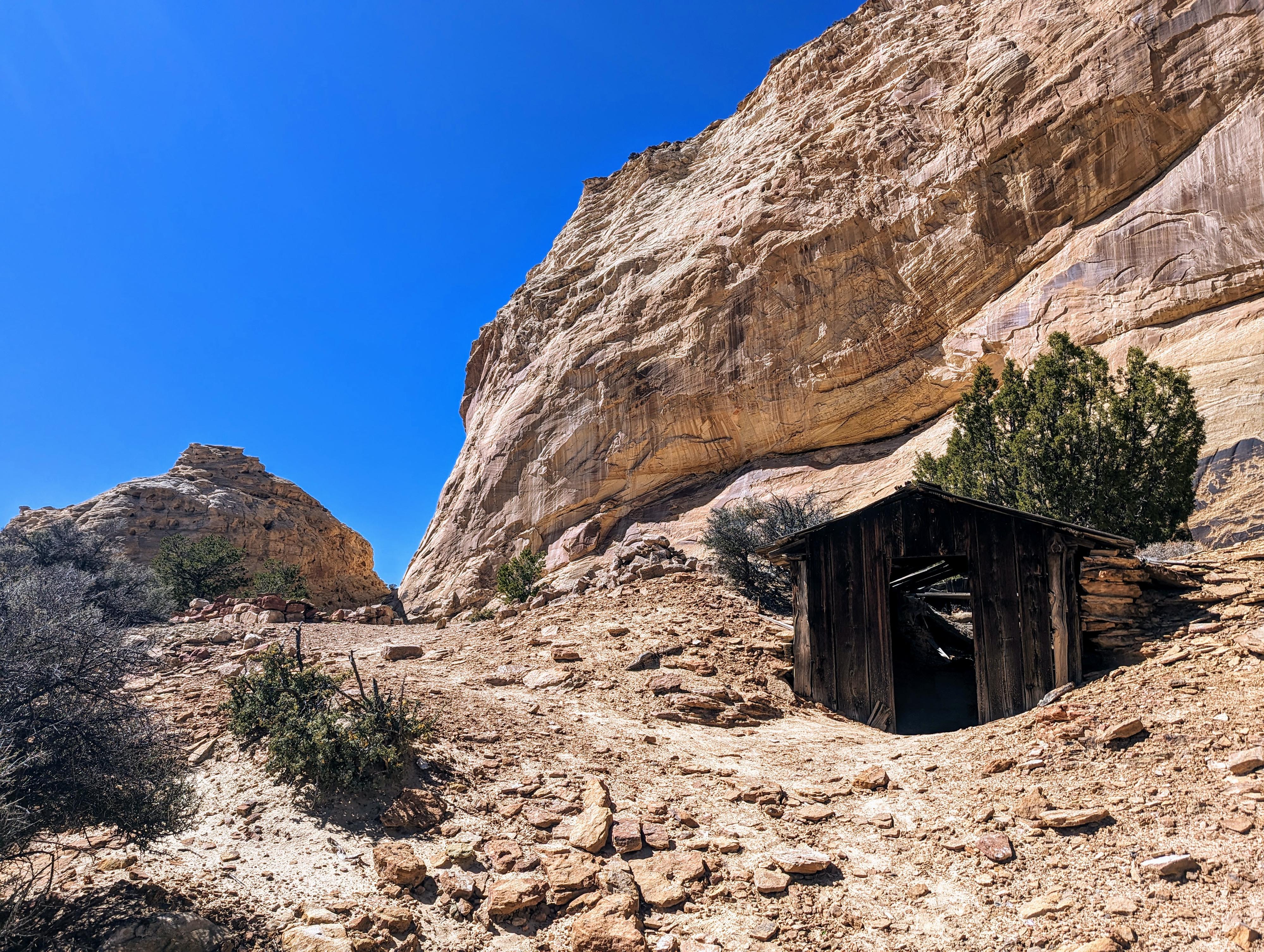
Copper Globe Mine had been on my list to visit for years. I had made an initial attempt many years ago, but the road had proved too rough for my medium clearance vehicle. We finally visited in the fall of 2023 while in the area and in a more capable vehicle. It turned out to be a highlight of our weekend in the San Rafael Swell. The old mine, steeped in history, has several old buildings, shafts and interesting things to see. It also is in an absolutely stunning spot, surrounded by towering sandstone cliffs and domes. This turned out to be an attraction our family thoroughly enjoyed and one I would highly recommend, especially to those interested in the history of the Swell.
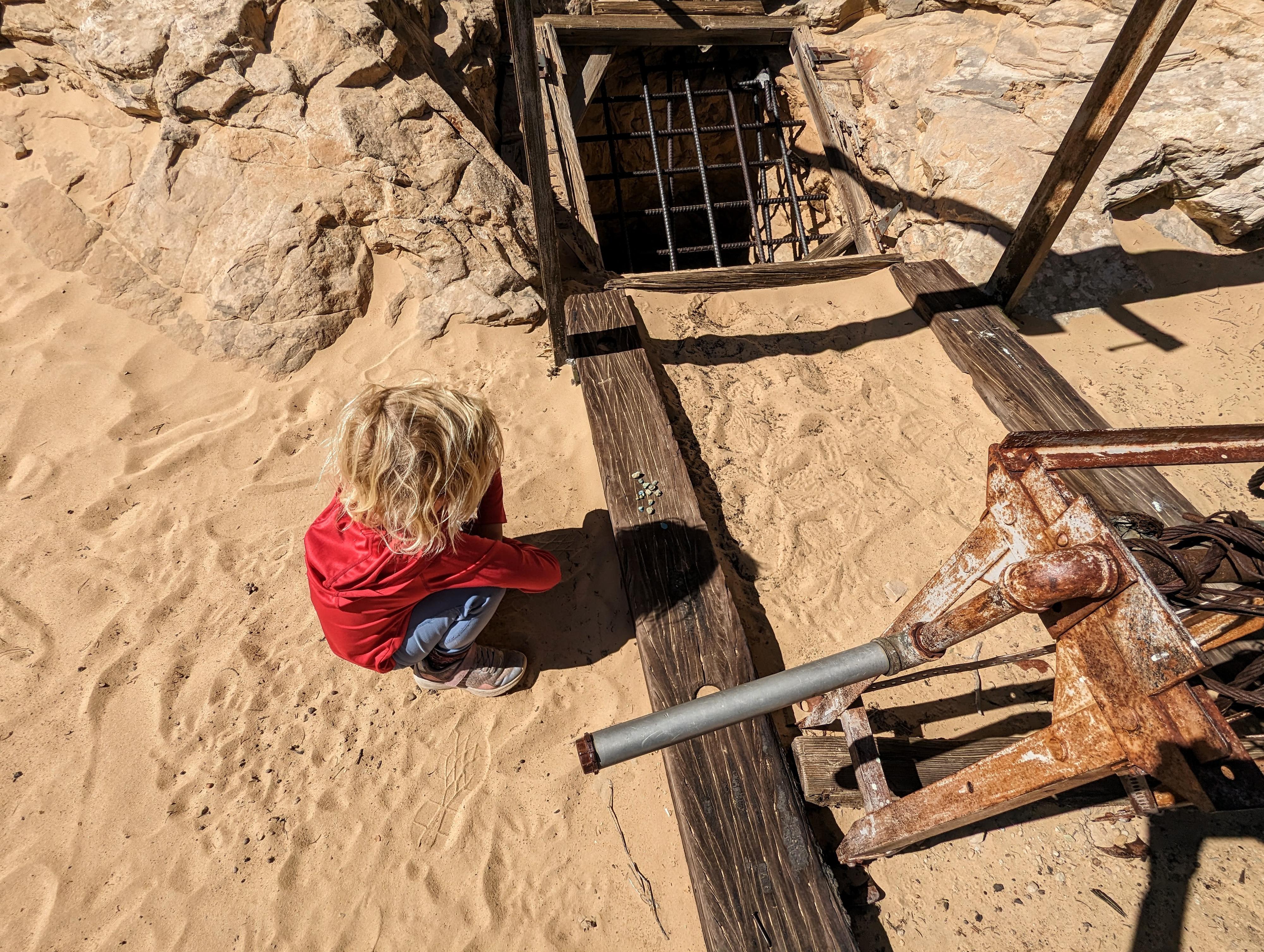
Owners invested substantially in the project, spending $3000 to have an improved road built from Moore, to about the current day I-70 to help move the ore more easily to Price. The mine consisted of numerous vertical and horizontal shafts. A few of these are still visible and fenced and/or grated to prevent entry. There are also still buildings, a woodpile, and cistern to visit.
The mine was fraught with some costly misfortune. A smelter was built onsite to process material and reduce shipping to only high-grade copper. This seems like a great efficiency, but improper bricks were used, and the smelter collapsed when it got hot. Also, the prominent shaft on the north side of the dome that has a grate over it went down and under the dome. The vertical shaft south of the dome was meant to intersect the horizontal shaft from the north, but miscalculation caused them not to intersect.
All-in-all, the mine did not prove profitable.
Getting There
Take exit 116 off of I-70, and head south. This is the same exit as the Moore cutoff road, and about 45 miles west of Green River.
Route Description
From the trailhead, the woodpile, and a building are visible to the west. Visiting these, you will also find a gated shaft angling down with a few remains of an old ladder. I know at least a few people have thought that was all to see, and headed back at this point!
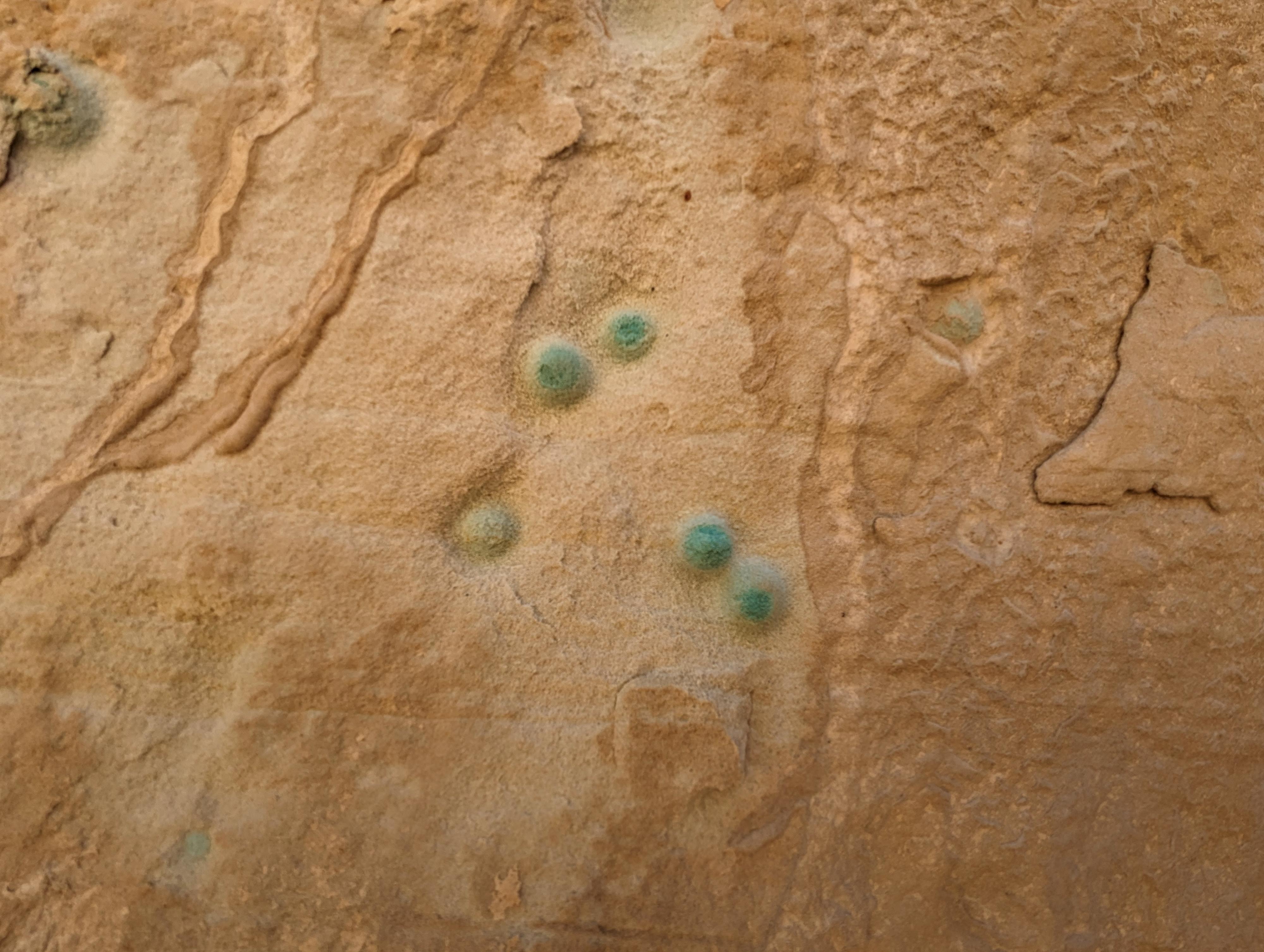
Instead, continue hiking on a social trail that ambles around the east side of the dome. As you go around the dome, be sure to look at the sandstone closely. It is riddled with small copper concretions that are blue and green. It is fascinating, I haven't seen something like this before.
Around the dome are a couple of more buildings, a large fenced and gated off vertical shaft, and partial walls of a cistern in the wash bottom. The cabin to the west is still in good condition, with some old mattresses and such in it. It feels like a window back in time.
Returning, if scrambling is your thing, be sure to scramble over the notch between the dome and larger sandstone cliff. There are some carved steps to help get up the south side, then a scrambling move or two to get down the north side.
Photos
Maps
12S 508815E 4296320N
38°48'56"N 110°53'54"W
12S 508071E 4295356N
38°48'25"N 110°54'25"W
12S 507812E 4294964N
38°48'12"N 110°54'36"W
12S 507681E 4294931N
38°48'11"N 110°54'42"W
12S 507571E 4294909N
38°48'10"N 110°54'46"W
12S 507583E 4294894N
38°48'10"N 110°54'46"W
12S 507600E 4294907N
38°48'10"N 110°54'45"W
12S 507591E 4294894N
38°48'10"N 110°54'45"W
12S 507731E 4294929N
38°48'11"N 110°54'39"W
12S 507755E 4294967N
38°48'12"N 110°54'38"W
12S 507860E 4295101N
38°48'17"N 110°54'34"W
12S 507729E 4294908N
38°48'10"N 110°54'40"W