 Roadside Attraction
Spring Canyon
Roadside Attraction
Spring Canyon
Helper
Overview
Spring Canyon, near Helper, was the site of extensive coal mining in the early 1900s. The area was heavily mined between 1912 to the end of World War II, with lingering operations all the way through about 1970. The canyon's coal deposits attracted many to come, settle, and try to make a life in the mines and supporting businesses. In the approximately 6 mile length of the canyon, over a half a dozen communities sprung up to support the miners and mining industry, as well as a railroad line to move the coal down canyon. It must have been quite a bustling place back in the peak mining days.
As with many old mining areas, the boom led to a bust and by the mid-1900s, the canyon was emptying and old buildings we either being torn down or falling into disrepair. Today, the various communities have little left of their former selves. A few of the old buildings and other relics from the mining time remain, but much is gone. Driving through the canyon offers a glimpse back into those early mining days and the change to see a beautiful canyon.
Getting There
From US-6/US-191, take exit 232 for Helper Main Street and turn west. Follow Main Street west for about 0.3 miles to Bryner Street. Turn left onto Bryner and follow it 0.2 miles to Spring Canyon road. Turn right onto Spring Canyon road and follow it about a mile to where the road passes under the railroad bridge.
Route Description
The railroad bridge the Spring Canyon road goes under is known as Jacob’s Bridge. Reset your odometer as you go under it.
1.9 miles - The community of Pearless used to be situated here, named for the nearby Pearless Mine. The community had about 300 people at its peak. Now, there is not much left. A few foundations are visible on the left, and a few ruins on the right side of the road.
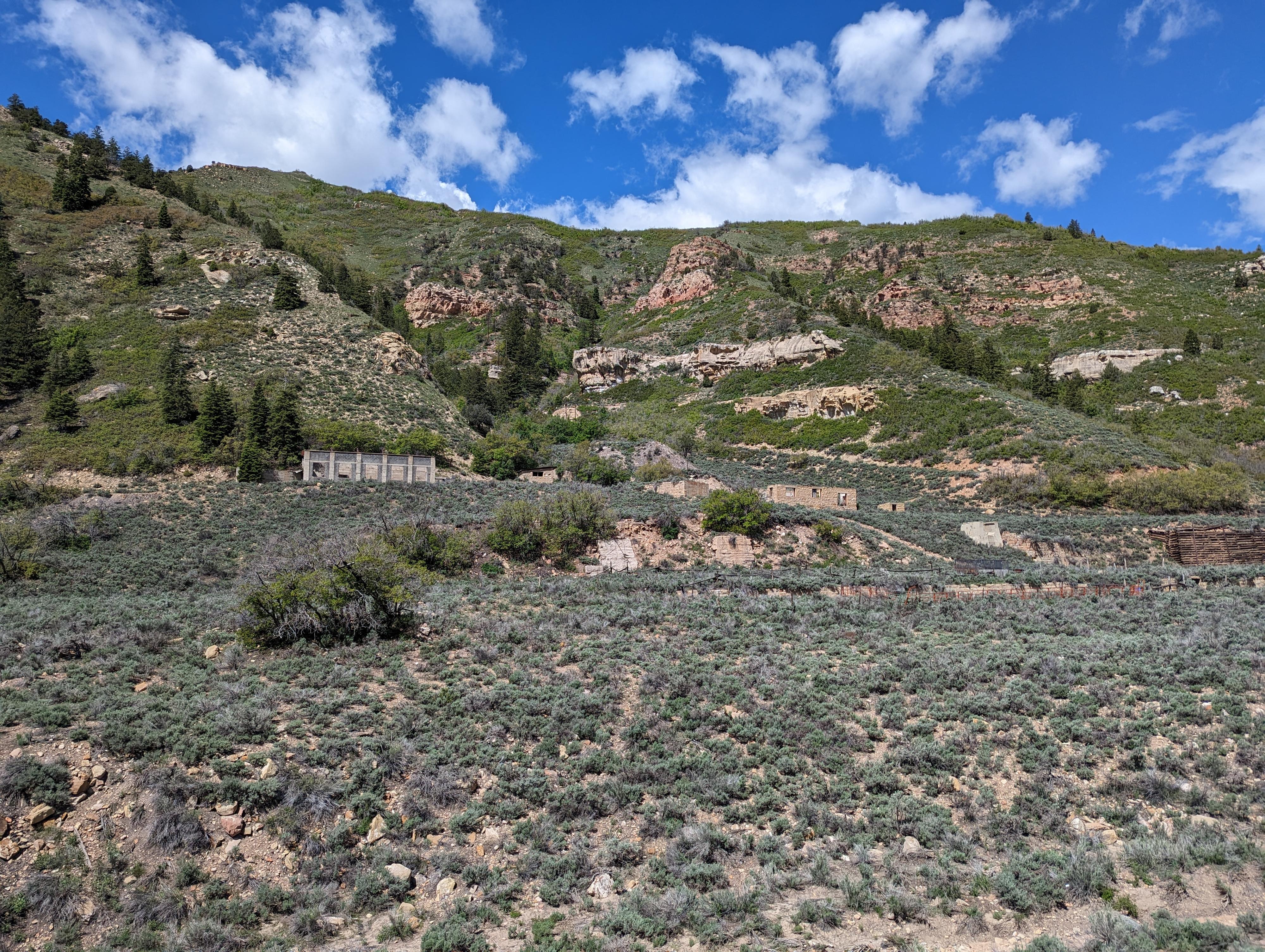
2.7 miles - Pit toilet and parking area on the right. The cliffs to the north are popular with climbers. The canyon on the right just before this stop held the community of Storrs that was later re-named Spring Canyon after the town's namesake, George Storrs, was indicted for mail fraud. The road up to Storrs is signed private. On top of the cliffs north of the pit toilet, there is part of an old building foundation. I assume this was part of the town of Storrs. The community of Storrs had over 1,000 people during its high point.
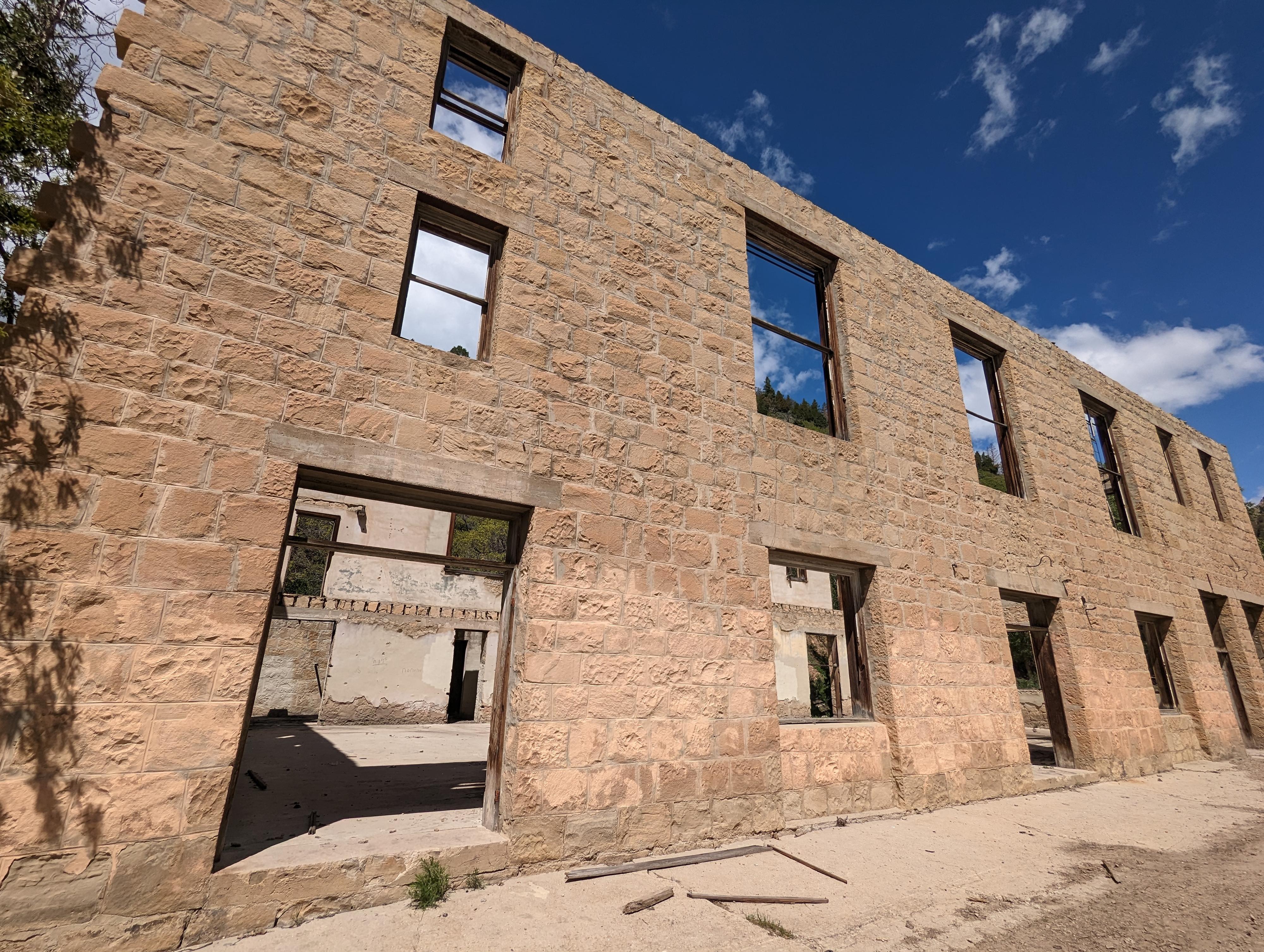
3.5 miles - The community of Standardville is on the right, with several large buildings visible. The largest concrete building is an old coal chute that loaded trains. This community was not as populous as some others in the canyon, but still had over 200 children in its school at its peak. It is fenced and signed private, so it should only be viewed from the road.
4.25 miles - The small community of Latuda peaked at about 300 people. I could not see any remains of the town on our visit.
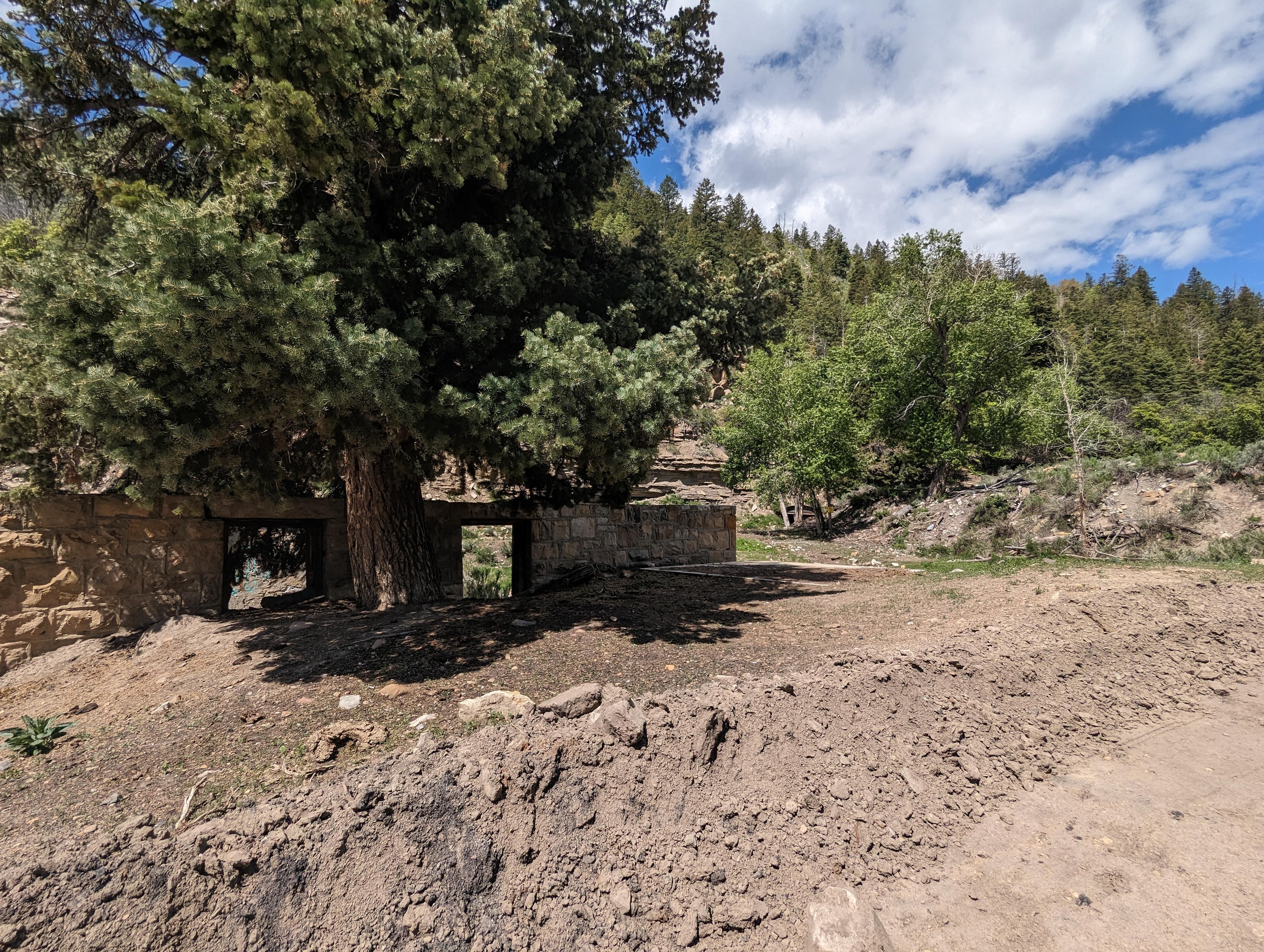
4.8 miles - Large mine on the left (south) side of the road with quite a few building remains and an old railroad bridge.
5.6 miles - The road turns right and begins heading up, passing a large building that is left of the road. The large building was likely the company store of Mutual. Near this building were 3 communities tightly spaced, Rains, Little Standard, and Mutual. There are quite a few building and mining remains in the next mile or so, but are all marked private and should be viewed from the road. Unforutnatley, the old building is becoming quite graffitied.
6.5 miles - End of the road. The road ends here with private lands and private roads above. Return the same way.
Many ghost towns have legends, and Spring Canyon is no exception. There are quite a few variations on the story, but a ghostly Woman in White is said to haunt the canyon. Some say she is seeking revenge on the mining companies for the death of her husband, who died in a mine accident. Other versions of the tale say she went mad after her baby was kidnapped and drowned in a ravine. Most versions of the tale say the woman was from Latuda and still haunts that area. If you see a ghostly figure dressed in all white, perhaps the folklore is true, especially if you are passing near Latuda.
There is a paved trail that follows along the road, partially right next to the road and partially on the old railroad grade from the junction of 1st Avenue and Spring Canyon road up the canyon, to the pit toilet. The trail is for non-motorized use, and is an excellent biking, walking, or running trail.
Maps

12S 510319E 4392960N
39°41'11"N 110°52'47"W
12S 507720E 4393772N
39°41'38"N 110°54'36"W
12S 506739E 4394458N
39°41'60"N 110°55'17"W
12S 505759E 4394328N
39°41'56"N 110°55'58"W
12S 503926E 4395263N
39°42'26"N 110°57'15"W
12S 504760E 4394899N
39°42'14"N 110°56'40"W
12S 503117E 4395508N
39°42'34"N 110°57'49"W
12S 502904E 4395626N
39°42'38"N 110°57'58"W
12S 502151E 4396614N
39°43'10"N 110°58'30"W